
Hikes and treks around Pune
150 hikes and treks, from hill loops inside Pune city to forts and long trails in the Sahyadri. Every entry credits its source and says plainly what nobody has checked yet, like access and safety.
Dataset compiled 7 October 2026 by desk research. Not field-verified.
Hill loops, ghats, naals, forts and long trails
150 routes: 76 hikes and 74 treks. 1 pune city, 1 urban edge, 148 outside pune. 145 have a route line drawn on the card. The rest show the mapped area only.
A hike is a day route on paths; a trek is a fort climb or a long trail stage, following the source's own activity. No elevation, difficulty, season or access hours are recorded for any of them. Where the source has nothing, the card says Not recorded.
Showing all 150 hikes and treks.
Nothing matches these filters.
-
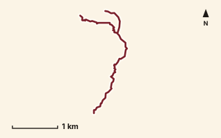
OSM route line, simplified. Branches and gaps as mapped. Hiking Hike, trail / ghat / naal route
Adagaon to Singheshwar Peak
Near Bhimashankar, about 50.9 km from Pune centre (computed)
Mapped relation length 4.57 kmElevation Not recordedMapped in OpenStreetMap; access not checked Mapped only, not field-tested
Source: OpenStreetMap relation 19892674 (opens in a new tab) . © OpenStreetMap contributors, ODbL.
The route
- Original activity
- Hiking
- Type
- Trail / ghat / naal route. Hiking, Trail routes.
- Shape in OSM
- Non-linear in OSM (loop or multi-branch)
- Surface
- Trail (OSM hiking relation; may include road segments)
- Distance
- 4.57 km. Mapped relation length (OpenStreetMap via Waymarked Trails). Can include branches and alternatives.
- Elevation
- Not recorded. No gain, loss or profile data in the source.
- Difficulty
- Not recorded
- Start and finish
- Not recorded
Access and safety
- Access
- Not recorded. That does not mean open.
- Hazards
- Not recorded. That does not mean there are none.
- Permission
- Not recorded
- Field check
- Mapped only, not field-tested. Field check recommended (geometry from source)
Data and source
- Status
- Mapped in OSM: geometry exists; ground truth not verified
- Graphic
- Route line from the OpenStreetMap relation (5 ways, fetched 7 Oct 2026), simplified for the card. Not field-checked.
- Overlap
- Overlap (one route's extent lies inside the other's)
- Source notes
- website manav.in
- Source
- OpenStreetMap via Waymarked Trails (hiking). OpenStreetMap (opens in a new tab) Waymarked Trails (opens in a new tab)
- Credit
- OpenStreetMap contributors (see relation history): relation tags reference manav.in
- Source checked
- 7 Oct 2026 , OSM data via Waymarked Trails API; not field-verified
- GPX
- Download GPX , built from the OpenStreetMap line (ODbL). Mapped, not field-verified.
- Route ID
- OSM-19892674 Show on the map
Route record
- Category
- HIKES & TREKS
- Type
- Hike
- Area
- Near Bhimashankar (computed)
- City status
- OUTSIDE PUNE
- Distance
- 4.57 km
- Elevation gain
- Not recorded
- Difficulty
- Not recorded
- Technicality
- Not recorded
- Endurance
- Not recorded
- Navigation
- Not recorded
- Exposure
- Not recorded
- Remoteness
- Not recorded
- Terrain
- Trail (OSM hiking relation; may include road segments)
- Surface
- Not recorded
- Monsoon risk
- Not recorded
- Heat risk
- Not recorded
- Wildlife
- Not recorded
- Water
- Not recorded
- Mobile network
- Not recorded
- Emergency access
- Not recorded
- Beginner suitability
- Not recorded
- Start
- Not recorded
- Finish
- Not recorded
- Nearest landmark
- Not recorded
- Creator
- OpenStreetMap contributors (see relation history): relation tags reference manav.in
- Source
- OpenStreetMap via Waymarked Trails (hiking)
- GPX
- Yes
- GPX link
- GPX file
- Licence
- ODbL 1.0
- Reuse
- Open licence: credit OpenStreetMap contributors, share-alike
- Route date
- Not recorded
- Last verified
- 7 Oct 2026
- Data confidence
- OSM route line, desk-checked; not field-verified
- Safety notes
- Not recorded
-
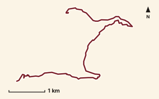
OSM route line, simplified. Branches and gaps as mapped. Hiking Hike, trail / ghat / naal route
Ambe Hill
Near Raigad, about 49.1 km from Pune centre (computed)
Mapped relation length 8.02 kmElevation Not recordedMapped in OpenStreetMap; access not checked Mapped only, not field-tested
Source: OpenStreetMap relation 18560604 (opens in a new tab) . © OpenStreetMap contributors, ODbL.
The route
- Original activity
- Hiking
- Type
- Trail / ghat / naal route. Hiking, Trail routes.
- Shape in OSM
- Linear (A→B or one-way trail)
- Surface
- Trail (OSM hiking relation; may include road segments)
- Distance
- 8.02 km. Mapped relation length (OpenStreetMap via Waymarked Trails). Can include branches and alternatives.
- Elevation
- Not recorded. No gain, loss or profile data in the source.
- Difficulty
- Not recorded
- Start and finish
- Not recorded
Access and safety
- Access
- Not recorded. That does not mean open.
- Hazards
- Not recorded. That does not mean there are none.
- Permission
- Not recorded
- Field check
- Mapped only, not field-tested. Field check recommended (geometry from source)
Data and source
- Status
- Mapped in OSM: geometry exists; ground truth not verified
- Graphic
- Route line from the OpenStreetMap relation (3 ways, fetched 7 Oct 2026), simplified for the card. Not field-checked.
- Source
- OpenStreetMap via Waymarked Trails (hiking). OpenStreetMap (opens in a new tab) Waymarked Trails (opens in a new tab)
- Credit
- OpenStreetMap contributors (see relation history)
- Source checked
- 7 Oct 2026 , OSM data via Waymarked Trails API; not field-verified
- GPX
- Download GPX , built from the OpenStreetMap line (ODbL). Mapped, not field-verified.
- Route ID
- OSM-18560604 Show on the map
Route record
- Category
- HIKES & TREKS
- Type
- Hike
- Area
- Near Raigad (computed)
- City status
- OUTSIDE PUNE
- Distance
- 8.02 km
- Elevation gain
- Not recorded
- Difficulty
- Not recorded
- Technicality
- Not recorded
- Endurance
- Not recorded
- Navigation
- Not recorded
- Exposure
- Not recorded
- Remoteness
- Not recorded
- Terrain
- Trail (OSM hiking relation; may include road segments)
- Surface
- Not recorded
- Monsoon risk
- Not recorded
- Heat risk
- Not recorded
- Wildlife
- Not recorded
- Water
- Not recorded
- Mobile network
- Not recorded
- Emergency access
- Not recorded
- Beginner suitability
- Not recorded
- Start
- Not recorded
- Finish
- Not recorded
- Nearest landmark
- Not recorded
- Creator
- OpenStreetMap contributors (see relation history)
- Source
- OpenStreetMap via Waymarked Trails (hiking)
- GPX
- Yes
- GPX link
- GPX file
- Licence
- ODbL 1.0
- Reuse
- Open licence: credit OpenStreetMap contributors, share-alike
- Route date
- Not recorded
- Last verified
- 7 Oct 2026
- Data confidence
- OSM route line, desk-checked; not field-verified
- Safety notes
- Not recorded
-
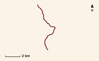
OSM route line, simplified. Branches and gaps as mapped. Trekking Trek, fort trek
Anghai Fort to Tail Baila
Near Sudhagad / Pali, about 55.7 km from Pune centre (computed)
Mapped relation length 9.11 kmElevation Not recordedMapped in OpenStreetMap; access not checked Mapped only, not field-tested
Source: OpenStreetMap relation 16864572 (opens in a new tab) . © OpenStreetMap contributors, ODbL.
The route
- Original activity
- Trekking
- Type
- Fort trek. Trekking, Trail routes, Fort treks.
- Shape in OSM
- Linear (A→B or one-way trail)
- Surface
- Trail (OSM hiking relation; may include road segments)
- Distance
- 9.11 km. Mapped relation length (OpenStreetMap via Waymarked Trails). Can include branches and alternatives.
- Elevation
- Not recorded. No gain, loss or profile data in the source.
- Difficulty
- Not recorded
- Start and finish
- Not recorded
Access and safety
- Access
- Not recorded. That does not mean open.
- Hazards
- Not recorded. That does not mean there are none.
- Permission
- Not recorded
- Field check
- Mapped only, not field-tested. Field check recommended (geometry from source)
Data and source
- Status
- Mapped in OSM: geometry exists; ground truth not verified
- Graphic
- Route line from the OpenStreetMap relation (3 ways, fetched 7 Oct 2026), simplified for the card. Not field-checked.
- Overlap
- Overlap (one route's extent lies inside the other's)
- Source
- OpenStreetMap via Waymarked Trails (hiking). OpenStreetMap (opens in a new tab) Waymarked Trails (opens in a new tab)
- Credit
- OpenStreetMap contributors (see relation history)
- Source checked
- 7 Oct 2026 , OSM data via Waymarked Trails API; not field-verified
- GPX
- Download GPX , built from the OpenStreetMap line (ODbL). Mapped, not field-verified.
- Route ID
- OSM-16864572 Show on the map
Route record
- Category
- HIKES & TREKS
- Type
- Trek
- Area
- Near Sudhagad / Pali (computed)
- City status
- OUTSIDE PUNE
- Distance
- 9.11 km
- Elevation gain
- Not recorded
- Difficulty
- Not recorded
- Technicality
- Not recorded
- Endurance
- Not recorded
- Navigation
- Not recorded
- Exposure
- Not recorded
- Remoteness
- Not recorded
- Terrain
- Trail (OSM hiking relation; may include road segments)
- Surface
- Not recorded
- Monsoon risk
- Not recorded
- Heat risk
- Not recorded
- Wildlife
- Not recorded
- Water
- Not recorded
- Mobile network
- Not recorded
- Emergency access
- Not recorded
- Beginner suitability
- Not recorded
- Start
- Not recorded
- Finish
- Not recorded
- Nearest landmark
- Not recorded
- Creator
- OpenStreetMap contributors (see relation history)
- Source
- OpenStreetMap via Waymarked Trails (hiking)
- GPX
- Yes
- GPX link
- GPX file
- Licence
- ODbL 1.0
- Reuse
- Open licence: credit OpenStreetMap contributors, share-alike
- Route date
- Not recorded
- Last verified
- 7 Oct 2026
- Data confidence
- OSM route line, desk-checked; not field-verified
- Safety notes
- Not recorded
-
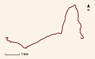
OSM route line, simplified. Branches and gaps as mapped. Hiking Hike, trail / ghat / naal route
Aswal Khind to Kampta
Near Varandha Ghat, about 58 km from Pune centre (computed)
Mapped relation length 10.54 kmElevation Not recordedMapped in OpenStreetMap; access not checked Mapped only, not field-tested
Source: OpenStreetMap relation 15555349 (opens in a new tab) . © OpenStreetMap contributors, ODbL.
The route
- Original activity
- Hiking
- Type
- Trail / ghat / naal route. Hiking, Trail routes.
- Shape in OSM
- Linear (A→B or one-way trail)
- Surface
- Trail (OSM hiking relation; may include road segments)
- Distance
- 10.54 km. Mapped relation length (OpenStreetMap via Waymarked Trails). Can include branches and alternatives.
- Elevation
- Not recorded. No gain, loss or profile data in the source.
- Difficulty
- Not recorded
- Start and finish
- Not recorded
Access and safety
- Access
- Not recorded. That does not mean open.
- Hazards
- Not recorded. That does not mean there are none.
- Permission
- Not recorded
- Field check
- Mapped only, not field-tested. Field check recommended (geometry from source)
Data and source
- Status
- Mapped in OSM: geometry exists; ground truth not verified
- Graphic
- Route line from the OpenStreetMap relation (3 ways, fetched 7 Oct 2026), simplified for the card. Not field-checked.
- Overlap
- Overlap (one route's extent lies inside the other's)
- Source
- OpenStreetMap via Waymarked Trails (hiking). OpenStreetMap (opens in a new tab) Waymarked Trails (opens in a new tab)
- Credit
- OpenStreetMap contributors (see relation history)
- Source checked
- 7 Oct 2026 , OSM data via Waymarked Trails API; not field-verified
- GPX
- Download GPX , built from the OpenStreetMap line (ODbL). Mapped, not field-verified.
- Route ID
- OSM-15555349 Show on the map
Route record
- Category
- HIKES & TREKS
- Type
- Hike
- Area
- Near Varandha Ghat (computed)
- City status
- OUTSIDE PUNE
- Distance
- 10.54 km
- Elevation gain
- Not recorded
- Difficulty
- Not recorded
- Technicality
- Not recorded
- Endurance
- Not recorded
- Navigation
- Not recorded
- Exposure
- Not recorded
- Remoteness
- Not recorded
- Terrain
- Trail (OSM hiking relation; may include road segments)
- Surface
- Not recorded
- Monsoon risk
- Not recorded
- Heat risk
- Not recorded
- Wildlife
- Not recorded
- Water
- Not recorded
- Mobile network
- Not recorded
- Emergency access
- Not recorded
- Beginner suitability
- Not recorded
- Start
- Not recorded
- Finish
- Not recorded
- Nearest landmark
- Not recorded
- Creator
- OpenStreetMap contributors (see relation history)
- Source
- OpenStreetMap via Waymarked Trails (hiking)
- GPX
- Yes
- GPX link
- GPX file
- Licence
- ODbL 1.0
- Reuse
- Open licence: credit OpenStreetMap contributors, share-alike
- Route date
- Not recorded
- Last verified
- 7 Oct 2026
- Data confidence
- OSM route line, desk-checked; not field-verified
- Safety notes
- Not recorded
-
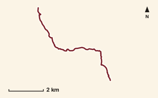
OSM route line, simplified. Branches and gaps as mapped. Hiking Hike, trail / ghat / naal route
Bagadwadi to Rajpe
Near Bhimashankar, about 70 km from Pune centre (computed)
Mapped relation length 8.13 kmElevation Not recordedMapped in OpenStreetMap; access not checked Mapped only, not field-tested
Source: OpenStreetMap relation 18550491 (opens in a new tab) . © OpenStreetMap contributors, ODbL.
The route
- Original activity
- Hiking
- Type
- Trail / ghat / naal route. Hiking, Trail routes.
- Shape in OSM
- Linear (A→B or one-way trail)
- Surface
- Trail (OSM hiking relation; may include road segments)
- Distance
- 8.13 km. Mapped relation length (OpenStreetMap via Waymarked Trails). Can include branches and alternatives.
- Elevation
- Not recorded. No gain, loss or profile data in the source.
- Difficulty
- Not recorded
- Start and finish
- Not recorded
Access and safety
- Access
- Not recorded. That does not mean open.
- Hazards
- Not recorded. That does not mean there are none.
- Permission
- Not recorded
- Field check
- Mapped only, not field-tested. Field check recommended (geometry from source)
Data and source
- Status
- Mapped in OSM: geometry exists; ground truth not verified
- Graphic
- Route line from the OpenStreetMap relation (6 ways, fetched 7 Oct 2026), simplified for the card. Not field-checked.
- Overlap
- Overlap (one route's extent lies inside the other's)
- Source
- OpenStreetMap via Waymarked Trails (hiking). OpenStreetMap (opens in a new tab) Waymarked Trails (opens in a new tab)
- Credit
- OpenStreetMap contributors (see relation history)
- Source checked
- 7 Oct 2026 , OSM data via Waymarked Trails API; not field-verified
- GPX
- Download GPX , built from the OpenStreetMap line (ODbL). Mapped, not field-verified.
- Route ID
- OSM-18550491 Show on the map
Route record
- Category
- HIKES & TREKS
- Type
- Hike
- Area
- Near Bhimashankar (computed)
- City status
- OUTSIDE PUNE
- Distance
- 8.13 km
- Elevation gain
- Not recorded
- Difficulty
- Not recorded
- Technicality
- Not recorded
- Endurance
- Not recorded
- Navigation
- Not recorded
- Exposure
- Not recorded
- Remoteness
- Not recorded
- Terrain
- Trail (OSM hiking relation; may include road segments)
- Surface
- Not recorded
- Monsoon risk
- Not recorded
- Heat risk
- Not recorded
- Wildlife
- Not recorded
- Water
- Not recorded
- Mobile network
- Not recorded
- Emergency access
- Not recorded
- Beginner suitability
- Not recorded
- Start
- Not recorded
- Finish
- Not recorded
- Nearest landmark
- Not recorded
- Creator
- OpenStreetMap contributors (see relation history)
- Source
- OpenStreetMap via Waymarked Trails (hiking)
- GPX
- Yes
- GPX link
- GPX file
- Licence
- ODbL 1.0
- Reuse
- Open licence: credit OpenStreetMap contributors, share-alike
- Route date
- Not recorded
- Last verified
- 7 Oct 2026
- Data confidence
- OSM route line, desk-checked; not field-verified
- Safety notes
- Not recorded
-
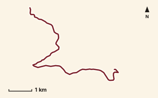
OSM route line, simplified. Branches and gaps as mapped. Hiking Hike, trail / ghat / naal route
Bahirichi Ghumati to Mahabaleshwar
Near Mahabaleshwar, about 64.6 km from Pune centre (computed)
Mapped relation length 8.8 kmElevation Not recordedMapped in OpenStreetMap; access not checked Mapped only, not field-tested
Source: OpenStreetMap relation 15555350 (opens in a new tab) . © OpenStreetMap contributors, ODbL.
The route
- Original activity
- Hiking
- Type
- Trail / ghat / naal route. Hiking, Trail routes.
- Shape in OSM
- Linear (A→B or one-way trail)
- Surface
- Trail (OSM hiking relation; may include road segments)
- Distance
- 8.8 km. Mapped relation length (OpenStreetMap via Waymarked Trails). Can include branches and alternatives.
- Elevation
- Not recorded. No gain, loss or profile data in the source.
- Difficulty
- Not recorded
- Start and finish
- Not recorded
Access and safety
- Access
- Not recorded. That does not mean open.
- Hazards
- Not recorded. That does not mean there are none.
- Permission
- Not recorded
- Field check
- Mapped only, not field-tested. Field check recommended (geometry from source)
Data and source
- Status
- Mapped in OSM: geometry exists; ground truth not verified
- Graphic
- Route line from the OpenStreetMap relation (6 ways, fetched 7 Oct 2026), simplified for the card. Not field-checked.
- Overlap
- Overlap (one route's extent lies inside the other's)
- Source
- OpenStreetMap via Waymarked Trails (hiking). OpenStreetMap (opens in a new tab) Waymarked Trails (opens in a new tab)
- Credit
- OpenStreetMap contributors (see relation history)
- Source checked
- 7 Oct 2026 , OSM data via Waymarked Trails API; not field-verified
- GPX
- Download GPX , built from the OpenStreetMap line (ODbL). Mapped, not field-verified.
- Route ID
- OSM-15555350 Show on the map
Route record
- Category
- HIKES & TREKS
- Type
- Hike
- Area
- Near Mahabaleshwar (computed)
- City status
- OUTSIDE PUNE
- Distance
- 8.8 km
- Elevation gain
- Not recorded
- Difficulty
- Not recorded
- Technicality
- Not recorded
- Endurance
- Not recorded
- Navigation
- Not recorded
- Exposure
- Not recorded
- Remoteness
- Not recorded
- Terrain
- Trail (OSM hiking relation; may include road segments)
- Surface
- Not recorded
- Monsoon risk
- Not recorded
- Heat risk
- Not recorded
- Wildlife
- Not recorded
- Water
- Not recorded
- Mobile network
- Not recorded
- Emergency access
- Not recorded
- Beginner suitability
- Not recorded
- Start
- Not recorded
- Finish
- Not recorded
- Nearest landmark
- Not recorded
- Creator
- OpenStreetMap contributors (see relation history)
- Source
- OpenStreetMap via Waymarked Trails (hiking)
- GPX
- Yes
- GPX link
- GPX file
- Licence
- ODbL 1.0
- Reuse
- Open licence: credit OpenStreetMap contributors, share-alike
- Route date
- Not recorded
- Last verified
- 7 Oct 2026
- Data confidence
- OSM route line, desk-checked; not field-verified
- Safety notes
- Not recorded
-
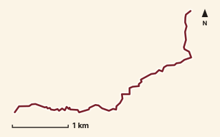
OSM route line, simplified. Branches and gaps as mapped. Hiking Hike, trail / ghat / naal route
Bahirichi to Koleshwar
Near Mahabaleshwar, about 62.4 km from Pune centre (computed)
Mapped relation length 5.21 kmElevation Not recordedMapped in OpenStreetMap; access not checked Mapped only, not field-tested
Source: OpenStreetMap relation 11875861 (opens in a new tab) . © OpenStreetMap contributors, ODbL.
The route
- Original activity
- Hiking
- Type
- Trail / ghat / naal route. Hiking, Trail routes.
- Shape in OSM
- Linear (A→B or one-way trail)
- Surface
- Trail (OSM hiking relation; may include road segments)
- Distance
- 5.21 km. Mapped relation length (OpenStreetMap via Waymarked Trails). Can include branches and alternatives.
- Elevation
- Not recorded. No gain, loss or profile data in the source.
- Difficulty
- Not recorded
- Start and finish
- Not recorded
Access and safety
- Access
- Not recorded. That does not mean open.
- Hazards
- Not recorded. That does not mean there are none.
- Permission
- Not recorded
- Field check
- Mapped only, not field-tested. Field check recommended (geometry from source)
Data and source
- Status
- Mapped in OSM: geometry exists; ground truth not verified
- Graphic
- Route line from the OpenStreetMap relation (3 ways, fetched 7 Oct 2026), simplified for the card. Not field-checked.
- Overlap
- Overlap (one route's extent lies inside the other's)
- Source
- OpenStreetMap via Waymarked Trails (hiking). OpenStreetMap (opens in a new tab) Waymarked Trails (opens in a new tab)
- Credit
- OpenStreetMap contributors (see relation history)
- Source checked
- 7 Oct 2026 , OSM data via Waymarked Trails API; not field-verified
- GPX
- Download GPX , built from the OpenStreetMap line (ODbL). Mapped, not field-verified.
- Route ID
- OSM-11875861 Show on the map
Route record
- Category
- HIKES & TREKS
- Type
- Hike
- Area
- Near Mahabaleshwar (computed)
- City status
- OUTSIDE PUNE
- Distance
- 5.21 km
- Elevation gain
- Not recorded
- Difficulty
- Not recorded
- Technicality
- Not recorded
- Endurance
- Not recorded
- Navigation
- Not recorded
- Exposure
- Not recorded
- Remoteness
- Not recorded
- Terrain
- Trail (OSM hiking relation; may include road segments)
- Surface
- Not recorded
- Monsoon risk
- Not recorded
- Heat risk
- Not recorded
- Wildlife
- Not recorded
- Water
- Not recorded
- Mobile network
- Not recorded
- Emergency access
- Not recorded
- Beginner suitability
- Not recorded
- Start
- Not recorded
- Finish
- Not recorded
- Nearest landmark
- Not recorded
- Creator
- OpenStreetMap contributors (see relation history)
- Source
- OpenStreetMap via Waymarked Trails (hiking)
- GPX
- Yes
- GPX link
- GPX file
- Licence
- ODbL 1.0
- Reuse
- Open licence: credit OpenStreetMap contributors, share-alike
- Route date
- Not recorded
- Last verified
- 7 Oct 2026
- Data confidence
- OSM route line, desk-checked; not field-verified
- Safety notes
- Not recorded
-
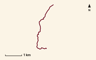
OSM route line, simplified. Branches and gaps as mapped. Hiking Hike, trail / ghat / naal route
Bail Ghat
Near Malshej, about 89.1 km from Pune centre (computed)
Mapped relation length 4.17 kmElevation Not recordedMapped in OpenStreetMap; access not checked Mapped only, not field-tested
Source: OpenStreetMap relation 18549429 (opens in a new tab) . © OpenStreetMap contributors, ODbL.
The route
- Original activity
- Hiking
- Type
- Trail / ghat / naal route. Hiking, Trail routes.
- Shape in OSM
- Linear (A→B or one-way trail)
- Surface
- Trail (OSM hiking relation; may include road segments)
- Distance
- 4.17 km. Mapped relation length (OpenStreetMap via Waymarked Trails). Can include branches and alternatives.
- Elevation
- Not recorded. No gain, loss or profile data in the source.
- Difficulty
- Not recorded
- Start and finish
- Not recorded
Access and safety
- Access
- Not recorded. That does not mean open.
- Hazards
- Not recorded. That does not mean there are none.
- Permission
- Not recorded
- Field check
- Mapped only, not field-tested. Field check recommended (geometry from source)
Data and source
- Status
- Mapped in OSM: geometry exists; ground truth not verified
- Graphic
- Route line from the OpenStreetMap relation (1 ways, fetched 7 Oct 2026), simplified for the card. Not field-checked.
- Overlap
- Overlap (one route's extent lies inside the other's)
- Source notes
- website manav.in
- Source
- OpenStreetMap via Waymarked Trails (hiking). OpenStreetMap (opens in a new tab) Waymarked Trails (opens in a new tab)
- Credit
- OpenStreetMap contributors (see relation history): relation tags reference manav.in
- Source checked
- 7 Oct 2026 , OSM data via Waymarked Trails API; not field-verified
- GPX
- Download GPX , built from the OpenStreetMap line (ODbL). Mapped, not field-verified.
- Route ID
- OSM-18549429 Show on the map
Route record
- Category
- HIKES & TREKS
- Type
- Hike
- Area
- Near Malshej (computed)
- City status
- OUTSIDE PUNE
- Distance
- 4.17 km
- Elevation gain
- Not recorded
- Difficulty
- Not recorded
- Technicality
- Not recorded
- Endurance
- Not recorded
- Navigation
- Not recorded
- Exposure
- Not recorded
- Remoteness
- Not recorded
- Terrain
- Trail (OSM hiking relation; may include road segments)
- Surface
- Not recorded
- Monsoon risk
- Not recorded
- Heat risk
- Not recorded
- Wildlife
- Not recorded
- Water
- Not recorded
- Mobile network
- Not recorded
- Emergency access
- Not recorded
- Beginner suitability
- Not recorded
- Start
- Not recorded
- Finish
- Not recorded
- Nearest landmark
- Not recorded
- Creator
- OpenStreetMap contributors (see relation history): relation tags reference manav.in
- Source
- OpenStreetMap via Waymarked Trails (hiking)
- GPX
- Yes
- GPX link
- GPX file
- Licence
- ODbL 1.0
- Reuse
- Open licence: credit OpenStreetMap contributors, share-alike
- Route date
- Not recorded
- Last verified
- 7 Oct 2026
- Data confidence
- OSM route line, desk-checked; not field-verified
- Safety notes
- Not recorded
-
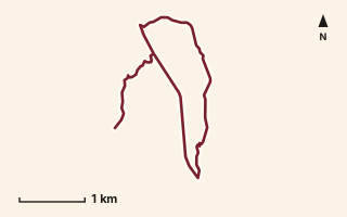
OSM route line, simplified. Branches and gaps as mapped. Hiking Hike, trail / ghat / naal route
Behran Plateau
Near Lonavala, about 60.7 km from Pune centre (computed)
Mapped relation length 9.17 kmElevation Not recordedMapped in OpenStreetMap; access not checked Mapped only, not field-tested
Source: OpenStreetMap relation 18560636 (opens in a new tab) . © OpenStreetMap contributors, ODbL.
The route
- Original activity
- Hiking
- Type
- Trail / ghat / naal route. Hiking, Trail routes.
- Shape in OSM
- Linear (A→B or one-way trail)
- Surface
- Trail (OSM hiking relation; may include road segments)
- Distance
- 9.17 km. Mapped relation length (OpenStreetMap via Waymarked Trails). Can include branches and alternatives.
- Elevation
- Not recorded. No gain, loss or profile data in the source.
- Difficulty
- Not recorded
- Start and finish
- Not recorded
Access and safety
- Access
- Not recorded. That does not mean open.
- Hazards
- Not recorded. That does not mean there are none.
- Permission
- Not recorded
- Field check
- Mapped only, not field-tested. Field check recommended (geometry from source)
Data and source
- Status
- Mapped in OSM: geometry exists; ground truth not verified
- Graphic
- Route line from the OpenStreetMap relation (9 ways, fetched 7 Oct 2026), simplified for the card. Not field-checked.
- Source notes
- website manav.in
- Source
- OpenStreetMap via Waymarked Trails (hiking). OpenStreetMap (opens in a new tab) Waymarked Trails (opens in a new tab)
- Credit
- OpenStreetMap contributors (see relation history): relation tags reference manav.in
- Source checked
- 7 Oct 2026 , OSM data via Waymarked Trails API; not field-verified
- GPX
- Download GPX , built from the OpenStreetMap line (ODbL). Mapped, not field-verified.
- Route ID
- OSM-18560636 Show on the map
Route record
- Category
- HIKES & TREKS
- Type
- Hike
- Area
- Near Lonavala (computed)
- City status
- OUTSIDE PUNE
- Distance
- 9.17 km
- Elevation gain
- Not recorded
- Difficulty
- Not recorded
- Technicality
- Not recorded
- Endurance
- Not recorded
- Navigation
- Not recorded
- Exposure
- Not recorded
- Remoteness
- Not recorded
- Terrain
- Trail (OSM hiking relation; may include road segments)
- Surface
- Not recorded
- Monsoon risk
- Not recorded
- Heat risk
- Not recorded
- Wildlife
- Not recorded
- Water
- Not recorded
- Mobile network
- Not recorded
- Emergency access
- Not recorded
- Beginner suitability
- Not recorded
- Start
- Not recorded
- Finish
- Not recorded
- Nearest landmark
- Not recorded
- Creator
- OpenStreetMap contributors (see relation history): relation tags reference manav.in
- Source
- OpenStreetMap via Waymarked Trails (hiking)
- GPX
- Yes
- GPX link
- GPX file
- Licence
- ODbL 1.0
- Reuse
- Open licence: credit OpenStreetMap contributors, share-alike
- Route date
- Not recorded
- Last verified
- 7 Oct 2026
- Data confidence
- OSM route line, desk-checked; not field-verified
- Safety notes
- Not recorded
-
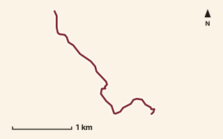
OSM route line, simplified. Branches and gaps as mapped. Trekking Trek, fort trek
Bhairavgad Moroshi
Near Malshej, about 90.8 km from Pune centre (computed)
Mapped relation length 3.3 kmElevation Not recordedMapped in OpenStreetMap; access not checked Mapped only, not field-tested
Source: OpenStreetMap relation 11846920 (opens in a new tab) . © OpenStreetMap contributors, ODbL.
The route
- Original activity
- Trekking
- Type
- Fort trek. Trekking, Trail routes, Fort treks.
- Shape in OSM
- Linear (A→B or one-way trail)
- Surface
- Trail (OSM hiking relation; may include road segments)
- Distance
- 3.3 km. Mapped relation length (OpenStreetMap via Waymarked Trails). Can include branches and alternatives.
- Elevation
- Not recorded. No gain, loss or profile data in the source.
- Difficulty
- Not recorded
- Start and finish
- Not recorded
Access and safety
- Access
- Not recorded. That does not mean open.
- Hazards
- Not recorded. That does not mean there are none.
- Permission
- Not recorded
- Field check
- Mapped only, not field-tested. Field check recommended (geometry from source)
Data and source
- Status
- Mapped in OSM: geometry exists; ground truth not verified
- Graphic
- Route line from the OpenStreetMap relation (1 ways, fetched 7 Oct 2026), simplified for the card. Not field-checked.
- Source
- OpenStreetMap via Waymarked Trails (hiking). OpenStreetMap (opens in a new tab) Waymarked Trails (opens in a new tab)
- Credit
- OpenStreetMap contributors (see relation history)
- Source checked
- 7 Oct 2026 , OSM data via Waymarked Trails API; not field-verified
- GPX
- Download GPX , built from the OpenStreetMap line (ODbL). Mapped, not field-verified.
- Route ID
- OSM-11846920 Show on the map
Route record
- Category
- HIKES & TREKS
- Type
- Trek
- Area
- Near Malshej (computed)
- City status
- OUTSIDE PUNE
- Distance
- 3.3 km
- Elevation gain
- Not recorded
- Difficulty
- Not recorded
- Technicality
- Not recorded
- Endurance
- Not recorded
- Navigation
- Not recorded
- Exposure
- Not recorded
- Remoteness
- Not recorded
- Terrain
- Trail (OSM hiking relation; may include road segments)
- Surface
- Not recorded
- Monsoon risk
- Not recorded
- Heat risk
- Not recorded
- Wildlife
- Not recorded
- Water
- Not recorded
- Mobile network
- Not recorded
- Emergency access
- Not recorded
- Beginner suitability
- Not recorded
- Start
- Not recorded
- Finish
- Not recorded
- Nearest landmark
- Not recorded
- Creator
- OpenStreetMap contributors (see relation history)
- Source
- OpenStreetMap via Waymarked Trails (hiking)
- GPX
- Yes
- GPX link
- GPX file
- Licence
- ODbL 1.0
- Reuse
- Open licence: credit OpenStreetMap contributors, share-alike
- Route date
- Not recorded
- Last verified
- 7 Oct 2026
- Data confidence
- OSM route line, desk-checked; not field-verified
- Safety notes
- Not recorded
-
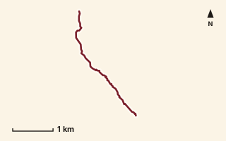
OSM route line, simplified. Branches and gaps as mapped. Hiking Hike, trail / ghat / naal route
Bhairavnaath Daar
Near Ahupe / Siddhagad, about 80.7 km from Pune centre (computed)
Mapped relation length 3.58 kmElevation Not recordedMapped in OpenStreetMap; access not checked Mapped only, not field-tested
Source: OpenStreetMap relation 18560534 (opens in a new tab) . © OpenStreetMap contributors, ODbL.
The route
- Original activity
- Hiking
- Type
- Trail / ghat / naal route. Hiking, Trail routes.
- Shape in OSM
- Linear (A→B or one-way trail)
- Surface
- Trail (OSM hiking relation; may include road segments)
- Distance
- 3.58 km. Mapped relation length (OpenStreetMap via Waymarked Trails). Can include branches and alternatives.
- Elevation
- Not recorded. No gain, loss or profile data in the source.
- Difficulty
- Not recorded
- Start and finish
- Not recorded
Access and safety
- Access
- Not recorded. That does not mean open.
- Hazards
- Not recorded. That does not mean there are none.
- Permission
- Not recorded
- Field check
- Mapped only, not field-tested. Field check recommended (geometry from source)
Data and source
- Status
- Mapped in OSM: geometry exists; ground truth not verified
- Graphic
- Route line from the OpenStreetMap relation (1 ways, fetched 7 Oct 2026), simplified for the card. Not field-checked.
- Source notes
- website manav.in
- Source
- OpenStreetMap via Waymarked Trails (hiking). OpenStreetMap (opens in a new tab) Waymarked Trails (opens in a new tab)
- Credit
- OpenStreetMap contributors (see relation history): relation tags reference manav.in
- Source checked
- 7 Oct 2026 , OSM data via Waymarked Trails API; not field-verified
- GPX
- Download GPX , built from the OpenStreetMap line (ODbL). Mapped, not field-verified.
- Route ID
- OSM-18560534 Show on the map
Route record
- Category
- HIKES & TREKS
- Type
- Hike
- Area
- Near Ahupe / Siddhagad (computed)
- City status
- OUTSIDE PUNE
- Distance
- 3.58 km
- Elevation gain
- Not recorded
- Difficulty
- Not recorded
- Technicality
- Not recorded
- Endurance
- Not recorded
- Navigation
- Not recorded
- Exposure
- Not recorded
- Remoteness
- Not recorded
- Terrain
- Trail (OSM hiking relation; may include road segments)
- Surface
- Not recorded
- Monsoon risk
- Not recorded
- Heat risk
- Not recorded
- Wildlife
- Not recorded
- Water
- Not recorded
- Mobile network
- Not recorded
- Emergency access
- Not recorded
- Beginner suitability
- Not recorded
- Start
- Not recorded
- Finish
- Not recorded
- Nearest landmark
- Not recorded
- Creator
- OpenStreetMap contributors (see relation history): relation tags reference manav.in
- Source
- OpenStreetMap via Waymarked Trails (hiking)
- GPX
- Yes
- GPX link
- GPX file
- Licence
- ODbL 1.0
- Reuse
- Open licence: credit OpenStreetMap contributors, share-alike
- Route date
- Not recorded
- Last verified
- 7 Oct 2026
- Data confidence
- OSM route line, desk-checked; not field-verified
- Safety notes
- Not recorded
-
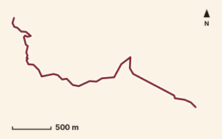
OSM route line, simplified. Branches and gaps as mapped. Hiking Hike, trail / ghat / naal route
Bhatrashi Peak
Near Kamshet / Pawna, about 43.8 km from Pune centre (computed)
Mapped relation length 3.8 kmElevation Not recordedMapped in OpenStreetMap; access not checked Mapped only, not field-tested
Source: OpenStreetMap relation 11855339 (opens in a new tab) . © OpenStreetMap contributors, ODbL.
The route
- Original activity
- Hiking
- Type
- Trail / ghat / naal route. Hiking, Trail routes.
- Shape in OSM
- Linear (A→B or one-way trail)
- Surface
- Trail (OSM hiking relation; may include road segments)
- Distance
- 3.8 km. Mapped relation length (OpenStreetMap via Waymarked Trails). Can include branches and alternatives.
- Elevation
- Not recorded. No gain, loss or profile data in the source.
- Difficulty
- Not recorded
- Start and finish
- Not recorded
Access and safety
- Access
- Not recorded. That does not mean open.
- Hazards
- Not recorded. That does not mean there are none.
- Permission
- Not recorded
- Field check
- Mapped only, not field-tested. Field check recommended (geometry from source)
Data and source
- Status
- Mapped in OSM: geometry exists; ground truth not verified
- Graphic
- Route line from the OpenStreetMap relation (2 ways, fetched 7 Oct 2026), simplified for the card. Not field-checked.
- Source
- OpenStreetMap via Waymarked Trails (hiking). OpenStreetMap (opens in a new tab) Waymarked Trails (opens in a new tab)
- Credit
- OpenStreetMap contributors (see relation history)
- Source checked
- 7 Oct 2026 , OSM data via Waymarked Trails API; not field-verified
- GPX
- Download GPX , built from the OpenStreetMap line (ODbL). Mapped, not field-verified.
- Route ID
- OSM-11855339 Show on the map
Route record
- Category
- HIKES & TREKS
- Type
- Hike
- Area
- Near Kamshet / Pawna (computed)
- City status
- OUTSIDE PUNE
- Distance
- 3.8 km
- Elevation gain
- Not recorded
- Difficulty
- Not recorded
- Technicality
- Not recorded
- Endurance
- Not recorded
- Navigation
- Not recorded
- Exposure
- Not recorded
- Remoteness
- Not recorded
- Terrain
- Trail (OSM hiking relation; may include road segments)
- Surface
- Not recorded
- Monsoon risk
- Not recorded
- Heat risk
- Not recorded
- Wildlife
- Not recorded
- Water
- Not recorded
- Mobile network
- Not recorded
- Emergency access
- Not recorded
- Beginner suitability
- Not recorded
- Start
- Not recorded
- Finish
- Not recorded
- Nearest landmark
- Not recorded
- Creator
- OpenStreetMap contributors (see relation history)
- Source
- OpenStreetMap via Waymarked Trails (hiking)
- GPX
- Yes
- GPX link
- GPX file
- Licence
- ODbL 1.0
- Reuse
- Open licence: credit OpenStreetMap contributors, share-alike
- Route date
- Not recorded
- Last verified
- 7 Oct 2026
- Data confidence
- OSM route line, desk-checked; not field-verified
- Safety notes
- Not recorded
-
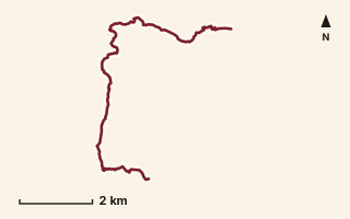
OSM route line, simplified. Branches and gaps as mapped. Hiking Hike, trail / ghat / naal route
Bhordi to Waki Budruk
Near Torna / Velhe, about 47.6 km from Pune centre (computed)
Mapped relation length 11.18 kmElevation Not recordedMapped in OpenStreetMap; access not checked Mapped only, not field-tested
Source: OpenStreetMap relation 15570553 (opens in a new tab) . © OpenStreetMap contributors, ODbL.
The route
- Original activity
- Hiking
- Type
- Trail / ghat / naal route. Hiking, Trail routes.
- Shape in OSM
- Linear (A→B or one-way trail)
- Surface
- Trail (OSM hiking relation; may include road segments)
- Distance
- 11.18 km. Mapped relation length (OpenStreetMap via Waymarked Trails). Can include branches and alternatives.
- Elevation
- Not recorded. No gain, loss or profile data in the source.
- Difficulty
- Not recorded
- Start and finish
- Not recorded
Access and safety
- Access
- Not recorded. That does not mean open.
- Hazards
- Not recorded. That does not mean there are none.
- Permission
- Not recorded
- Field check
- Mapped only, not field-tested. Field check recommended (geometry from source)
Data and source
- Status
- Mapped in OSM: geometry exists; ground truth not verified
- Graphic
- Route line from the OpenStreetMap relation (5 ways, fetched 7 Oct 2026), simplified for the card. Not field-checked.
- Overlap
- Overlap (one route's extent lies inside the other's)
- Source
- OpenStreetMap via Waymarked Trails (hiking). OpenStreetMap (opens in a new tab) Waymarked Trails (opens in a new tab)
- Credit
- OpenStreetMap contributors (see relation history)
- Source checked
- 7 Oct 2026 , OSM data via Waymarked Trails API; not field-verified
- GPX
- Download GPX , built from the OpenStreetMap line (ODbL). Mapped, not field-verified.
- Route ID
- OSM-15570553 Show on the map
Route record
- Category
- HIKES & TREKS
- Type
- Hike
- Area
- Near Torna / Velhe (computed)
- City status
- OUTSIDE PUNE
- Distance
- 11.18 km
- Elevation gain
- Not recorded
- Difficulty
- Not recorded
- Technicality
- Not recorded
- Endurance
- Not recorded
- Navigation
- Not recorded
- Exposure
- Not recorded
- Remoteness
- Not recorded
- Terrain
- Trail (OSM hiking relation; may include road segments)
- Surface
- Not recorded
- Monsoon risk
- Not recorded
- Heat risk
- Not recorded
- Wildlife
- Not recorded
- Water
- Not recorded
- Mobile network
- Not recorded
- Emergency access
- Not recorded
- Beginner suitability
- Not recorded
- Start
- Not recorded
- Finish
- Not recorded
- Nearest landmark
- Not recorded
- Creator
- OpenStreetMap contributors (see relation history)
- Source
- OpenStreetMap via Waymarked Trails (hiking)
- GPX
- Yes
- GPX link
- GPX file
- Licence
- ODbL 1.0
- Reuse
- Open licence: credit OpenStreetMap contributors, share-alike
- Route date
- Not recorded
- Last verified
- 7 Oct 2026
- Data confidence
- OSM route line, desk-checked; not field-verified
- Safety notes
- Not recorded
-
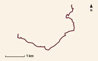
OSM route line, simplified. Branches and gaps as mapped. Hiking Hike, trail / ghat / naal route
Birwadi to Karviaale Wadi
Near Mahabaleshwar, about 72.7 km from Pune centre (computed)
Mapped relation length 6.22 kmElevation Not recordedMapped in OpenStreetMap; access not checked Mapped only, not field-tested
Source: OpenStreetMap relation 17126249 (opens in a new tab) . © OpenStreetMap contributors, ODbL.
The route
- Original activity
- Hiking
- Type
- Trail / ghat / naal route. Hiking, Trail routes.
- Shape in OSM
- Linear (A→B or one-way trail)
- Surface
- Trail (OSM hiking relation; may include road segments)
- Distance
- 6.22 km. Mapped relation length (OpenStreetMap via Waymarked Trails). Can include branches and alternatives.
- Elevation
- Not recorded. No gain, loss or profile data in the source.
- Difficulty
- Not recorded
- Start and finish
- Not recorded
Access and safety
- Access
- Not recorded. That does not mean open.
- Hazards
- Not recorded. That does not mean there are none.
- Permission
- Not recorded
- Field check
- Mapped only, not field-tested. Field check recommended (geometry from source)
Data and source
- Status
- Mapped in OSM: geometry exists; ground truth not verified
- Graphic
- Route line from the OpenStreetMap relation (6 ways, fetched 7 Oct 2026), simplified for the card. Not field-checked.
- Overlap
- Overlap (one route's extent lies inside the other's)
- Source notes
- website_old creedaz.in
- Source
- OpenStreetMap via Waymarked Trails (hiking). OpenStreetMap (opens in a new tab) Waymarked Trails (opens in a new tab)
- Credit
- OpenStreetMap contributors (see relation history): relation tags reference creedaz.in
- Source checked
- 7 Oct 2026 , OSM data via Waymarked Trails API; not field-verified
- GPX
- Download GPX , built from the OpenStreetMap line (ODbL). Mapped, not field-verified.
- Route ID
- OSM-17126249 Show on the map
Route record
- Category
- HIKES & TREKS
- Type
- Hike
- Area
- Near Mahabaleshwar (computed)
- City status
- OUTSIDE PUNE
- Distance
- 6.22 km
- Elevation gain
- Not recorded
- Difficulty
- Not recorded
- Technicality
- Not recorded
- Endurance
- Not recorded
- Navigation
- Not recorded
- Exposure
- Not recorded
- Remoteness
- Not recorded
- Terrain
- Trail (OSM hiking relation; may include road segments)
- Surface
- Not recorded
- Monsoon risk
- Not recorded
- Heat risk
- Not recorded
- Wildlife
- Not recorded
- Water
- Not recorded
- Mobile network
- Not recorded
- Emergency access
- Not recorded
- Beginner suitability
- Not recorded
- Start
- Not recorded
- Finish
- Not recorded
- Nearest landmark
- Not recorded
- Creator
- OpenStreetMap contributors (see relation history): relation tags reference creedaz.in
- Source
- OpenStreetMap via Waymarked Trails (hiking)
- GPX
- Yes
- GPX link
- GPX file
- Licence
- ODbL 1.0
- Reuse
- Open licence: credit OpenStreetMap contributors, share-alike
- Route date
- Not recorded
- Last verified
- 7 Oct 2026
- Data confidence
- OSM route line, desk-checked; not field-verified
- Safety notes
- Not recorded
-
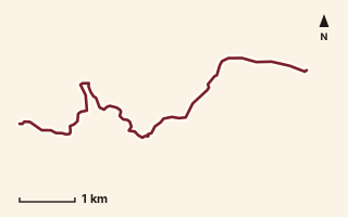
OSM route line, simplified. Branches and gaps as mapped. Hiking Hike, trail / ghat / naal route
Bopdev to Katraj
Near Katraj, about 13.2 km from Pune centre (computed)
Mapped relation length 7.91 kmElevation Not recordedMapped in OpenStreetMap; access not checked Mapped only, not field-tested
Source: OpenStreetMap relation 11856160 (opens in a new tab) . © OpenStreetMap contributors, ODbL.
The route
- Original activity
- Hiking
- Type
- Trail / ghat / naal route. Hiking, Trail routes.
- Shape in OSM
- Linear (A→B or one-way trail)
- Surface
- Trail (OSM hiking relation; may include road segments)
- Distance
- 7.91 km. Mapped relation length (OpenStreetMap via Waymarked Trails). Can include branches and alternatives.
- Elevation
- Not recorded. No gain, loss or profile data in the source.
- Difficulty
- Not recorded
- Start and finish
- Not recorded
Access and safety
- Access
- Not recorded. That does not mean open.
- Hazards
- Not recorded. That does not mean there are none.
- Permission
- Not recorded
- Field check
- Mapped only, not field-tested. Field check recommended (geometry from source)
Data and source
- Status
- Mapped in OSM: geometry exists; ground truth not verified
- Graphic
- Route line from the OpenStreetMap relation (11 ways, fetched 7 Oct 2026), simplified for the card. Not field-checked.
- Source
- OpenStreetMap via Waymarked Trails (hiking). OpenStreetMap (opens in a new tab) Waymarked Trails (opens in a new tab)
- Credit
- OpenStreetMap contributors (see relation history)
- Source checked
- 7 Oct 2026 , OSM data via Waymarked Trails API; not field-verified
- GPX
- Download GPX , built from the OpenStreetMap line (ODbL). Mapped, not field-verified.
- Route ID
- OSM-11856160 Show on the map
Route record
- Category
- HIKES & TREKS
- Type
- Hike
- Area
- Near Katraj (computed)
- City status
- URBAN EDGE
- Distance
- 7.91 km
- Elevation gain
- Not recorded
- Difficulty
- Not recorded
- Technicality
- Not recorded
- Endurance
- Not recorded
- Navigation
- Not recorded
- Exposure
- Not recorded
- Remoteness
- Not recorded
- Terrain
- Trail (OSM hiking relation; may include road segments)
- Surface
- Not recorded
- Monsoon risk
- Not recorded
- Heat risk
- Not recorded
- Wildlife
- Not recorded
- Water
- Not recorded
- Mobile network
- Not recorded
- Emergency access
- Not recorded
- Beginner suitability
- Not recorded
- Start
- Not recorded
- Finish
- Not recorded
- Nearest landmark
- Not recorded
- Creator
- OpenStreetMap contributors (see relation history)
- Source
- OpenStreetMap via Waymarked Trails (hiking)
- GPX
- Yes
- GPX link
- GPX file
- Licence
- ODbL 1.0
- Reuse
- Open licence: credit OpenStreetMap contributors, share-alike
- Route date
- Not recorded
- Last verified
- 7 Oct 2026
- Data confidence
- OSM route line, desk-checked; not field-verified
- Safety notes
- Not recorded
-
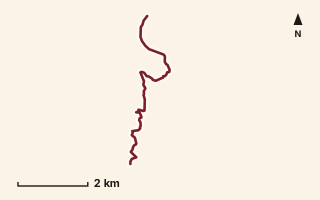
OSM route line, simplified. Branches and gaps as mapped. Hiking Hike, trail / ghat / naal route
Borwadi to Bhamblewai
Near Ahupe / Siddhagad, about 76.7 km from Pune centre (computed)
Mapped relation length 6.76 kmElevation Not recordedMapped in OpenStreetMap; access not checked Mapped only, not field-tested
Source: OpenStreetMap relation 15614632 (opens in a new tab) . © OpenStreetMap contributors, ODbL.
The route
- Original activity
- Hiking
- Type
- Trail / ghat / naal route. Hiking, Trail routes.
- Shape in OSM
- Linear (A→B or one-way trail)
- Surface
- Trail (OSM hiking relation; may include road segments)
- Distance
- 6.76 km. Mapped relation length (OpenStreetMap via Waymarked Trails). Can include branches and alternatives.
- Elevation
- Not recorded. No gain, loss or profile data in the source.
- Difficulty
- Not recorded
- Start and finish
- Not recorded
Access and safety
- Access
- Not recorded. That does not mean open.
- Hazards
- Not recorded. That does not mean there are none.
- Permission
- Not recorded
- Field check
- Mapped only, not field-tested. Field check recommended (geometry from source)
Data and source
- Status
- Mapped in OSM: geometry exists; ground truth not verified
- Graphic
- Route line from the OpenStreetMap relation (9 ways, fetched 7 Oct 2026), simplified for the card. Not field-checked.
- Source
- OpenStreetMap via Waymarked Trails (hiking). OpenStreetMap (opens in a new tab) Waymarked Trails (opens in a new tab)
- Credit
- OpenStreetMap contributors (see relation history)
- Source checked
- 7 Oct 2026 , OSM data via Waymarked Trails API; not field-verified
- GPX
- Download GPX , built from the OpenStreetMap line (ODbL). Mapped, not field-verified.
- Route ID
- OSM-15614632 Show on the map
Route record
- Category
- HIKES & TREKS
- Type
- Hike
- Area
- Near Ahupe / Siddhagad (computed)
- City status
- OUTSIDE PUNE
- Distance
- 6.76 km
- Elevation gain
- Not recorded
- Difficulty
- Not recorded
- Technicality
- Not recorded
- Endurance
- Not recorded
- Navigation
- Not recorded
- Exposure
- Not recorded
- Remoteness
- Not recorded
- Terrain
- Trail (OSM hiking relation; may include road segments)
- Surface
- Not recorded
- Monsoon risk
- Not recorded
- Heat risk
- Not recorded
- Wildlife
- Not recorded
- Water
- Not recorded
- Mobile network
- Not recorded
- Emergency access
- Not recorded
- Beginner suitability
- Not recorded
- Start
- Not recorded
- Finish
- Not recorded
- Nearest landmark
- Not recorded
- Creator
- OpenStreetMap contributors (see relation history)
- Source
- OpenStreetMap via Waymarked Trails (hiking)
- GPX
- Yes
- GPX link
- GPX file
- Licence
- ODbL 1.0
- Reuse
- Open licence: credit OpenStreetMap contributors, share-alike
- Route date
- Not recorded
- Last verified
- 7 Oct 2026
- Data confidence
- OSM route line, desk-checked; not field-verified
- Safety notes
- Not recorded
-
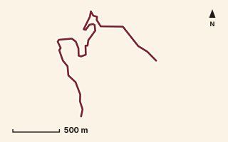
OSM route line, simplified. Branches and gaps as mapped. Hiking Hike, trail / ghat / naal route
Canyon valley
Near Lonavala, about 57 km from Pune centre (computed)
Mapped relation length 3.1 kmElevation Not recordedMapped in OpenStreetMap; access not checked Mapped only, not field-tested
Source: OpenStreetMap relation 11855342 (opens in a new tab) . © OpenStreetMap contributors, ODbL.
The route
- Original activity
- Hiking
- Type
- Trail / ghat / naal route. Hiking, Trail routes.
- Shape in OSM
- Linear (A→B or one-way trail)
- Surface
- Trail (OSM hiking relation; may include road segments)
- Distance
- 3.1 km. Mapped relation length (OpenStreetMap via Waymarked Trails). Can include branches and alternatives.
- Elevation
- Not recorded. No gain, loss or profile data in the source.
- Difficulty
- Not recorded
- Start and finish
- Not recorded
Access and safety
- Access
- Not recorded. That does not mean open.
- Hazards
- Not recorded. That does not mean there are none.
- Permission
- Not recorded
- Field check
- Mapped only, not field-tested. Field check recommended (geometry from source)
Data and source
- Status
- Mapped in OSM: geometry exists; ground truth not verified
- Graphic
- Route line from the OpenStreetMap relation (2 ways, fetched 7 Oct 2026), simplified for the card. Not field-checked.
- Source
- OpenStreetMap via Waymarked Trails (hiking). OpenStreetMap (opens in a new tab) Waymarked Trails (opens in a new tab)
- Credit
- OpenStreetMap contributors (see relation history)
- Source checked
- 7 Oct 2026 , OSM data via Waymarked Trails API; not field-verified
- GPX
- Download GPX , built from the OpenStreetMap line (ODbL). Mapped, not field-verified.
- Route ID
- OSM-11855342 Show on the map
Route record
- Category
- HIKES & TREKS
- Type
- Hike
- Area
- Near Lonavala (computed)
- City status
- OUTSIDE PUNE
- Distance
- 3.1 km
- Elevation gain
- Not recorded
- Difficulty
- Not recorded
- Technicality
- Not recorded
- Endurance
- Not recorded
- Navigation
- Not recorded
- Exposure
- Not recorded
- Remoteness
- Not recorded
- Terrain
- Trail (OSM hiking relation; may include road segments)
- Surface
- Not recorded
- Monsoon risk
- Not recorded
- Heat risk
- Not recorded
- Wildlife
- Not recorded
- Water
- Not recorded
- Mobile network
- Not recorded
- Emergency access
- Not recorded
- Beginner suitability
- Not recorded
- Start
- Not recorded
- Finish
- Not recorded
- Nearest landmark
- Not recorded
- Creator
- OpenStreetMap contributors (see relation history)
- Source
- OpenStreetMap via Waymarked Trails (hiking)
- GPX
- Yes
- GPX link
- GPX file
- Licence
- ODbL 1.0
- Reuse
- Open licence: credit OpenStreetMap contributors, share-alike
- Route date
- Not recorded
- Last verified
- 7 Oct 2026
- Data confidence
- OSM route line, desk-checked; not field-verified
- Safety notes
- Not recorded
-
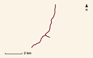
OSM route line, simplified. Branches and gaps as mapped. Trekking Trek, fort trek
Chanderi Fort
Near Matheran, about 89.4 km from Pune centre (computed)
Mapped relation length 8.06 kmElevation Not recordedMapped in OpenStreetMap; access not checked Mapped only, not field-tested
Source: OpenStreetMap relation 11855347 (opens in a new tab) . © OpenStreetMap contributors, ODbL.
The route
- Original activity
- Trekking
- Type
- Fort trek. Trekking, Trail routes, Fort treks.
- Shape in OSM
- Linear (A→B or one-way trail)
- Surface
- Trail (OSM hiking relation; may include road segments)
- Distance
- 8.06 km. Mapped relation length (OpenStreetMap via Waymarked Trails). Can include branches and alternatives.
- Elevation
- Not recorded. No gain, loss or profile data in the source.
- Difficulty
- Not recorded
- Start and finish
- Not recorded
Access and safety
- Access
- Not recorded. That does not mean open.
- Hazards
- Not recorded. That does not mean there are none.
- Permission
- Not recorded
- Field check
- Mapped only, not field-tested. Field check recommended (geometry from source)
Data and source
- Status
- Mapped in OSM: geometry exists; ground truth not verified
- Graphic
- Route line from the OpenStreetMap relation (4 ways, fetched 7 Oct 2026), simplified for the card. Not field-checked.
- Source notes
- Panvel and Badlapur approaches
- Source
- OpenStreetMap via Waymarked Trails (hiking). OpenStreetMap (opens in a new tab) Waymarked Trails (opens in a new tab)
- Credit
- OpenStreetMap contributors (see relation history)
- Source checked
- 7 Oct 2026 , OSM data via Waymarked Trails API; not field-verified
- GPX
- Download GPX , built from the OpenStreetMap line (ODbL). Mapped, not field-verified.
- Route ID
- OSM-11855347 Show on the map
Route record
- Category
- HIKES & TREKS
- Type
- Trek
- Area
- Near Matheran (computed)
- City status
- OUTSIDE PUNE
- Distance
- 8.06 km
- Elevation gain
- Not recorded
- Difficulty
- Not recorded
- Technicality
- Not recorded
- Endurance
- Not recorded
- Navigation
- Not recorded
- Exposure
- Not recorded
- Remoteness
- Not recorded
- Terrain
- Trail (OSM hiking relation; may include road segments)
- Surface
- Not recorded
- Monsoon risk
- Not recorded
- Heat risk
- Not recorded
- Wildlife
- Not recorded
- Water
- Not recorded
- Mobile network
- Not recorded
- Emergency access
- Not recorded
- Beginner suitability
- Not recorded
- Start
- Not recorded
- Finish
- Not recorded
- Nearest landmark
- Not recorded
- Creator
- OpenStreetMap contributors (see relation history)
- Source
- OpenStreetMap via Waymarked Trails (hiking)
- GPX
- Yes
- GPX link
- GPX file
- Licence
- ODbL 1.0
- Reuse
- Open licence: credit OpenStreetMap contributors, share-alike
- Route date
- Not recorded
- Last verified
- 7 Oct 2026
- Data confidence
- OSM route line, desk-checked; not field-verified
- Safety notes
- Not recorded
-
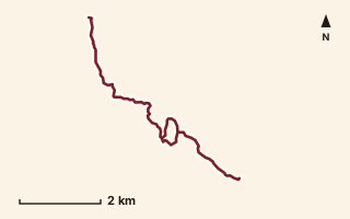
OSM route line, simplified. Branches and gaps as mapped. Trekking Trek, fort trek
Chanderi to Dodhani
Near Matheran, about 86 km from Pune centre (computed)
Mapped relation length 8.37 kmElevation Not recordedMapped in OpenStreetMap; access not checked Mapped only, not field-tested
Source: OpenStreetMap relation 15567376 (opens in a new tab) . © OpenStreetMap contributors, ODbL.
The route
- Original activity
- Trekking
- Type
- Fort trek. Trekking, Trail routes, Fort treks.
- Shape in OSM
- Non-linear in OSM (loop or multi-branch)
- Surface
- Trail (OSM hiking relation; may include road segments)
- Distance
- 8.37 km. Mapped relation length (OpenStreetMap via Waymarked Trails). Can include branches and alternatives.
- Elevation
- Not recorded. No gain, loss or profile data in the source.
- Difficulty
- Not recorded
- Start and finish
- Not recorded
Access and safety
- Access
- Not recorded. That does not mean open.
- Hazards
- Not recorded. That does not mean there are none.
- Permission
- Not recorded
- Field check
- Mapped only, not field-tested. Field check recommended (geometry from source)
Data and source
- Status
- Mapped in OSM: geometry exists; ground truth not verified
- Graphic
- Route line from the OpenStreetMap relation (19 ways, fetched 7 Oct 2026), simplified for the card. Not field-checked.
- Source
- OpenStreetMap via Waymarked Trails (hiking). OpenStreetMap (opens in a new tab) Waymarked Trails (opens in a new tab)
- Credit
- OpenStreetMap contributors (see relation history)
- Source checked
- 7 Oct 2026 , OSM data via Waymarked Trails API; not field-verified
- GPX
- Download GPX , built from the OpenStreetMap line (ODbL). Mapped, not field-verified.
- Route ID
- OSM-15567376 Show on the map
Route record
- Category
- HIKES & TREKS
- Type
- Trek
- Area
- Near Matheran (computed)
- City status
- OUTSIDE PUNE
- Distance
- 8.37 km
- Elevation gain
- Not recorded
- Difficulty
- Not recorded
- Technicality
- Not recorded
- Endurance
- Not recorded
- Navigation
- Not recorded
- Exposure
- Not recorded
- Remoteness
- Not recorded
- Terrain
- Trail (OSM hiking relation; may include road segments)
- Surface
- Not recorded
- Monsoon risk
- Not recorded
- Heat risk
- Not recorded
- Wildlife
- Not recorded
- Water
- Not recorded
- Mobile network
- Not recorded
- Emergency access
- Not recorded
- Beginner suitability
- Not recorded
- Start
- Not recorded
- Finish
- Not recorded
- Nearest landmark
- Not recorded
- Creator
- OpenStreetMap contributors (see relation history)
- Source
- OpenStreetMap via Waymarked Trails (hiking)
- GPX
- Yes
- GPX link
- GPX file
- Licence
- ODbL 1.0
- Reuse
- Open licence: credit OpenStreetMap contributors, share-alike
- Route date
- Not recorded
- Last verified
- 7 Oct 2026
- Data confidence
- OSM route line, desk-checked; not field-verified
- Safety notes
- Not recorded
-
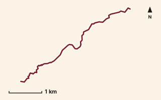
OSM route line, simplified. Branches and gaps as mapped. Hiking Hike, trail / ghat / naal route
Chikna Ghat
Near Varandha Ghat, about 55.3 km from Pune centre (computed)
Mapped relation length 5.01 kmElevation Not recordedMapped in OpenStreetMap; access not checked Mapped only, not field-tested
Source: OpenStreetMap relation 19876734 (opens in a new tab) . © OpenStreetMap contributors, ODbL.
The route
- Original activity
- Hiking
- Type
- Trail / ghat / naal route. Hiking, Trail routes.
- Shape in OSM
- Linear (A→B or one-way trail)
- Surface
- Trail (OSM hiking relation; may include road segments)
- Distance
- 5.01 km. Mapped relation length (OpenStreetMap via Waymarked Trails). Can include branches and alternatives.
- Elevation
- Not recorded. No gain, loss or profile data in the source.
- Difficulty
- Not recorded
- Start and finish
- Not recorded
Access and safety
- Access
- Not recorded. That does not mean open.
- Hazards
- Not recorded. That does not mean there are none.
- Permission
- Not recorded
- Field check
- Mapped only, not field-tested. Field check recommended (geometry from source)
Data and source
- Status
- Mapped in OSM: geometry exists; ground truth not verified
- Graphic
- Route line from the OpenStreetMap relation (4 ways, fetched 7 Oct 2026), simplified for the card. Not field-checked.
- Overlap
- Overlap (one route's extent lies inside the other's)
- Source notes
- website manav.in
- Source
- OpenStreetMap via Waymarked Trails (hiking). OpenStreetMap (opens in a new tab) Waymarked Trails (opens in a new tab)
- Credit
- OpenStreetMap contributors (see relation history): relation tags reference manav.in
- Source checked
- 7 Oct 2026 , OSM data via Waymarked Trails API; not field-verified
- GPX
- Download GPX , built from the OpenStreetMap line (ODbL). Mapped, not field-verified.
- Route ID
- OSM-19876734 Show on the map
Route record
- Category
- HIKES & TREKS
- Type
- Hike
- Area
- Near Varandha Ghat (computed)
- City status
- OUTSIDE PUNE
- Distance
- 5.01 km
- Elevation gain
- Not recorded
- Difficulty
- Not recorded
- Technicality
- Not recorded
- Endurance
- Not recorded
- Navigation
- Not recorded
- Exposure
- Not recorded
- Remoteness
- Not recorded
- Terrain
- Trail (OSM hiking relation; may include road segments)
- Surface
- Not recorded
- Monsoon risk
- Not recorded
- Heat risk
- Not recorded
- Wildlife
- Not recorded
- Water
- Not recorded
- Mobile network
- Not recorded
- Emergency access
- Not recorded
- Beginner suitability
- Not recorded
- Start
- Not recorded
- Finish
- Not recorded
- Nearest landmark
- Not recorded
- Creator
- OpenStreetMap contributors (see relation history): relation tags reference manav.in
- Source
- OpenStreetMap via Waymarked Trails (hiking)
- GPX
- Yes
- GPX link
- GPX file
- Licence
- ODbL 1.0
- Reuse
- Open licence: credit OpenStreetMap contributors, share-alike
- Route date
- Not recorded
- Last verified
- 7 Oct 2026
- Data confidence
- OSM route line, desk-checked; not field-verified
- Safety notes
- Not recorded
-
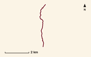
OSM route line, simplified. Branches and gaps as mapped. Hiking Hike, trail / ghat / naal route
Choudharwadi to Methalwadi
Near Bhimashankar, about 63.8 km from Pune centre (computed)
Mapped relation length 4.32 kmElevation Not recordedMapped in OpenStreetMap; access not checked Mapped only, not field-tested
Source: OpenStreetMap relation 18497203 (opens in a new tab) . © OpenStreetMap contributors, ODbL.
The route
- Original activity
- Hiking
- Type
- Trail / ghat / naal route. Hiking, Trail routes.
- Shape in OSM
- Linear (A→B or one-way trail)
- Surface
- Trail (OSM hiking relation; may include road segments)
- Distance
- 4.32 km. Mapped relation length (OpenStreetMap via Waymarked Trails). Can include branches and alternatives.
- Elevation
- Not recorded. No gain, loss or profile data in the source.
- Difficulty
- Not recorded
- Start and finish
- Not recorded
- Places named in OSM
- Fenyadevi ghat, Kalkaraiwadi
Access and safety
- Access
- Not recorded. That does not mean open.
- Hazards
- Not recorded. That does not mean there are none.
- Permission
- Not recorded
- Field check
- Mapped only, not field-tested. Field check recommended (geometry from source)
Data and source
- Status
- Mapped in OSM: geometry exists; ground truth not verified
- Graphic
- Route line from the OpenStreetMap relation (2 ways, fetched 7 Oct 2026), simplified for the card. Not field-checked.
- Overlap
- Overlap (one route's extent lies inside the other's)
- Source notes
- website manav.in
- Source
- OpenStreetMap via Waymarked Trails (hiking). OpenStreetMap (opens in a new tab) Waymarked Trails (opens in a new tab)
- Credit
- OpenStreetMap contributors (see relation history): relation tags reference manav.in
- Source checked
- 7 Oct 2026 , OSM data via Waymarked Trails API; not field-verified
- GPX
- Download GPX , built from the OpenStreetMap line (ODbL). Mapped, not field-verified.
- Route ID
- OSM-18497203 Show on the map
Route record
- Category
- HIKES & TREKS
- Type
- Hike
- Area
- Near Bhimashankar (computed)
- City status
- OUTSIDE PUNE
- Distance
- 4.32 km
- Elevation gain
- Not recorded
- Difficulty
- Not recorded
- Technicality
- Not recorded
- Endurance
- Not recorded
- Navigation
- Not recorded
- Exposure
- Not recorded
- Remoteness
- Not recorded
- Terrain
- Trail (OSM hiking relation; may include road segments)
- Surface
- Not recorded
- Monsoon risk
- Not recorded
- Heat risk
- Not recorded
- Wildlife
- Not recorded
- Water
- Not recorded
- Mobile network
- Not recorded
- Emergency access
- Not recorded
- Beginner suitability
- Not recorded
- Start
- Not recorded
- Finish
- Not recorded
- Nearest landmark
- Fenyadevi ghat
- Creator
- OpenStreetMap contributors (see relation history): relation tags reference manav.in
- Source
- OpenStreetMap via Waymarked Trails (hiking)
- GPX
- Yes
- GPX link
- GPX file
- Licence
- ODbL 1.0
- Reuse
- Open licence: credit OpenStreetMap contributors, share-alike
- Route date
- Not recorded
- Last verified
- 7 Oct 2026
- Data confidence
- OSM route line, desk-checked; not field-verified
- Safety notes
- Not recorded
-
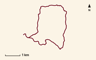
OSM route line, simplified. Branches and gaps as mapped. Hiking Hike, trail / ghat / naal route
Damdamia Loop
Near Ahupe / Siddhagad, about 78.1 km from Pune centre (computed)
Mapped relation length 11.54 kmElevation Not recordedMapped in OpenStreetMap; access not checked Mapped only, not field-tested
Source: OpenStreetMap relation 19892941 (opens in a new tab) . © OpenStreetMap contributors, ODbL.
The route
- Original activity
- Hiking
- Type
- Trail / ghat / naal route. Hiking, Trail routes.
- Shape in OSM
- Loop (by name)
- Surface
- Trail (OSM hiking relation; may include road segments)
- Distance
- 11.54 km. Mapped relation length (OpenStreetMap via Waymarked Trails). Can include branches and alternatives.
- Elevation
- Not recorded. No gain, loss or profile data in the source.
- Difficulty
- Not recorded
- Start and finish
- Not recorded
Access and safety
- Access
- Not recorded. That does not mean open.
- Hazards
- Not recorded. That does not mean there are none.
- Permission
- Not recorded
- Field check
- Mapped only, not field-tested. Field check recommended (geometry from source)
Data and source
- Status
- Mapped in OSM: geometry exists; ground truth not verified
- Graphic
- Route line from the OpenStreetMap relation (11 ways, fetched 7 Oct 2026), simplified for the card. Not field-checked.
- Overlap
- Overlap (one route's extent lies inside the other's)
- Source notes
- website manav.in
- Source
- OpenStreetMap via Waymarked Trails (hiking). OpenStreetMap (opens in a new tab) Waymarked Trails (opens in a new tab)
- Credit
- OpenStreetMap contributors (see relation history): relation tags reference manav.in
- Source checked
- 7 Oct 2026 , OSM data via Waymarked Trails API; not field-verified
- GPX
- Download GPX , built from the OpenStreetMap line (ODbL). Mapped, not field-verified.
- Route ID
- OSM-19892941 Show on the map
Route record
- Category
- HIKES & TREKS
- Type
- Hike
- Area
- Near Ahupe / Siddhagad (computed)
- City status
- OUTSIDE PUNE
- Distance
- 11.54 km
- Elevation gain
- Not recorded
- Difficulty
- Not recorded
- Technicality
- Not recorded
- Endurance
- Not recorded
- Navigation
- Not recorded
- Exposure
- Not recorded
- Remoteness
- Not recorded
- Terrain
- Trail (OSM hiking relation; may include road segments)
- Surface
- Not recorded
- Monsoon risk
- Not recorded
- Heat risk
- Not recorded
- Wildlife
- Not recorded
- Water
- Not recorded
- Mobile network
- Not recorded
- Emergency access
- Not recorded
- Beginner suitability
- Not recorded
- Start
- Not recorded
- Finish
- Not recorded
- Nearest landmark
- Not recorded
- Creator
- OpenStreetMap contributors (see relation history): relation tags reference manav.in
- Source
- OpenStreetMap via Waymarked Trails (hiking)
- GPX
- Yes
- GPX link
- GPX file
- Licence
- ODbL 1.0
- Reuse
- Open licence: credit OpenStreetMap contributors, share-alike
- Route date
- Not recorded
- Last verified
- 7 Oct 2026
- Data confidence
- OSM route line, desk-checked; not field-verified
- Safety notes
- Not recorded
-
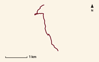
OSM route line, simplified. Branches and gaps as mapped. Hiking Hike, trail / ghat / naal route
Derya Ghat
Near Sudhagad / Pali, about 52.2 km from Pune centre (computed)
Mapped relation length 3.2 kmElevation Not recordedMapped in OpenStreetMap; access not checked Mapped only, not field-tested
Source: OpenStreetMap relation 19930339 (opens in a new tab) . © OpenStreetMap contributors, ODbL.
The route
- Original activity
- Hiking
- Type
- Trail / ghat / naal route. Hiking, Trail routes.
- Shape in OSM
- Linear (A→B or one-way trail)
- Surface
- Trail (OSM hiking relation; may include road segments)
- Distance
- 3.2 km. Mapped relation length (OpenStreetMap via Waymarked Trails). Can include branches and alternatives.
- Elevation
- Not recorded. No gain, loss or profile data in the source.
- Difficulty
- Not recorded
- Start and finish
- Not recorded
Access and safety
- Access
- Not recorded. That does not mean open.
- Hazards
- Not recorded. That does not mean there are none.
- Permission
- Not recorded
- Field check
- Mapped only, not field-tested. Field check recommended (geometry from source)
Data and source
- Status
- Mapped in OSM: geometry exists; ground truth not verified
- Graphic
- Route line from the OpenStreetMap relation (1 ways, fetched 7 Oct 2026), simplified for the card. Not field-checked.
- Overlap
- Overlap (one route's extent lies inside the other's)
- Source notes
- website manav.in
- Source
- OpenStreetMap via Waymarked Trails (hiking). OpenStreetMap (opens in a new tab) Waymarked Trails (opens in a new tab)
- Credit
- OpenStreetMap contributors (see relation history): relation tags reference manav.in
- Source checked
- 7 Oct 2026 , OSM data via Waymarked Trails API; not field-verified
- GPX
- Download GPX , built from the OpenStreetMap line (ODbL). Mapped, not field-verified.
- Route ID
- OSM-19930339 Show on the map
Route record
- Category
- HIKES & TREKS
- Type
- Hike
- Area
- Near Sudhagad / Pali (computed)
- City status
- OUTSIDE PUNE
- Distance
- 3.2 km
- Elevation gain
- Not recorded
- Difficulty
- Not recorded
- Technicality
- Not recorded
- Endurance
- Not recorded
- Navigation
- Not recorded
- Exposure
- Not recorded
- Remoteness
- Not recorded
- Terrain
- Trail (OSM hiking relation; may include road segments)
- Surface
- Not recorded
- Monsoon risk
- Not recorded
- Heat risk
- Not recorded
- Wildlife
- Not recorded
- Water
- Not recorded
- Mobile network
- Not recorded
- Emergency access
- Not recorded
- Beginner suitability
- Not recorded
- Start
- Not recorded
- Finish
- Not recorded
- Nearest landmark
- Not recorded
- Creator
- OpenStreetMap contributors (see relation history): relation tags reference manav.in
- Source
- OpenStreetMap via Waymarked Trails (hiking)
- GPX
- Yes
- GPX link
- GPX file
- Licence
- ODbL 1.0
- Reuse
- Open licence: credit OpenStreetMap contributors, share-alike
- Route date
- Not recorded
- Last verified
- 7 Oct 2026
- Data confidence
- OSM route line, desk-checked; not field-verified
- Safety notes
- Not recorded
-
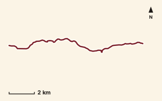
OSM route line, simplified. Branches and gaps as mapped. Hiking Hike, trail / ghat / naal route
Dive Ghat to Bobdev Ghat
Near Saswad / Purandar, about 16.1 km from Pune centre (computed)
Mapped relation length 11.99 kmElevation Not recordedMapped in OpenStreetMap; access not checked Mapped only, not field-tested
Source: OpenStreetMap relation 15554667 (opens in a new tab) . © OpenStreetMap contributors, ODbL.
The route
- Original activity
- Hiking
- Type
- Trail / ghat / naal route. Hiking, Trail routes.
- Shape in OSM
- Non-linear in OSM (loop or multi-branch)
- Surface
- Trail (OSM hiking relation; may include road segments)
- Distance
- 11.99 km. Mapped relation length (OpenStreetMap via Waymarked Trails). Can include branches and alternatives.
- Elevation
- Not recorded. No gain, loss or profile data in the source.
- Difficulty
- Not recorded
- Start and finish
- Not recorded
Access and safety
- Access
- Not recorded. That does not mean open.
- Hazards
- Not recorded. That does not mean there are none.
- Permission
- Not recorded
- Field check
- Mapped only, not field-tested. Field check recommended (geometry from source)
Data and source
- Status
- Mapped in OSM: geometry exists; ground truth not verified
- Graphic
- Route line from the OpenStreetMap relation (10 ways, fetched 7 Oct 2026), simplified for the card. Not field-checked.
- Source
- OpenStreetMap via Waymarked Trails (hiking). OpenStreetMap (opens in a new tab) Waymarked Trails (opens in a new tab)
- Credit
- OpenStreetMap contributors (see relation history)
- Source checked
- 7 Oct 2026 , OSM data via Waymarked Trails API; not field-verified
- GPX
- Download GPX , built from the OpenStreetMap line (ODbL). Mapped, not field-verified.
- Route ID
- OSM-15554667 Show on the map
Route record
- Category
- HIKES & TREKS
- Type
- Hike
- Area
- Near Saswad / Purandar (computed)
- City status
- OUTSIDE PUNE
- Distance
- 11.99 km
- Elevation gain
- Not recorded
- Difficulty
- Not recorded
- Technicality
- Not recorded
- Endurance
- Not recorded
- Navigation
- Not recorded
- Exposure
- Not recorded
- Remoteness
- Not recorded
- Terrain
- Trail (OSM hiking relation; may include road segments)
- Surface
- Not recorded
- Monsoon risk
- Not recorded
- Heat risk
- Not recorded
- Wildlife
- Not recorded
- Water
- Not recorded
- Mobile network
- Not recorded
- Emergency access
- Not recorded
- Beginner suitability
- Not recorded
- Start
- Not recorded
- Finish
- Not recorded
- Nearest landmark
- Not recorded
- Creator
- OpenStreetMap contributors (see relation history)
- Source
- OpenStreetMap via Waymarked Trails (hiking)
- GPX
- Yes
- GPX link
- GPX file
- Licence
- ODbL 1.0
- Reuse
- Open licence: credit OpenStreetMap contributors, share-alike
- Route date
- Not recorded
- Last verified
- 7 Oct 2026
- Data confidence
- OSM route line, desk-checked; not field-verified
- Safety notes
- Not recorded
-
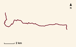
OSM route line, simplified. Branches and gaps as mapped. Hiking Hike, trail / ghat / naal route
Dongarwadi - Malewadi
Near Kamshet / Pawna, about 37.6 km from Pune centre (computed)
Mapped relation length 19.39 kmElevation Not recordedMapped in OpenStreetMap; access not checked Mapped only, not field-tested
Source: OpenStreetMap relation 11855340 (opens in a new tab) . © OpenStreetMap contributors, ODbL.
The route
- Original activity
- Hiking
- Type
- Trail / ghat / naal route. Hiking, Trail routes.
- Shape in OSM
- Linear (A→B or one-way trail)
- Surface
- Trail (OSM hiking relation; may include road segments)
- Distance
- 19.39 km. Mapped relation length (OpenStreetMap via Waymarked Trails). Can include branches and alternatives.
- Elevation
- Not recorded. No gain, loss or profile data in the source.
- Difficulty
- Not recorded
- Start and finish
- Not recorded
Access and safety
- Access
- Not recorded. That does not mean open.
- Hazards
- Not recorded. That does not mean there are none.
- Permission
- Not recorded
- Field check
- Mapped only, not field-tested. Field check recommended (geometry from source)
Data and source
- Status
- Mapped in OSM: geometry exists; ground truth not verified
- Graphic
- Route line from the OpenStreetMap relation (2 ways, fetched 7 Oct 2026), simplified for the card. Not field-checked.
- Source
- OpenStreetMap via Waymarked Trails (hiking). OpenStreetMap (opens in a new tab) Waymarked Trails (opens in a new tab)
- Credit
- OpenStreetMap contributors (see relation history)
- Source checked
- 7 Oct 2026 , OSM data via Waymarked Trails API; not field-verified
- GPX
- Download GPX , built from the OpenStreetMap line (ODbL). Mapped, not field-verified.
- Route ID
- OSM-11855340 Show on the map
Route record
- Category
- HIKES & TREKS
- Type
- Hike
- Area
- Near Kamshet / Pawna (computed)
- City status
- OUTSIDE PUNE
- Distance
- 19.39 km
- Elevation gain
- Not recorded
- Difficulty
- Not recorded
- Technicality
- Not recorded
- Endurance
- Not recorded
- Navigation
- Not recorded
- Exposure
- Not recorded
- Remoteness
- Not recorded
- Terrain
- Trail (OSM hiking relation; may include road segments)
- Surface
- Not recorded
- Monsoon risk
- Not recorded
- Heat risk
- Not recorded
- Wildlife
- Not recorded
- Water
- Not recorded
- Mobile network
- Not recorded
- Emergency access
- Not recorded
- Beginner suitability
- Not recorded
- Start
- Not recorded
- Finish
- Not recorded
- Nearest landmark
- Not recorded
- Creator
- OpenStreetMap contributors (see relation history)
- Source
- OpenStreetMap via Waymarked Trails (hiking)
- GPX
- Yes
- GPX link
- GPX file
- Licence
- ODbL 1.0
- Reuse
- Open licence: credit OpenStreetMap contributors, share-alike
- Route date
- Not recorded
- Last verified
- 7 Oct 2026
- Data confidence
- OSM route line, desk-checked; not field-verified
- Safety notes
- Not recorded
-
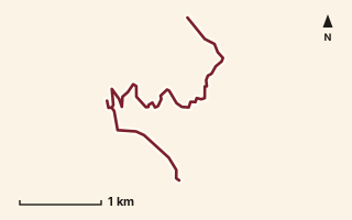
OSM route line, simplified. Branches and gaps as mapped. Hiking Hike, trail / ghat / naal route
Duke's Nose
Near Lonavala, about 57.1 km from Pune centre (computed)
Mapped relation length 5.14 kmElevation Not recordedMapped in OpenStreetMap; access not checked Mapped only, not field-tested
Source: OpenStreetMap relation 11855341 (opens in a new tab) . © OpenStreetMap contributors, ODbL.
The route
- Original activity
- Hiking
- Type
- Trail / ghat / naal route. Hiking, Trail routes.
- Shape in OSM
- Non-linear in OSM (loop or multi-branch)
- Surface
- Trail (OSM hiking relation; may include road segments)
- Distance
- 5.14 km. Mapped relation length (OpenStreetMap via Waymarked Trails). Can include branches and alternatives.
- Elevation
- Not recorded. No gain, loss or profile data in the source.
- Difficulty
- Not recorded
- Start and finish
- Not recorded
Access and safety
- Access
- Not recorded. That does not mean open.
- Hazards
- Not recorded. That does not mean there are none.
- Permission
- Not recorded
- Field check
- Mapped only, not field-tested. Field check recommended (geometry from source)
Data and source
- Status
- Mapped in OSM: geometry exists; ground truth not verified
- Graphic
- Route line from the OpenStreetMap relation (3 ways, fetched 7 Oct 2026), simplified for the card. Not field-checked.
- Overlap
- Overlap
- Source
- OpenStreetMap via Waymarked Trails (hiking). OpenStreetMap (opens in a new tab) Waymarked Trails (opens in a new tab)
- Credit
- OpenStreetMap contributors (see relation history)
- Source checked
- 7 Oct 2026 , OSM data via Waymarked Trails API; not field-verified
- GPX
- Download GPX , built from the OpenStreetMap line (ODbL). Mapped, not field-verified.
- Route ID
- OSM-11855341 Show on the map
Route record
- Category
- HIKES & TREKS
- Type
- Hike
- Area
- Near Lonavala (computed)
- City status
- OUTSIDE PUNE
- Distance
- 5.14 km
- Elevation gain
- Not recorded
- Difficulty
- Not recorded
- Technicality
- Not recorded
- Endurance
- Not recorded
- Navigation
- Not recorded
- Exposure
- Not recorded
- Remoteness
- Not recorded
- Terrain
- Trail (OSM hiking relation; may include road segments)
- Surface
- Not recorded
- Monsoon risk
- Not recorded
- Heat risk
- Not recorded
- Wildlife
- Not recorded
- Water
- Not recorded
- Mobile network
- Not recorded
- Emergency access
- Not recorded
- Beginner suitability
- Not recorded
- Start
- Not recorded
- Finish
- Not recorded
- Nearest landmark
- Not recorded
- Creator
- OpenStreetMap contributors (see relation history)
- Source
- OpenStreetMap via Waymarked Trails (hiking)
- GPX
- Yes
- GPX link
- GPX file
- Licence
- ODbL 1.0
- Reuse
- Open licence: credit OpenStreetMap contributors, share-alike
- Route date
- Not recorded
- Last verified
- 7 Oct 2026
- Data confidence
- OSM route line, desk-checked; not field-verified
- Safety notes
- Not recorded
-
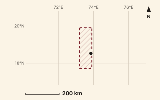
Mapped area only - not a route path. Trekking Trek, long-distance trail (master relation)
Epic Sahyadri Trail
Near Kamshet / Pawna, about 46.1 km from Pune centre (computed)
Mapped relation length 1699.84 kmElevation Not recordedMapped in OpenStreetMap; access not checked Mapped only, not field-tested
Source: OpenStreetMap relation 21100478 (opens in a new tab) . © OpenStreetMap contributors, ODbL.
The route
- Original activity
- Trekking
- Type
- Long-distance trail (master relation). Trekking, Trail routes, Long-distance trails, Mountain routes.
- Shape in OSM
- Non-linear in OSM (loop or multi-branch)
- Surface
- Trail (OSM hiking relation; may include road segments)
- Distance
- 1699.84 km. Mapped relation length (OpenStreetMap via Waymarked Trails). Can include branches and alternatives.
- Elevation
- Not recorded. No gain, loss or profile data in the source.
- Difficulty
- Not recorded
- Start and finish
- Not recorded
- Places named in OSM
- Gadgad Sanghvi, EST Stage 1-to-40, Bombay Point
Access and safety
- Access
- Not recorded. That does not mean open.
- Hazards
- Not recorded. That does not mean there are none.
- Permission
- Not recorded
- Field check
- Mapped only, not field-tested. Field check recommended (geometry from source)
Data and source
- Status
- Mapped in OSM: geometry exists; ground truth not verified
- Graphic
- Mapped area only. master relation of about 1,700 km, not fetched on purpose
- Overlap
- Parent-child (super-route stage)
- Source notes
- operator HikeX; website hikex.in
- Source
- OpenStreetMap via Waymarked Trails (hiking). OpenStreetMap (opens in a new tab) Waymarked Trails (opens in a new tab)
- Credit
- OpenStreetMap contributors (see relation history): relation tags reference HikeX (hikex.in)
- Source checked
- 7 Oct 2026 , OSM data via Waymarked Trails API; not field-verified
- GPX
- None: this record is an area, not a route line. Follow the source link to OpenStreetMap.
- Route ID
- OSM-21100478 Show on the map
Route record
- Category
- HIKES & TREKS
- Type
- Trek
- Area
- Near Kamshet / Pawna (computed)
- City status
- OUTSIDE PUNE
- Distance
- 1699.84 km
- Elevation gain
- Not recorded
- Difficulty
- Not recorded
- Technicality
- Not recorded
- Endurance
- Not recorded
- Navigation
- Not recorded
- Exposure
- Not recorded
- Remoteness
- Not recorded
- Terrain
- Trail (OSM hiking relation; may include road segments)
- Surface
- Not recorded
- Monsoon risk
- Not recorded
- Heat risk
- Not recorded
- Wildlife
- Not recorded
- Water
- Not recorded
- Mobile network
- Not recorded
- Emergency access
- Not recorded
- Beginner suitability
- Not recorded
- Start
- Not recorded
- Finish
- Not recorded
- Nearest landmark
- Gadgad Sanghvi
- Creator
- OpenStreetMap contributors (see relation history): relation tags reference HikeX (hikex.in)
- Source
- OpenStreetMap via Waymarked Trails (hiking)
- GPX
- No: an area, not a route line
- GPX link
- Not recorded
- Licence
- ODbL 1.0
- Reuse
- Open licence: credit OpenStreetMap contributors, share-alike
- Route date
- Not recorded
- Last verified
- 7 Oct 2026
- Data confidence
- Mapped area only, desk-checked; not field-verified
- Safety notes
- Not recorded
-
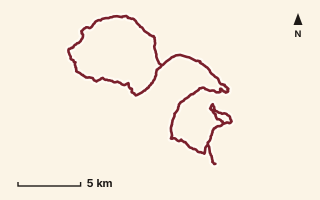
OSM route line, simplified. Branches and gaps as mapped. Trekking Trek, long-distance trail stage
EST 09
Near Harishchandragad, about 102.5 km from Pune centre (computed)
Mapped relation length 57.69 kmElevation Not recordedMapped in OpenStreetMap; access not checked Mapped only, not field-tested
Source: OpenStreetMap relation 20973791 (opens in a new tab) . © OpenStreetMap contributors, ODbL.
The route
- Original activity
- Trekking
- Type
- Long-distance trail stage. Trekking, Trail routes, Long-distance trails, Mountain routes.
- Shape in OSM
- Linear (A→B or one-way trail)
- Surface
- Trail (OSM hiking relation; may include road segments)
- Distance
- 57.69 km. Mapped relation length (OpenStreetMap via Waymarked Trails). Can include branches and alternatives.
- Elevation
- Not recorded. No gain, loss or profile data in the source.
- Difficulty
- Not recorded
- Start and finish
- Not recorded
- Places named in OSM
- Thakarwadi, Guiricha Dara, Gundey, Pathraghat, Kumshet, Umber Dara, Kadapdara Naal/Sadhale Ghat, Valhivare
Access and safety
- Access
- Not recorded. That does not mean open.
- Hazards
- Not recorded. That does not mean there are none.
- Permission
- Not recorded
- Field check
- Mapped only, not field-tested. Field check recommended (geometry from source)
Data and source
- Status
- Mapped in OSM: geometry exists; ground truth not verified
- Graphic
- Route line from the OpenStreetMap relation (54 ways, fetched 7 Oct 2026), simplified for the card. Not field-checked.
- Overlap
- Parent-child (super-route stage)
- Source notes
- operator HikeX
- Source
- OpenStreetMap via Waymarked Trails (hiking). OpenStreetMap (opens in a new tab) Waymarked Trails (opens in a new tab)
- Credit
- OpenStreetMap contributors (see relation history): relation tags reference HikeX (hikex.in)
- Source checked
- 7 Oct 2026 , OSM data via Waymarked Trails API; not field-verified
- GPX
- Download GPX , built from the OpenStreetMap line (ODbL). Mapped, not field-verified.
- Route ID
- OSM-20973791 Show on the map
Route record
- Category
- HIKES & TREKS
- Type
- Trek
- Area
- Near Harishchandragad (computed)
- City status
- OUTSIDE PUNE
- Distance
- 57.69 km
- Elevation gain
- Not recorded
- Difficulty
- Not recorded
- Technicality
- Not recorded
- Endurance
- Not recorded
- Navigation
- Not recorded
- Exposure
- Not recorded
- Remoteness
- Not recorded
- Terrain
- Trail (OSM hiking relation; may include road segments)
- Surface
- Not recorded
- Monsoon risk
- Not recorded
- Heat risk
- Not recorded
- Wildlife
- Not recorded
- Water
- Not recorded
- Mobile network
- Not recorded
- Emergency access
- Not recorded
- Beginner suitability
- Not recorded
- Start
- Not recorded
- Finish
- Not recorded
- Nearest landmark
- Thakarwadi
- Creator
- OpenStreetMap contributors (see relation history): relation tags reference HikeX (hikex.in)
- Source
- OpenStreetMap via Waymarked Trails (hiking)
- GPX
- Yes
- GPX link
- GPX file
- Licence
- ODbL 1.0
- Reuse
- Open licence: credit OpenStreetMap contributors, share-alike
- Route date
- Not recorded
- Last verified
- 7 Oct 2026
- Data confidence
- OSM route line, desk-checked; not field-verified
- Safety notes
- Not recorded
-
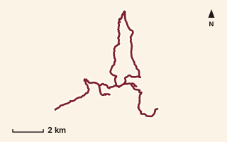
OSM route line, simplified. Branches and gaps as mapped. Trekking Trek, long-distance trail stage
EST 10
Near Harishchandragad, about 98.5 km from Pune centre (computed)
Mapped relation length 28.5 kmElevation Not recordedMapped in OpenStreetMap; access not checked Mapped only, not field-tested
Source: OpenStreetMap relation 20976315 (opens in a new tab) . © OpenStreetMap contributors, ODbL.
The route
- Original activity
- Trekking
- Type
- Long-distance trail stage. Trekking, Trail routes, Long-distance trails, Mountain routes.
- Shape in OSM
- Linear (A→B or one-way trail)
- Surface
- Trail (OSM hiking relation; may include road segments)
- Distance
- 28.5 km. Mapped relation length (OpenStreetMap via Waymarked Trails). Can include branches and alternatives.
- Elevation
- Not recorded. No gain, loss or profile data in the source.
- Difficulty
- Not recorded
- Start and finish
- Not recorded
- Places named in OSM
- Valhivare, Nalichi Vaat, Betachi Nali, Konkankada, Taramati Peak, Vaitaal Dhar, Harishchandragad, Bale Killa, Junnar Darwaza, Khireshwar
Access and safety
- Access
- Not recorded. That does not mean open.
- Hazards
- Not recorded. That does not mean there are none.
- Permission
- Not recorded
- Field check
- Mapped only, not field-tested. Field check recommended (geometry from source)
Data and source
- Status
- Mapped in OSM: geometry exists; ground truth not verified
- Graphic
- Route line from the OpenStreetMap relation (33 ways, fetched 7 Oct 2026), simplified for the card. Not field-checked.
- Overlap
- Parent-child (super-route stage)
- Source notes
- operator HikeX
- Source
- OpenStreetMap via Waymarked Trails (hiking). OpenStreetMap (opens in a new tab) Waymarked Trails (opens in a new tab)
- Credit
- OpenStreetMap contributors (see relation history): relation tags reference HikeX (hikex.in)
- Source checked
- 7 Oct 2026 , OSM data via Waymarked Trails API; not field-verified
- GPX
- Download GPX , built from the OpenStreetMap line (ODbL). Mapped, not field-verified.
- Route ID
- OSM-20976315 Show on the map
Route record
- Category
- HIKES & TREKS
- Type
- Trek
- Area
- Near Harishchandragad (computed)
- City status
- OUTSIDE PUNE
- Distance
- 28.5 km
- Elevation gain
- Not recorded
- Difficulty
- Not recorded
- Technicality
- Not recorded
- Endurance
- Not recorded
- Navigation
- Not recorded
- Exposure
- Not recorded
- Remoteness
- Not recorded
- Terrain
- Trail (OSM hiking relation; may include road segments)
- Surface
- Not recorded
- Monsoon risk
- Not recorded
- Heat risk
- Not recorded
- Wildlife
- Not recorded
- Water
- Not recorded
- Mobile network
- Not recorded
- Emergency access
- Not recorded
- Beginner suitability
- Not recorded
- Start
- Not recorded
- Finish
- Not recorded
- Nearest landmark
- Valhivare
- Creator
- OpenStreetMap contributors (see relation history): relation tags reference HikeX (hikex.in)
- Source
- OpenStreetMap via Waymarked Trails (hiking)
- GPX
- Yes
- GPX link
- GPX file
- Licence
- ODbL 1.0
- Reuse
- Open licence: credit OpenStreetMap contributors, share-alike
- Route date
- Not recorded
- Last verified
- 7 Oct 2026
- Data confidence
- OSM route line, desk-checked; not field-verified
- Safety notes
- Not recorded
-
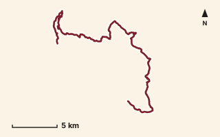
OSM route line, simplified. Branches and gaps as mapped. Trekking Trek, long-distance trail stage
EST 11
Near Harishchandragad, about 93.2 km from Pune centre (computed)
Mapped relation length 37.74 kmElevation Not recordedMapped in OpenStreetMap; access not checked Mapped only, not field-tested
Source: OpenStreetMap relation 20976763 (opens in a new tab) . © OpenStreetMap contributors, ODbL.
The route
- Original activity
- Trekking
- Type
- Long-distance trail stage. Trekking, Trail routes, Long-distance trails, Mountain routes.
- Shape in OSM
- Linear (A→B or one-way trail)
- Surface
- Trail (OSM hiking relation; may include road segments)
- Distance
- 37.74 km. Mapped relation length (OpenStreetMap via Waymarked Trails). Can include branches and alternatives.
- Elevation
- Not recorded. No gain, loss or profile data in the source.
- Difficulty
- Not recorded
- Start and finish
- Not recorded
- Places named in OSM
- Khireshwar, Tolar Khind, Bhairavgad (Kothale), Vanar Khind, Karkai Plateau, Kunjargad, Bhairobai Dongar, Bhardu Mahadev Mandir, Khandichi Vaat, Bhoirwadi
Access and safety
- Access
- Not recorded. That does not mean open.
- Hazards
- Not recorded. That does not mean there are none.
- Permission
- Not recorded
- Field check
- Mapped only, not field-tested. Field check recommended (geometry from source)
Data and source
- Status
- Mapped in OSM: geometry exists; ground truth not verified
- Graphic
- Route line from the OpenStreetMap relation (26 ways, fetched 7 Oct 2026), simplified for the card. Not field-checked.
- Overlap
- Overlap (one route's extent lies inside the other's); Parent-child (super-route stage)
- Source notes
- operator HikeX
- Source
- OpenStreetMap via Waymarked Trails (hiking). OpenStreetMap (opens in a new tab) Waymarked Trails (opens in a new tab)
- Credit
- OpenStreetMap contributors (see relation history): relation tags reference HikeX (hikex.in)
- Source checked
- 7 Oct 2026 , OSM data via Waymarked Trails API; not field-verified
- GPX
- Download GPX , built from the OpenStreetMap line (ODbL). Mapped, not field-verified.
- Route ID
- OSM-20976763 Show on the map
Route record
- Category
- HIKES & TREKS
- Type
- Trek
- Area
- Near Harishchandragad (computed)
- City status
- OUTSIDE PUNE
- Distance
- 37.74 km
- Elevation gain
- Not recorded
- Difficulty
- Not recorded
- Technicality
- Not recorded
- Endurance
- Not recorded
- Navigation
- Not recorded
- Exposure
- Not recorded
- Remoteness
- Not recorded
- Terrain
- Trail (OSM hiking relation; may include road segments)
- Surface
- Not recorded
- Monsoon risk
- Not recorded
- Heat risk
- Not recorded
- Wildlife
- Not recorded
- Water
- Not recorded
- Mobile network
- Not recorded
- Emergency access
- Not recorded
- Beginner suitability
- Not recorded
- Start
- Not recorded
- Finish
- Not recorded
- Nearest landmark
- Khireshwar
- Creator
- OpenStreetMap contributors (see relation history): relation tags reference HikeX (hikex.in)
- Source
- OpenStreetMap via Waymarked Trails (hiking)
- GPX
- Yes
- GPX link
- GPX file
- Licence
- ODbL 1.0
- Reuse
- Open licence: credit OpenStreetMap contributors, share-alike
- Route date
- Not recorded
- Last verified
- 7 Oct 2026
- Data confidence
- OSM route line, desk-checked; not field-verified
- Safety notes
- Not recorded
-
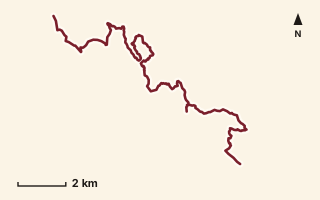
OSM route line, simplified. Branches and gaps as mapped. Trekking Trek, long-distance trail stage
EST 12
Near Malshej, about 91.9 km from Pune centre (computed)
Mapped relation length 23.49 kmElevation Not recordedMapped in OpenStreetMap; access not checked Mapped only, not field-tested
Source: OpenStreetMap relation 20976776 (opens in a new tab) . © OpenStreetMap contributors, ODbL.
The route
- Original activity
- Trekking
- Type
- Long-distance trail stage. Trekking, Trail routes, Long-distance trails, Mountain routes.
- Shape in OSM
- Linear (A→B or one-way trail)
- Surface
- Trail (OSM hiking relation; may include road segments)
- Distance
- 23.49 km. Mapped relation length (OpenStreetMap via Waymarked Trails). Can include branches and alternatives.
- Elevation
- Not recorded. No gain, loss or profile data in the source.
- Difficulty
- Not recorded
- Start and finish
- Not recorded
- Places named in OSM
- Bhoirwadi, Bazaarchi Vaat, Vasubai Maata Mandir, Ranjana Dongar, Gayadhara, Takorichi Vaat, Umberyachi Vaat, Khireshwar
Access and safety
- Access
- Not recorded. That does not mean open.
- Hazards
- Not recorded. That does not mean there are none.
- Permission
- Not recorded
- Field check
- Mapped only, not field-tested. Field check recommended (geometry from source)
Data and source
- Status
- Mapped in OSM: geometry exists; ground truth not verified
- Graphic
- Route line from the OpenStreetMap relation (20 ways, fetched 7 Oct 2026), simplified for the card. Not field-checked.
- Overlap
- Overlap (one route's extent lies inside the other's); Parent-child (super-route stage)
- Source notes
- operator HikeX
- Source
- OpenStreetMap via Waymarked Trails (hiking). OpenStreetMap (opens in a new tab) Waymarked Trails (opens in a new tab)
- Credit
- OpenStreetMap contributors (see relation history): relation tags reference HikeX (hikex.in)
- Source checked
- 7 Oct 2026 , OSM data via Waymarked Trails API; not field-verified
- GPX
- Download GPX , built from the OpenStreetMap line (ODbL). Mapped, not field-verified.
- Route ID
- OSM-20976776 Show on the map
Route record
- Category
- HIKES & TREKS
- Type
- Trek
- Area
- Near Malshej (computed)
- City status
- OUTSIDE PUNE
- Distance
- 23.49 km
- Elevation gain
- Not recorded
- Difficulty
- Not recorded
- Technicality
- Not recorded
- Endurance
- Not recorded
- Navigation
- Not recorded
- Exposure
- Not recorded
- Remoteness
- Not recorded
- Terrain
- Trail (OSM hiking relation; may include road segments)
- Surface
- Not recorded
- Monsoon risk
- Not recorded
- Heat risk
- Not recorded
- Wildlife
- Not recorded
- Water
- Not recorded
- Mobile network
- Not recorded
- Emergency access
- Not recorded
- Beginner suitability
- Not recorded
- Start
- Not recorded
- Finish
- Not recorded
- Nearest landmark
- Bhoirwadi
- Creator
- OpenStreetMap contributors (see relation history): relation tags reference HikeX (hikex.in)
- Source
- OpenStreetMap via Waymarked Trails (hiking)
- GPX
- Yes
- GPX link
- GPX file
- Licence
- ODbL 1.0
- Reuse
- Open licence: credit OpenStreetMap contributors, share-alike
- Route date
- Not recorded
- Last verified
- 7 Oct 2026
- Data confidence
- OSM route line, desk-checked; not field-verified
- Safety notes
- Not recorded
-
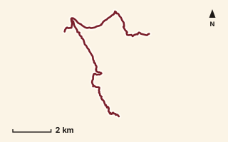
OSM route line, simplified. Branches and gaps as mapped. Trekking Trek, long-distance trail stage
EST 13
Near Harishchandragad, about 93.7 km from Pune centre (computed)
Mapped relation length 15.78 kmElevation Not recordedMapped in OpenStreetMap; access not checked Mapped only, not field-tested
Source: OpenStreetMap relation 20978405 (opens in a new tab) . © OpenStreetMap contributors, ODbL.
The route
- Original activity
- Trekking
- Type
- Long-distance trail stage. Trekking, Trail routes, Long-distance trails, Mountain routes.
- Shape in OSM
- Linear (A→B or one-way trail)
- Surface
- Trail (OSM hiking relation; may include road segments)
- Distance
- 15.78 km. Mapped relation length (OpenStreetMap via Waymarked Trails). Can include branches and alternatives.
- Elevation
- Not recorded. No gain, loss or profile data in the source.
- Difficulty
- Not recorded
- Start and finish
- Not recorded
- Places named in OSM
- Khireshwar, Rohidas, Rohidas Ghal, Kaalu Waterfall, Malshej Ghat, NH 61 (MTDC Resort)
Access and safety
- Access
- Not recorded. That does not mean open.
- Hazards
- Not recorded. That does not mean there are none.
- Permission
- Not recorded
- Field check
- Mapped only, not field-tested. Field check recommended (geometry from source)
Data and source
- Status
- Mapped in OSM: geometry exists; ground truth not verified
- Graphic
- Route line from the OpenStreetMap relation (18 ways, fetched 7 Oct 2026), simplified for the card. Not field-checked.
- Overlap
- Parent-child (super-route stage)
- Source notes
- operator HikeX
- Source
- OpenStreetMap via Waymarked Trails (hiking). OpenStreetMap (opens in a new tab) Waymarked Trails (opens in a new tab)
- Credit
- OpenStreetMap contributors (see relation history): relation tags reference HikeX (hikex.in)
- Source checked
- 7 Oct 2026 , OSM data via Waymarked Trails API; not field-verified
- GPX
- Download GPX , built from the OpenStreetMap line (ODbL). Mapped, not field-verified.
- Route ID
- OSM-20978405 Show on the map
Route record
- Category
- HIKES & TREKS
- Type
- Trek
- Area
- Near Harishchandragad (computed)
- City status
- OUTSIDE PUNE
- Distance
- 15.78 km
- Elevation gain
- Not recorded
- Difficulty
- Not recorded
- Technicality
- Not recorded
- Endurance
- Not recorded
- Navigation
- Not recorded
- Exposure
- Not recorded
- Remoteness
- Not recorded
- Terrain
- Trail (OSM hiking relation; may include road segments)
- Surface
- Not recorded
- Monsoon risk
- Not recorded
- Heat risk
- Not recorded
- Wildlife
- Not recorded
- Water
- Not recorded
- Mobile network
- Not recorded
- Emergency access
- Not recorded
- Beginner suitability
- Not recorded
- Start
- Not recorded
- Finish
- Not recorded
- Nearest landmark
- Khireshwar
- Creator
- OpenStreetMap contributors (see relation history): relation tags reference HikeX (hikex.in)
- Source
- OpenStreetMap via Waymarked Trails (hiking)
- GPX
- Yes
- GPX link
- GPX file
- Licence
- ODbL 1.0
- Reuse
- Open licence: credit OpenStreetMap contributors, share-alike
- Route date
- Not recorded
- Last verified
- 7 Oct 2026
- Data confidence
- OSM route line, desk-checked; not field-verified
- Safety notes
- Not recorded
-
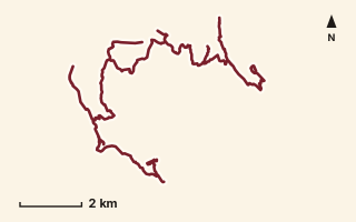
OSM route line, simplified. Branches and gaps as mapped. Trekking Trek, long-distance trail stage
EST 14
Near Malshej, about 88.4 km from Pune centre (computed)
Mapped relation length 32.35 kmElevation Not recordedMapped in OpenStreetMap; access not checked Mapped only, not field-tested
Source: OpenStreetMap relation 20978685 (opens in a new tab) . © OpenStreetMap contributors, ODbL.
The route
- Original activity
- Trekking
- Type
- Long-distance trail stage. Trekking, Trail routes, Long-distance trails, Mountain routes.
- Shape in OSM
- Linear (A→B or one-way trail)
- Surface
- Trail (OSM hiking relation; may include road segments)
- Distance
- 32.35 km. Mapped relation length (OpenStreetMap via Waymarked Trails). Can include branches and alternatives.
- Elevation
- Not recorded. No gain, loss or profile data in the source.
- Difficulty
- Not recorded
- Start and finish
- Not recorded
- Places named in OSM
- NH 61 (MTDC Resort), Sindola, Udhlya, Gunya, Bhojgiri, Dev Daundya, Chaurya, Taleran Route, Nimgiri, Hanumantgad, Khandichiwadi
Access and safety
- Access
- Not recorded. That does not mean open.
- Hazards
- Not recorded. That does not mean there are none.
- Permission
- Not recorded
- Field check
- Mapped only, not field-tested. Field check recommended (geometry from source)
Data and source
- Status
- Mapped in OSM: geometry exists; ground truth not verified
- Graphic
- Route line from the OpenStreetMap relation (50 ways, fetched 7 Oct 2026), simplified for the card. Not field-checked.
- Overlap
- Overlap (one route's extent lies inside the other's); Parent-child (super-route stage)
- Source notes
- operator HikeX
- Source
- OpenStreetMap via Waymarked Trails (hiking). OpenStreetMap (opens in a new tab) Waymarked Trails (opens in a new tab)
- Credit
- OpenStreetMap contributors (see relation history): relation tags reference HikeX (hikex.in)
- Source checked
- 7 Oct 2026 , OSM data via Waymarked Trails API; not field-verified
- GPX
- Download GPX , built from the OpenStreetMap line (ODbL). Mapped, not field-verified.
- Route ID
- OSM-20978685 Show on the map
Route record
- Category
- HIKES & TREKS
- Type
- Trek
- Area
- Near Malshej (computed)
- City status
- OUTSIDE PUNE
- Distance
- 32.35 km
- Elevation gain
- Not recorded
- Difficulty
- Not recorded
- Technicality
- Not recorded
- Endurance
- Not recorded
- Navigation
- Not recorded
- Exposure
- Not recorded
- Remoteness
- Not recorded
- Terrain
- Trail (OSM hiking relation; may include road segments)
- Surface
- Not recorded
- Monsoon risk
- Not recorded
- Heat risk
- Not recorded
- Wildlife
- Not recorded
- Water
- Not recorded
- Mobile network
- Not recorded
- Emergency access
- Not recorded
- Beginner suitability
- Not recorded
- Start
- Not recorded
- Finish
- Not recorded
- Nearest landmark
- NH 61 (MTDC Resort)
- Creator
- OpenStreetMap contributors (see relation history): relation tags reference HikeX (hikex.in)
- Source
- OpenStreetMap via Waymarked Trails (hiking)
- GPX
- Yes
- GPX link
- GPX file
- Licence
- ODbL 1.0
- Reuse
- Open licence: credit OpenStreetMap contributors, share-alike
- Route date
- Not recorded
- Last verified
- 7 Oct 2026
- Data confidence
- OSM route line, desk-checked; not field-verified
- Safety notes
- Not recorded
-
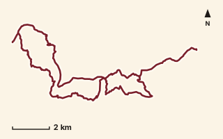
OSM route line, simplified. Branches and gaps as mapped. Trekking Trek, long-distance trail stage
EST 15
Near Malshej, about 84.3 km from Pune centre (computed)
Mapped relation length 37.21 kmElevation Not recordedMapped in OpenStreetMap; access not checked Mapped only, not field-tested
Source: OpenStreetMap relation 20978752 (opens in a new tab) . © OpenStreetMap contributors, ODbL.
The route
- Original activity
- Trekking
- Type
- Long-distance trail stage. Trekking, Trail routes, Long-distance trails, Mountain routes.
- Shape in OSM
- Linear (A→B or one-way trail)
- Surface
- Trail (OSM hiking relation; may include road segments)
- Distance
- 37.21 km. Mapped relation length (OpenStreetMap via Waymarked Trails). Can include branches and alternatives.
- Elevation
- Not recorded. No gain, loss or profile data in the source.
- Difficulty
- Not recorded
- Start and finish
- Not recorded
- Places named in OSM
- Khandichiwadi, Hadsar, Mangnaimaata Mandir, Hatkeshwar Natural Bridge, Ganesh Khind, Hadsar Khind, Khuntichi Vaat, Hadsar Fort, Mashedicha Dongar, Khandichiwadi
Access and safety
- Access
- Not recorded. That does not mean open.
- Hazards
- Not recorded. That does not mean there are none.
- Permission
- Not recorded
- Field check
- Mapped only, not field-tested. Field check recommended (geometry from source)
Data and source
- Status
- Mapped in OSM: geometry exists; ground truth not verified
- Graphic
- Route line from the OpenStreetMap relation (40 ways, fetched 7 Oct 2026), simplified for the card. Not field-checked.
- Overlap
- Overlap (one route's extent lies inside the other's); Parent-child (super-route stage)
- Source notes
- operator HikeX
- Source
- OpenStreetMap via Waymarked Trails (hiking). OpenStreetMap (opens in a new tab) Waymarked Trails (opens in a new tab)
- Credit
- OpenStreetMap contributors (see relation history): relation tags reference HikeX (hikex.in)
- Source checked
- 7 Oct 2026 , OSM data via Waymarked Trails API; not field-verified
- GPX
- Download GPX , built from the OpenStreetMap line (ODbL). Mapped, not field-verified.
- Route ID
- OSM-20978752 Show on the map
Route record
- Category
- HIKES & TREKS
- Type
- Trek
- Area
- Near Malshej (computed)
- City status
- OUTSIDE PUNE
- Distance
- 37.21 km
- Elevation gain
- Not recorded
- Difficulty
- Not recorded
- Technicality
- Not recorded
- Endurance
- Not recorded
- Navigation
- Not recorded
- Exposure
- Not recorded
- Remoteness
- Not recorded
- Terrain
- Trail (OSM hiking relation; may include road segments)
- Surface
- Not recorded
- Monsoon risk
- Not recorded
- Heat risk
- Not recorded
- Wildlife
- Not recorded
- Water
- Not recorded
- Mobile network
- Not recorded
- Emergency access
- Not recorded
- Beginner suitability
- Not recorded
- Start
- Not recorded
- Finish
- Not recorded
- Nearest landmark
- Khandichiwadi
- Creator
- OpenStreetMap contributors (see relation history): relation tags reference HikeX (hikex.in)
- Source
- OpenStreetMap via Waymarked Trails (hiking)
- GPX
- Yes
- GPX link
- GPX file
- Licence
- ODbL 1.0
- Reuse
- Open licence: credit OpenStreetMap contributors, share-alike
- Route date
- Not recorded
- Last verified
- 7 Oct 2026
- Data confidence
- OSM route line, desk-checked; not field-verified
- Safety notes
- Not recorded
-
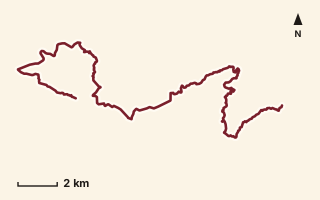
OSM route line, simplified. Branches and gaps as mapped. Trekking Trek, long-distance trail stage
EST 16
Near Malshej, about 87.4 km from Pune centre (computed)
Mapped relation length 33.02 kmElevation Not recordedMapped in OpenStreetMap; access not checked Mapped only, not field-tested
Source: OpenStreetMap relation 20979864 (opens in a new tab) . © OpenStreetMap contributors, ODbL.
The route
- Original activity
- Trekking
- Type
- Long-distance trail stage. Trekking, Trail routes, Long-distance trails, Mountain routes.
- Shape in OSM
- Linear (A→B or one-way trail)
- Surface
- Trail (OSM hiking relation; may include road segments)
- Distance
- 33.02 km. Mapped relation length (OpenStreetMap via Waymarked Trails). Can include branches and alternatives.
- Elevation
- Not recorded. No gain, loss or profile data in the source.
- Difficulty
- Not recorded
- Start and finish
- Not recorded
- Places named in OSM
- Khandichiwadi, Chaurya, Borandyache Daar, Naneghat, Ghatghar
Access and safety
- Access
- Not recorded. That does not mean open.
- Hazards
- Not recorded. That does not mean there are none.
- Permission
- Not recorded
- Field check
- Mapped only, not field-tested. Field check recommended (geometry from source)
Data and source
- Status
- Mapped in OSM: geometry exists; ground truth not verified
- Graphic
- Route line from the OpenStreetMap relation (23 ways, fetched 7 Oct 2026), simplified for the card. Not field-checked.
- Overlap
- Overlap (one route's extent lies inside the other's); Parent-child (super-route stage)
- Source notes
- operator HikeX
- Source
- OpenStreetMap via Waymarked Trails (hiking). OpenStreetMap (opens in a new tab) Waymarked Trails (opens in a new tab)
- Credit
- OpenStreetMap contributors (see relation history): relation tags reference HikeX (hikex.in)
- Source checked
- 7 Oct 2026 , OSM data via Waymarked Trails API; not field-verified
- GPX
- Download GPX , built from the OpenStreetMap line (ODbL). Mapped, not field-verified.
- Route ID
- OSM-20979864 Show on the map
Route record
- Category
- HIKES & TREKS
- Type
- Trek
- Area
- Near Malshej (computed)
- City status
- OUTSIDE PUNE
- Distance
- 33.02 km
- Elevation gain
- Not recorded
- Difficulty
- Not recorded
- Technicality
- Not recorded
- Endurance
- Not recorded
- Navigation
- Not recorded
- Exposure
- Not recorded
- Remoteness
- Not recorded
- Terrain
- Trail (OSM hiking relation; may include road segments)
- Surface
- Not recorded
- Monsoon risk
- Not recorded
- Heat risk
- Not recorded
- Wildlife
- Not recorded
- Water
- Not recorded
- Mobile network
- Not recorded
- Emergency access
- Not recorded
- Beginner suitability
- Not recorded
- Start
- Not recorded
- Finish
- Not recorded
- Nearest landmark
- Khandichiwadi
- Creator
- OpenStreetMap contributors (see relation history): relation tags reference HikeX (hikex.in)
- Source
- OpenStreetMap via Waymarked Trails (hiking)
- GPX
- Yes
- GPX link
- GPX file
- Licence
- ODbL 1.0
- Reuse
- Open licence: credit OpenStreetMap contributors, share-alike
- Route date
- Not recorded
- Last verified
- 7 Oct 2026
- Data confidence
- OSM route line, desk-checked; not field-verified
- Safety notes
- Not recorded
-
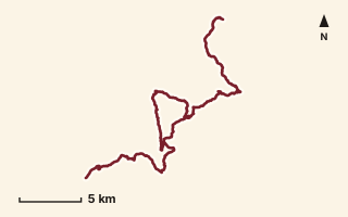
OSM route line, simplified. Branches and gaps as mapped. Trekking Trek, long-distance trail stage
EST 17
Near Junnar / Naneghat, about 82.8 km from Pune centre (computed)
Mapped relation length 47.8 kmElevation Not recordedMapped in OpenStreetMap; access not checked Mapped only, not field-tested
Source: OpenStreetMap relation 20980014 (opens in a new tab) . © OpenStreetMap contributors, ODbL.
The route
- Original activity
- Trekking
- Type
- Long-distance trail stage. Trekking, Trail routes, Long-distance trails, Mountain routes.
- Shape in OSM
- Linear (A→B or one-way trail)
- Surface
- Trail (OSM hiking relation; may include road segments)
- Distance
- 47.8 km. Mapped relation length (OpenStreetMap via Waymarked Trails). Can include branches and alternatives.
- Elevation
- Not recorded. No gain, loss or profile data in the source.
- Difficulty
- Not recorded
- Start and finish
- Not recorded
- Places named in OSM
- Ghatghar, Darya Ghat, Dhakoba, Durg, Donicha Daar, Khuntyachi Vaat, Ahupe
Access and safety
- Access
- Not recorded. That does not mean open.
- Hazards
- Not recorded. That does not mean there are none.
- Permission
- Not recorded
- Field check
- Mapped only, not field-tested. Field check recommended (geometry from source)
Data and source
- Status
- Mapped in OSM: geometry exists; ground truth not verified
- Graphic
- Route line from the OpenStreetMap relation (48 ways, fetched 7 Oct 2026), simplified for the card. Not field-checked.
- Overlap
- Overlap (one route's extent lies inside the other's); Parent-child (super-route stage)
- Source notes
- operator HikeX
- Source
- OpenStreetMap via Waymarked Trails (hiking). OpenStreetMap (opens in a new tab) Waymarked Trails (opens in a new tab)
- Credit
- OpenStreetMap contributors (see relation history): relation tags reference HikeX (hikex.in)
- Source checked
- 7 Oct 2026 , OSM data via Waymarked Trails API; not field-verified
- GPX
- Download GPX , built from the OpenStreetMap line (ODbL). Mapped, not field-verified.
- Route ID
- OSM-20980014 Show on the map
Route record
- Category
- HIKES & TREKS
- Type
- Trek
- Area
- Near Junnar / Naneghat (computed)
- City status
- OUTSIDE PUNE
- Distance
- 47.8 km
- Elevation gain
- Not recorded
- Difficulty
- Not recorded
- Technicality
- Not recorded
- Endurance
- Not recorded
- Navigation
- Not recorded
- Exposure
- Not recorded
- Remoteness
- Not recorded
- Terrain
- Trail (OSM hiking relation; may include road segments)
- Surface
- Not recorded
- Monsoon risk
- Not recorded
- Heat risk
- Not recorded
- Wildlife
- Not recorded
- Water
- Not recorded
- Mobile network
- Not recorded
- Emergency access
- Not recorded
- Beginner suitability
- Not recorded
- Start
- Not recorded
- Finish
- Not recorded
- Nearest landmark
- Ghatghar
- Creator
- OpenStreetMap contributors (see relation history): relation tags reference HikeX (hikex.in)
- Source
- OpenStreetMap via Waymarked Trails (hiking)
- GPX
- Yes
- GPX link
- GPX file
- Licence
- ODbL 1.0
- Reuse
- Open licence: credit OpenStreetMap contributors, share-alike
- Route date
- Not recorded
- Last verified
- 7 Oct 2026
- Data confidence
- OSM route line, desk-checked; not field-verified
- Safety notes
- Not recorded
-
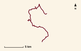
OSM route line, simplified. Branches and gaps as mapped. Trekking Trek, long-distance trail stage
EST 18
Near Ahupe / Siddhagad, about 77.4 km from Pune centre (computed)
Mapped relation length 27.53 kmElevation Not recordedMapped in OpenStreetMap; access not checked Mapped only, not field-tested
Source: OpenStreetMap relation 20980070 (opens in a new tab) . © OpenStreetMap contributors, ODbL.
The route
- Original activity
- Trekking
- Type
- Long-distance trail stage. Trekking, Trail routes, Long-distance trails, Mountain routes.
- Shape in OSM
- Linear (A→B or one-way trail)
- Surface
- Trail (OSM hiking relation; may include road segments)
- Distance
- 27.53 km. Mapped relation length (OpenStreetMap via Waymarked Trails). Can include branches and alternatives.
- Elevation
- Not recorded. No gain, loss or profile data in the source.
- Difficulty
- Not recorded
- Start and finish
- Not recorded
- Places named in OSM
- Ahupe, Ahupe Ghat, Gorakhgad, Siddhagad, Zaakh Maata Khind, Umber Daara, Kondhval
Access and safety
- Access
- Not recorded. That does not mean open.
- Hazards
- Not recorded. That does not mean there are none.
- Permission
- Not recorded
- Field check
- Mapped only, not field-tested. Field check recommended (geometry from source)
Data and source
- Status
- Mapped in OSM: geometry exists; ground truth not verified
- Graphic
- Route line from the OpenStreetMap relation (24 ways, fetched 7 Oct 2026), simplified for the card. Not field-checked.
- Overlap
- Overlap (one route's extent lies inside the other's); Parent-child (super-route stage)
- Source notes
- operator HikeX
- Source
- OpenStreetMap via Waymarked Trails (hiking). OpenStreetMap (opens in a new tab) Waymarked Trails (opens in a new tab)
- Credit
- OpenStreetMap contributors (see relation history): relation tags reference HikeX (hikex.in)
- Source checked
- 7 Oct 2026 , OSM data via Waymarked Trails API; not field-verified
- GPX
- Download GPX , built from the OpenStreetMap line (ODbL). Mapped, not field-verified.
- Route ID
- OSM-20980070 Show on the map
Route record
- Category
- HIKES & TREKS
- Type
- Trek
- Area
- Near Ahupe / Siddhagad (computed)
- City status
- OUTSIDE PUNE
- Distance
- 27.53 km
- Elevation gain
- Not recorded
- Difficulty
- Not recorded
- Technicality
- Not recorded
- Endurance
- Not recorded
- Navigation
- Not recorded
- Exposure
- Not recorded
- Remoteness
- Not recorded
- Terrain
- Trail (OSM hiking relation; may include road segments)
- Surface
- Not recorded
- Monsoon risk
- Not recorded
- Heat risk
- Not recorded
- Wildlife
- Not recorded
- Water
- Not recorded
- Mobile network
- Not recorded
- Emergency access
- Not recorded
- Beginner suitability
- Not recorded
- Start
- Not recorded
- Finish
- Not recorded
- Nearest landmark
- Ahupe
- Creator
- OpenStreetMap contributors (see relation history): relation tags reference HikeX (hikex.in)
- Source
- OpenStreetMap via Waymarked Trails (hiking)
- GPX
- Yes
- GPX link
- GPX file
- Licence
- ODbL 1.0
- Reuse
- Open licence: credit OpenStreetMap contributors, share-alike
- Route date
- Not recorded
- Last verified
- 7 Oct 2026
- Data confidence
- OSM route line, desk-checked; not field-verified
- Safety notes
- Not recorded
-
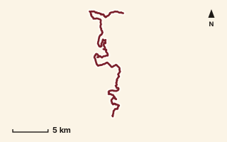
OSM route line, simplified. Branches and gaps as mapped. Trekking Trek, long-distance trail stage
EST 19
Near Bhimashankar, about 67.2 km from Pune centre (computed)
Mapped relation length 40.53 kmElevation Not recordedMapped in OpenStreetMap; access not checked Mapped only, not field-tested
Source: OpenStreetMap relation 20980112 (opens in a new tab) . © OpenStreetMap contributors, ODbL.
The route
- Original activity
- Trekking
- Type
- Long-distance trail stage. Trekking, Trail routes, Long-distance trails, Mountain routes.
- Shape in OSM
- Linear (A→B or one-way trail)
- Surface
- Trail (OSM hiking relation; may include road segments)
- Distance
- 40.53 km. Mapped relation length (OpenStreetMap via Waymarked Trails). Can include branches and alternatives.
- Elevation
- Not recorded. No gain, loss or profile data in the source.
- Difficulty
- Not recorded
- Start and finish
- Not recorded
- Places named in OSM
- Kondhval, Dara Ghat, Bail Ghat, Ransheel Ghat, Ganesh Ghat, Bhimashankar, Nagphani, Padargad, Pedyacha Ghat, Ambenali Ghat, Khetoba, Vajintri Ghat, Ghogol Ghat, Ramkhand Forest, Andhraichi Vaat, Padharwadi
Access and safety
- Access
- Not recorded. That does not mean open.
- Hazards
- Not recorded. That does not mean there are none.
- Permission
- Not recorded
- Field check
- Mapped only, not field-tested. Field check recommended (geometry from source)
Data and source
- Status
- Mapped in OSM: geometry exists; ground truth not verified
- Graphic
- Route line from the OpenStreetMap relation (41 ways, fetched 7 Oct 2026), simplified for the card. Not field-checked.
- Overlap
- Overlap (one route's extent lies inside the other's); Parent-child (super-route stage)
- Source notes
- operator HikeX
- Source
- OpenStreetMap via Waymarked Trails (hiking). OpenStreetMap (opens in a new tab) Waymarked Trails (opens in a new tab)
- Credit
- OpenStreetMap contributors (see relation history): relation tags reference HikeX (hikex.in)
- Source checked
- 7 Oct 2026 , OSM data via Waymarked Trails API; not field-verified
- GPX
- Download GPX , built from the OpenStreetMap line (ODbL). Mapped, not field-verified.
- Route ID
- OSM-20980112 Show on the map
Route record
- Category
- HIKES & TREKS
- Type
- Trek
- Area
- Near Bhimashankar (computed)
- City status
- OUTSIDE PUNE
- Distance
- 40.53 km
- Elevation gain
- Not recorded
- Difficulty
- Not recorded
- Technicality
- Not recorded
- Endurance
- Not recorded
- Navigation
- Not recorded
- Exposure
- Not recorded
- Remoteness
- Not recorded
- Terrain
- Trail (OSM hiking relation; may include road segments)
- Surface
- Not recorded
- Monsoon risk
- Not recorded
- Heat risk
- Not recorded
- Wildlife
- Not recorded
- Water
- Not recorded
- Mobile network
- Not recorded
- Emergency access
- Not recorded
- Beginner suitability
- Not recorded
- Start
- Not recorded
- Finish
- Not recorded
- Nearest landmark
- Kondhval
- Creator
- OpenStreetMap contributors (see relation history): relation tags reference HikeX (hikex.in)
- Source
- OpenStreetMap via Waymarked Trails (hiking)
- GPX
- Yes
- GPX link
- GPX file
- Licence
- ODbL 1.0
- Reuse
- Open licence: credit OpenStreetMap contributors, share-alike
- Route date
- Not recorded
- Last verified
- 7 Oct 2026
- Data confidence
- OSM route line, desk-checked; not field-verified
- Safety notes
- Not recorded
-
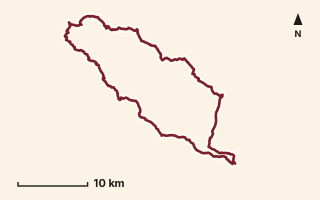
OSM route line, simplified. Branches and gaps as mapped. Trekking Trek, long-distance trail stage
EST 20
Near Bhimashankar, about 46.2 km from Pune centre (computed)
Mapped relation length 90.13 kmElevation Not recordedMapped in OpenStreetMap; access not checked Mapped only, not field-tested
Source: OpenStreetMap relation 20980147 (opens in a new tab) . © OpenStreetMap contributors, ODbL.
The route
- Original activity
- Trekking
- Type
- Long-distance trail stage. Trekking, Trail routes, Long-distance trails, Mountain routes.
- Shape in OSM
- Linear (A→B or one-way trail)
- Surface
- Trail (OSM hiking relation; may include road segments)
- Distance
- 90.13 km. Mapped relation length (OpenStreetMap via Waymarked Trails). Can include branches and alternatives.
- Elevation
- Not recorded. No gain, loss or profile data in the source.
- Difficulty
- Not recorded
- Start and finish
- Not recorded
- Places named in OSM
- Padharwadi, Kakubai Maata Mandir, Shingeshwar Mandir, Chor Khind, Hadruj Khind, Kundeshwar Peak, Mukhai Mandir, Bhamchandra Mandir, Satwai Maata Mandir, Navlakhya Dongar, Taasubai Mandir, Ambhu Khind, Varsubai Mandir, Padharwadi
Access and safety
- Access
- Not recorded. That does not mean open.
- Hazards
- Not recorded. That does not mean there are none.
- Permission
- Not recorded
- Field check
- Mapped only, not field-tested. Field check recommended (geometry from source)
Data and source
- Status
- Mapped in OSM: geometry exists; ground truth not verified
- Graphic
- Route line from the OpenStreetMap relation (54 ways, fetched 7 Oct 2026), simplified for the card. Not field-checked.
- Overlap
- Overlap (one route's extent lies inside the other's); Parent-child (super-route stage)
- Source notes
- operator HikeX
- Source
- OpenStreetMap via Waymarked Trails (hiking). OpenStreetMap (opens in a new tab) Waymarked Trails (opens in a new tab)
- Credit
- OpenStreetMap contributors (see relation history): relation tags reference HikeX (hikex.in)
- Source checked
- 7 Oct 2026 , OSM data via Waymarked Trails API; not field-verified
- GPX
- Download GPX , built from the OpenStreetMap line (ODbL). Mapped, not field-verified.
- Route ID
- OSM-20980147 Show on the map
Route record
- Category
- HIKES & TREKS
- Type
- Trek
- Area
- Near Bhimashankar (computed)
- City status
- OUTSIDE PUNE
- Distance
- 90.13 km
- Elevation gain
- Not recorded
- Difficulty
- Not recorded
- Technicality
- Not recorded
- Endurance
- Not recorded
- Navigation
- Not recorded
- Exposure
- Not recorded
- Remoteness
- Not recorded
- Terrain
- Trail (OSM hiking relation; may include road segments)
- Surface
- Not recorded
- Monsoon risk
- Not recorded
- Heat risk
- Not recorded
- Wildlife
- Not recorded
- Water
- Not recorded
- Mobile network
- Not recorded
- Emergency access
- Not recorded
- Beginner suitability
- Not recorded
- Start
- Not recorded
- Finish
- Not recorded
- Nearest landmark
- Padharwadi
- Creator
- OpenStreetMap contributors (see relation history): relation tags reference HikeX (hikex.in)
- Source
- OpenStreetMap via Waymarked Trails (hiking)
- GPX
- Yes
- GPX link
- GPX file
- Licence
- ODbL 1.0
- Reuse
- Open licence: credit OpenStreetMap contributors, share-alike
- Route date
- Not recorded
- Last verified
- 7 Oct 2026
- Data confidence
- OSM route line, desk-checked; not field-verified
- Safety notes
- Not recorded
-
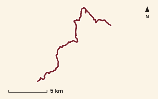
OSM route line, simplified. Branches and gaps as mapped. Trekking Trek, long-distance trail stage
EST 21
Near Bhimashankar, about 61.1 km from Pune centre (computed)
Mapped relation length 23.56 kmElevation Not recordedMapped in OpenStreetMap; access not checked Mapped only, not field-tested
Source: OpenStreetMap relation 20980446 (opens in a new tab) . © OpenStreetMap contributors, ODbL.
The route
- Original activity
- Trekking
- Type
- Long-distance trail stage. Trekking, Trail routes, Long-distance trails, Mountain routes.
- Shape in OSM
- Linear (A→B or one-way trail)
- Surface
- Trail (OSM hiking relation; may include road segments)
- Distance
- 23.56 km. Mapped relation length (OpenStreetMap via Waymarked Trails). Can include branches and alternatives.
- Elevation
- Not recorded. No gain, loss or profile data in the source.
- Difficulty
- Not recorded
- Start and finish
- Not recorded
- Places named in OSM
- Padharwadi, Nisanchi Waat, Peth Kothaligad, Payari Ghat, Kusur
Access and safety
- Access
- Not recorded. That does not mean open.
- Hazards
- Not recorded. That does not mean there are none.
- Permission
- Not recorded
- Field check
- Mapped only, not field-tested. Field check recommended (geometry from source)
Data and source
- Status
- Mapped in OSM: geometry exists; ground truth not verified
- Graphic
- Route line from the OpenStreetMap relation (36 ways, fetched 7 Oct 2026), simplified for the card. Not field-checked.
- Overlap
- Overlap (one route's extent lies inside the other's); Parent-child (super-route stage)
- Source notes
- operator HikeX
- Source
- OpenStreetMap via Waymarked Trails (hiking). OpenStreetMap (opens in a new tab) Waymarked Trails (opens in a new tab)
- Credit
- OpenStreetMap contributors (see relation history): relation tags reference HikeX (hikex.in)
- Source checked
- 7 Oct 2026 , OSM data via Waymarked Trails API; not field-verified
- GPX
- Download GPX , built from the OpenStreetMap line (ODbL). Mapped, not field-verified.
- Route ID
- OSM-20980446 Show on the map
Route record
- Category
- HIKES & TREKS
- Type
- Trek
- Area
- Near Bhimashankar (computed)
- City status
- OUTSIDE PUNE
- Distance
- 23.56 km
- Elevation gain
- Not recorded
- Difficulty
- Not recorded
- Technicality
- Not recorded
- Endurance
- Not recorded
- Navigation
- Not recorded
- Exposure
- Not recorded
- Remoteness
- Not recorded
- Terrain
- Trail (OSM hiking relation; may include road segments)
- Surface
- Not recorded
- Monsoon risk
- Not recorded
- Heat risk
- Not recorded
- Wildlife
- Not recorded
- Water
- Not recorded
- Mobile network
- Not recorded
- Emergency access
- Not recorded
- Beginner suitability
- Not recorded
- Start
- Not recorded
- Finish
- Not recorded
- Nearest landmark
- Padharwadi
- Creator
- OpenStreetMap contributors (see relation history): relation tags reference HikeX (hikex.in)
- Source
- OpenStreetMap via Waymarked Trails (hiking)
- GPX
- Yes
- GPX link
- GPX file
- Licence
- ODbL 1.0
- Reuse
- Open licence: credit OpenStreetMap contributors, share-alike
- Route date
- Not recorded
- Last verified
- 7 Oct 2026
- Data confidence
- OSM route line, desk-checked; not field-verified
- Safety notes
- Not recorded
-
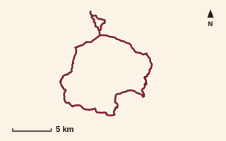
OSM route line, simplified. Branches and gaps as mapped. Trekking Trek, long-distance trail stage
EST 22
Near Lonavala, about 54.6 km from Pune centre (computed)
Mapped relation length 52.8 kmElevation Not recordedMapped in OpenStreetMap; access not checked Mapped only, not field-tested
Source: OpenStreetMap relation 20980485 (opens in a new tab) . © OpenStreetMap contributors, ODbL.
The route
- Original activity
- Trekking
- Type
- Long-distance trail stage. Trekking, Trail routes, Long-distance trails, Mountain routes.
- Shape in OSM
- Linear (A→B or one-way trail)
- Surface
- Trail (OSM hiking relation; may include road segments)
- Distance
- 52.8 km. Mapped relation length (OpenStreetMap via Waymarked Trails). Can include branches and alternatives.
- Elevation
- Not recorded. No gain, loss or profile data in the source.
- Difficulty
- Not recorded
- Start and finish
- Not recorded
- Places named in OSM
- Kusur, Nanemawal Ridge, Karla Mountain Range, Kusur
Access and safety
- Access
- Not recorded. That does not mean open.
- Hazards
- Not recorded. That does not mean there are none.
- Permission
- Not recorded
- Field check
- Mapped only, not field-tested. Field check recommended (geometry from source)
Data and source
- Status
- Mapped in OSM: geometry exists; ground truth not verified
- Graphic
- Route line from the OpenStreetMap relation (34 ways, fetched 7 Oct 2026), simplified for the card. Not field-checked.
- Overlap
- Parent-child (super-route stage)
- Source notes
- operator HikeX
- Source
- OpenStreetMap via Waymarked Trails (hiking). OpenStreetMap (opens in a new tab) Waymarked Trails (opens in a new tab)
- Credit
- OpenStreetMap contributors (see relation history): relation tags reference HikeX (hikex.in)
- Source checked
- 7 Oct 2026 , OSM data via Waymarked Trails API; not field-verified
- GPX
- Download GPX , built from the OpenStreetMap line (ODbL). Mapped, not field-verified.
- Route ID
- OSM-20980485 Show on the map
Route record
- Category
- HIKES & TREKS
- Type
- Trek
- Area
- Near Lonavala (computed)
- City status
- OUTSIDE PUNE
- Distance
- 52.8 km
- Elevation gain
- Not recorded
- Difficulty
- Not recorded
- Technicality
- Not recorded
- Endurance
- Not recorded
- Navigation
- Not recorded
- Exposure
- Not recorded
- Remoteness
- Not recorded
- Terrain
- Trail (OSM hiking relation; may include road segments)
- Surface
- Not recorded
- Monsoon risk
- Not recorded
- Heat risk
- Not recorded
- Wildlife
- Not recorded
- Water
- Not recorded
- Mobile network
- Not recorded
- Emergency access
- Not recorded
- Beginner suitability
- Not recorded
- Start
- Not recorded
- Finish
- Not recorded
- Nearest landmark
- Kusur
- Creator
- OpenStreetMap contributors (see relation history): relation tags reference HikeX (hikex.in)
- Source
- OpenStreetMap via Waymarked Trails (hiking)
- GPX
- Yes
- GPX link
- GPX file
- Licence
- ODbL 1.0
- Reuse
- Open licence: credit OpenStreetMap contributors, share-alike
- Route date
- Not recorded
- Last verified
- 7 Oct 2026
- Data confidence
- OSM route line, desk-checked; not field-verified
- Safety notes
- Not recorded
-
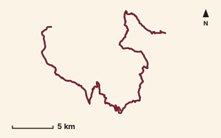
OSM route line, simplified. Branches and gaps as mapped. Trekking Trek, long-distance trail stage
EST 23
Near Karjat, about 63.9 km from Pune centre (computed)
Mapped relation length 56.74 kmElevation Not recordedMapped in OpenStreetMap; access not checked Mapped only, not field-tested
Source: OpenStreetMap relation 20989124 (opens in a new tab) . © OpenStreetMap contributors, ODbL.
The route
- Original activity
- Trekking
- Type
- Long-distance trail stage. Trekking, Trail routes, Long-distance trails, Mountain routes.
- Shape in OSM
- Linear (A→B or one-way trail)
- Surface
- Trail (OSM hiking relation; may include road segments)
- Distance
- 56.74 km. Mapped relation length (OpenStreetMap via Waymarked Trails). Can include branches and alternatives.
- Elevation
- Not recorded. No gain, loss or profile data in the source.
- Difficulty
- Not recorded
- Start and finish
- Not recorded
- Places named in OSM
- Kusur, Sai Dongar, Shila Chi Waat, Karjat
Access and safety
- Access
- Not recorded. That does not mean open.
- Hazards
- Not recorded. That does not mean there are none.
- Permission
- Not recorded
- Field check
- Mapped only, not field-tested. Field check recommended (geometry from source)
Data and source
- Status
- Mapped in OSM: geometry exists; ground truth not verified
- Graphic
- Route line from the OpenStreetMap relation (83 ways, fetched 7 Oct 2026), simplified for the card. Not field-checked.
- Overlap
- Overlap (one route's extent lies inside the other's); Parent-child (super-route stage)
- Source notes
- operator HikeX
- Source
- OpenStreetMap via Waymarked Trails (hiking). OpenStreetMap (opens in a new tab) Waymarked Trails (opens in a new tab)
- Credit
- OpenStreetMap contributors (see relation history): relation tags reference HikeX (hikex.in)
- Source checked
- 7 Oct 2026 , OSM data via Waymarked Trails API; not field-verified
- GPX
- Download GPX , built from the OpenStreetMap line (ODbL). Mapped, not field-verified.
- Route ID
- OSM-20989124 Show on the map
Route record
- Category
- HIKES & TREKS
- Type
- Trek
- Area
- Near Karjat (computed)
- City status
- OUTSIDE PUNE
- Distance
- 56.74 km
- Elevation gain
- Not recorded
- Difficulty
- Not recorded
- Technicality
- Not recorded
- Endurance
- Not recorded
- Navigation
- Not recorded
- Exposure
- Not recorded
- Remoteness
- Not recorded
- Terrain
- Trail (OSM hiking relation; may include road segments)
- Surface
- Not recorded
- Monsoon risk
- Not recorded
- Heat risk
- Not recorded
- Wildlife
- Not recorded
- Water
- Not recorded
- Mobile network
- Not recorded
- Emergency access
- Not recorded
- Beginner suitability
- Not recorded
- Start
- Not recorded
- Finish
- Not recorded
- Nearest landmark
- Kusur
- Creator
- OpenStreetMap contributors (see relation history): relation tags reference HikeX (hikex.in)
- Source
- OpenStreetMap via Waymarked Trails (hiking)
- GPX
- Yes
- GPX link
- GPX file
- Licence
- ODbL 1.0
- Reuse
- Open licence: credit OpenStreetMap contributors, share-alike
- Route date
- Not recorded
- Last verified
- 7 Oct 2026
- Data confidence
- OSM route line, desk-checked; not field-verified
- Safety notes
- Not recorded
-
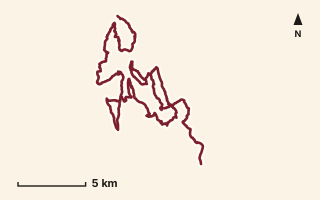
OSM route line, simplified. Branches and gaps as mapped. Trekking Trek, long-distance trail stage
EST 24
Near Matheran, about 78 km from Pune centre (computed)
Mapped relation length 58.84 kmElevation Not recordedMapped in OpenStreetMap; access not checked Mapped only, not field-tested
Source: OpenStreetMap relation 20989437 (opens in a new tab) . © OpenStreetMap contributors, ODbL.
The route
- Original activity
- Trekking
- Type
- Long-distance trail stage. Trekking, Trail routes, Long-distance trails, Mountain routes.
- Shape in OSM
- Linear (A→B or one-way trail)
- Surface
- Trail (OSM hiking relation; may include road segments)
- Distance
- 58.84 km. Mapped relation length (OpenStreetMap via Waymarked Trails). Can include branches and alternatives.
- Elevation
- Not recorded. No gain, loss or profile data in the source.
- Difficulty
- Not recorded
- Start and finish
- Not recorded
- Places named in OSM
- Karjat, Dodhani
Access and safety
- Access
- Not recorded. That does not mean open.
- Hazards
- Not recorded. That does not mean there are none.
- Permission
- Not recorded
- Field check
- Mapped only, not field-tested. Field check recommended (geometry from source)
Data and source
- Status
- Mapped in OSM: geometry exists; ground truth not verified
- Graphic
- Route line from the OpenStreetMap relation (72 ways, fetched 7 Oct 2026), simplified for the card. Not field-checked.
- Overlap
- Overlap (one route's extent lies inside the other's); Parent-child (super-route stage)
- Source notes
- operator HikeX
- Source
- OpenStreetMap via Waymarked Trails (hiking). OpenStreetMap (opens in a new tab) Waymarked Trails (opens in a new tab)
- Credit
- OpenStreetMap contributors (see relation history): relation tags reference HikeX (hikex.in)
- Source checked
- 7 Oct 2026 , OSM data via Waymarked Trails API; not field-verified
- GPX
- Download GPX , built from the OpenStreetMap line (ODbL). Mapped, not field-verified.
- Route ID
- OSM-20989437 Show on the map
Route record
- Category
- HIKES & TREKS
- Type
- Trek
- Area
- Near Matheran (computed)
- City status
- OUTSIDE PUNE
- Distance
- 58.84 km
- Elevation gain
- Not recorded
- Difficulty
- Not recorded
- Technicality
- Not recorded
- Endurance
- Not recorded
- Navigation
- Not recorded
- Exposure
- Not recorded
- Remoteness
- Not recorded
- Terrain
- Trail (OSM hiking relation; may include road segments)
- Surface
- Not recorded
- Monsoon risk
- Not recorded
- Heat risk
- Not recorded
- Wildlife
- Not recorded
- Water
- Not recorded
- Mobile network
- Not recorded
- Emergency access
- Not recorded
- Beginner suitability
- Not recorded
- Start
- Not recorded
- Finish
- Not recorded
- Nearest landmark
- Karjat
- Creator
- OpenStreetMap contributors (see relation history): relation tags reference HikeX (hikex.in)
- Source
- OpenStreetMap via Waymarked Trails (hiking)
- GPX
- Yes
- GPX link
- GPX file
- Licence
- ODbL 1.0
- Reuse
- Open licence: credit OpenStreetMap contributors, share-alike
- Route date
- Not recorded
- Last verified
- 7 Oct 2026
- Data confidence
- OSM route line, desk-checked; not field-verified
- Safety notes
- Not recorded
-
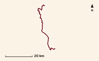
OSM route line, simplified. Branches and gaps as mapped. Trekking Trek, long-distance trail stage
EST 25
Near Karjat, about 72.4 km from Pune centre (computed)
Mapped relation length 59.03 kmElevation Not recordedMapped in OpenStreetMap; access not checked Mapped only, not field-tested
Source: OpenStreetMap relation 20990500 (opens in a new tab) . © OpenStreetMap contributors, ODbL.
The route
- Original activity
- Trekking
- Type
- Long-distance trail stage. Trekking, Trail routes, Long-distance trails, Mountain routes.
- Shape in OSM
- Non-linear in OSM (loop or multi-branch)
- Surface
- Trail (OSM hiking relation; may include road segments)
- Distance
- 59.03 km. Mapped relation length (OpenStreetMap via Waymarked Trails). Can include branches and alternatives.
- Elevation
- Not recorded. No gain, loss or profile data in the source.
- Difficulty
- Not recorded
- Start and finish
- Not recorded
- Places named in OSM
- Dodhani, Chavni
Access and safety
- Access
- Not recorded. That does not mean open.
- Hazards
- Not recorded. That does not mean there are none.
- Permission
- Not recorded
- Field check
- Mapped only, not field-tested. Field check recommended (geometry from source)
Data and source
- Status
- Mapped in OSM: geometry exists; ground truth not verified
- Graphic
- Route line from the OpenStreetMap relation (75 ways, fetched 7 Oct 2026), simplified for the card. Not field-checked.
- Overlap
- Overlap (one route's extent lies inside the other's); Parent-child (super-route stage)
- Source notes
- operator HikeX
- Source
- OpenStreetMap via Waymarked Trails (hiking). OpenStreetMap (opens in a new tab) Waymarked Trails (opens in a new tab)
- Credit
- OpenStreetMap contributors (see relation history): relation tags reference HikeX (hikex.in)
- Source checked
- 7 Oct 2026 , OSM data via Waymarked Trails API; not field-verified
- GPX
- Download GPX , built from the OpenStreetMap line (ODbL). Mapped, not field-verified.
- Route ID
- OSM-20990500 Show on the map
Route record
- Category
- HIKES & TREKS
- Type
- Trek
- Area
- Near Karjat (computed)
- City status
- OUTSIDE PUNE
- Distance
- 59.03 km
- Elevation gain
- Not recorded
- Difficulty
- Not recorded
- Technicality
- Not recorded
- Endurance
- Not recorded
- Navigation
- Not recorded
- Exposure
- Not recorded
- Remoteness
- Not recorded
- Terrain
- Trail (OSM hiking relation; may include road segments)
- Surface
- Not recorded
- Monsoon risk
- Not recorded
- Heat risk
- Not recorded
- Wildlife
- Not recorded
- Water
- Not recorded
- Mobile network
- Not recorded
- Emergency access
- Not recorded
- Beginner suitability
- Not recorded
- Start
- Not recorded
- Finish
- Not recorded
- Nearest landmark
- Dodhani
- Creator
- OpenStreetMap contributors (see relation history): relation tags reference HikeX (hikex.in)
- Source
- OpenStreetMap via Waymarked Trails (hiking)
- GPX
- Yes
- GPX link
- GPX file
- Licence
- ODbL 1.0
- Reuse
- Open licence: credit OpenStreetMap contributors, share-alike
- Route date
- Not recorded
- Last verified
- 7 Oct 2026
- Data confidence
- OSM route line, desk-checked; not field-verified
- Safety notes
- Not recorded
-
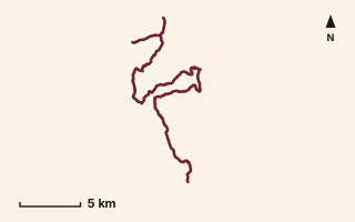
OSM route line, simplified. Branches and gaps as mapped. Trekking Trek, long-distance trail stage
EST 26
Near Lonavala, about 55 km from Pune centre (computed)
Mapped relation length 37.8 kmElevation Not recordedMapped in OpenStreetMap; access not checked Mapped only, not field-tested
Source: OpenStreetMap relation 20990621 (opens in a new tab) . © OpenStreetMap contributors, ODbL.
The route
- Original activity
- Trekking
- Type
- Long-distance trail stage. Trekking, Trail routes, Long-distance trails, Mountain routes.
- Shape in OSM
- Linear (A→B or one-way trail)
- Surface
- Trail (OSM hiking relation; may include road segments)
- Distance
- 37.8 km. Mapped relation length (OpenStreetMap via Waymarked Trails). Can include branches and alternatives.
- Elevation
- Not recorded. No gain, loss or profile data in the source.
- Difficulty
- Not recorded
- Start and finish
- Not recorded
- Places named in OSM
- Chavni, Ambevane
Access and safety
- Access
- Not recorded. That does not mean open.
- Hazards
- Not recorded. That does not mean there are none.
- Permission
- Not recorded
- Field check
- Mapped only, not field-tested. Field check recommended (geometry from source)
Data and source
- Status
- Mapped in OSM: geometry exists; ground truth not verified
- Graphic
- Route line from the OpenStreetMap relation (34 ways, fetched 7 Oct 2026), simplified for the card. Not field-checked.
- Overlap
- Overlap (one route's extent lies inside the other's); Parent-child (super-route stage)
- Source notes
- operator HikeX; incl. Duke's Nose & Mrugagad segments
- Source
- OpenStreetMap via Waymarked Trails (hiking). OpenStreetMap (opens in a new tab) Waymarked Trails (opens in a new tab)
- Credit
- OpenStreetMap contributors (see relation history): relation tags reference HikeX (hikex.in)
- Source checked
- 7 Oct 2026 , OSM data via Waymarked Trails API; not field-verified
- GPX
- Download GPX , built from the OpenStreetMap line (ODbL). Mapped, not field-verified.
- Route ID
- OSM-20990621 Show on the map
Route record
- Category
- HIKES & TREKS
- Type
- Trek
- Area
- Near Lonavala (computed)
- City status
- OUTSIDE PUNE
- Distance
- 37.8 km
- Elevation gain
- Not recorded
- Difficulty
- Not recorded
- Technicality
- Not recorded
- Endurance
- Not recorded
- Navigation
- Not recorded
- Exposure
- Not recorded
- Remoteness
- Not recorded
- Terrain
- Trail (OSM hiking relation; may include road segments)
- Surface
- Not recorded
- Monsoon risk
- Not recorded
- Heat risk
- Not recorded
- Wildlife
- Not recorded
- Water
- Not recorded
- Mobile network
- Not recorded
- Emergency access
- Not recorded
- Beginner suitability
- Not recorded
- Start
- Not recorded
- Finish
- Not recorded
- Nearest landmark
- Chavni
- Creator
- OpenStreetMap contributors (see relation history): relation tags reference HikeX (hikex.in)
- Source
- OpenStreetMap via Waymarked Trails (hiking)
- GPX
- Yes
- GPX link
- GPX file
- Licence
- ODbL 1.0
- Reuse
- Open licence: credit OpenStreetMap contributors, share-alike
- Route date
- Not recorded
- Last verified
- 7 Oct 2026
- Data confidence
- OSM route line, desk-checked; not field-verified
- Safety notes
- Not recorded
-
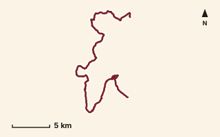
OSM route line, simplified. Branches and gaps as mapped. Trekking Trek, long-distance trail stage
EST 27
Near Sudhagad / Pali, about 54.1 km from Pune centre (computed)
Mapped relation length 42.54 kmElevation Not recordedMapped in OpenStreetMap; access not checked Mapped only, not field-tested
Source: OpenStreetMap relation 20990811 (opens in a new tab) . © OpenStreetMap contributors, ODbL.
The route
- Original activity
- Trekking
- Type
- Long-distance trail stage. Trekking, Trail routes, Long-distance trails, Mountain routes.
- Shape in OSM
- Linear (A→B or one-way trail)
- Surface
- Trail (OSM hiking relation; may include road segments)
- Distance
- 42.54 km. Mapped relation length (OpenStreetMap via Waymarked Trails). Can include branches and alternatives.
- Elevation
- Not recorded. No gain, loss or profile data in the source.
- Difficulty
- Not recorded
- Start and finish
- Not recorded
- Places named in OSM
- Ambavane, Asanwadi
Access and safety
- Access
- Not recorded. That does not mean open.
- Hazards
- Not recorded. That does not mean there are none.
- Permission
- Not recorded
- Field check
- Mapped only, not field-tested. Field check recommended (geometry from source)
Data and source
- Status
- Mapped in OSM: geometry exists; ground truth not verified
- Graphic
- Route line from the OpenStreetMap relation (27 ways, fetched 7 Oct 2026), simplified for the card. Not field-checked.
- Overlap
- Overlap (one route's extent lies inside the other's); Parent-child (super-route stage)
- Source notes
- operator HikeX
- Source
- OpenStreetMap via Waymarked Trails (hiking). OpenStreetMap (opens in a new tab) Waymarked Trails (opens in a new tab)
- Credit
- OpenStreetMap contributors (see relation history): relation tags reference HikeX (hikex.in)
- Source checked
- 7 Oct 2026 , OSM data via Waymarked Trails API; not field-verified
- GPX
- Download GPX , built from the OpenStreetMap line (ODbL). Mapped, not field-verified.
- Route ID
- OSM-20990811 Show on the map
Route record
- Category
- HIKES & TREKS
- Type
- Trek
- Area
- Near Sudhagad / Pali (computed)
- City status
- OUTSIDE PUNE
- Distance
- 42.54 km
- Elevation gain
- Not recorded
- Difficulty
- Not recorded
- Technicality
- Not recorded
- Endurance
- Not recorded
- Navigation
- Not recorded
- Exposure
- Not recorded
- Remoteness
- Not recorded
- Terrain
- Trail (OSM hiking relation; may include road segments)
- Surface
- Not recorded
- Monsoon risk
- Not recorded
- Heat risk
- Not recorded
- Wildlife
- Not recorded
- Water
- Not recorded
- Mobile network
- Not recorded
- Emergency access
- Not recorded
- Beginner suitability
- Not recorded
- Start
- Not recorded
- Finish
- Not recorded
- Nearest landmark
- Ambavane
- Creator
- OpenStreetMap contributors (see relation history): relation tags reference HikeX (hikex.in)
- Source
- OpenStreetMap via Waymarked Trails (hiking)
- GPX
- Yes
- GPX link
- GPX file
- Licence
- ODbL 1.0
- Reuse
- Open licence: credit OpenStreetMap contributors, share-alike
- Route date
- Not recorded
- Last verified
- 7 Oct 2026
- Data confidence
- OSM route line, desk-checked; not field-verified
- Safety notes
- Not recorded
-
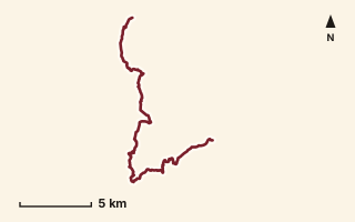
OSM route line, simplified. Branches and gaps as mapped. Trekking Trek, long-distance trail stage
EST 28
Near Tamhini / Mulshi, about 48.6 km from Pune centre (computed)
Mapped relation length 25.59 kmElevation Not recordedMapped in OpenStreetMap; access not checked Mapped only, not field-tested
Source: OpenStreetMap relation 20990955 (opens in a new tab) . © OpenStreetMap contributors, ODbL.
The route
- Original activity
- Trekking
- Type
- Long-distance trail stage. Trekking, Trail routes, Long-distance trails, Mountain routes.
- Shape in OSM
- Linear (A→B or one-way trail)
- Surface
- Trail (OSM hiking relation; may include road segments)
- Distance
- 25.59 km. Mapped relation length (OpenStreetMap via Waymarked Trails). Can include branches and alternatives.
- Elevation
- Not recorded. No gain, loss or profile data in the source.
- Difficulty
- Not recorded
- Start and finish
- Not recorded
- Places named in OSM
- Asanwadi, Tamhini
Access and safety
- Access
- Not recorded. That does not mean open.
- Hazards
- Not recorded. That does not mean there are none.
- Permission
- Not recorded
- Field check
- Mapped only, not field-tested. Field check recommended (geometry from source)
Data and source
- Status
- Mapped in OSM: geometry exists; ground truth not verified
- Graphic
- Route line from the OpenStreetMap relation (18 ways, fetched 7 Oct 2026), simplified for the card. Not field-checked.
- Overlap
- Overlap (one route's extent lies inside the other's); Parent-child (super-route stage)
- Source notes
- operator HikeX
- Source
- OpenStreetMap via Waymarked Trails (hiking). OpenStreetMap (opens in a new tab) Waymarked Trails (opens in a new tab)
- Credit
- OpenStreetMap contributors (see relation history): relation tags reference HikeX (hikex.in)
- Source checked
- 7 Oct 2026 , OSM data via Waymarked Trails API; not field-verified
- GPX
- Download GPX , built from the OpenStreetMap line (ODbL). Mapped, not field-verified.
- Route ID
- OSM-20990955 Show on the map
Route record
- Category
- HIKES & TREKS
- Type
- Trek
- Area
- Near Tamhini / Mulshi (computed)
- City status
- OUTSIDE PUNE
- Distance
- 25.59 km
- Elevation gain
- Not recorded
- Difficulty
- Not recorded
- Technicality
- Not recorded
- Endurance
- Not recorded
- Navigation
- Not recorded
- Exposure
- Not recorded
- Remoteness
- Not recorded
- Terrain
- Trail (OSM hiking relation; may include road segments)
- Surface
- Not recorded
- Monsoon risk
- Not recorded
- Heat risk
- Not recorded
- Wildlife
- Not recorded
- Water
- Not recorded
- Mobile network
- Not recorded
- Emergency access
- Not recorded
- Beginner suitability
- Not recorded
- Start
- Not recorded
- Finish
- Not recorded
- Nearest landmark
- Asanwadi
- Creator
- OpenStreetMap contributors (see relation history): relation tags reference HikeX (hikex.in)
- Source
- OpenStreetMap via Waymarked Trails (hiking)
- GPX
- Yes
- GPX link
- GPX file
- Licence
- ODbL 1.0
- Reuse
- Open licence: credit OpenStreetMap contributors, share-alike
- Route date
- Not recorded
- Last verified
- 7 Oct 2026
- Data confidence
- OSM route line, desk-checked; not field-verified
- Safety notes
- Not recorded
-
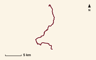
OSM route line, simplified. Branches and gaps as mapped. Trekking Trek, long-distance trail stage
EST 29
Near Tamhini / Mulshi, about 49.1 km from Pune centre (computed)
Mapped relation length 27.96 kmElevation Not recordedMapped in OpenStreetMap; access not checked Mapped only, not field-tested
Source: OpenStreetMap relation 20990998 (opens in a new tab) . © OpenStreetMap contributors, ODbL.
The route
- Original activity
- Trekking
- Type
- Long-distance trail stage. Trekking, Trail routes, Long-distance trails, Mountain routes.
- Shape in OSM
- Linear (A→B or one-way trail)
- Surface
- Trail (OSM hiking relation; may include road segments)
- Distance
- 27.96 km. Mapped relation length (OpenStreetMap via Waymarked Trails). Can include branches and alternatives.
- Elevation
- Not recorded. No gain, loss or profile data in the source.
- Difficulty
- Not recorded
- Start and finish
- Not recorded
- Places named in OSM
- Tamhini, Ghol
Access and safety
- Access
- Not recorded. That does not mean open.
- Hazards
- Not recorded. That does not mean there are none.
- Permission
- Not recorded
- Field check
- Mapped only, not field-tested. Field check recommended (geometry from source)
Data and source
- Status
- Mapped in OSM: geometry exists; ground truth not verified
- Graphic
- Route line from the OpenStreetMap relation (23 ways, fetched 7 Oct 2026), simplified for the card. Not field-checked.
- Overlap
- Overlap (one route's extent lies inside the other's); Parent-child (super-route stage)
- Source notes
- operator HikeX
- Source
- OpenStreetMap via Waymarked Trails (hiking). OpenStreetMap (opens in a new tab) Waymarked Trails (opens in a new tab)
- Credit
- OpenStreetMap contributors (see relation history): relation tags reference HikeX (hikex.in)
- Source checked
- 7 Oct 2026 , OSM data via Waymarked Trails API; not field-verified
- GPX
- Download GPX , built from the OpenStreetMap line (ODbL). Mapped, not field-verified.
- Route ID
- OSM-20990998 Show on the map
Route record
- Category
- HIKES & TREKS
- Type
- Trek
- Area
- Near Tamhini / Mulshi (computed)
- City status
- OUTSIDE PUNE
- Distance
- 27.96 km
- Elevation gain
- Not recorded
- Difficulty
- Not recorded
- Technicality
- Not recorded
- Endurance
- Not recorded
- Navigation
- Not recorded
- Exposure
- Not recorded
- Remoteness
- Not recorded
- Terrain
- Trail (OSM hiking relation; may include road segments)
- Surface
- Not recorded
- Monsoon risk
- Not recorded
- Heat risk
- Not recorded
- Wildlife
- Not recorded
- Water
- Not recorded
- Mobile network
- Not recorded
- Emergency access
- Not recorded
- Beginner suitability
- Not recorded
- Start
- Not recorded
- Finish
- Not recorded
- Nearest landmark
- Tamhini
- Creator
- OpenStreetMap contributors (see relation history): relation tags reference HikeX (hikex.in)
- Source
- OpenStreetMap via Waymarked Trails (hiking)
- GPX
- Yes
- GPX link
- GPX file
- Licence
- ODbL 1.0
- Reuse
- Open licence: credit OpenStreetMap contributors, share-alike
- Route date
- Not recorded
- Last verified
- 7 Oct 2026
- Data confidence
- OSM route line, desk-checked; not field-verified
- Safety notes
- Not recorded
-
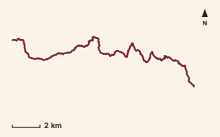
OSM route line, simplified. Branches and gaps as mapped. Trekking Trek, long-distance trail stage
EST 30
Near Raigad, about 44.7 km from Pune centre (computed)
Mapped relation length 23.21 kmElevation Not recordedMapped in OpenStreetMap; access not checked Mapped only, not field-tested
Source: OpenStreetMap relation 20991076 (opens in a new tab) . © OpenStreetMap contributors, ODbL.
The route
- Original activity
- Trekking
- Type
- Long-distance trail stage. Trekking, Trail routes, Long-distance trails, Mountain routes.
- Shape in OSM
- Linear (A→B or one-way trail)
- Surface
- Trail (OSM hiking relation; may include road segments)
- Distance
- 23.21 km. Mapped relation length (OpenStreetMap via Waymarked Trails). Can include branches and alternatives.
- Elevation
- Not recorded. No gain, loss or profile data in the source.
- Difficulty
- Not recorded
- Start and finish
- Not recorded
- Places named in OSM
- Ghol, Ghisar
Access and safety
- Access
- Not recorded. That does not mean open.
- Hazards
- Not recorded. That does not mean there are none.
- Permission
- Not recorded
- Field check
- Mapped only, not field-tested. Field check recommended (geometry from source)
Data and source
- Status
- Mapped in OSM: geometry exists; ground truth not verified
- Graphic
- Route line from the OpenStreetMap relation (24 ways, fetched 7 Oct 2026), simplified for the card. Not field-checked.
- Overlap
- Overlap (one route's extent lies inside the other's); Parent-child (super-route stage)
- Source notes
- operator HikeX
- Source
- OpenStreetMap via Waymarked Trails (hiking). OpenStreetMap (opens in a new tab) Waymarked Trails (opens in a new tab)
- Credit
- OpenStreetMap contributors (see relation history): relation tags reference HikeX (hikex.in)
- Source checked
- 7 Oct 2026 , OSM data via Waymarked Trails API; not field-verified
- GPX
- Download GPX , built from the OpenStreetMap line (ODbL). Mapped, not field-verified.
- Route ID
- OSM-20991076 Show on the map
Route record
- Category
- HIKES & TREKS
- Type
- Trek
- Area
- Near Raigad (computed)
- City status
- OUTSIDE PUNE
- Distance
- 23.21 km
- Elevation gain
- Not recorded
- Difficulty
- Not recorded
- Technicality
- Not recorded
- Endurance
- Not recorded
- Navigation
- Not recorded
- Exposure
- Not recorded
- Remoteness
- Not recorded
- Terrain
- Trail (OSM hiking relation; may include road segments)
- Surface
- Not recorded
- Monsoon risk
- Not recorded
- Heat risk
- Not recorded
- Wildlife
- Not recorded
- Water
- Not recorded
- Mobile network
- Not recorded
- Emergency access
- Not recorded
- Beginner suitability
- Not recorded
- Start
- Not recorded
- Finish
- Not recorded
- Nearest landmark
- Ghol
- Creator
- OpenStreetMap contributors (see relation history): relation tags reference HikeX (hikex.in)
- Source
- OpenStreetMap via Waymarked Trails (hiking)
- GPX
- Yes
- GPX link
- GPX file
- Licence
- ODbL 1.0
- Reuse
- Open licence: credit OpenStreetMap contributors, share-alike
- Route date
- Not recorded
- Last verified
- 7 Oct 2026
- Data confidence
- OSM route line, desk-checked; not field-verified
- Safety notes
- Not recorded
-
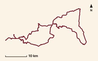
OSM route line, simplified. Branches and gaps as mapped. Trekking Trek, long-distance trail stage
EST 31
Near Sinhagad, about 27.4 km from Pune centre (computed)
Mapped relation length 141.35 kmElevation Not recordedMapped in OpenStreetMap; access not checked Mapped only, not field-tested
Source: OpenStreetMap relation 20998179 (opens in a new tab) . © OpenStreetMap contributors, ODbL.
The route
- Original activity
- Trekking
- Type
- Long-distance trail stage. Trekking, Trail routes, Long-distance trails, Mountain routes.
- Shape in OSM
- Linear (A→B or one-way trail)
- Surface
- Trail (OSM hiking relation; may include road segments)
- Distance
- 141.35 km. Mapped relation length (OpenStreetMap via Waymarked Trails). Can include branches and alternatives.
- Elevation
- Not recorded. No gain, loss or profile data in the source.
- Difficulty
- Not recorded
- Start and finish
- Not recorded
- Places named in OSM
- Ghisar, Mohari
Access and safety
- Access
- Not recorded. That does not mean open.
- Hazards
- Not recorded. That does not mean there are none.
- Permission
- Not recorded
- Field check
- Mapped only, not field-tested. Field check recommended (geometry from source)
Data and source
- Status
- Mapped in OSM: geometry exists; ground truth not verified
- Graphic
- Route line from the OpenStreetMap relation (105 ways, fetched 7 Oct 2026), simplified for the card. Not field-checked.
- Overlap
- Overlap (one route's extent lies inside the other's); Parent-child (super-route stage)
- Source notes
- operator HikeX; very long stage: bbox reaches Katraj; verify
- Source
- OpenStreetMap via Waymarked Trails (hiking). OpenStreetMap (opens in a new tab) Waymarked Trails (opens in a new tab)
- Credit
- OpenStreetMap contributors (see relation history): relation tags reference HikeX (hikex.in)
- Source checked
- 7 Oct 2026 , OSM data via Waymarked Trails API; not field-verified
- GPX
- Download GPX , built from the OpenStreetMap line (ODbL). Mapped, not field-verified.
- Route ID
- OSM-20998179 Show on the map
Route record
- Category
- HIKES & TREKS
- Type
- Trek
- Area
- Near Sinhagad (computed)
- City status
- OUTSIDE PUNE
- Distance
- 141.35 km
- Elevation gain
- Not recorded
- Difficulty
- Not recorded
- Technicality
- Not recorded
- Endurance
- Not recorded
- Navigation
- Not recorded
- Exposure
- Not recorded
- Remoteness
- Not recorded
- Terrain
- Trail (OSM hiking relation; may include road segments)
- Surface
- Not recorded
- Monsoon risk
- Not recorded
- Heat risk
- Not recorded
- Wildlife
- Not recorded
- Water
- Not recorded
- Mobile network
- Not recorded
- Emergency access
- Not recorded
- Beginner suitability
- Not recorded
- Start
- Not recorded
- Finish
- Not recorded
- Nearest landmark
- Ghisar
- Creator
- OpenStreetMap contributors (see relation history): relation tags reference HikeX (hikex.in)
- Source
- OpenStreetMap via Waymarked Trails (hiking)
- GPX
- Yes
- GPX link
- GPX file
- Licence
- ODbL 1.0
- Reuse
- Open licence: credit OpenStreetMap contributors, share-alike
- Route date
- Not recorded
- Last verified
- 7 Oct 2026
- Data confidence
- OSM route line, desk-checked; not field-verified
- Safety notes
- Not recorded
-
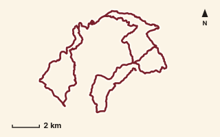
OSM route line, simplified. Branches and gaps as mapped. Trekking Trek, long-distance trail stage
EST 32
Near Raigad, about 46.9 km from Pune centre (computed)
Mapped relation length 63.68 kmElevation Not recordedMapped in OpenStreetMap; access not checked Mapped only, not field-tested
Source: OpenStreetMap relation 20998726 (opens in a new tab) . © OpenStreetMap contributors, ODbL.
The route
- Original activity
- Trekking
- Type
- Long-distance trail stage. Trekking, Trail routes, Long-distance trails, Mountain routes.
- Shape in OSM
- Linear (A→B or one-way trail)
- Surface
- Trail (OSM hiking relation; may include road segments)
- Distance
- 63.68 km. Mapped relation length (OpenStreetMap via Waymarked Trails). Can include branches and alternatives.
- Elevation
- Not recorded. No gain, loss or profile data in the source.
- Difficulty
- Not recorded
- Start and finish
- Not recorded
- Places named in OSM
- Mohari, Singapur
Access and safety
- Access
- Not recorded. That does not mean open.
- Hazards
- Not recorded. That does not mean there are none.
- Permission
- Not recorded
- Field check
- Mapped only, not field-tested. Field check recommended (geometry from source)
Data and source
- Status
- Mapped in OSM: geometry exists; ground truth not verified
- Graphic
- Route line from the OpenStreetMap relation (57 ways, fetched 7 Oct 2026), simplified for the card. Not field-checked.
- Overlap
- Overlap (one route's extent lies inside the other's); Parent-child (super-route stage)
- Source notes
- operator HikeX
- Source
- OpenStreetMap via Waymarked Trails (hiking). OpenStreetMap (opens in a new tab) Waymarked Trails (opens in a new tab)
- Credit
- OpenStreetMap contributors (see relation history): relation tags reference HikeX (hikex.in)
- Source checked
- 7 Oct 2026 , OSM data via Waymarked Trails API; not field-verified
- GPX
- Download GPX , built from the OpenStreetMap line (ODbL). Mapped, not field-verified.
- Route ID
- OSM-20998726 Show on the map
Route record
- Category
- HIKES & TREKS
- Type
- Trek
- Area
- Near Raigad (computed)
- City status
- OUTSIDE PUNE
- Distance
- 63.68 km
- Elevation gain
- Not recorded
- Difficulty
- Not recorded
- Technicality
- Not recorded
- Endurance
- Not recorded
- Navigation
- Not recorded
- Exposure
- Not recorded
- Remoteness
- Not recorded
- Terrain
- Trail (OSM hiking relation; may include road segments)
- Surface
- Not recorded
- Monsoon risk
- Not recorded
- Heat risk
- Not recorded
- Wildlife
- Not recorded
- Water
- Not recorded
- Mobile network
- Not recorded
- Emergency access
- Not recorded
- Beginner suitability
- Not recorded
- Start
- Not recorded
- Finish
- Not recorded
- Nearest landmark
- Mohari
- Creator
- OpenStreetMap contributors (see relation history): relation tags reference HikeX (hikex.in)
- Source
- OpenStreetMap via Waymarked Trails (hiking)
- GPX
- Yes
- GPX link
- GPX file
- Licence
- ODbL 1.0
- Reuse
- Open licence: credit OpenStreetMap contributors, share-alike
- Route date
- Not recorded
- Last verified
- 7 Oct 2026
- Data confidence
- OSM route line, desk-checked; not field-verified
- Safety notes
- Not recorded
-
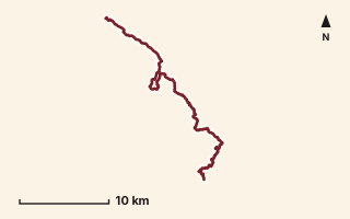
OSM route line, simplified. Branches and gaps as mapped. Trekking Trek, long-distance trail stage
EST 33
Near Varandha Ghat, about 47.3 km from Pune centre (computed)
Mapped relation length 39.73 kmElevation Not recordedMapped in OpenStreetMap; access not checked Mapped only, not field-tested
Source: OpenStreetMap relation 20998781 (opens in a new tab) . © OpenStreetMap contributors, ODbL.
The route
- Original activity
- Trekking
- Type
- Long-distance trail stage. Trekking, Trail routes, Long-distance trails, Mountain routes.
- Shape in OSM
- Linear (A→B or one-way trail)
- Surface
- Trail (OSM hiking relation; may include road segments)
- Distance
- 39.73 km. Mapped relation length (OpenStreetMap via Waymarked Trails). Can include branches and alternatives.
- Elevation
- Not recorded. No gain, loss or profile data in the source.
- Difficulty
- Not recorded
- Start and finish
- Not recorded
- Places named in OSM
- Singapur, Shirgaon
Access and safety
- Access
- Not recorded. That does not mean open.
- Hazards
- Not recorded. That does not mean there are none.
- Permission
- Not recorded
- Field check
- Mapped only, not field-tested. Field check recommended (geometry from source)
Data and source
- Status
- Mapped in OSM: geometry exists; ground truth not verified
- Graphic
- Route line from the OpenStreetMap relation (39 ways, fetched 7 Oct 2026), simplified for the card. Not field-checked.
- Overlap
- Overlap (one route's extent lies inside the other's); Parent-child (super-route stage)
- Source notes
- operator HikeX
- Source
- OpenStreetMap via Waymarked Trails (hiking). OpenStreetMap (opens in a new tab) Waymarked Trails (opens in a new tab)
- Credit
- OpenStreetMap contributors (see relation history): relation tags reference HikeX (hikex.in)
- Source checked
- 7 Oct 2026 , OSM data via Waymarked Trails API; not field-verified
- GPX
- Download GPX , built from the OpenStreetMap line (ODbL). Mapped, not field-verified.
- Route ID
- OSM-20998781 Show on the map
Route record
- Category
- HIKES & TREKS
- Type
- Trek
- Area
- Near Varandha Ghat (computed)
- City status
- OUTSIDE PUNE
- Distance
- 39.73 km
- Elevation gain
- Not recorded
- Difficulty
- Not recorded
- Technicality
- Not recorded
- Endurance
- Not recorded
- Navigation
- Not recorded
- Exposure
- Not recorded
- Remoteness
- Not recorded
- Terrain
- Trail (OSM hiking relation; may include road segments)
- Surface
- Not recorded
- Monsoon risk
- Not recorded
- Heat risk
- Not recorded
- Wildlife
- Not recorded
- Water
- Not recorded
- Mobile network
- Not recorded
- Emergency access
- Not recorded
- Beginner suitability
- Not recorded
- Start
- Not recorded
- Finish
- Not recorded
- Nearest landmark
- Singapur
- Creator
- OpenStreetMap contributors (see relation history): relation tags reference HikeX (hikex.in)
- Source
- OpenStreetMap via Waymarked Trails (hiking)
- GPX
- Yes
- GPX link
- GPX file
- Licence
- ODbL 1.0
- Reuse
- Open licence: credit OpenStreetMap contributors, share-alike
- Route date
- Not recorded
- Last verified
- 7 Oct 2026
- Data confidence
- OSM route line, desk-checked; not field-verified
- Safety notes
- Not recorded
-
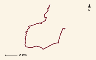
OSM route line, simplified. Branches and gaps as mapped. Trekking Trek, long-distance trail stage
EST 34
Near Varandha Ghat, about 56.4 km from Pune centre (computed)
Mapped relation length 22.55 kmElevation Not recordedMapped in OpenStreetMap; access not checked Mapped only, not field-tested
Source: OpenStreetMap relation 20998811 (opens in a new tab) . © OpenStreetMap contributors, ODbL.
The route
- Original activity
- Trekking
- Type
- Long-distance trail stage. Trekking, Trail routes, Long-distance trails, Mountain routes.
- Shape in OSM
- Linear (A→B or one-way trail)
- Surface
- Trail (OSM hiking relation; may include road segments)
- Distance
- 22.55 km. Mapped relation length (OpenStreetMap via Waymarked Trails). Can include branches and alternatives.
- Elevation
- Not recorded. No gain, loss or profile data in the source.
- Difficulty
- Not recorded
- Start and finish
- Not recorded
- Places named in OSM
- Shirgaon, Kudali Khurd
Access and safety
- Access
- Not recorded. That does not mean open.
- Hazards
- Not recorded. That does not mean there are none.
- Permission
- Not recorded
- Field check
- Mapped only, not field-tested. Field check recommended (geometry from source)
Data and source
- Status
- Mapped in OSM: geometry exists; ground truth not verified
- Graphic
- Route line from the OpenStreetMap relation (27 ways, fetched 7 Oct 2026), simplified for the card. Not field-checked.
- Overlap
- Overlap (one route's extent lies inside the other's); Parent-child (super-route stage)
- Source notes
- operator HikeX
- Source
- OpenStreetMap via Waymarked Trails (hiking). OpenStreetMap (opens in a new tab) Waymarked Trails (opens in a new tab)
- Credit
- OpenStreetMap contributors (see relation history): relation tags reference HikeX (hikex.in)
- Source checked
- 7 Oct 2026 , OSM data via Waymarked Trails API; not field-verified
- GPX
- Download GPX , built from the OpenStreetMap line (ODbL). Mapped, not field-verified.
- Route ID
- OSM-20998811 Show on the map
Route record
- Category
- HIKES & TREKS
- Type
- Trek
- Area
- Near Varandha Ghat (computed)
- City status
- OUTSIDE PUNE
- Distance
- 22.55 km
- Elevation gain
- Not recorded
- Difficulty
- Not recorded
- Technicality
- Not recorded
- Endurance
- Not recorded
- Navigation
- Not recorded
- Exposure
- Not recorded
- Remoteness
- Not recorded
- Terrain
- Trail (OSM hiking relation; may include road segments)
- Surface
- Not recorded
- Monsoon risk
- Not recorded
- Heat risk
- Not recorded
- Wildlife
- Not recorded
- Water
- Not recorded
- Mobile network
- Not recorded
- Emergency access
- Not recorded
- Beginner suitability
- Not recorded
- Start
- Not recorded
- Finish
- Not recorded
- Nearest landmark
- Shirgaon
- Creator
- OpenStreetMap contributors (see relation history): relation tags reference HikeX (hikex.in)
- Source
- OpenStreetMap via Waymarked Trails (hiking)
- GPX
- Yes
- GPX link
- GPX file
- Licence
- ODbL 1.0
- Reuse
- Open licence: credit OpenStreetMap contributors, share-alike
- Route date
- Not recorded
- Last verified
- 7 Oct 2026
- Data confidence
- OSM route line, desk-checked; not field-verified
- Safety notes
- Not recorded
-
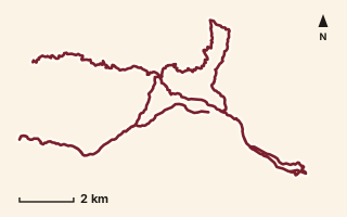
OSM route line, simplified. Branches and gaps as mapped. Trekking Trek, long-distance trail stage
EST 35
Near Raireshwar, about 54.8 km from Pune centre (computed)
Mapped relation length 46.46 kmElevation Not recordedMapped in OpenStreetMap; access not checked Mapped only, not field-tested
Source: OpenStreetMap relation 21100239 (opens in a new tab) . © OpenStreetMap contributors, ODbL.
The route
- Original activity
- Trekking
- Type
- Long-distance trail stage. Trekking, Trail routes, Long-distance trails, Mountain routes.
- Shape in OSM
- Linear (A→B or one-way trail)
- Surface
- Trail (OSM hiking relation; may include road segments)
- Distance
- 46.46 km. Mapped relation length (OpenStreetMap via Waymarked Trails). Can include branches and alternatives.
- Elevation
- Not recorded. No gain, loss or profile data in the source.
- Difficulty
- Not recorded
- Start and finish
- Not recorded
- Places named in OSM
- Kudali Khurd, Gudhe, Nivangan, Dhanivali, Malwadi, Raireshwar, Kenjalgad, Kukurnyachi Vaat, Dharambe, Kankwadi, Gayadhara, Nakhinda, Nishnichi Vaat, Jambhali
Access and safety
- Access
- Not recorded. That does not mean open.
- Hazards
- Not recorded. That does not mean there are none.
- Permission
- Not recorded
- Field check
- Mapped only, not field-tested. Field check recommended (geometry from source)
Data and source
- Status
- Mapped in OSM: geometry exists; ground truth not verified
- Graphic
- Route line from the OpenStreetMap relation (57 ways, fetched 7 Oct 2026), simplified for the card. Not field-checked.
- Overlap
- Overlap (one route's extent lies inside the other's); Parent-child (super-route stage)
- Source notes
- operator HikeX
- Source
- OpenStreetMap via Waymarked Trails (hiking). OpenStreetMap (opens in a new tab) Waymarked Trails (opens in a new tab)
- Credit
- OpenStreetMap contributors (see relation history): relation tags reference HikeX (hikex.in)
- Source checked
- 7 Oct 2026 , OSM data via Waymarked Trails API; not field-verified
- GPX
- Download GPX , built from the OpenStreetMap line (ODbL). Mapped, not field-verified.
- Route ID
- OSM-21100239 Show on the map
Route record
- Category
- HIKES & TREKS
- Type
- Trek
- Area
- Near Raireshwar (computed)
- City status
- OUTSIDE PUNE
- Distance
- 46.46 km
- Elevation gain
- Not recorded
- Difficulty
- Not recorded
- Technicality
- Not recorded
- Endurance
- Not recorded
- Navigation
- Not recorded
- Exposure
- Not recorded
- Remoteness
- Not recorded
- Terrain
- Trail (OSM hiking relation; may include road segments)
- Surface
- Not recorded
- Monsoon risk
- Not recorded
- Heat risk
- Not recorded
- Wildlife
- Not recorded
- Water
- Not recorded
- Mobile network
- Not recorded
- Emergency access
- Not recorded
- Beginner suitability
- Not recorded
- Start
- Not recorded
- Finish
- Not recorded
- Nearest landmark
- Kudali Khurd
- Creator
- OpenStreetMap contributors (see relation history): relation tags reference HikeX (hikex.in)
- Source
- OpenStreetMap via Waymarked Trails (hiking)
- GPX
- Yes
- GPX link
- GPX file
- Licence
- ODbL 1.0
- Reuse
- Open licence: credit OpenStreetMap contributors, share-alike
- Route date
- Not recorded
- Last verified
- 7 Oct 2026
- Data confidence
- OSM route line, desk-checked; not field-verified
- Safety notes
- Not recorded
-
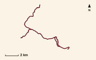
OSM route line, simplified. Branches and gaps as mapped. Trekking Trek, long-distance trail stage
EST 36
Near Raireshwar, about 60 km from Pune centre (computed)
Mapped relation length 25.87 kmElevation Not recordedMapped in OpenStreetMap; access not checked Mapped only, not field-tested
Source: OpenStreetMap relation 20999330 (opens in a new tab) . © OpenStreetMap contributors, ODbL.
The route
- Original activity
- Trekking
- Type
- Long-distance trail stage. Trekking, Trail routes, Long-distance trails, Mountain routes.
- Shape in OSM
- Linear (A→B or one-way trail)
- Surface
- Trail (OSM hiking relation; may include road segments)
- Distance
- 25.87 km. Mapped relation length (OpenStreetMap via Waymarked Trails). Can include branches and alternatives.
- Elevation
- Not recorded. No gain, loss or profile data in the source.
- Difficulty
- Not recorded
- Start and finish
- Not recorded
- Places named in OSM
- Jambhali, Jor
Access and safety
- Access
- Not recorded. That does not mean open.
- Hazards
- Not recorded. That does not mean there are none.
- Permission
- Not recorded
- Field check
- Mapped only, not field-tested. Field check recommended (geometry from source)
Data and source
- Status
- Mapped in OSM: geometry exists; ground truth not verified
- Graphic
- Route line from the OpenStreetMap relation (23 ways, fetched 7 Oct 2026), simplified for the card. Not field-checked.
- Overlap
- Overlap (one route's extent lies inside the other's); Parent-child (super-route stage)
- Source notes
- operator HikeX
- Source
- OpenStreetMap via Waymarked Trails (hiking). OpenStreetMap (opens in a new tab) Waymarked Trails (opens in a new tab)
- Credit
- OpenStreetMap contributors (see relation history): relation tags reference HikeX (hikex.in)
- Source checked
- 7 Oct 2026 , OSM data via Waymarked Trails API; not field-verified
- GPX
- Download GPX , built from the OpenStreetMap line (ODbL). Mapped, not field-verified.
- Route ID
- OSM-20999330 Show on the map
Route record
- Category
- HIKES & TREKS
- Type
- Trek
- Area
- Near Raireshwar (computed)
- City status
- OUTSIDE PUNE
- Distance
- 25.87 km
- Elevation gain
- Not recorded
- Difficulty
- Not recorded
- Technicality
- Not recorded
- Endurance
- Not recorded
- Navigation
- Not recorded
- Exposure
- Not recorded
- Remoteness
- Not recorded
- Terrain
- Trail (OSM hiking relation; may include road segments)
- Surface
- Not recorded
- Monsoon risk
- Not recorded
- Heat risk
- Not recorded
- Wildlife
- Not recorded
- Water
- Not recorded
- Mobile network
- Not recorded
- Emergency access
- Not recorded
- Beginner suitability
- Not recorded
- Start
- Not recorded
- Finish
- Not recorded
- Nearest landmark
- Jambhali
- Creator
- OpenStreetMap contributors (see relation history): relation tags reference HikeX (hikex.in)
- Source
- OpenStreetMap via Waymarked Trails (hiking)
- GPX
- Yes
- GPX link
- GPX file
- Licence
- ODbL 1.0
- Reuse
- Open licence: credit OpenStreetMap contributors, share-alike
- Route date
- Not recorded
- Last verified
- 7 Oct 2026
- Data confidence
- OSM route line, desk-checked; not field-verified
- Safety notes
- Not recorded
-
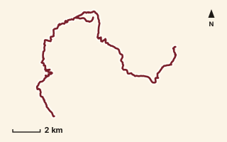
OSM route line, simplified. Branches and gaps as mapped. Trekking Trek, long-distance trail stage
EST 37
Near Mahabaleshwar, about 65.5 km from Pune centre (computed)
Mapped relation length 31.23 kmElevation Not recordedMapped in OpenStreetMap; access not checked Mapped only, not field-tested
Source: OpenStreetMap relation 20999371 (opens in a new tab) . © OpenStreetMap contributors, ODbL.
The route
- Original activity
- Trekking
- Type
- Long-distance trail stage. Trekking, Trail routes, Long-distance trails, Mountain routes.
- Shape in OSM
- Linear (A→B or one-way trail)
- Surface
- Trail (OSM hiking relation; may include road segments)
- Distance
- 31.23 km. Mapped relation length (OpenStreetMap via Waymarked Trails). Can include branches and alternatives.
- Elevation
- Not recorded. No gain, loss or profile data in the source.
- Difficulty
- Not recorded
- Start and finish
- Not recorded
- Places named in OSM
- Jor, Vada Kumbharoshi
Access and safety
- Access
- Not recorded. That does not mean open.
- Hazards
- Not recorded. That does not mean there are none.
- Permission
- Not recorded
- Field check
- Mapped only, not field-tested. Field check recommended (geometry from source)
Data and source
- Status
- Mapped in OSM: geometry exists; ground truth not verified
- Graphic
- Route line from the OpenStreetMap relation (34 ways, fetched 7 Oct 2026), simplified for the card. Not field-checked.
- Overlap
- Overlap (one route's extent lies inside the other's); Parent-child (super-route stage)
- Source notes
- operator HikeX
- Source
- OpenStreetMap via Waymarked Trails (hiking). OpenStreetMap (opens in a new tab) Waymarked Trails (opens in a new tab)
- Credit
- OpenStreetMap contributors (see relation history): relation tags reference HikeX (hikex.in)
- Source checked
- 7 Oct 2026 , OSM data via Waymarked Trails API; not field-verified
- GPX
- Download GPX , built from the OpenStreetMap line (ODbL). Mapped, not field-verified.
- Route ID
- OSM-20999371 Show on the map
Route record
- Category
- HIKES & TREKS
- Type
- Trek
- Area
- Near Mahabaleshwar (computed)
- City status
- OUTSIDE PUNE
- Distance
- 31.23 km
- Elevation gain
- Not recorded
- Difficulty
- Not recorded
- Technicality
- Not recorded
- Endurance
- Not recorded
- Navigation
- Not recorded
- Exposure
- Not recorded
- Remoteness
- Not recorded
- Terrain
- Trail (OSM hiking relation; may include road segments)
- Surface
- Not recorded
- Monsoon risk
- Not recorded
- Heat risk
- Not recorded
- Wildlife
- Not recorded
- Water
- Not recorded
- Mobile network
- Not recorded
- Emergency access
- Not recorded
- Beginner suitability
- Not recorded
- Start
- Not recorded
- Finish
- Not recorded
- Nearest landmark
- Jor
- Creator
- OpenStreetMap contributors (see relation history): relation tags reference HikeX (hikex.in)
- Source
- OpenStreetMap via Waymarked Trails (hiking)
- GPX
- Yes
- GPX link
- GPX file
- Licence
- ODbL 1.0
- Reuse
- Open licence: credit OpenStreetMap contributors, share-alike
- Route date
- Not recorded
- Last verified
- 7 Oct 2026
- Data confidence
- OSM route line, desk-checked; not field-verified
- Safety notes
- Not recorded
-
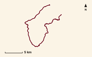
OSM route line, simplified. Branches and gaps as mapped. Trekking Trek, long-distance trail stage
EST 38
Near Mahabaleshwar, about 76.8 km from Pune centre (computed)
Mapped relation length 40.44 kmElevation Not recordedMapped in OpenStreetMap; access not checked Mapped only, not field-tested
Source: OpenStreetMap relation 20999500 (opens in a new tab) . © OpenStreetMap contributors, ODbL.
The route
- Original activity
- Trekking
- Type
- Long-distance trail stage. Trekking, Trail routes, Long-distance trails, Mountain routes.
- Shape in OSM
- Linear (A→B or one-way trail)
- Surface
- Trail (OSM hiking relation; may include road segments)
- Distance
- 40.44 km. Mapped relation length (OpenStreetMap via Waymarked Trails). Can include branches and alternatives.
- Elevation
- Not recorded. No gain, loss or profile data in the source.
- Difficulty
- Not recorded
- Start and finish
- Not recorded
- Places named in OSM
- Vada Kumbharoshi, Metatale
Access and safety
- Access
- Not recorded. That does not mean open.
- Hazards
- Not recorded. That does not mean there are none.
- Permission
- Not recorded
- Field check
- Mapped only, not field-tested. Field check recommended (geometry from source)
Data and source
- Status
- Mapped in OSM: geometry exists; ground truth not verified
- Graphic
- Route line from the OpenStreetMap relation (32 ways, fetched 7 Oct 2026), simplified for the card. Not field-checked.
- Overlap
- Overlap (one route's extent lies inside the other's); Parent-child (super-route stage)
- Source notes
- operator HikeX
- Source
- OpenStreetMap via Waymarked Trails (hiking). OpenStreetMap (opens in a new tab) Waymarked Trails (opens in a new tab)
- Credit
- OpenStreetMap contributors (see relation history): relation tags reference HikeX (hikex.in)
- Source checked
- 7 Oct 2026 , OSM data via Waymarked Trails API; not field-verified
- GPX
- Download GPX , built from the OpenStreetMap line (ODbL). Mapped, not field-verified.
- Route ID
- OSM-20999500 Show on the map
Route record
- Category
- HIKES & TREKS
- Type
- Trek
- Area
- Near Mahabaleshwar (computed)
- City status
- OUTSIDE PUNE
- Distance
- 40.44 km
- Elevation gain
- Not recorded
- Difficulty
- Not recorded
- Technicality
- Not recorded
- Endurance
- Not recorded
- Navigation
- Not recorded
- Exposure
- Not recorded
- Remoteness
- Not recorded
- Terrain
- Trail (OSM hiking relation; may include road segments)
- Surface
- Not recorded
- Monsoon risk
- Not recorded
- Heat risk
- Not recorded
- Wildlife
- Not recorded
- Water
- Not recorded
- Mobile network
- Not recorded
- Emergency access
- Not recorded
- Beginner suitability
- Not recorded
- Start
- Not recorded
- Finish
- Not recorded
- Nearest landmark
- Vada Kumbharoshi
- Creator
- OpenStreetMap contributors (see relation history): relation tags reference HikeX (hikex.in)
- Source
- OpenStreetMap via Waymarked Trails (hiking)
- GPX
- Yes
- GPX link
- GPX file
- Licence
- ODbL 1.0
- Reuse
- Open licence: credit OpenStreetMap contributors, share-alike
- Route date
- Not recorded
- Last verified
- 7 Oct 2026
- Data confidence
- OSM route line, desk-checked; not field-verified
- Safety notes
- Not recorded
-
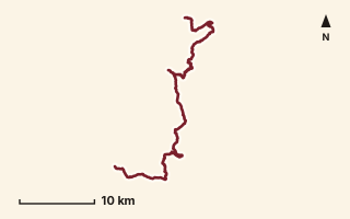
OSM route line, simplified. Branches and gaps as mapped. Trekking Trek, long-distance trail stage
EST 39
Near Mahabaleshwar, about 82.9 km from Pune centre (computed)
Mapped relation length 54.46 kmElevation Not recordedMapped in OpenStreetMap; access not checked Mapped only, not field-tested
Source: OpenStreetMap relation 20999550 (opens in a new tab) . © OpenStreetMap contributors, ODbL.
The route
- Original activity
- Trekking
- Type
- Long-distance trail stage. Trekking, Trail routes, Long-distance trails, Mountain routes.
- Shape in OSM
- Linear (A→B or one-way trail)
- Surface
- Trail (OSM hiking relation; may include road segments)
- Distance
- 54.46 km. Mapped relation length (OpenStreetMap via Waymarked Trails). Can include branches and alternatives.
- Elevation
- Not recorded. No gain, loss or profile data in the source.
- Difficulty
- Not recorded
- Start and finish
- Not recorded
- Places named in OSM
- Metatale, Ambavli
Access and safety
- Access
- Not recorded. That does not mean open.
- Hazards
- Not recorded. That does not mean there are none.
- Permission
- Not recorded
- Field check
- Mapped only, not field-tested. Field check recommended (geometry from source)
Data and source
- Status
- Mapped in OSM: geometry exists; ground truth not verified
- Graphic
- Route line from the OpenStreetMap relation (41 ways, fetched 7 Oct 2026), simplified for the card. Not field-checked.
- Overlap
- Overlap (one route's extent lies inside the other's); Parent-child (super-route stage)
- Source notes
- operator HikeX
- Source
- OpenStreetMap via Waymarked Trails (hiking). OpenStreetMap (opens in a new tab) Waymarked Trails (opens in a new tab)
- Credit
- OpenStreetMap contributors (see relation history): relation tags reference HikeX (hikex.in)
- Source checked
- 7 Oct 2026 , OSM data via Waymarked Trails API; not field-verified
- GPX
- Download GPX , built from the OpenStreetMap line (ODbL). Mapped, not field-verified.
- Route ID
- OSM-20999550 Show on the map
Route record
- Category
- HIKES & TREKS
- Type
- Trek
- Area
- Near Mahabaleshwar (computed)
- City status
- OUTSIDE PUNE
- Distance
- 54.46 km
- Elevation gain
- Not recorded
- Difficulty
- Not recorded
- Technicality
- Not recorded
- Endurance
- Not recorded
- Navigation
- Not recorded
- Exposure
- Not recorded
- Remoteness
- Not recorded
- Terrain
- Trail (OSM hiking relation; may include road segments)
- Surface
- Not recorded
- Monsoon risk
- Not recorded
- Heat risk
- Not recorded
- Wildlife
- Not recorded
- Water
- Not recorded
- Mobile network
- Not recorded
- Emergency access
- Not recorded
- Beginner suitability
- Not recorded
- Start
- Not recorded
- Finish
- Not recorded
- Nearest landmark
- Metatale
- Creator
- OpenStreetMap contributors (see relation history): relation tags reference HikeX (hikex.in)
- Source
- OpenStreetMap via Waymarked Trails (hiking)
- GPX
- Yes
- GPX link
- GPX file
- Licence
- ODbL 1.0
- Reuse
- Open licence: credit OpenStreetMap contributors, share-alike
- Route date
- Not recorded
- Last verified
- 7 Oct 2026
- Data confidence
- OSM route line, desk-checked; not field-verified
- Safety notes
- Not recorded
-
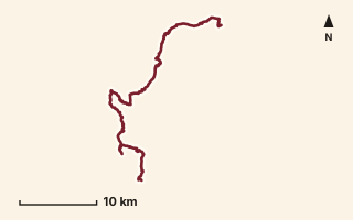
OSM route line, simplified. Branches and gaps as mapped. Trekking Trek, long-distance trail stage
EST 40
Near Mahabaleshwar, about 82.6 km from Pune centre (computed)
Mapped relation length 52.27 kmElevation Not recordedMapped in OpenStreetMap; access not checked Mapped only, not field-tested
Source: OpenStreetMap relation 20999700 (opens in a new tab) . © OpenStreetMap contributors, ODbL.
The route
- Original activity
- Trekking
- Type
- Long-distance trail stage. Trekking, Trail routes, Long-distance trails, Mountain routes.
- Shape in OSM
- Linear (A→B or one-way trail)
- Surface
- Trail (OSM hiking relation; may include road segments)
- Distance
- 52.27 km. Mapped relation length (OpenStreetMap via Waymarked Trails). Can include branches and alternatives.
- Elevation
- Not recorded. No gain, loss or profile data in the source.
- Difficulty
- Not recorded
- Start and finish
- Not recorded
- Places named in OSM
- Ambavali, Bombay Point
Access and safety
- Access
- Not recorded. That does not mean open.
- Hazards
- Not recorded. That does not mean there are none.
- Permission
- Not recorded
- Field check
- Mapped only, not field-tested. Field check recommended (geometry from source)
Data and source
- Status
- Mapped in OSM: geometry exists; ground truth not verified
- Graphic
- Route line from the OpenStreetMap relation (47 ways, fetched 7 Oct 2026), simplified for the card. Not field-checked.
- Overlap
- Overlap (one route's extent lies inside the other's); Parent-child (super-route stage)
- Source notes
- operator HikeX
- Source
- OpenStreetMap via Waymarked Trails (hiking). OpenStreetMap (opens in a new tab) Waymarked Trails (opens in a new tab)
- Credit
- OpenStreetMap contributors (see relation history): relation tags reference HikeX (hikex.in)
- Source checked
- 7 Oct 2026 , OSM data via Waymarked Trails API; not field-verified
- GPX
- Download GPX , built from the OpenStreetMap line (ODbL). Mapped, not field-verified.
- Route ID
- OSM-20999700 Show on the map
Route record
- Category
- HIKES & TREKS
- Type
- Trek
- Area
- Near Mahabaleshwar (computed)
- City status
- OUTSIDE PUNE
- Distance
- 52.27 km
- Elevation gain
- Not recorded
- Difficulty
- Not recorded
- Technicality
- Not recorded
- Endurance
- Not recorded
- Navigation
- Not recorded
- Exposure
- Not recorded
- Remoteness
- Not recorded
- Terrain
- Trail (OSM hiking relation; may include road segments)
- Surface
- Not recorded
- Monsoon risk
- Not recorded
- Heat risk
- Not recorded
- Wildlife
- Not recorded
- Water
- Not recorded
- Mobile network
- Not recorded
- Emergency access
- Not recorded
- Beginner suitability
- Not recorded
- Start
- Not recorded
- Finish
- Not recorded
- Nearest landmark
- Ambavali
- Creator
- OpenStreetMap contributors (see relation history): relation tags reference HikeX (hikex.in)
- Source
- OpenStreetMap via Waymarked Trails (hiking)
- GPX
- Yes
- GPX link
- GPX file
- Licence
- ODbL 1.0
- Reuse
- Open licence: credit OpenStreetMap contributors, share-alike
- Route date
- Not recorded
- Last verified
- 7 Oct 2026
- Data confidence
- OSM route line, desk-checked; not field-verified
- Safety notes
- Not recorded
-
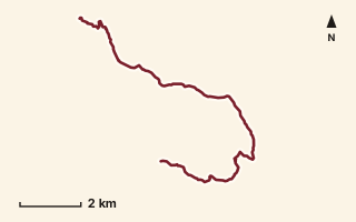
OSM route line, simplified. Branches and gaps as mapped. Hiking Hike, trail / ghat / naal route
Gaaldevi Ghat
Near Karjat, about 62.7 km from Pune centre (computed)
Mapped relation length 14.05 kmElevation Not recordedMapped in OpenStreetMap; access not checked Mapped only, not field-tested
Source: OpenStreetMap relation 18497286 (opens in a new tab) . © OpenStreetMap contributors, ODbL.
The route
- Original activity
- Hiking
- Type
- Trail / ghat / naal route. Hiking, Trail routes.
- Shape in OSM
- Linear (A→B or one-way trail)
- Surface
- Trail (OSM hiking relation; may include road segments)
- Distance
- 14.05 km. Mapped relation length (OpenStreetMap via Waymarked Trails). Can include branches and alternatives.
- Elevation
- Not recorded. No gain, loss or profile data in the source.
- Difficulty
- Not recorded
- Start and finish
- Not recorded
- Places named in OSM
- Dhak village, Dhak Bahiri Caves
Access and safety
- Access
- Not recorded. That does not mean open.
- Hazards
- Not recorded. That does not mean there are none.
- Permission
- Not recorded
- Field check
- Mapped only, not field-tested. Field check recommended (geometry from source)
Data and source
- Status
- Mapped in OSM: geometry exists; ground truth not verified
- Graphic
- Route line from the OpenStreetMap relation (11 ways, fetched 7 Oct 2026), simplified for the card. Not field-checked.
- Overlap
- Overlap (one route's extent lies inside the other's)
- Source notes
- via Dhak village & Dhak Bahiri caves
- Source
- OpenStreetMap via Waymarked Trails (hiking). OpenStreetMap (opens in a new tab) Waymarked Trails (opens in a new tab)
- Credit
- OpenStreetMap contributors (see relation history)
- Source checked
- 7 Oct 2026 , OSM data via Waymarked Trails API; not field-verified
- GPX
- Download GPX , built from the OpenStreetMap line (ODbL). Mapped, not field-verified.
- Route ID
- OSM-18497286 Show on the map
Route record
- Category
- HIKES & TREKS
- Type
- Hike
- Area
- Near Karjat (computed)
- City status
- OUTSIDE PUNE
- Distance
- 14.05 km
- Elevation gain
- Not recorded
- Difficulty
- Not recorded
- Technicality
- Not recorded
- Endurance
- Not recorded
- Navigation
- Not recorded
- Exposure
- Not recorded
- Remoteness
- Not recorded
- Terrain
- Trail (OSM hiking relation; may include road segments)
- Surface
- Not recorded
- Monsoon risk
- Not recorded
- Heat risk
- Not recorded
- Wildlife
- Not recorded
- Water
- Not recorded
- Mobile network
- Not recorded
- Emergency access
- Not recorded
- Beginner suitability
- Not recorded
- Start
- Not recorded
- Finish
- Not recorded
- Nearest landmark
- Dhak village
- Creator
- OpenStreetMap contributors (see relation history)
- Source
- OpenStreetMap via Waymarked Trails (hiking)
- GPX
- Yes
- GPX link
- GPX file
- Licence
- ODbL 1.0
- Reuse
- Open licence: credit OpenStreetMap contributors, share-alike
- Route date
- Not recorded
- Last verified
- 7 Oct 2026
- Data confidence
- OSM route line, desk-checked; not field-verified
- Safety notes
- Not recorded
-
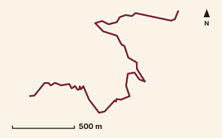
OSM route line, simplified. Branches and gaps as mapped. Hiking Hike, trail / ghat / naal route
Gayadhara Route
Near Malshej, about 92.3 km from Pune centre (computed)
Mapped relation length 3.2 kmElevation Not recordedMapped in OpenStreetMap; access not checked Mapped only, not field-tested
Source: OpenStreetMap relation 18545783 (opens in a new tab) . © OpenStreetMap contributors, ODbL.
The route
- Original activity
- Hiking
- Type
- Trail / ghat / naal route. Hiking, Trail routes.
- Shape in OSM
- Linear (A→B or one-way trail)
- Surface
- Trail (OSM hiking relation; may include road segments)
- Distance
- 3.2 km. Mapped relation length (OpenStreetMap via Waymarked Trails). Can include branches and alternatives.
- Elevation
- Not recorded. No gain, loss or profile data in the source.
- Difficulty
- Not recorded
- Start and finish
- Not recorded
Access and safety
- Access
- Not recorded. That does not mean open.
- Hazards
- Not recorded. That does not mean there are none.
- Permission
- Not recorded
- Field check
- Mapped only, not field-tested. Field check recommended (geometry from source)
Data and source
- Status
- Mapped in OSM: geometry exists; ground truth not verified
- Graphic
- Route line from the OpenStreetMap relation (2 ways, fetched 7 Oct 2026), simplified for the card. Not field-checked.
- Overlap
- Overlap (one route's extent lies inside the other's)
- Source notes
- website manav.in
- Source
- OpenStreetMap via Waymarked Trails (hiking). OpenStreetMap (opens in a new tab) Waymarked Trails (opens in a new tab)
- Credit
- OpenStreetMap contributors (see relation history): relation tags reference manav.in
- Source checked
- 7 Oct 2026 , OSM data via Waymarked Trails API; not field-verified
- GPX
- Download GPX , built from the OpenStreetMap line (ODbL). Mapped, not field-verified.
- Route ID
- OSM-18545783 Show on the map
Route record
- Category
- HIKES & TREKS
- Type
- Hike
- Area
- Near Malshej (computed)
- City status
- OUTSIDE PUNE
- Distance
- 3.2 km
- Elevation gain
- Not recorded
- Difficulty
- Not recorded
- Technicality
- Not recorded
- Endurance
- Not recorded
- Navigation
- Not recorded
- Exposure
- Not recorded
- Remoteness
- Not recorded
- Terrain
- Trail (OSM hiking relation; may include road segments)
- Surface
- Not recorded
- Monsoon risk
- Not recorded
- Heat risk
- Not recorded
- Wildlife
- Not recorded
- Water
- Not recorded
- Mobile network
- Not recorded
- Emergency access
- Not recorded
- Beginner suitability
- Not recorded
- Start
- Not recorded
- Finish
- Not recorded
- Nearest landmark
- Not recorded
- Creator
- OpenStreetMap contributors (see relation history): relation tags reference manav.in
- Source
- OpenStreetMap via Waymarked Trails (hiking)
- GPX
- Yes
- GPX link
- GPX file
- Licence
- ODbL 1.0
- Reuse
- Open licence: credit OpenStreetMap contributors, share-alike
- Route date
- Not recorded
- Last verified
- 7 Oct 2026
- Data confidence
- OSM route line, desk-checked; not field-verified
- Safety notes
- Not recorded
-
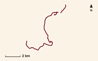
OSM route line, simplified. Branches and gaps as mapped. Trekking Trek, fort trek
Ghangad Fort
Near Sudhagad / Pali, about 53.5 km from Pune centre (computed)
Mapped relation length 14.88 kmElevation Not recordedMapped in OpenStreetMap; access not checked Mapped only, not field-tested
Source: OpenStreetMap relation 11855364 (opens in a new tab) . © OpenStreetMap contributors, ODbL.
The route
- Original activity
- Trekking
- Type
- Fort trek. Trekking, Trail routes, Fort treks.
- Shape in OSM
- Non-linear in OSM (loop or multi-branch)
- Surface
- Trail (OSM hiking relation; may include road segments)
- Distance
- 14.88 km. Mapped relation length (OpenStreetMap via Waymarked Trails). Can include branches and alternatives.
- Elevation
- Not recorded. No gain, loss or profile data in the source.
- Difficulty
- Not recorded
- Start and finish
- Not recorded
Access and safety
- Access
- Not recorded. That does not mean open.
- Hazards
- Not recorded. That does not mean there are none.
- Permission
- Not recorded
- Field check
- Mapped only, not field-tested. Field check recommended (geometry from source)
Data and source
- Status
- Mapped in OSM: geometry exists; ground truth not verified
- Graphic
- Route line from the OpenStreetMap relation (12 ways, fetched 7 Oct 2026), simplified for the card. Not field-checked.
- Overlap
- Overlap (one route's extent lies inside the other's); Probable duplicate / variant
- Source
- OpenStreetMap via Waymarked Trails (hiking). OpenStreetMap (opens in a new tab) Waymarked Trails (opens in a new tab)
- Credit
- OpenStreetMap contributors (see relation history)
- Source checked
- 7 Oct 2026 , OSM data via Waymarked Trails API; not field-verified
- GPX
- Download GPX , built from the OpenStreetMap line (ODbL). Mapped, not field-verified.
- Route ID
- OSM-11855364 Show on the map
Route record
- Category
- HIKES & TREKS
- Type
- Trek
- Area
- Near Sudhagad / Pali (computed)
- City status
- OUTSIDE PUNE
- Distance
- 14.88 km
- Elevation gain
- Not recorded
- Difficulty
- Not recorded
- Technicality
- Not recorded
- Endurance
- Not recorded
- Navigation
- Not recorded
- Exposure
- Not recorded
- Remoteness
- Not recorded
- Terrain
- Trail (OSM hiking relation; may include road segments)
- Surface
- Not recorded
- Monsoon risk
- Not recorded
- Heat risk
- Not recorded
- Wildlife
- Not recorded
- Water
- Not recorded
- Mobile network
- Not recorded
- Emergency access
- Not recorded
- Beginner suitability
- Not recorded
- Start
- Not recorded
- Finish
- Not recorded
- Nearest landmark
- Not recorded
- Creator
- OpenStreetMap contributors (see relation history)
- Source
- OpenStreetMap via Waymarked Trails (hiking)
- GPX
- Yes
- GPX link
- GPX file
- Licence
- ODbL 1.0
- Reuse
- Open licence: credit OpenStreetMap contributors, share-alike
- Route date
- Not recorded
- Last verified
- 7 Oct 2026
- Data confidence
- OSM route line, desk-checked; not field-verified
- Safety notes
- Not recorded
-
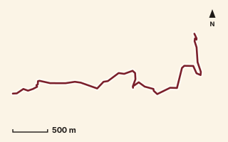
OSM route line, simplified. Branches and gaps as mapped. Trekking Trek, fort trek
Ghera Surgad Fort
Near Sudhagad / Pali, about 68.1 km from Pune centre (computed)
Mapped relation length 4.34 kmElevation Not recordedMapped in OpenStreetMap; access not checked Mapped only, not field-tested
Source: OpenStreetMap relation 15570837 (opens in a new tab) . © OpenStreetMap contributors, ODbL.
The route
- Original activity
- Trekking
- Type
- Fort trek. Trekking, Trail routes, Fort treks.
- Shape in OSM
- Non-linear in OSM (loop or multi-branch)
- Surface
- Trail (OSM hiking relation; may include road segments)
- Distance
- 4.34 km. Mapped relation length (OpenStreetMap via Waymarked Trails). Can include branches and alternatives.
- Elevation
- Not recorded. No gain, loss or profile data in the source.
- Difficulty
- Not recorded
- Start and finish
- Not recorded
Access and safety
- Access
- Not recorded. That does not mean open.
- Hazards
- Not recorded. That does not mean there are none.
- Permission
- Not recorded
- Field check
- Mapped only, not field-tested. Field check recommended (geometry from source)
Data and source
- Status
- Mapped in OSM: geometry exists; ground truth not verified
- Graphic
- Route line from the OpenStreetMap relation (5 ways, fetched 7 Oct 2026), simplified for the card. Not field-checked.
- Source
- OpenStreetMap via Waymarked Trails (hiking). OpenStreetMap (opens in a new tab) Waymarked Trails (opens in a new tab)
- Credit
- OpenStreetMap contributors (see relation history)
- Source checked
- 7 Oct 2026 , OSM data via Waymarked Trails API; not field-verified
- GPX
- Download GPX , built from the OpenStreetMap line (ODbL). Mapped, not field-verified.
- Route ID
- OSM-15570837 Show on the map
Route record
- Category
- HIKES & TREKS
- Type
- Trek
- Area
- Near Sudhagad / Pali (computed)
- City status
- OUTSIDE PUNE
- Distance
- 4.34 km
- Elevation gain
- Not recorded
- Difficulty
- Not recorded
- Technicality
- Not recorded
- Endurance
- Not recorded
- Navigation
- Not recorded
- Exposure
- Not recorded
- Remoteness
- Not recorded
- Terrain
- Trail (OSM hiking relation; may include road segments)
- Surface
- Not recorded
- Monsoon risk
- Not recorded
- Heat risk
- Not recorded
- Wildlife
- Not recorded
- Water
- Not recorded
- Mobile network
- Not recorded
- Emergency access
- Not recorded
- Beginner suitability
- Not recorded
- Start
- Not recorded
- Finish
- Not recorded
- Nearest landmark
- Not recorded
- Creator
- OpenStreetMap contributors (see relation history)
- Source
- OpenStreetMap via Waymarked Trails (hiking)
- GPX
- Yes
- GPX link
- GPX file
- Licence
- ODbL 1.0
- Reuse
- Open licence: credit OpenStreetMap contributors, share-alike
- Route date
- Not recorded
- Last verified
- 7 Oct 2026
- Data confidence
- OSM route line, desk-checked; not field-verified
- Safety notes
- Not recorded
-
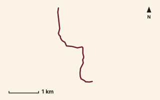
OSM route line, simplified. Branches and gaps as mapped. Hiking Hike, trail / ghat / naal route
Ghol to Kumbermachi
Near Raigad, about 49.6 km from Pune centre (computed)
Mapped relation length 3.56 kmElevation Not recordedMapped in OpenStreetMap; access not checked Mapped only, not field-tested
Source: OpenStreetMap relation 15570791 (opens in a new tab) . © OpenStreetMap contributors, ODbL.
The route
- Original activity
- Hiking
- Type
- Trail / ghat / naal route. Hiking, Trail routes.
- Shape in OSM
- Linear (A→B or one-way trail)
- Surface
- Trail (OSM hiking relation; may include road segments)
- Distance
- 3.56 km. Mapped relation length (OpenStreetMap via Waymarked Trails). Can include branches and alternatives.
- Elevation
- Not recorded. No gain, loss or profile data in the source.
- Difficulty
- Not recorded
- Start and finish
- Not recorded
Access and safety
- Access
- Not recorded. That does not mean open.
- Hazards
- Not recorded. That does not mean there are none.
- Permission
- Not recorded
- Field check
- Mapped only, not field-tested. Field check recommended (geometry from source)
Data and source
- Status
- Mapped in OSM: geometry exists; ground truth not verified
- Graphic
- Route line from the OpenStreetMap relation (3 ways, fetched 7 Oct 2026), simplified for the card. Not field-checked.
- Overlap
- Overlap (one route's extent lies inside the other's)
- Source notes
- Telyachi Naal / Waghjai Ghat / Thipthipya Ghat segments
- Source
- OpenStreetMap via Waymarked Trails (hiking). OpenStreetMap (opens in a new tab) Waymarked Trails (opens in a new tab)
- Credit
- OpenStreetMap contributors (see relation history)
- Source checked
- 7 Oct 2026 , OSM data via Waymarked Trails API; not field-verified
- GPX
- Download GPX , built from the OpenStreetMap line (ODbL). Mapped, not field-verified.
- Route ID
- OSM-15570791 Show on the map
Route record
- Category
- HIKES & TREKS
- Type
- Hike
- Area
- Near Raigad (computed)
- City status
- OUTSIDE PUNE
- Distance
- 3.56 km
- Elevation gain
- Not recorded
- Difficulty
- Not recorded
- Technicality
- Not recorded
- Endurance
- Not recorded
- Navigation
- Not recorded
- Exposure
- Not recorded
- Remoteness
- Not recorded
- Terrain
- Trail (OSM hiking relation; may include road segments)
- Surface
- Not recorded
- Monsoon risk
- Not recorded
- Heat risk
- Not recorded
- Wildlife
- Not recorded
- Water
- Not recorded
- Mobile network
- Not recorded
- Emergency access
- Not recorded
- Beginner suitability
- Not recorded
- Start
- Not recorded
- Finish
- Not recorded
- Nearest landmark
- Not recorded
- Creator
- OpenStreetMap contributors (see relation history)
- Source
- OpenStreetMap via Waymarked Trails (hiking)
- GPX
- Yes
- GPX link
- GPX file
- Licence
- ODbL 1.0
- Reuse
- Open licence: credit OpenStreetMap contributors, share-alike
- Route date
- Not recorded
- Last verified
- 7 Oct 2026
- Data confidence
- OSM route line, desk-checked; not field-verified
- Safety notes
- Not recorded
-
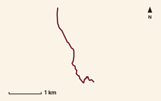
OSM route line, simplified. Branches and gaps as mapped. Hiking Hike, trail / ghat / naal route
Ghondaand
Near Sudhagad / Pali, about 53.2 km from Pune centre (computed)
Mapped relation length 3.25 kmElevation Not recordedMapped in OpenStreetMap; access not checked Mapped only, not field-tested
Source: OpenStreetMap relation 19930338 (opens in a new tab) . © OpenStreetMap contributors, ODbL.
The route
- Original activity
- Hiking
- Type
- Trail / ghat / naal route. Hiking, Trail routes.
- Shape in OSM
- Linear (A→B or one-way trail)
- Surface
- Trail (OSM hiking relation; may include road segments)
- Distance
- 3.25 km. Mapped relation length (OpenStreetMap via Waymarked Trails). Can include branches and alternatives.
- Elevation
- Not recorded. No gain, loss or profile data in the source.
- Difficulty
- Not recorded
- Start and finish
- Not recorded
Access and safety
- Access
- Not recorded. That does not mean open.
- Hazards
- Not recorded. That does not mean there are none.
- Permission
- Not recorded
- Field check
- Mapped only, not field-tested. Field check recommended (geometry from source)
Data and source
- Status
- Mapped in OSM: geometry exists; ground truth not verified
- Graphic
- Route line from the OpenStreetMap relation (1 ways, fetched 7 Oct 2026), simplified for the card. Not field-checked.
- Overlap
- Overlap (one route's extent lies inside the other's)
- Source notes
- website manav.in
- Source
- OpenStreetMap via Waymarked Trails (hiking). OpenStreetMap (opens in a new tab) Waymarked Trails (opens in a new tab)
- Credit
- OpenStreetMap contributors (see relation history): relation tags reference manav.in
- Source checked
- 7 Oct 2026 , OSM data via Waymarked Trails API; not field-verified
- GPX
- Download GPX , built from the OpenStreetMap line (ODbL). Mapped, not field-verified.
- Route ID
- OSM-19930338 Show on the map
Route record
- Category
- HIKES & TREKS
- Type
- Hike
- Area
- Near Sudhagad / Pali (computed)
- City status
- OUTSIDE PUNE
- Distance
- 3.25 km
- Elevation gain
- Not recorded
- Difficulty
- Not recorded
- Technicality
- Not recorded
- Endurance
- Not recorded
- Navigation
- Not recorded
- Exposure
- Not recorded
- Remoteness
- Not recorded
- Terrain
- Trail (OSM hiking relation; may include road segments)
- Surface
- Not recorded
- Monsoon risk
- Not recorded
- Heat risk
- Not recorded
- Wildlife
- Not recorded
- Water
- Not recorded
- Mobile network
- Not recorded
- Emergency access
- Not recorded
- Beginner suitability
- Not recorded
- Start
- Not recorded
- Finish
- Not recorded
- Nearest landmark
- Not recorded
- Creator
- OpenStreetMap contributors (see relation history): relation tags reference manav.in
- Source
- OpenStreetMap via Waymarked Trails (hiking)
- GPX
- Yes
- GPX link
- GPX file
- Licence
- ODbL 1.0
- Reuse
- Open licence: credit OpenStreetMap contributors, share-alike
- Route date
- Not recorded
- Last verified
- 7 Oct 2026
- Data confidence
- OSM route line, desk-checked; not field-verified
- Safety notes
- Not recorded
-
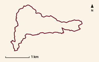
OSM route line, simplified. Branches and gaps as mapped. Hiking Hike, trail / ghat / naal route
Gopya Ghat and Supe Naal
Near Varandha Ghat, about 44.4 km from Pune centre (computed)
Mapped relation length 9.85 kmElevation Not recordedMapped in OpenStreetMap; access not checked Mapped only, not field-tested
Source: OpenStreetMap relation 19793630 (opens in a new tab) . © OpenStreetMap contributors, ODbL.
The route
- Original activity
- Hiking
- Type
- Trail / ghat / naal route. Hiking, Trail routes.
- Shape in OSM
- Linear (A→B or one-way trail)
- Surface
- Trail (OSM hiking relation; may include road segments)
- Distance
- 9.85 km. Mapped relation length (OpenStreetMap via Waymarked Trails). Can include branches and alternatives.
- Elevation
- Not recorded. No gain, loss or profile data in the source.
- Difficulty
- Not recorded
- Start and finish
- Not recorded
Access and safety
- Access
- Not recorded. That does not mean open.
- Hazards
- Not recorded. That does not mean there are none.
- Permission
- Not recorded
- Field check
- Mapped only, not field-tested. Field check recommended (geometry from source)
Data and source
- Status
- Mapped in OSM: geometry exists; ground truth not verified
- Graphic
- Route line from the OpenStreetMap relation (3 ways, fetched 7 Oct 2026), simplified for the card. Not field-checked.
- Source
- OpenStreetMap via Waymarked Trails (hiking). OpenStreetMap (opens in a new tab) Waymarked Trails (opens in a new tab)
- Credit
- OpenStreetMap contributors (see relation history)
- Source checked
- 7 Oct 2026 , OSM data via Waymarked Trails API; not field-verified
- GPX
- Download GPX , built from the OpenStreetMap line (ODbL). Mapped, not field-verified.
- Route ID
- OSM-19793630 Show on the map
Route record
- Category
- HIKES & TREKS
- Type
- Hike
- Area
- Near Varandha Ghat (computed)
- City status
- OUTSIDE PUNE
- Distance
- 9.85 km
- Elevation gain
- Not recorded
- Difficulty
- Not recorded
- Technicality
- Not recorded
- Endurance
- Not recorded
- Navigation
- Not recorded
- Exposure
- Not recorded
- Remoteness
- Not recorded
- Terrain
- Trail (OSM hiking relation; may include road segments)
- Surface
- Not recorded
- Monsoon risk
- Not recorded
- Heat risk
- Not recorded
- Wildlife
- Not recorded
- Water
- Not recorded
- Mobile network
- Not recorded
- Emergency access
- Not recorded
- Beginner suitability
- Not recorded
- Start
- Not recorded
- Finish
- Not recorded
- Nearest landmark
- Not recorded
- Creator
- OpenStreetMap contributors (see relation history)
- Source
- OpenStreetMap via Waymarked Trails (hiking)
- GPX
- Yes
- GPX link
- GPX file
- Licence
- ODbL 1.0
- Reuse
- Open licence: credit OpenStreetMap contributors, share-alike
- Route date
- Not recorded
- Last verified
- 7 Oct 2026
- Data confidence
- OSM route line, desk-checked; not field-verified
- Safety notes
- Not recorded
-
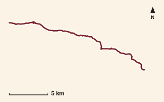
OSM route line, simplified. Branches and gaps as mapped. Trekking Trek, fort trek
Hinjawadi to Tikona
Near Kamshet / Pawna, about 29 km from Pune centre (computed)
Mapped relation length 22.3 kmElevation Not recordedMapped in OpenStreetMap; access not checked Mapped only, not field-tested
Source: OpenStreetMap relation 15623107 (opens in a new tab) . © OpenStreetMap contributors, ODbL.
The route
- Original activity
- Trekking
- Type
- Fort trek. Trekking, Trail routes, Fort treks.
- Shape in OSM
- Non-linear in OSM (loop or multi-branch)
- Surface
- Trail (OSM hiking relation; may include road segments)
- Distance
- 22.3 km. Mapped relation length (OpenStreetMap via Waymarked Trails). Can include branches and alternatives.
- Elevation
- Not recorded. No gain, loss or profile data in the source.
- Difficulty
- Not recorded
- Start and finish
- Not recorded
Access and safety
- Access
- Not recorded. That does not mean open.
- Hazards
- Not recorded. That does not mean there are none.
- Permission
- Not recorded
- Field check
- Mapped only, not field-tested. Field check recommended (geometry from source)
Data and source
- Status
- Mapped in OSM: geometry exists; ground truth not verified
- Graphic
- Route line from the OpenStreetMap relation (8 ways, fetched 7 Oct 2026), simplified for the card. Not field-checked.
- Overlap
- Overlap (one route's extent lies inside the other's)
- Source
- OpenStreetMap via Waymarked Trails (hiking). OpenStreetMap (opens in a new tab) Waymarked Trails (opens in a new tab)
- Credit
- OpenStreetMap contributors (see relation history)
- Source checked
- 7 Oct 2026 , OSM data via Waymarked Trails API; not field-verified
- GPX
- Download GPX , built from the OpenStreetMap line (ODbL). Mapped, not field-verified.
- Route ID
- OSM-15623107 Show on the map
Route record
- Category
- HIKES & TREKS
- Type
- Trek
- Area
- Near Kamshet / Pawna (computed)
- City status
- OUTSIDE PUNE
- Distance
- 22.3 km
- Elevation gain
- Not recorded
- Difficulty
- Not recorded
- Technicality
- Not recorded
- Endurance
- Not recorded
- Navigation
- Not recorded
- Exposure
- Not recorded
- Remoteness
- Not recorded
- Terrain
- Trail (OSM hiking relation; may include road segments)
- Surface
- Not recorded
- Monsoon risk
- Not recorded
- Heat risk
- Not recorded
- Wildlife
- Not recorded
- Water
- Not recorded
- Mobile network
- Not recorded
- Emergency access
- Not recorded
- Beginner suitability
- Not recorded
- Start
- Not recorded
- Finish
- Not recorded
- Nearest landmark
- Not recorded
- Creator
- OpenStreetMap contributors (see relation history)
- Source
- OpenStreetMap via Waymarked Trails (hiking)
- GPX
- Yes
- GPX link
- GPX file
- Licence
- ODbL 1.0
- Reuse
- Open licence: credit OpenStreetMap contributors, share-alike
- Route date
- Not recorded
- Last verified
- 7 Oct 2026
- Data confidence
- OSM route line, desk-checked; not field-verified
- Safety notes
- Not recorded
-
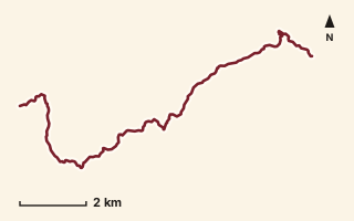
OSM route line, simplified. Branches and gaps as mapped. Hiking Hike, trail / ghat / naal route
Kadave Khind to Pol
Near Torna / Velhe, about 36.8 km from Pune centre (computed)
Mapped relation length 14.71 kmElevation Not recordedMapped in OpenStreetMap; access not checked Mapped only, not field-tested
Source: OpenStreetMap relation 11842887 (opens in a new tab) . © OpenStreetMap contributors, ODbL.
The route
- Original activity
- Hiking
- Type
- Trail / ghat / naal route. Hiking, Trail routes.
- Shape in OSM
- Linear (A→B or one-way trail)
- Surface
- Trail (OSM hiking relation; may include road segments)
- Distance
- 14.71 km. Mapped relation length (OpenStreetMap via Waymarked Trails). Can include branches and alternatives.
- Elevation
- Not recorded. No gain, loss or profile data in the source.
- Difficulty
- Not recorded
- Start and finish
- Not recorded
Access and safety
- Access
- Not recorded. That does not mean open.
- Hazards
- Not recorded. That does not mean there are none.
- Permission
- Not recorded
- Field check
- Mapped only, not field-tested. Field check recommended (geometry from source)
Data and source
- Status
- Mapped in OSM: geometry exists; ground truth not verified
- Graphic
- Route line from the OpenStreetMap relation (4 ways, fetched 7 Oct 2026), simplified for the card. Not field-checked.
- Overlap
- Overlap (one route's extent lies inside the other's)
- Source
- OpenStreetMap via Waymarked Trails (hiking). OpenStreetMap (opens in a new tab) Waymarked Trails (opens in a new tab)
- Credit
- OpenStreetMap contributors (see relation history)
- Source checked
- 7 Oct 2026 , OSM data via Waymarked Trails API; not field-verified
- GPX
- Download GPX , built from the OpenStreetMap line (ODbL). Mapped, not field-verified.
- Route ID
- OSM-11842887 Show on the map
Route record
- Category
- HIKES & TREKS
- Type
- Hike
- Area
- Near Torna / Velhe (computed)
- City status
- OUTSIDE PUNE
- Distance
- 14.71 km
- Elevation gain
- Not recorded
- Difficulty
- Not recorded
- Technicality
- Not recorded
- Endurance
- Not recorded
- Navigation
- Not recorded
- Exposure
- Not recorded
- Remoteness
- Not recorded
- Terrain
- Trail (OSM hiking relation; may include road segments)
- Surface
- Not recorded
- Monsoon risk
- Not recorded
- Heat risk
- Not recorded
- Wildlife
- Not recorded
- Water
- Not recorded
- Mobile network
- Not recorded
- Emergency access
- Not recorded
- Beginner suitability
- Not recorded
- Start
- Not recorded
- Finish
- Not recorded
- Nearest landmark
- Not recorded
- Creator
- OpenStreetMap contributors (see relation history)
- Source
- OpenStreetMap via Waymarked Trails (hiking)
- GPX
- Yes
- GPX link
- GPX file
- Licence
- ODbL 1.0
- Reuse
- Open licence: credit OpenStreetMap contributors, share-alike
- Route date
- Not recorded
- Last verified
- 7 Oct 2026
- Data confidence
- OSM route line, desk-checked; not field-verified
- Safety notes
- Not recorded
-
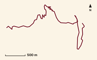
OSM route line, simplified. Branches and gaps as mapped. Trekking Trek, fort trek
Kalavantin Durg
Near Matheran, about 84.7 km from Pune centre (computed)
Mapped relation length 5.33 kmElevation Not recordedMapped in OpenStreetMap; access not checked Mapped only, not field-tested
Source: OpenStreetMap relation 15587601 (opens in a new tab) . © OpenStreetMap contributors, ODbL.
The route
- Original activity
- Trekking
- Type
- Fort trek. Trekking, Trail routes, Fort treks.
- Shape in OSM
- Linear (A→B or one-way trail)
- Surface
- Trail (OSM hiking relation; may include road segments)
- Distance
- 5.33 km. Mapped relation length (OpenStreetMap via Waymarked Trails). Can include branches and alternatives.
- Elevation
- Not recorded. No gain, loss or profile data in the source.
- Difficulty
- Not recorded
- Start and finish
- Not recorded
Access and safety
- Access
- Not recorded. That does not mean open.
- Hazards
- Not recorded. That does not mean there are none.
- Permission
- Not recorded
- Field check
- Mapped only, not field-tested. Field check recommended (geometry from source)
Data and source
- Status
- Mapped in OSM: geometry exists; ground truth not verified
- Graphic
- Route line from the OpenStreetMap relation (9 ways, fetched 7 Oct 2026), simplified for the card. Not field-checked.
- Overlap
- Overlap
- Source notes
- way to Prabalgad Machi
- Source
- OpenStreetMap via Waymarked Trails (hiking). OpenStreetMap (opens in a new tab) Waymarked Trails (opens in a new tab)
- Credit
- OpenStreetMap contributors (see relation history)
- Source checked
- 7 Oct 2026 , OSM data via Waymarked Trails API; not field-verified
- GPX
- Download GPX , built from the OpenStreetMap line (ODbL). Mapped, not field-verified.
- Route ID
- OSM-15587601 Show on the map
Route record
- Category
- HIKES & TREKS
- Type
- Trek
- Area
- Near Matheran (computed)
- City status
- OUTSIDE PUNE
- Distance
- 5.33 km
- Elevation gain
- Not recorded
- Difficulty
- Not recorded
- Technicality
- Not recorded
- Endurance
- Not recorded
- Navigation
- Not recorded
- Exposure
- Not recorded
- Remoteness
- Not recorded
- Terrain
- Trail (OSM hiking relation; may include road segments)
- Surface
- Not recorded
- Monsoon risk
- Not recorded
- Heat risk
- Not recorded
- Wildlife
- Not recorded
- Water
- Not recorded
- Mobile network
- Not recorded
- Emergency access
- Not recorded
- Beginner suitability
- Not recorded
- Start
- Not recorded
- Finish
- Not recorded
- Nearest landmark
- Not recorded
- Creator
- OpenStreetMap contributors (see relation history)
- Source
- OpenStreetMap via Waymarked Trails (hiking)
- GPX
- Yes
- GPX link
- GPX file
- Licence
- ODbL 1.0
- Reuse
- Open licence: credit OpenStreetMap contributors, share-alike
- Route date
- Not recorded
- Last verified
- 7 Oct 2026
- Data confidence
- OSM route line, desk-checked; not field-verified
- Safety notes
- Not recorded
-
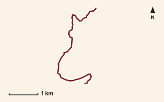
OSM route line, simplified. Branches and gaps as mapped. Trekking Trek, fort trek
Kamalgad Fort
Near Raireshwar, about 61.3 km from Pune centre (computed)
Mapped relation length 5.42 kmElevation Not recordedMapped in OpenStreetMap; access not checked Mapped only, not field-tested
Source: OpenStreetMap relation 11879770 (opens in a new tab) . © OpenStreetMap contributors, ODbL.
The route
- Original activity
- Trekking
- Type
- Fort trek. Trekking, Trail routes, Fort treks.
- Shape in OSM
- Linear (A→B or one-way trail)
- Surface
- Trail (OSM hiking relation; may include road segments)
- Distance
- 5.42 km. Mapped relation length (OpenStreetMap via Waymarked Trails). Can include branches and alternatives.
- Elevation
- Not recorded. No gain, loss or profile data in the source.
- Difficulty
- Not recorded
- Start and finish
- Not recorded
Access and safety
- Access
- Not recorded. That does not mean open.
- Hazards
- Not recorded. That does not mean there are none.
- Permission
- Not recorded
- Field check
- Mapped only, not field-tested. Field check recommended (geometry from source)
Data and source
- Status
- Mapped in OSM: geometry exists; ground truth not verified
- Graphic
- Route line from the OpenStreetMap relation (3 ways, fetched 7 Oct 2026), simplified for the card. Not field-checked.
- Overlap
- Overlap (one route's extent lies inside the other's); Variant
- Source notes
- website creedaz.in
- Source
- OpenStreetMap via Waymarked Trails (hiking). OpenStreetMap (opens in a new tab) Waymarked Trails (opens in a new tab)
- Credit
- OpenStreetMap contributors (see relation history): relation tags reference creedaz.in
- Source checked
- 7 Oct 2026 , OSM data via Waymarked Trails API; not field-verified
- GPX
- Download GPX , built from the OpenStreetMap line (ODbL). Mapped, not field-verified.
- Route ID
- OSM-11879770 Show on the map
Route record
- Category
- HIKES & TREKS
- Type
- Trek
- Area
- Near Raireshwar (computed)
- City status
- OUTSIDE PUNE
- Distance
- 5.42 km
- Elevation gain
- Not recorded
- Difficulty
- Not recorded
- Technicality
- Not recorded
- Endurance
- Not recorded
- Navigation
- Not recorded
- Exposure
- Not recorded
- Remoteness
- Not recorded
- Terrain
- Trail (OSM hiking relation; may include road segments)
- Surface
- Not recorded
- Monsoon risk
- Not recorded
- Heat risk
- Not recorded
- Wildlife
- Not recorded
- Water
- Not recorded
- Mobile network
- Not recorded
- Emergency access
- Not recorded
- Beginner suitability
- Not recorded
- Start
- Not recorded
- Finish
- Not recorded
- Nearest landmark
- Not recorded
- Creator
- OpenStreetMap contributors (see relation history): relation tags reference creedaz.in
- Source
- OpenStreetMap via Waymarked Trails (hiking)
- GPX
- Yes
- GPX link
- GPX file
- Licence
- ODbL 1.0
- Reuse
- Open licence: credit OpenStreetMap contributors, share-alike
- Route date
- Not recorded
- Last verified
- 7 Oct 2026
- Data confidence
- OSM route line, desk-checked; not field-verified
- Safety notes
- Not recorded
-
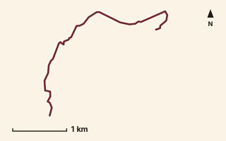
OSM route line, simplified. Branches and gaps as mapped. Trekking Trek, fort trek
Kamalgad Fort 2
Near Mahabaleshwar, about 63.3 km from Pune centre (computed)
Mapped relation length 4.43 kmElevation Not recordedMapped in OpenStreetMap; access not checked Mapped only, not field-tested
Source: OpenStreetMap relation 15570601 (opens in a new tab) . © OpenStreetMap contributors, ODbL.
The route
- Original activity
- Trekking
- Type
- Fort trek. Trekking, Trail routes, Fort treks.
- Shape in OSM
- Linear (A→B or one-way trail)
- Surface
- Trail (OSM hiking relation; may include road segments)
- Distance
- 4.43 km. Mapped relation length (OpenStreetMap via Waymarked Trails). Can include branches and alternatives.
- Elevation
- Not recorded. No gain, loss or profile data in the source.
- Difficulty
- Not recorded
- Start and finish
- Not recorded
Access and safety
- Access
- Not recorded. That does not mean open.
- Hazards
- Not recorded. That does not mean there are none.
- Permission
- Not recorded
- Field check
- Mapped only, not field-tested. Field check recommended (geometry from source)
Data and source
- Status
- Mapped in OSM: geometry exists; ground truth not verified
- Graphic
- Route line from the OpenStreetMap relation (4 ways, fetched 7 Oct 2026), simplified for the card. Not field-checked.
- Overlap
- Variant
- Source
- OpenStreetMap via Waymarked Trails (hiking). OpenStreetMap (opens in a new tab) Waymarked Trails (opens in a new tab)
- Credit
- OpenStreetMap contributors (see relation history)
- Source checked
- 7 Oct 2026 , OSM data via Waymarked Trails API; not field-verified
- GPX
- Download GPX , built from the OpenStreetMap line (ODbL). Mapped, not field-verified.
- Route ID
- OSM-15570601 Show on the map
Route record
- Category
- HIKES & TREKS
- Type
- Trek
- Area
- Near Mahabaleshwar (computed)
- City status
- OUTSIDE PUNE
- Distance
- 4.43 km
- Elevation gain
- Not recorded
- Difficulty
- Not recorded
- Technicality
- Not recorded
- Endurance
- Not recorded
- Navigation
- Not recorded
- Exposure
- Not recorded
- Remoteness
- Not recorded
- Terrain
- Trail (OSM hiking relation; may include road segments)
- Surface
- Not recorded
- Monsoon risk
- Not recorded
- Heat risk
- Not recorded
- Wildlife
- Not recorded
- Water
- Not recorded
- Mobile network
- Not recorded
- Emergency access
- Not recorded
- Beginner suitability
- Not recorded
- Start
- Not recorded
- Finish
- Not recorded
- Nearest landmark
- Not recorded
- Creator
- OpenStreetMap contributors (see relation history)
- Source
- OpenStreetMap via Waymarked Trails (hiking)
- GPX
- Yes
- GPX link
- GPX file
- Licence
- ODbL 1.0
- Reuse
- Open licence: credit OpenStreetMap contributors, share-alike
- Route date
- Not recorded
- Last verified
- 7 Oct 2026
- Data confidence
- OSM route line, desk-checked; not field-verified
- Safety notes
- Not recorded
-
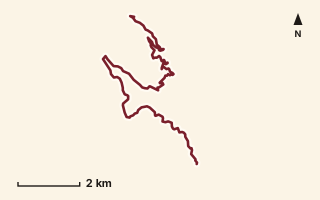
OSM route line, simplified. Branches and gaps as mapped. Trekking Trek, fort trek
Kamalgad to Raireshwar
Near Raireshwar, about 57.8 km from Pune centre (computed)
Mapped relation length 14.67 kmElevation Not recordedMapped in OpenStreetMap; access not checked Mapped only, not field-tested
Source: OpenStreetMap relation 15555575 (opens in a new tab) . © OpenStreetMap contributors, ODbL.
The route
- Original activity
- Trekking
- Type
- Fort trek. Trekking, Trail routes, Fort treks.
- Shape in OSM
- Linear (A→B or one-way trail)
- Surface
- Trail (OSM hiking relation; may include road segments)
- Distance
- 14.67 km. Mapped relation length (OpenStreetMap via Waymarked Trails). Can include branches and alternatives.
- Elevation
- Not recorded. No gain, loss or profile data in the source.
- Difficulty
- Not recorded
- Start and finish
- Not recorded
Access and safety
- Access
- Not recorded. That does not mean open.
- Hazards
- Not recorded. That does not mean there are none.
- Permission
- Not recorded
- Field check
- Mapped only, not field-tested. Field check recommended (geometry from source)
Data and source
- Status
- Mapped in OSM: geometry exists; ground truth not verified
- Graphic
- Route line from the OpenStreetMap relation (4 ways, fetched 7 Oct 2026), simplified for the card. Not field-checked.
- Overlap
- Overlap (one route's extent lies inside the other's)
- Source
- OpenStreetMap via Waymarked Trails (hiking). OpenStreetMap (opens in a new tab) Waymarked Trails (opens in a new tab)
- Credit
- OpenStreetMap contributors (see relation history)
- Source checked
- 7 Oct 2026 , OSM data via Waymarked Trails API; not field-verified
- GPX
- Download GPX , built from the OpenStreetMap line (ODbL). Mapped, not field-verified.
- Route ID
- OSM-15555575 Show on the map
Route record
- Category
- HIKES & TREKS
- Type
- Trek
- Area
- Near Raireshwar (computed)
- City status
- OUTSIDE PUNE
- Distance
- 14.67 km
- Elevation gain
- Not recorded
- Difficulty
- Not recorded
- Technicality
- Not recorded
- Endurance
- Not recorded
- Navigation
- Not recorded
- Exposure
- Not recorded
- Remoteness
- Not recorded
- Terrain
- Trail (OSM hiking relation; may include road segments)
- Surface
- Not recorded
- Monsoon risk
- Not recorded
- Heat risk
- Not recorded
- Wildlife
- Not recorded
- Water
- Not recorded
- Mobile network
- Not recorded
- Emergency access
- Not recorded
- Beginner suitability
- Not recorded
- Start
- Not recorded
- Finish
- Not recorded
- Nearest landmark
- Not recorded
- Creator
- OpenStreetMap contributors (see relation history)
- Source
- OpenStreetMap via Waymarked Trails (hiking)
- GPX
- Yes
- GPX link
- GPX file
- Licence
- ODbL 1.0
- Reuse
- Open licence: credit OpenStreetMap contributors, share-alike
- Route date
- Not recorded
- Last verified
- 7 Oct 2026
- Data confidence
- OSM route line, desk-checked; not field-verified
- Safety notes
- Not recorded
-
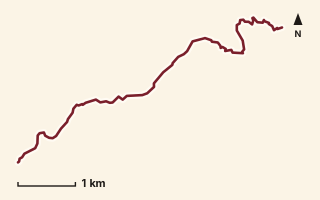
OSM route line, simplified. Branches and gaps as mapped. Hiking Hike, trail / ghat / naal route
Karvandi Ghat
Near Lonavala, about 55 km from Pune centre (computed)
Mapped relation length 7.17 kmElevation Not recordedMapped in OpenStreetMap; access not checked Mapped only, not field-tested
Source: OpenStreetMap relation 16563430 (opens in a new tab) . © OpenStreetMap contributors, ODbL.
The route
- Original activity
- Hiking
- Type
- Trail / ghat / naal route. Hiking, Trail routes.
- Shape in OSM
- Linear (sorted)
- Surface
- Trail (OSM hiking relation; may include road segments)
- Distance
- 7.17 km. Mapped relation length (OpenStreetMap via Waymarked Trails). Can include branches and alternatives.
- Elevation
- Not recorded. No gain, loss or profile data in the source.
- Difficulty
- Not recorded
- Start and finish
- Not recorded
- Places named in OSM
- Bheliv, Lion Point
Access and safety
- Access
- Not recorded. That does not mean open.
- Hazards
- Not recorded. That does not mean there are none.
- Permission
- Not recorded
- Field check
- Mapped only, not field-tested. Field check recommended (geometry from source)
Data and source
- Status
- Mapped in OSM: geometry exists; ground truth not verified
- Graphic
- Route line from the OpenStreetMap relation (4 ways, fetched 7 Oct 2026), simplified for the card. Not field-checked.
- Overlap
- Overlap (one route's extent lies inside the other's)
- Source notes
- website manav.in
- Source
- OpenStreetMap via Waymarked Trails (hiking). OpenStreetMap (opens in a new tab) Waymarked Trails (opens in a new tab)
- Credit
- OpenStreetMap contributors (see relation history): relation tags reference manav.in
- Source checked
- 7 Oct 2026 , OSM data via Waymarked Trails API; not field-verified
- GPX
- Download GPX , built from the OpenStreetMap line (ODbL). Mapped, not field-verified.
- Route ID
- OSM-16563430 Show on the map
Route record
- Category
- HIKES & TREKS
- Type
- Hike
- Area
- Near Lonavala (computed)
- City status
- OUTSIDE PUNE
- Distance
- 7.17 km
- Elevation gain
- Not recorded
- Difficulty
- Not recorded
- Technicality
- Not recorded
- Endurance
- Not recorded
- Navigation
- Not recorded
- Exposure
- Not recorded
- Remoteness
- Not recorded
- Terrain
- Trail (OSM hiking relation; may include road segments)
- Surface
- Not recorded
- Monsoon risk
- Not recorded
- Heat risk
- Not recorded
- Wildlife
- Not recorded
- Water
- Not recorded
- Mobile network
- Not recorded
- Emergency access
- Not recorded
- Beginner suitability
- Not recorded
- Start
- Not recorded
- Finish
- Not recorded
- Nearest landmark
- Bheliv
- Creator
- OpenStreetMap contributors (see relation history): relation tags reference manav.in
- Source
- OpenStreetMap via Waymarked Trails (hiking)
- GPX
- Yes
- GPX link
- GPX file
- Licence
- ODbL 1.0
- Reuse
- Open licence: credit OpenStreetMap contributors, share-alike
- Route date
- Not recorded
- Last verified
- 7 Oct 2026
- Data confidence
- OSM route line, desk-checked; not field-verified
- Safety notes
- Not recorded
-
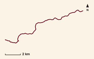
OSM route line, simplified. Branches and gaps as mapped. Trekking Trek, fort trek
Katraj to Sinhagad
Near Sinhagad, about 16.3 km from Pune centre (computed)
Mapped relation length 13.58 kmElevation Not recordedMapped in OpenStreetMap; access not checked Mapped only, not field-tested
Source: OpenStreetMap relation 11856161 (opens in a new tab) . © OpenStreetMap contributors, ODbL.
The route
- Original activity
- Trekking
- Type
- Fort trek. Trekking, Trail routes, Fort treks.
- Shape in OSM
- Linear (A→B or one-way trail)
- Surface
- Trail (OSM hiking relation; may include road segments)
- Distance
- 13.58 km. Mapped relation length (OpenStreetMap via Waymarked Trails). Can include branches and alternatives.
- Elevation
- Not recorded. No gain, loss or profile data in the source.
- Difficulty
- Not recorded
- Start and finish
- Not recorded
Access and safety
- Access
- Not recorded. That does not mean open.
- Hazards
- Not recorded. That does not mean there are none.
- Permission
- Not recorded
- Field check
- Mapped only, not field-tested. Field check recommended (geometry from source)
Data and source
- Status
- Mapped in OSM: geometry exists; ground truth not verified
- Graphic
- Route line from the OpenStreetMap relation (3 ways, fetched 7 Oct 2026), simplified for the card. Not field-checked.
- Overlap
- Overlap (one route's extent lies inside the other's); Same corridor: conflicting distance
- Source
- OpenStreetMap via Waymarked Trails (hiking). OpenStreetMap (opens in a new tab) Waymarked Trails (opens in a new tab)
- Credit
- OpenStreetMap contributors (see relation history)
- Source checked
- 7 Oct 2026 , OSM data via Waymarked Trails API; not field-verified
- GPX
- Download GPX , built from the OpenStreetMap line (ODbL). Mapped, not field-verified.
- Route ID
- OSM-11856161 Show on the map
Route record
- Category
- HIKES & TREKS
- Type
- Trek
- Area
- Near Sinhagad (computed)
- City status
- OUTSIDE PUNE
- Distance
- 13.58 km
- Elevation gain
- Not recorded
- Difficulty
- Not recorded
- Technicality
- Not recorded
- Endurance
- Not recorded
- Navigation
- Not recorded
- Exposure
- Not recorded
- Remoteness
- Not recorded
- Terrain
- Trail (OSM hiking relation; may include road segments)
- Surface
- Not recorded
- Monsoon risk
- Not recorded
- Heat risk
- Not recorded
- Wildlife
- Not recorded
- Water
- Not recorded
- Mobile network
- Not recorded
- Emergency access
- Not recorded
- Beginner suitability
- Not recorded
- Start
- Not recorded
- Finish
- Not recorded
- Nearest landmark
- Not recorded
- Creator
- OpenStreetMap contributors (see relation history)
- Source
- OpenStreetMap via Waymarked Trails (hiking)
- GPX
- Yes
- GPX link
- GPX file
- Licence
- ODbL 1.0
- Reuse
- Open licence: credit OpenStreetMap contributors, share-alike
- Route date
- Not recorded
- Last verified
- 7 Oct 2026
- Data confidence
- OSM route line, desk-checked; not field-verified
- Safety notes
- Not recorded
-
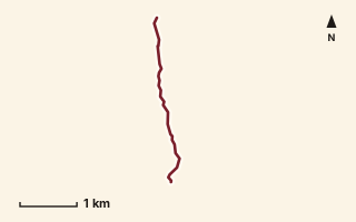
OSM route line, simplified. Branches and gaps as mapped. Hiking Hike, trail / ghat / naal route
Katwan to Beatrice Cliff
Near Matheran, about 79.7 km from Pune centre (computed)
Mapped relation length 3.26 kmElevation Not recordedMapped in OpenStreetMap; access not checked Mapped only, not field-tested
Source: OpenStreetMap relation 19799896 (opens in a new tab) . © OpenStreetMap contributors, ODbL.
The route
- Original activity
- Hiking
- Type
- Trail / ghat / naal route. Hiking, Trail routes.
- Shape in OSM
- Linear (A→B or one-way trail)
- Surface
- Trail (OSM hiking relation; may include road segments)
- Distance
- 3.26 km. Mapped relation length (OpenStreetMap via Waymarked Trails). Can include branches and alternatives.
- Elevation
- Not recorded. No gain, loss or profile data in the source.
- Difficulty
- Not recorded
- Start and finish
- Not recorded
Access and safety
- Access
- Not recorded. That does not mean open.
- Hazards
- Not recorded. That does not mean there are none.
- Permission
- Not recorded
- Field check
- Mapped only, not field-tested. Field check recommended (geometry from source)
Data and source
- Status
- Mapped in OSM: geometry exists; ground truth not verified
- Graphic
- Route line from the OpenStreetMap relation (2 ways, fetched 7 Oct 2026), simplified for the card. Not field-checked.
- Overlap
- Overlap (one route's extent lies inside the other's)
- Source notes
- website manav.in
- Source
- OpenStreetMap via Waymarked Trails (hiking). OpenStreetMap (opens in a new tab) Waymarked Trails (opens in a new tab)
- Credit
- OpenStreetMap contributors (see relation history): relation tags reference manav.in
- Source checked
- 7 Oct 2026 , OSM data via Waymarked Trails API; not field-verified
- GPX
- Download GPX , built from the OpenStreetMap line (ODbL). Mapped, not field-verified.
- Route ID
- OSM-19799896 Show on the map
Route record
- Category
- HIKES & TREKS
- Type
- Hike
- Area
- Near Matheran (computed)
- City status
- OUTSIDE PUNE
- Distance
- 3.26 km
- Elevation gain
- Not recorded
- Difficulty
- Not recorded
- Technicality
- Not recorded
- Endurance
- Not recorded
- Navigation
- Not recorded
- Exposure
- Not recorded
- Remoteness
- Not recorded
- Terrain
- Trail (OSM hiking relation; may include road segments)
- Surface
- Not recorded
- Monsoon risk
- Not recorded
- Heat risk
- Not recorded
- Wildlife
- Not recorded
- Water
- Not recorded
- Mobile network
- Not recorded
- Emergency access
- Not recorded
- Beginner suitability
- Not recorded
- Start
- Not recorded
- Finish
- Not recorded
- Nearest landmark
- Not recorded
- Creator
- OpenStreetMap contributors (see relation history): relation tags reference manav.in
- Source
- OpenStreetMap via Waymarked Trails (hiking)
- GPX
- Yes
- GPX link
- GPX file
- Licence
- ODbL 1.0
- Reuse
- Open licence: credit OpenStreetMap contributors, share-alike
- Route date
- Not recorded
- Last verified
- 7 Oct 2026
- Data confidence
- OSM route line, desk-checked; not field-verified
- Safety notes
- Not recorded
-
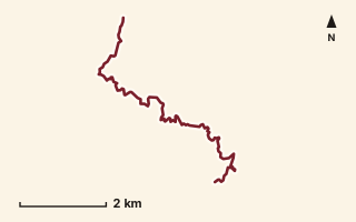
OSM route line, simplified. Branches and gaps as mapped. Trekking Trek, fort trek
Kavlya to Mohangad
Near Varandha Ghat, about 51.9 km from Pune centre (computed)
Mapped relation length 8.97 kmElevation Not recordedMapped in OpenStreetMap; access not checked Mapped only, not field-tested
Source: OpenStreetMap relation 15555548 (opens in a new tab) . © OpenStreetMap contributors, ODbL.
The route
- Original activity
- Trekking
- Type
- Fort trek. Trekking, Trail routes, Fort treks.
- Shape in OSM
- Linear (A→B or one-way trail)
- Surface
- Trail (OSM hiking relation; may include road segments)
- Distance
- 8.97 km. Mapped relation length (OpenStreetMap via Waymarked Trails). Can include branches and alternatives.
- Elevation
- Not recorded. No gain, loss or profile data in the source.
- Difficulty
- Not recorded
- Start and finish
- Not recorded
Access and safety
- Access
- Not recorded. That does not mean open.
- Hazards
- Not recorded. That does not mean there are none.
- Permission
- Not recorded
- Field check
- Mapped only, not field-tested. Field check recommended (geometry from source)
Data and source
- Status
- Mapped in OSM: geometry exists; ground truth not verified
- Graphic
- Route line from the OpenStreetMap relation (7 ways, fetched 7 Oct 2026), simplified for the card. Not field-checked.
- Overlap
- Overlap (one route's extent lies inside the other's)
- Source notes
- on Varandha Ghat (road segments)
- Source
- OpenStreetMap via Waymarked Trails (hiking). OpenStreetMap (opens in a new tab) Waymarked Trails (opens in a new tab)
- Credit
- OpenStreetMap contributors (see relation history)
- Source checked
- 7 Oct 2026 , OSM data via Waymarked Trails API; not field-verified
- GPX
- Download GPX , built from the OpenStreetMap line (ODbL). Mapped, not field-verified.
- Route ID
- OSM-15555548 Show on the map
Route record
- Category
- HIKES & TREKS
- Type
- Trek
- Area
- Near Varandha Ghat (computed)
- City status
- OUTSIDE PUNE
- Distance
- 8.97 km
- Elevation gain
- Not recorded
- Difficulty
- Not recorded
- Technicality
- Not recorded
- Endurance
- Not recorded
- Navigation
- Not recorded
- Exposure
- Not recorded
- Remoteness
- Not recorded
- Terrain
- Trail (OSM hiking relation; may include road segments)
- Surface
- Not recorded
- Monsoon risk
- Not recorded
- Heat risk
- Not recorded
- Wildlife
- Not recorded
- Water
- Not recorded
- Mobile network
- Not recorded
- Emergency access
- Not recorded
- Beginner suitability
- Not recorded
- Start
- Not recorded
- Finish
- Not recorded
- Nearest landmark
- Not recorded
- Creator
- OpenStreetMap contributors (see relation history)
- Source
- OpenStreetMap via Waymarked Trails (hiking)
- GPX
- Yes
- GPX link
- GPX file
- Licence
- ODbL 1.0
- Reuse
- Open licence: credit OpenStreetMap contributors, share-alike
- Route date
- Not recorded
- Last verified
- 7 Oct 2026
- Data confidence
- OSM route line, desk-checked; not field-verified
- Safety notes
- Not recorded
-
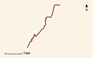
OSM route line, simplified. Branches and gaps as mapped. Hiking Hike, trail / ghat / naal route
Kelad to Dhangarwadi
Near Torna / Velhe, about 47 km from Pune centre (computed)
Mapped relation length 4.37 kmElevation Not recordedMapped in OpenStreetMap; access not checked Mapped only, not field-tested
Source: OpenStreetMap relation 15568813 (opens in a new tab) . © OpenStreetMap contributors, ODbL.
The route
- Original activity
- Hiking
- Type
- Trail / ghat / naal route. Hiking, Trail routes.
- Shape in OSM
- Linear (A→B or one-way trail)
- Surface
- Trail (OSM hiking relation; may include road segments)
- Distance
- 4.37 km. Mapped relation length (OpenStreetMap via Waymarked Trails). Can include branches and alternatives.
- Elevation
- Not recorded. No gain, loss or profile data in the source.
- Difficulty
- Not recorded
- Start and finish
- Not recorded
Access and safety
- Access
- Not recorded. That does not mean open.
- Hazards
- Not recorded. That does not mean there are none.
- Permission
- Not recorded
- Field check
- Mapped only, not field-tested. Field check recommended (geometry from source)
Data and source
- Status
- Mapped in OSM: geometry exists; ground truth not verified
- Graphic
- Route line from the OpenStreetMap relation (6 ways, fetched 7 Oct 2026), simplified for the card. Not field-checked.
- Overlap
- Overlap (one route's extent lies inside the other's)
- Source
- OpenStreetMap via Waymarked Trails (hiking). OpenStreetMap (opens in a new tab) Waymarked Trails (opens in a new tab)
- Credit
- OpenStreetMap contributors (see relation history)
- Source checked
- 7 Oct 2026 , OSM data via Waymarked Trails API; not field-verified
- GPX
- Download GPX , built from the OpenStreetMap line (ODbL). Mapped, not field-verified.
- Route ID
- OSM-15568813 Show on the map
Route record
- Category
- HIKES & TREKS
- Type
- Hike
- Area
- Near Torna / Velhe (computed)
- City status
- OUTSIDE PUNE
- Distance
- 4.37 km
- Elevation gain
- Not recorded
- Difficulty
- Not recorded
- Technicality
- Not recorded
- Endurance
- Not recorded
- Navigation
- Not recorded
- Exposure
- Not recorded
- Remoteness
- Not recorded
- Terrain
- Trail (OSM hiking relation; may include road segments)
- Surface
- Not recorded
- Monsoon risk
- Not recorded
- Heat risk
- Not recorded
- Wildlife
- Not recorded
- Water
- Not recorded
- Mobile network
- Not recorded
- Emergency access
- Not recorded
- Beginner suitability
- Not recorded
- Start
- Not recorded
- Finish
- Not recorded
- Nearest landmark
- Not recorded
- Creator
- OpenStreetMap contributors (see relation history)
- Source
- OpenStreetMap via Waymarked Trails (hiking)
- GPX
- Yes
- GPX link
- GPX file
- Licence
- ODbL 1.0
- Reuse
- Open licence: credit OpenStreetMap contributors, share-alike
- Route date
- Not recorded
- Last verified
- 7 Oct 2026
- Data confidence
- OSM route line, desk-checked; not field-verified
- Safety notes
- Not recorded
-
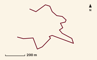
OSM route line, simplified. Branches and gaps as mapped. Trekking Trek, fort trek
Kenjalgad Fort (Pakirewadi)
Near Raireshwar, about 56 km from Pune centre (computed)
Mapped relation length 3.31 kmElevation Not recordedMapped in OpenStreetMap; access not checked Mapped only, not field-tested
Source: OpenStreetMap relation 15555281 (opens in a new tab) . © OpenStreetMap contributors, ODbL.
The route
- Original activity
- Trekking
- Type
- Fort trek. Trekking, Trail routes, Fort treks.
- Shape in OSM
- Linear (A→B or one-way trail)
- Surface
- Trail (OSM hiking relation; may include road segments)
- Distance
- 3.31 km. Mapped relation length (OpenStreetMap via Waymarked Trails). Can include branches and alternatives.
- Elevation
- Not recorded. No gain, loss or profile data in the source.
- Difficulty
- Not recorded
- Start and finish
- Not recorded
Access and safety
- Access
- Not recorded. That does not mean open.
- Hazards
- Not recorded. That does not mean there are none.
- Permission
- Not recorded
- Field check
- Mapped only, not field-tested. Field check recommended (geometry from source)
Data and source
- Status
- Mapped in OSM: geometry exists; ground truth not verified
- Graphic
- Route line from the OpenStreetMap relation (4 ways, fetched 7 Oct 2026), simplified for the card. Not field-checked.
- Overlap
- Overlap (one route's extent lies inside the other's)
- Source
- OpenStreetMap via Waymarked Trails (hiking). OpenStreetMap (opens in a new tab) Waymarked Trails (opens in a new tab)
- Credit
- OpenStreetMap contributors (see relation history)
- Source checked
- 7 Oct 2026 , OSM data via Waymarked Trails API; not field-verified
- GPX
- Download GPX , built from the OpenStreetMap line (ODbL). Mapped, not field-verified.
- Route ID
- OSM-15555281 Show on the map
Route record
- Category
- HIKES & TREKS
- Type
- Trek
- Area
- Near Raireshwar (computed)
- City status
- OUTSIDE PUNE
- Distance
- 3.31 km
- Elevation gain
- Not recorded
- Difficulty
- Not recorded
- Technicality
- Not recorded
- Endurance
- Not recorded
- Navigation
- Not recorded
- Exposure
- Not recorded
- Remoteness
- Not recorded
- Terrain
- Trail (OSM hiking relation; may include road segments)
- Surface
- Not recorded
- Monsoon risk
- Not recorded
- Heat risk
- Not recorded
- Wildlife
- Not recorded
- Water
- Not recorded
- Mobile network
- Not recorded
- Emergency access
- Not recorded
- Beginner suitability
- Not recorded
- Start
- Not recorded
- Finish
- Not recorded
- Nearest landmark
- Not recorded
- Creator
- OpenStreetMap contributors (see relation history)
- Source
- OpenStreetMap via Waymarked Trails (hiking)
- GPX
- Yes
- GPX link
- GPX file
- Licence
- ODbL 1.0
- Reuse
- Open licence: credit OpenStreetMap contributors, share-alike
- Route date
- Not recorded
- Last verified
- 7 Oct 2026
- Data confidence
- OSM route line, desk-checked; not field-verified
- Safety notes
- Not recorded
-
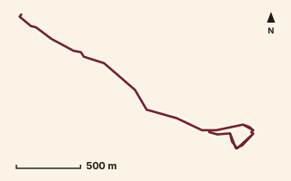
OSM route line, simplified. Branches and gaps as mapped. Trekking Trek, fort trek
Kenjalgad Fort (Rayreshwar Parking)
Near Raireshwar, about 55.9 km from Pune centre (computed)
Mapped relation length 5.45 kmElevation Not recordedMapped in OpenStreetMap; access not checked Mapped only, not field-tested
Source: OpenStreetMap relation 16908894 (opens in a new tab) . © OpenStreetMap contributors, ODbL.
The route
- Original activity
- Trekking
- Type
- Fort trek. Trekking, Trail routes, Fort treks.
- Shape in OSM
- Linear (A→B or one-way trail)
- Surface
- Trail (OSM hiking relation; may include road segments)
- Distance
- 5.45 km. Mapped relation length (OpenStreetMap via Waymarked Trails). Can include branches and alternatives.
- Elevation
- Not recorded. No gain, loss or profile data in the source.
- Difficulty
- Not recorded
- Start and finish
- Not recorded
- Places named in OSM
- Rayreshwar Parking, Kenjalgad
Access and safety
- Access
- Not recorded. That does not mean open.
- Hazards
- Not recorded. That does not mean there are none.
- Permission
- Not recorded
- Field check
- Mapped only, not field-tested. Field check recommended (geometry from source)
Data and source
- Status
- Mapped in OSM: geometry exists; ground truth not verified
- Graphic
- Route line from the OpenStreetMap relation (4 ways, fetched 7 Oct 2026), simplified for the card. Not field-checked.
- Overlap
- Overlap (one route's extent lies inside the other's)
- Source notes
- website_old creedaz.in
- Source
- OpenStreetMap via Waymarked Trails (hiking). OpenStreetMap (opens in a new tab) Waymarked Trails (opens in a new tab)
- Credit
- OpenStreetMap contributors (see relation history): relation tags reference creedaz.in
- Source checked
- 7 Oct 2026 , OSM data via Waymarked Trails API; not field-verified
- GPX
- Download GPX , built from the OpenStreetMap line (ODbL). Mapped, not field-verified.
- Route ID
- OSM-16908894 Show on the map
Route record
- Category
- HIKES & TREKS
- Type
- Trek
- Area
- Near Raireshwar (computed)
- City status
- OUTSIDE PUNE
- Distance
- 5.45 km
- Elevation gain
- Not recorded
- Difficulty
- Not recorded
- Technicality
- Not recorded
- Endurance
- Not recorded
- Navigation
- Not recorded
- Exposure
- Not recorded
- Remoteness
- Not recorded
- Terrain
- Trail (OSM hiking relation; may include road segments)
- Surface
- Not recorded
- Monsoon risk
- Not recorded
- Heat risk
- Not recorded
- Wildlife
- Not recorded
- Water
- Not recorded
- Mobile network
- Not recorded
- Emergency access
- Not recorded
- Beginner suitability
- Not recorded
- Start
- Not recorded
- Finish
- Not recorded
- Nearest landmark
- Rayreshwar Parking
- Creator
- OpenStreetMap contributors (see relation history): relation tags reference creedaz.in
- Source
- OpenStreetMap via Waymarked Trails (hiking)
- GPX
- Yes
- GPX link
- GPX file
- Licence
- ODbL 1.0
- Reuse
- Open licence: credit OpenStreetMap contributors, share-alike
- Route date
- Not recorded
- Last verified
- 7 Oct 2026
- Data confidence
- OSM route line, desk-checked; not field-verified
- Safety notes
- Not recorded
-
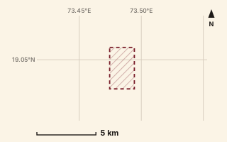
Mapped area only - not a route path. Hiking Hike, trail / ghat / naal route
Khandas to Dhotre
Near Bhimashankar, about 70 km from Pune centre (computed)
Mapped relation length 5.75 kmElevation Not recordedMapped in OpenStreetMap; access not checked Mapped only, not field-tested
Source: OpenStreetMap relation 18497275 (opens in a new tab) . © OpenStreetMap contributors, ODbL.
The route
- Original activity
- Hiking
- Type
- Trail / ghat / naal route. Hiking, Trail routes.
- Shape in OSM
- Linear (A→B or one-way trail)
- Surface
- Trail (OSM hiking relation; may include road segments)
- Distance
- 5.75 km. Mapped relation length (OpenStreetMap via Waymarked Trails). Can include branches and alternatives.
- Elevation
- Not recorded. No gain, loss or profile data in the source.
- Difficulty
- Not recorded
- Start and finish
- Not recorded
- Places named in OSM
- tungi village
Access and safety
- Access
- Not recorded. That does not mean open.
- Hazards
- Not recorded. That does not mean there are none.
- Permission
- Not recorded
- Field check
- Mapped only, not field-tested. Field check recommended (geometry from source)
Data and source
- Status
- Mapped in OSM: geometry exists; ground truth not verified
- Graphic
- Mapped area only. relation download failed after retries; geometry not available
- Overlap
- Overlap (one route's extent lies inside the other's)
- Source notes
- website manav.in
- Source
- OpenStreetMap via Waymarked Trails (hiking). OpenStreetMap (opens in a new tab) Waymarked Trails (opens in a new tab)
- Credit
- OpenStreetMap contributors (see relation history): relation tags reference manav.in
- Source checked
- 7 Oct 2026 , OSM data via Waymarked Trails API; not field-verified
- GPX
- None: this record is an area, not a route line. Follow the source link to OpenStreetMap.
- Route ID
- OSM-18497275 Show on the map
Route record
- Category
- HIKES & TREKS
- Type
- Hike
- Area
- Near Bhimashankar (computed)
- City status
- OUTSIDE PUNE
- Distance
- 5.75 km
- Elevation gain
- Not recorded
- Difficulty
- Not recorded
- Technicality
- Not recorded
- Endurance
- Not recorded
- Navigation
- Not recorded
- Exposure
- Not recorded
- Remoteness
- Not recorded
- Terrain
- Trail (OSM hiking relation; may include road segments)
- Surface
- Not recorded
- Monsoon risk
- Not recorded
- Heat risk
- Not recorded
- Wildlife
- Not recorded
- Water
- Not recorded
- Mobile network
- Not recorded
- Emergency access
- Not recorded
- Beginner suitability
- Not recorded
- Start
- Not recorded
- Finish
- Not recorded
- Nearest landmark
- tungi village
- Creator
- OpenStreetMap contributors (see relation history): relation tags reference manav.in
- Source
- OpenStreetMap via Waymarked Trails (hiking)
- GPX
- No: an area, not a route line
- GPX link
- Not recorded
- Licence
- ODbL 1.0
- Reuse
- Open licence: credit OpenStreetMap contributors, share-alike
- Route date
- Not recorded
- Last verified
- 7 Oct 2026
- Data confidence
- Mapped area only, desk-checked; not field-verified
- Safety notes
- Not recorded
-
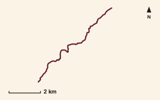
OSM route line, simplified. Branches and gaps as mapped. Hiking Hike, trail / ghat / naal route
Khanu to Warangi
Near Raigad, about 48.1 km from Pune centre (computed)
Mapped relation length 8.31 kmElevation Not recordedMapped in OpenStreetMap; access not checked Mapped only, not field-tested
Source: OpenStreetMap relation 11855358 (opens in a new tab) . © OpenStreetMap contributors, ODbL.
The route
- Original activity
- Hiking
- Type
- Trail / ghat / naal route. Hiking, Trail routes.
- Shape in OSM
- Linear (A→B or one-way trail)
- Surface
- Trail (OSM hiking relation; may include road segments)
- Distance
- 8.31 km. Mapped relation length (OpenStreetMap via Waymarked Trails). Can include branches and alternatives.
- Elevation
- Not recorded. No gain, loss or profile data in the source.
- Difficulty
- Not recorded
- Start and finish
- Not recorded
Access and safety
- Access
- Not recorded. That does not mean open.
- Hazards
- Not recorded. That does not mean there are none.
- Permission
- Not recorded
- Field check
- Mapped only, not field-tested. Field check recommended (geometry from source)
Data and source
- Status
- Mapped in OSM: geometry exists; ground truth not verified
- Graphic
- Route line from the OpenStreetMap relation (8 ways, fetched 7 Oct 2026), simplified for the card. Not field-checked.
- Overlap
- Overlap (one route's extent lies inside the other's)
- Source
- OpenStreetMap via Waymarked Trails (hiking). OpenStreetMap (opens in a new tab) Waymarked Trails (opens in a new tab)
- Credit
- OpenStreetMap contributors (see relation history)
- Source checked
- 7 Oct 2026 , OSM data via Waymarked Trails API; not field-verified
- GPX
- Download GPX , built from the OpenStreetMap line (ODbL). Mapped, not field-verified.
- Route ID
- OSM-11855358 Show on the map
Route record
- Category
- HIKES & TREKS
- Type
- Hike
- Area
- Near Raigad (computed)
- City status
- OUTSIDE PUNE
- Distance
- 8.31 km
- Elevation gain
- Not recorded
- Difficulty
- Not recorded
- Technicality
- Not recorded
- Endurance
- Not recorded
- Navigation
- Not recorded
- Exposure
- Not recorded
- Remoteness
- Not recorded
- Terrain
- Trail (OSM hiking relation; may include road segments)
- Surface
- Not recorded
- Monsoon risk
- Not recorded
- Heat risk
- Not recorded
- Wildlife
- Not recorded
- Water
- Not recorded
- Mobile network
- Not recorded
- Emergency access
- Not recorded
- Beginner suitability
- Not recorded
- Start
- Not recorded
- Finish
- Not recorded
- Nearest landmark
- Not recorded
- Creator
- OpenStreetMap contributors (see relation history)
- Source
- OpenStreetMap via Waymarked Trails (hiking)
- GPX
- Yes
- GPX link
- GPX file
- Licence
- ODbL 1.0
- Reuse
- Open licence: credit OpenStreetMap contributors, share-alike
- Route date
- Not recorded
- Last verified
- 7 Oct 2026
- Data confidence
- OSM route line, desk-checked; not field-verified
- Safety notes
- Not recorded
-
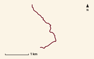
OSM route line, simplified. Branches and gaps as mapped. Hiking Hike, trail / ghat / naal route
Kharad Daara
Near Harishchandragad, about 95.1 km from Pune centre (computed)
Mapped relation length 3.05 kmElevation Not recordedMapped in OpenStreetMap; access not checked Mapped only, not field-tested
Source: OpenStreetMap relation 19891299 (opens in a new tab) . © OpenStreetMap contributors, ODbL.
The route
- Original activity
- Hiking
- Type
- Trail / ghat / naal route. Hiking, Trail routes.
- Shape in OSM
- Linear (A→B or one-way trail)
- Surface
- Trail (OSM hiking relation; may include road segments)
- Distance
- 3.05 km. Mapped relation length (OpenStreetMap via Waymarked Trails). Can include branches and alternatives.
- Elevation
- Not recorded. No gain, loss or profile data in the source.
- Difficulty
- Not recorded
- Start and finish
- Not recorded
Access and safety
- Access
- Not recorded. That does not mean open.
- Hazards
- Not recorded. That does not mean there are none.
- Permission
- Not recorded
- Field check
- Mapped only, not field-tested. Field check recommended (geometry from source)
Data and source
- Status
- Mapped in OSM: geometry exists; ground truth not verified
- Graphic
- Route line from the OpenStreetMap relation (3 ways, fetched 7 Oct 2026), simplified for the card. Not field-checked.
- Overlap
- Overlap (one route's extent lies inside the other's)
- Source notes
- website manav.in
- Source
- OpenStreetMap via Waymarked Trails (hiking). OpenStreetMap (opens in a new tab) Waymarked Trails (opens in a new tab)
- Credit
- OpenStreetMap contributors (see relation history): relation tags reference manav.in
- Source checked
- 7 Oct 2026 , OSM data via Waymarked Trails API; not field-verified
- GPX
- Download GPX , built from the OpenStreetMap line (ODbL). Mapped, not field-verified.
- Route ID
- OSM-19891299 Show on the map
Route record
- Category
- HIKES & TREKS
- Type
- Hike
- Area
- Near Harishchandragad (computed)
- City status
- OUTSIDE PUNE
- Distance
- 3.05 km
- Elevation gain
- Not recorded
- Difficulty
- Not recorded
- Technicality
- Not recorded
- Endurance
- Not recorded
- Navigation
- Not recorded
- Exposure
- Not recorded
- Remoteness
- Not recorded
- Terrain
- Trail (OSM hiking relation; may include road segments)
- Surface
- Not recorded
- Monsoon risk
- Not recorded
- Heat risk
- Not recorded
- Wildlife
- Not recorded
- Water
- Not recorded
- Mobile network
- Not recorded
- Emergency access
- Not recorded
- Beginner suitability
- Not recorded
- Start
- Not recorded
- Finish
- Not recorded
- Nearest landmark
- Not recorded
- Creator
- OpenStreetMap contributors (see relation history): relation tags reference manav.in
- Source
- OpenStreetMap via Waymarked Trails (hiking)
- GPX
- Yes
- GPX link
- GPX file
- Licence
- ODbL 1.0
- Reuse
- Open licence: credit OpenStreetMap contributors, share-alike
- Route date
- Not recorded
- Last verified
- 7 Oct 2026
- Data confidence
- OSM route line, desk-checked; not field-verified
- Safety notes
- Not recorded
-
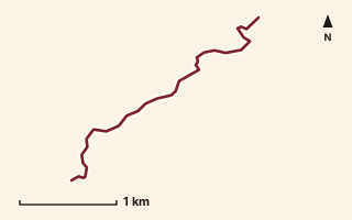
OSM route line, simplified. Branches and gaps as mapped. Hiking Hike, trail / ghat / naal route
Khumbe Nali
Near Varandha Ghat, about 55.3 km from Pune centre (computed)
Mapped relation length 3.4 kmElevation Not recordedMapped in OpenStreetMap; access not checked Mapped only, not field-tested
Source: OpenStreetMap relation 19876589 (opens in a new tab) . © OpenStreetMap contributors, ODbL.
The route
- Original activity
- Hiking
- Type
- Trail / ghat / naal route. Hiking, Trail routes.
- Shape in OSM
- Linear (A→B or one-way trail)
- Surface
- Trail (OSM hiking relation; may include road segments)
- Distance
- 3.4 km. Mapped relation length (OpenStreetMap via Waymarked Trails). Can include branches and alternatives.
- Elevation
- Not recorded. No gain, loss or profile data in the source.
- Difficulty
- Not recorded
- Start and finish
- Not recorded
Access and safety
- Access
- Not recorded. That does not mean open.
- Hazards
- Not recorded. That does not mean there are none.
- Permission
- Not recorded
- Field check
- Mapped only, not field-tested. Field check recommended (geometry from source)
Data and source
- Status
- Mapped in OSM: geometry exists; ground truth not verified
- Graphic
- Route line from the OpenStreetMap relation (1 ways, fetched 7 Oct 2026), simplified for the card. Not field-checked.
- Overlap
- Overlap (one route's extent lies inside the other's)
- Source notes
- website manav.in
- Source
- OpenStreetMap via Waymarked Trails (hiking). OpenStreetMap (opens in a new tab) Waymarked Trails (opens in a new tab)
- Credit
- OpenStreetMap contributors (see relation history): relation tags reference manav.in
- Source checked
- 7 Oct 2026 , OSM data via Waymarked Trails API; not field-verified
- GPX
- Download GPX , built from the OpenStreetMap line (ODbL). Mapped, not field-verified.
- Route ID
- OSM-19876589 Show on the map
Route record
- Category
- HIKES & TREKS
- Type
- Hike
- Area
- Near Varandha Ghat (computed)
- City status
- OUTSIDE PUNE
- Distance
- 3.4 km
- Elevation gain
- Not recorded
- Difficulty
- Not recorded
- Technicality
- Not recorded
- Endurance
- Not recorded
- Navigation
- Not recorded
- Exposure
- Not recorded
- Remoteness
- Not recorded
- Terrain
- Trail (OSM hiking relation; may include road segments)
- Surface
- Not recorded
- Monsoon risk
- Not recorded
- Heat risk
- Not recorded
- Wildlife
- Not recorded
- Water
- Not recorded
- Mobile network
- Not recorded
- Emergency access
- Not recorded
- Beginner suitability
- Not recorded
- Start
- Not recorded
- Finish
- Not recorded
- Nearest landmark
- Not recorded
- Creator
- OpenStreetMap contributors (see relation history): relation tags reference manav.in
- Source
- OpenStreetMap via Waymarked Trails (hiking)
- GPX
- Yes
- GPX link
- GPX file
- Licence
- ODbL 1.0
- Reuse
- Open licence: credit OpenStreetMap contributors, share-alike
- Route date
- Not recorded
- Last verified
- 7 Oct 2026
- Data confidence
- OSM route line, desk-checked; not field-verified
- Safety notes
- Not recorded
-
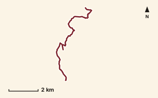
OSM route line, simplified. Branches and gaps as mapped. Hiking Hike, trail / ghat / naal route
Konkan Diva
Near Raigad, about 51.4 km from Pune centre (computed)
Mapped relation length 9.13 kmElevation Not recordedMapped in OpenStreetMap; access not checked Mapped only, not field-tested
Source: OpenStreetMap relation 11855359 (opens in a new tab) . © OpenStreetMap contributors, ODbL.
The route
- Original activity
- Hiking
- Type
- Trail / ghat / naal route. Hiking, Trail routes.
- Shape in OSM
- Linear (A→B or one-way trail)
- Surface
- Trail (OSM hiking relation; may include road segments)
- Distance
- 9.13 km. Mapped relation length (OpenStreetMap via Waymarked Trails). Can include branches and alternatives.
- Elevation
- Not recorded. No gain, loss or profile data in the source.
- Difficulty
- Not recorded
- Start and finish
- Not recorded
Access and safety
- Access
- Not recorded. That does not mean open.
- Hazards
- Not recorded. That does not mean there are none.
- Permission
- Not recorded
- Field check
- Mapped only, not field-tested. Field check recommended (geometry from source)
Data and source
- Status
- Mapped in OSM: geometry exists; ground truth not verified
- Graphic
- Route line from the OpenStreetMap relation (6 ways, fetched 7 Oct 2026), simplified for the card. Not field-checked.
- Source
- OpenStreetMap via Waymarked Trails (hiking). OpenStreetMap (opens in a new tab) Waymarked Trails (opens in a new tab)
- Credit
- OpenStreetMap contributors (see relation history)
- Source checked
- 7 Oct 2026 , OSM data via Waymarked Trails API; not field-verified
- GPX
- Download GPX , built from the OpenStreetMap line (ODbL). Mapped, not field-verified.
- Route ID
- OSM-11855359 Show on the map
Route record
- Category
- HIKES & TREKS
- Type
- Hike
- Area
- Near Raigad (computed)
- City status
- OUTSIDE PUNE
- Distance
- 9.13 km
- Elevation gain
- Not recorded
- Difficulty
- Not recorded
- Technicality
- Not recorded
- Endurance
- Not recorded
- Navigation
- Not recorded
- Exposure
- Not recorded
- Remoteness
- Not recorded
- Terrain
- Trail (OSM hiking relation; may include road segments)
- Surface
- Not recorded
- Monsoon risk
- Not recorded
- Heat risk
- Not recorded
- Wildlife
- Not recorded
- Water
- Not recorded
- Mobile network
- Not recorded
- Emergency access
- Not recorded
- Beginner suitability
- Not recorded
- Start
- Not recorded
- Finish
- Not recorded
- Nearest landmark
- Not recorded
- Creator
- OpenStreetMap contributors (see relation history)
- Source
- OpenStreetMap via Waymarked Trails (hiking)
- GPX
- Yes
- GPX link
- GPX file
- Licence
- ODbL 1.0
- Reuse
- Open licence: credit OpenStreetMap contributors, share-alike
- Route date
- Not recorded
- Last verified
- 7 Oct 2026
- Data confidence
- OSM route line, desk-checked; not field-verified
- Safety notes
- Not recorded
-
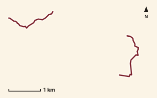
OSM route line, simplified. Branches and gaps as mapped. Hiking Hike, trail / ghat / naal route
Kopeshwar to Aswal Khind
Near Raireshwar, about 58.5 km from Pune centre (computed)
Mapped relation length 3.86 kmElevation Not recordedMapped in OpenStreetMap; access not checked Mapped only, not field-tested
Source: OpenStreetMap relation 15570599 (opens in a new tab) . © OpenStreetMap contributors, ODbL.
The route
- Original activity
- Hiking
- Type
- Trail / ghat / naal route. Hiking, Trail routes.
- Shape in OSM
- Non-linear in OSM (loop or multi-branch)
- Surface
- Trail (OSM hiking relation; may include road segments)
- Distance
- 3.86 km. Mapped relation length (OpenStreetMap via Waymarked Trails). Can include branches and alternatives.
- Elevation
- Not recorded. No gain, loss or profile data in the source.
- Difficulty
- Not recorded
- Start and finish
- Not recorded
Access and safety
- Access
- Not recorded. That does not mean open.
- Hazards
- Not recorded. That does not mean there are none.
- Permission
- Not recorded
- Field check
- Mapped only, not field-tested. Field check recommended (geometry from source)
Data and source
- Status
- Mapped in OSM: geometry exists; ground truth not verified
- Graphic
- Route line from the OpenStreetMap relation (5 ways, fetched 7 Oct 2026), simplified for the card. Not field-checked.
- Source
- OpenStreetMap via Waymarked Trails (hiking). OpenStreetMap (opens in a new tab) Waymarked Trails (opens in a new tab)
- Credit
- OpenStreetMap contributors (see relation history)
- Source checked
- 7 Oct 2026 , OSM data via Waymarked Trails API; not field-verified
- GPX
- Download GPX , built from the OpenStreetMap line (ODbL). Mapped, not field-verified.
- Route ID
- OSM-15570599 Show on the map
Route record
- Category
- HIKES & TREKS
- Type
- Hike
- Area
- Near Raireshwar (computed)
- City status
- OUTSIDE PUNE
- Distance
- 3.86 km
- Elevation gain
- Not recorded
- Difficulty
- Not recorded
- Technicality
- Not recorded
- Endurance
- Not recorded
- Navigation
- Not recorded
- Exposure
- Not recorded
- Remoteness
- Not recorded
- Terrain
- Trail (OSM hiking relation; may include road segments)
- Surface
- Not recorded
- Monsoon risk
- Not recorded
- Heat risk
- Not recorded
- Wildlife
- Not recorded
- Water
- Not recorded
- Mobile network
- Not recorded
- Emergency access
- Not recorded
- Beginner suitability
- Not recorded
- Start
- Not recorded
- Finish
- Not recorded
- Nearest landmark
- Not recorded
- Creator
- OpenStreetMap contributors (see relation history)
- Source
- OpenStreetMap via Waymarked Trails (hiking)
- GPX
- Yes
- GPX link
- GPX file
- Licence
- ODbL 1.0
- Reuse
- Open licence: credit OpenStreetMap contributors, share-alike
- Route date
- Not recorded
- Last verified
- 7 Oct 2026
- Data confidence
- OSM route line, desk-checked; not field-verified
- Safety notes
- Not recorded
-
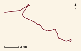
OSM route line, simplified. Branches and gaps as mapped. Trekking Trek, fort trek
Kopeshwar to Kamalgad
Near Mahabaleshwar, about 61 km from Pune centre (computed)
Mapped relation length 15.21 kmElevation Not recordedMapped in OpenStreetMap; access not checked Mapped only, not field-tested
Source: OpenStreetMap relation 15555288 (opens in a new tab) . © OpenStreetMap contributors, ODbL.
The route
- Original activity
- Trekking
- Type
- Fort trek. Trekking, Trail routes, Fort treks.
- Shape in OSM
- Linear (A→B or one-way trail)
- Surface
- Trail (OSM hiking relation; may include road segments)
- Distance
- 15.21 km. Mapped relation length (OpenStreetMap via Waymarked Trails). Can include branches and alternatives.
- Elevation
- Not recorded. No gain, loss or profile data in the source.
- Difficulty
- Not recorded
- Start and finish
- Not recorded
Access and safety
- Access
- Not recorded. That does not mean open.
- Hazards
- Not recorded. That does not mean there are none.
- Permission
- Not recorded
- Field check
- Mapped only, not field-tested. Field check recommended (geometry from source)
Data and source
- Status
- Mapped in OSM: geometry exists; ground truth not verified
- Graphic
- Route line from the OpenStreetMap relation (9 ways, fetched 7 Oct 2026), simplified for the card. Not field-checked.
- Overlap
- Overlap (one route's extent lies inside the other's)
- Source
- OpenStreetMap via Waymarked Trails (hiking). OpenStreetMap (opens in a new tab) Waymarked Trails (opens in a new tab)
- Credit
- OpenStreetMap contributors (see relation history)
- Source checked
- 7 Oct 2026 , OSM data via Waymarked Trails API; not field-verified
- GPX
- Download GPX , built from the OpenStreetMap line (ODbL). Mapped, not field-verified.
- Route ID
- OSM-15555288 Show on the map
Route record
- Category
- HIKES & TREKS
- Type
- Trek
- Area
- Near Mahabaleshwar (computed)
- City status
- OUTSIDE PUNE
- Distance
- 15.21 km
- Elevation gain
- Not recorded
- Difficulty
- Not recorded
- Technicality
- Not recorded
- Endurance
- Not recorded
- Navigation
- Not recorded
- Exposure
- Not recorded
- Remoteness
- Not recorded
- Terrain
- Trail (OSM hiking relation; may include road segments)
- Surface
- Not recorded
- Monsoon risk
- Not recorded
- Heat risk
- Not recorded
- Wildlife
- Not recorded
- Water
- Not recorded
- Mobile network
- Not recorded
- Emergency access
- Not recorded
- Beginner suitability
- Not recorded
- Start
- Not recorded
- Finish
- Not recorded
- Nearest landmark
- Not recorded
- Creator
- OpenStreetMap contributors (see relation history)
- Source
- OpenStreetMap via Waymarked Trails (hiking)
- GPX
- Yes
- GPX link
- GPX file
- Licence
- ODbL 1.0
- Reuse
- Open licence: credit OpenStreetMap contributors, share-alike
- Route date
- Not recorded
- Last verified
- 7 Oct 2026
- Data confidence
- OSM route line, desk-checked; not field-verified
- Safety notes
- Not recorded
-
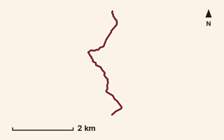
OSM route line, simplified. Branches and gaps as mapped. Hiking Hike, trail / ghat / naal route
Kopeshwar to Nakinda
Near Varandha Ghat, about 59.5 km from Pune centre (computed)
Mapped relation length 4.84 kmElevation Not recordedMapped in OpenStreetMap; access not checked Mapped only, not field-tested
Source: OpenStreetMap relation 15555289 (opens in a new tab) . © OpenStreetMap contributors, ODbL.
The route
- Original activity
- Hiking
- Type
- Trail / ghat / naal route. Hiking, Trail routes.
- Shape in OSM
- Linear (A→B or one-way trail)
- Surface
- Trail (OSM hiking relation; may include road segments)
- Distance
- 4.84 km. Mapped relation length (OpenStreetMap via Waymarked Trails). Can include branches and alternatives.
- Elevation
- Not recorded. No gain, loss or profile data in the source.
- Difficulty
- Not recorded
- Start and finish
- Not recorded
Access and safety
- Access
- Not recorded. That does not mean open.
- Hazards
- Not recorded. That does not mean there are none.
- Permission
- Not recorded
- Field check
- Mapped only, not field-tested. Field check recommended (geometry from source)
Data and source
- Status
- Mapped in OSM: geometry exists; ground truth not verified
- Graphic
- Route line from the OpenStreetMap relation (1 ways, fetched 7 Oct 2026), simplified for the card. Not field-checked.
- Source
- OpenStreetMap via Waymarked Trails (hiking). OpenStreetMap (opens in a new tab) Waymarked Trails (opens in a new tab)
- Credit
- OpenStreetMap contributors (see relation history)
- Source checked
- 7 Oct 2026 , OSM data via Waymarked Trails API; not field-verified
- GPX
- Download GPX , built from the OpenStreetMap line (ODbL). Mapped, not field-verified.
- Route ID
- OSM-15555289 Show on the map
Route record
- Category
- HIKES & TREKS
- Type
- Hike
- Area
- Near Varandha Ghat (computed)
- City status
- OUTSIDE PUNE
- Distance
- 4.84 km
- Elevation gain
- Not recorded
- Difficulty
- Not recorded
- Technicality
- Not recorded
- Endurance
- Not recorded
- Navigation
- Not recorded
- Exposure
- Not recorded
- Remoteness
- Not recorded
- Terrain
- Trail (OSM hiking relation; may include road segments)
- Surface
- Not recorded
- Monsoon risk
- Not recorded
- Heat risk
- Not recorded
- Wildlife
- Not recorded
- Water
- Not recorded
- Mobile network
- Not recorded
- Emergency access
- Not recorded
- Beginner suitability
- Not recorded
- Start
- Not recorded
- Finish
- Not recorded
- Nearest landmark
- Not recorded
- Creator
- OpenStreetMap contributors (see relation history)
- Source
- OpenStreetMap via Waymarked Trails (hiking)
- GPX
- Yes
- GPX link
- GPX file
- Licence
- ODbL 1.0
- Reuse
- Open licence: credit OpenStreetMap contributors, share-alike
- Route date
- Not recorded
- Last verified
- 7 Oct 2026
- Data confidence
- OSM route line, desk-checked; not field-verified
- Safety notes
- Not recorded
-
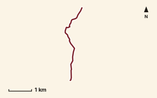
OSM route line, simplified. Branches and gaps as mapped. Hiking Hike, trail / ghat / naal route
Kothaldara (Ambenali to Falyan)
Near Lonavala, about 56.7 km from Pune centre (computed)
Mapped relation length 3.77 kmElevation Not recordedMapped in OpenStreetMap; access not checked Mapped only, not field-tested
Source: OpenStreetMap relation 19894330 (opens in a new tab) . © OpenStreetMap contributors, ODbL.
The route
- Original activity
- Hiking
- Type
- Trail / ghat / naal route. Hiking, Trail routes.
- Shape in OSM
- Linear (A→B or one-way trail)
- Surface
- Trail (OSM hiking relation; may include road segments)
- Distance
- 3.77 km. Mapped relation length (OpenStreetMap via Waymarked Trails). Can include branches and alternatives.
- Elevation
- Not recorded. No gain, loss or profile data in the source.
- Difficulty
- Not recorded
- Start and finish
- Not recorded
Access and safety
- Access
- Not recorded. That does not mean open.
- Hazards
- Not recorded. That does not mean there are none.
- Permission
- Not recorded
- Field check
- Mapped only, not field-tested. Field check recommended (geometry from source)
Data and source
- Status
- Mapped in OSM: geometry exists; ground truth not verified
- Graphic
- Route line from the OpenStreetMap relation (2 ways, fetched 7 Oct 2026), simplified for the card. Not field-checked.
- Overlap
- Overlap (one route's extent lies inside the other's)
- Source notes
- website manav.in
- Source
- OpenStreetMap via Waymarked Trails (hiking). OpenStreetMap (opens in a new tab) Waymarked Trails (opens in a new tab)
- Credit
- OpenStreetMap contributors (see relation history): relation tags reference manav.in
- Source checked
- 7 Oct 2026 , OSM data via Waymarked Trails API; not field-verified
- GPX
- Download GPX , built from the OpenStreetMap line (ODbL). Mapped, not field-verified.
- Route ID
- OSM-19894330 Show on the map
Route record
- Category
- HIKES & TREKS
- Type
- Hike
- Area
- Near Lonavala (computed)
- City status
- OUTSIDE PUNE
- Distance
- 3.77 km
- Elevation gain
- Not recorded
- Difficulty
- Not recorded
- Technicality
- Not recorded
- Endurance
- Not recorded
- Navigation
- Not recorded
- Exposure
- Not recorded
- Remoteness
- Not recorded
- Terrain
- Trail (OSM hiking relation; may include road segments)
- Surface
- Not recorded
- Monsoon risk
- Not recorded
- Heat risk
- Not recorded
- Wildlife
- Not recorded
- Water
- Not recorded
- Mobile network
- Not recorded
- Emergency access
- Not recorded
- Beginner suitability
- Not recorded
- Start
- Not recorded
- Finish
- Not recorded
- Nearest landmark
- Not recorded
- Creator
- OpenStreetMap contributors (see relation history): relation tags reference manav.in
- Source
- OpenStreetMap via Waymarked Trails (hiking)
- GPX
- Yes
- GPX link
- GPX file
- Licence
- ODbL 1.0
- Reuse
- Open licence: credit OpenStreetMap contributors, share-alike
- Route date
- Not recorded
- Last verified
- 7 Oct 2026
- Data confidence
- OSM route line, desk-checked; not field-verified
- Safety notes
- Not recorded
-
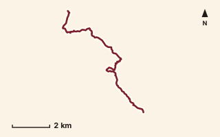
OSM route line, simplified. Branches and gaps as mapped. Hiking Hike, trail / ghat / naal route
Kumbheshivtar to Warwand
Near Varandha Ghat, about 48.6 km from Pune centre (computed)
Mapped relation length 10.52 kmElevation Not recordedMapped in OpenStreetMap; access not checked Mapped only, not field-tested
Source: OpenStreetMap relation 15570609 (opens in a new tab) . © OpenStreetMap contributors, ODbL.
The route
- Original activity
- Hiking
- Type
- Trail / ghat / naal route. Hiking, Trail routes.
- Shape in OSM
- Linear (A→B or one-way trail)
- Surface
- Trail (OSM hiking relation; may include road segments)
- Distance
- 10.52 km. Mapped relation length (OpenStreetMap via Waymarked Trails). Can include branches and alternatives.
- Elevation
- Not recorded. No gain, loss or profile data in the source.
- Difficulty
- Not recorded
- Start and finish
- Not recorded
Access and safety
- Access
- Not recorded. That does not mean open.
- Hazards
- Not recorded. That does not mean there are none.
- Permission
- Not recorded
- Field check
- Mapped only, not field-tested. Field check recommended (geometry from source)
Data and source
- Status
- Mapped in OSM: geometry exists; ground truth not verified
- Graphic
- Route line from the OpenStreetMap relation (5 ways, fetched 7 Oct 2026), simplified for the card. Not field-checked.
- Source
- OpenStreetMap via Waymarked Trails (hiking). OpenStreetMap (opens in a new tab) Waymarked Trails (opens in a new tab)
- Credit
- OpenStreetMap contributors (see relation history)
- Source checked
- 7 Oct 2026 , OSM data via Waymarked Trails API; not field-verified
- GPX
- Download GPX , built from the OpenStreetMap line (ODbL). Mapped, not field-verified.
- Route ID
- OSM-15570609 Show on the map
Route record
- Category
- HIKES & TREKS
- Type
- Hike
- Area
- Near Varandha Ghat (computed)
- City status
- OUTSIDE PUNE
- Distance
- 10.52 km
- Elevation gain
- Not recorded
- Difficulty
- Not recorded
- Technicality
- Not recorded
- Endurance
- Not recorded
- Navigation
- Not recorded
- Exposure
- Not recorded
- Remoteness
- Not recorded
- Terrain
- Trail (OSM hiking relation; may include road segments)
- Surface
- Not recorded
- Monsoon risk
- Not recorded
- Heat risk
- Not recorded
- Wildlife
- Not recorded
- Water
- Not recorded
- Mobile network
- Not recorded
- Emergency access
- Not recorded
- Beginner suitability
- Not recorded
- Start
- Not recorded
- Finish
- Not recorded
- Nearest landmark
- Not recorded
- Creator
- OpenStreetMap contributors (see relation history)
- Source
- OpenStreetMap via Waymarked Trails (hiking)
- GPX
- Yes
- GPX link
- GPX file
- Licence
- ODbL 1.0
- Reuse
- Open licence: credit OpenStreetMap contributors, share-alike
- Route date
- Not recorded
- Last verified
- 7 Oct 2026
- Data confidence
- OSM route line, desk-checked; not field-verified
- Safety notes
- Not recorded
-
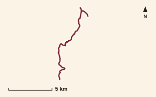
OSM route line, simplified. Branches and gaps as mapped. Hiking Hike, trail / ghat / naal route
Kurwande to Vasonde via Duke's Nose
Near Lonavala, about 56.9 km from Pune centre (computed)
Mapped relation length 13.41 kmElevation Not recordedMapped in OpenStreetMap; access not checked Mapped only, not field-tested
Source: OpenStreetMap relation 16863865 (opens in a new tab) . © OpenStreetMap contributors, ODbL.
The route
- Original activity
- Hiking
- Type
- Trail / ghat / naal route. Hiking, Trail routes.
- Shape in OSM
- Linear (A→B or one-way trail)
- Surface
- Trail (OSM hiking relation; may include road segments)
- Distance
- 13.41 km. Mapped relation length (OpenStreetMap via Waymarked Trails). Can include branches and alternatives.
- Elevation
- Not recorded. No gain, loss or profile data in the source.
- Difficulty
- Not recorded
- Start and finish
- Not recorded
- Places named in OSM
- Kurwande, Duke's Nose, Vasonde
Access and safety
- Access
- Not recorded. That does not mean open.
- Hazards
- Not recorded. That does not mean there are none.
- Permission
- Not recorded
- Field check
- Mapped only, not field-tested. Field check recommended (geometry from source)
Data and source
- Status
- Mapped in OSM: geometry exists; ground truth not verified
- Graphic
- Route line from the OpenStreetMap relation (13 ways, fetched 7 Oct 2026), simplified for the card. Not field-checked.
- Overlap
- Overlap; Overlap (one route's extent lies inside the other's)
- Source
- OpenStreetMap via Waymarked Trails (hiking). OpenStreetMap (opens in a new tab) Waymarked Trails (opens in a new tab)
- Credit
- OpenStreetMap contributors (see relation history)
- Source checked
- 7 Oct 2026 , OSM data via Waymarked Trails API; not field-verified
- GPX
- Download GPX , built from the OpenStreetMap line (ODbL). Mapped, not field-verified.
- Route ID
- OSM-16863865 Show on the map
Route record
- Category
- HIKES & TREKS
- Type
- Hike
- Area
- Near Lonavala (computed)
- City status
- OUTSIDE PUNE
- Distance
- 13.41 km
- Elevation gain
- Not recorded
- Difficulty
- Not recorded
- Technicality
- Not recorded
- Endurance
- Not recorded
- Navigation
- Not recorded
- Exposure
- Not recorded
- Remoteness
- Not recorded
- Terrain
- Trail (OSM hiking relation; may include road segments)
- Surface
- Not recorded
- Monsoon risk
- Not recorded
- Heat risk
- Not recorded
- Wildlife
- Not recorded
- Water
- Not recorded
- Mobile network
- Not recorded
- Emergency access
- Not recorded
- Beginner suitability
- Not recorded
- Start
- Not recorded
- Finish
- Not recorded
- Nearest landmark
- Kurwande
- Creator
- OpenStreetMap contributors (see relation history)
- Source
- OpenStreetMap via Waymarked Trails (hiking)
- GPX
- Yes
- GPX link
- GPX file
- Licence
- ODbL 1.0
- Reuse
- Open licence: credit OpenStreetMap contributors, share-alike
- Route date
- Not recorded
- Last verified
- 7 Oct 2026
- Data confidence
- OSM route line, desk-checked; not field-verified
- Safety notes
- Not recorded
-
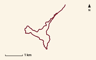
OSM route line, simplified. Branches and gaps as mapped. Hiking Hike, trail / ghat / naal route
Kusarbet Loop
Near Raigad, about 46.6 km from Pune centre (computed)
Mapped relation length 8.57 kmElevation Not recordedMapped in OpenStreetMap; access not checked Mapped only, not field-tested
Source: OpenStreetMap relation 15568810 (opens in a new tab) . © OpenStreetMap contributors, ODbL.
The route
- Original activity
- Hiking
- Type
- Trail / ghat / naal route. Hiking, Trail routes.
- Shape in OSM
- Loop (by name)
- Surface
- Trail (OSM hiking relation; may include road segments)
- Distance
- 8.57 km. Mapped relation length (OpenStreetMap via Waymarked Trails). Can include branches and alternatives.
- Elevation
- Not recorded. No gain, loss or profile data in the source.
- Difficulty
- Not recorded
- Start and finish
- Not recorded
Access and safety
- Access
- Not recorded. That does not mean open.
- Hazards
- Not recorded. That does not mean there are none.
- Permission
- Not recorded
- Field check
- Mapped only, not field-tested. Field check recommended (geometry from source)
Data and source
- Status
- Mapped in OSM: geometry exists; ground truth not verified
- Graphic
- Route line from the OpenStreetMap relation (1 ways, fetched 7 Oct 2026), simplified for the card. Not field-checked.
- Overlap
- Overlap (one route's extent lies inside the other's)
- Source
- OpenStreetMap via Waymarked Trails (hiking). OpenStreetMap (opens in a new tab) Waymarked Trails (opens in a new tab)
- Credit
- OpenStreetMap contributors (see relation history)
- Source checked
- 7 Oct 2026 , OSM data via Waymarked Trails API; not field-verified
- GPX
- Download GPX , built from the OpenStreetMap line (ODbL). Mapped, not field-verified.
- Route ID
- OSM-15568810 Show on the map
Route record
- Category
- HIKES & TREKS
- Type
- Hike
- Area
- Near Raigad (computed)
- City status
- OUTSIDE PUNE
- Distance
- 8.57 km
- Elevation gain
- Not recorded
- Difficulty
- Not recorded
- Technicality
- Not recorded
- Endurance
- Not recorded
- Navigation
- Not recorded
- Exposure
- Not recorded
- Remoteness
- Not recorded
- Terrain
- Trail (OSM hiking relation; may include road segments)
- Surface
- Not recorded
- Monsoon risk
- Not recorded
- Heat risk
- Not recorded
- Wildlife
- Not recorded
- Water
- Not recorded
- Mobile network
- Not recorded
- Emergency access
- Not recorded
- Beginner suitability
- Not recorded
- Start
- Not recorded
- Finish
- Not recorded
- Nearest landmark
- Not recorded
- Creator
- OpenStreetMap contributors (see relation history)
- Source
- OpenStreetMap via Waymarked Trails (hiking)
- GPX
- Yes
- GPX link
- GPX file
- Licence
- ODbL 1.0
- Reuse
- Open licence: credit OpenStreetMap contributors, share-alike
- Route date
- Not recorded
- Last verified
- 7 Oct 2026
- Data confidence
- OSM route line, desk-checked; not field-verified
- Safety notes
- Not recorded
-
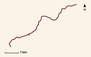
OSM route line, simplified. Branches and gaps as mapped. Trekking Trek, fort trek
Lingana Fort
Near Raigad, about 48.3 km from Pune centre (computed)
Mapped relation length 7.71 kmElevation Not recordedMapped in OpenStreetMap; access not checked Mapped only, not field-tested
Source: OpenStreetMap relation 15554617 (opens in a new tab) . © OpenStreetMap contributors, ODbL.
The route
- Original activity
- Trekking
- Type
- Fort trek. Trekking, Trail routes, Fort treks.
- Shape in OSM
- Linear (A→B or one-way trail)
- Surface
- Trail (OSM hiking relation; may include road segments)
- Distance
- 7.71 km. Mapped relation length (OpenStreetMap via Waymarked Trails). Can include branches and alternatives.
- Elevation
- Not recorded. No gain, loss or profile data in the source.
- Difficulty
- Not recorded
- Start and finish
- Not recorded
Access and safety
- Access
- Not recorded. That does not mean open.
- Hazards
- Not recorded. That does not mean there are none.
- Permission
- Not recorded
- Field check
- Mapped only, not field-tested. Field check recommended (geometry from source)
Data and source
- Status
- Mapped in OSM: geometry exists; ground truth not verified
- Graphic
- Route line from the OpenStreetMap relation (7 ways, fetched 7 Oct 2026), simplified for the card. Not field-checked.
- Overlap
- Overlap (one route's extent lies inside the other's); Race contains mapped route
- Source
- OpenStreetMap via Waymarked Trails (hiking). OpenStreetMap (opens in a new tab) Waymarked Trails (opens in a new tab)
- Credit
- OpenStreetMap contributors (see relation history)
- Source checked
- 7 Oct 2026 , OSM data via Waymarked Trails API; not field-verified
- GPX
- Download GPX , built from the OpenStreetMap line (ODbL). Mapped, not field-verified.
- Route ID
- OSM-15554617 Show on the map
Route record
- Category
- HIKES & TREKS
- Type
- Trek
- Area
- Near Raigad (computed)
- City status
- OUTSIDE PUNE
- Distance
- 7.71 km
- Elevation gain
- Not recorded
- Difficulty
- Not recorded
- Technicality
- Not recorded
- Endurance
- Not recorded
- Navigation
- Not recorded
- Exposure
- Not recorded
- Remoteness
- Not recorded
- Terrain
- Trail (OSM hiking relation; may include road segments)
- Surface
- Not recorded
- Monsoon risk
- Not recorded
- Heat risk
- Not recorded
- Wildlife
- Not recorded
- Water
- Not recorded
- Mobile network
- Not recorded
- Emergency access
- Not recorded
- Beginner suitability
- Not recorded
- Start
- Not recorded
- Finish
- Not recorded
- Nearest landmark
- Not recorded
- Creator
- OpenStreetMap contributors (see relation history)
- Source
- OpenStreetMap via Waymarked Trails (hiking)
- GPX
- Yes
- GPX link
- GPX file
- Licence
- ODbL 1.0
- Reuse
- Open licence: credit OpenStreetMap contributors, share-alike
- Route date
- Not recorded
- Last verified
- 7 Oct 2026
- Data confidence
- OSM route line, desk-checked; not field-verified
- Safety notes
- Not recorded
-
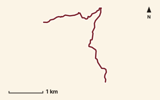
OSM route line, simplified. Branches and gaps as mapped. Trekking Trek, fort trek
Lingana Machi
Near Raigad, about 49.5 km from Pune centre (computed)
Mapped relation length 4.88 kmElevation Not recordedMapped in OpenStreetMap; access not checked Mapped only, not field-tested
Source: OpenStreetMap relation 15554620 (opens in a new tab) . © OpenStreetMap contributors, ODbL.
The route
- Original activity
- Trekking
- Type
- Fort trek. Trekking, Trail routes, Fort treks.
- Shape in OSM
- Linear (A→B or one-way trail)
- Surface
- Trail (OSM hiking relation; may include road segments)
- Distance
- 4.88 km. Mapped relation length (OpenStreetMap via Waymarked Trails). Can include branches and alternatives.
- Elevation
- Not recorded. No gain, loss or profile data in the source.
- Difficulty
- Not recorded
- Start and finish
- Not recorded
Access and safety
- Access
- Not recorded. That does not mean open.
- Hazards
- Not recorded. That does not mean there are none.
- Permission
- Not recorded
- Field check
- Mapped only, not field-tested. Field check recommended (geometry from source)
Data and source
- Status
- Mapped in OSM: geometry exists; ground truth not verified
- Graphic
- Route line from the OpenStreetMap relation (6 ways, fetched 7 Oct 2026), simplified for the card. Not field-checked.
- Overlap
- Overlap (one route's extent lies inside the other's)
- Source notes
- Lingana to Raigad via Boratyachi Naal
- Source
- OpenStreetMap via Waymarked Trails (hiking). OpenStreetMap (opens in a new tab) Waymarked Trails (opens in a new tab)
- Credit
- OpenStreetMap contributors (see relation history)
- Source checked
- 7 Oct 2026 , OSM data via Waymarked Trails API; not field-verified
- GPX
- Download GPX , built from the OpenStreetMap line (ODbL). Mapped, not field-verified.
- Route ID
- OSM-15554620 Show on the map
Route record
- Category
- HIKES & TREKS
- Type
- Trek
- Area
- Near Raigad (computed)
- City status
- OUTSIDE PUNE
- Distance
- 4.88 km
- Elevation gain
- Not recorded
- Difficulty
- Not recorded
- Technicality
- Not recorded
- Endurance
- Not recorded
- Navigation
- Not recorded
- Exposure
- Not recorded
- Remoteness
- Not recorded
- Terrain
- Trail (OSM hiking relation; may include road segments)
- Surface
- Not recorded
- Monsoon risk
- Not recorded
- Heat risk
- Not recorded
- Wildlife
- Not recorded
- Water
- Not recorded
- Mobile network
- Not recorded
- Emergency access
- Not recorded
- Beginner suitability
- Not recorded
- Start
- Not recorded
- Finish
- Not recorded
- Nearest landmark
- Not recorded
- Creator
- OpenStreetMap contributors (see relation history)
- Source
- OpenStreetMap via Waymarked Trails (hiking)
- GPX
- Yes
- GPX link
- GPX file
- Licence
- ODbL 1.0
- Reuse
- Open licence: credit OpenStreetMap contributors, share-alike
- Route date
- Not recorded
- Last verified
- 7 Oct 2026
- Data confidence
- OSM route line, desk-checked; not field-verified
- Safety notes
- Not recorded
-
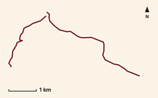
OSM route line, simplified. Branches and gaps as mapped. Trekking Trek, fort trek
Malhargad Fort
Near Saswad / Purandar, about 21 km from Pune centre (computed)
Mapped relation length 7.37 kmElevation Not recordedMapped in OpenStreetMap; access not checked Mapped only, not field-tested
Source: OpenStreetMap relation 15554668 (opens in a new tab) . © OpenStreetMap contributors, ODbL.
The route
- Original activity
- Trekking
- Type
- Fort trek. Trekking, Trail routes, Fort treks.
- Shape in OSM
- Non-linear in OSM (loop or multi-branch)
- Surface
- Trail (OSM hiking relation; may include road segments)
- Distance
- 7.37 km. Mapped relation length (OpenStreetMap via Waymarked Trails). Can include branches and alternatives.
- Elevation
- Not recorded. No gain, loss or profile data in the source.
- Difficulty
- Not recorded
- Start and finish
- Not recorded
Access and safety
- Access
- Not recorded. That does not mean open.
- Hazards
- Not recorded. That does not mean there are none.
- Permission
- Not recorded
- Field check
- Mapped only, not field-tested. Field check recommended (geometry from source)
Data and source
- Status
- Mapped in OSM: geometry exists; ground truth not verified
- Graphic
- Route line from the OpenStreetMap relation (5 ways, fetched 7 Oct 2026), simplified for the card. Not field-checked.
- Source
- OpenStreetMap via Waymarked Trails (hiking). OpenStreetMap (opens in a new tab) Waymarked Trails (opens in a new tab)
- Credit
- OpenStreetMap contributors (see relation history)
- Source checked
- 7 Oct 2026 , OSM data via Waymarked Trails API; not field-verified
- GPX
- Download GPX , built from the OpenStreetMap line (ODbL). Mapped, not field-verified.
- Route ID
- OSM-15554668 Show on the map
Route record
- Category
- HIKES & TREKS
- Type
- Trek
- Area
- Near Saswad / Purandar (computed)
- City status
- OUTSIDE PUNE
- Distance
- 7.37 km
- Elevation gain
- Not recorded
- Difficulty
- Not recorded
- Technicality
- Not recorded
- Endurance
- Not recorded
- Navigation
- Not recorded
- Exposure
- Not recorded
- Remoteness
- Not recorded
- Terrain
- Trail (OSM hiking relation; may include road segments)
- Surface
- Not recorded
- Monsoon risk
- Not recorded
- Heat risk
- Not recorded
- Wildlife
- Not recorded
- Water
- Not recorded
- Mobile network
- Not recorded
- Emergency access
- Not recorded
- Beginner suitability
- Not recorded
- Start
- Not recorded
- Finish
- Not recorded
- Nearest landmark
- Not recorded
- Creator
- OpenStreetMap contributors (see relation history)
- Source
- OpenStreetMap via Waymarked Trails (hiking)
- GPX
- Yes
- GPX link
- GPX file
- Licence
- ODbL 1.0
- Reuse
- Open licence: credit OpenStreetMap contributors, share-alike
- Route date
- Not recorded
- Last verified
- 7 Oct 2026
- Data confidence
- OSM route line, desk-checked; not field-verified
- Safety notes
- Not recorded
-
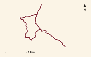
OSM route line, simplified. Branches and gaps as mapped. Hiking Hike, trail / ghat / naal route
Mandavi Top
Near Kamshet / Pawna, about 34.9 km from Pune centre (computed)
Mapped relation length 8.49 kmElevation Not recordedMapped in OpenStreetMap; access not checked Mapped only, not field-tested
Source: OpenStreetMap relation 11855334 (opens in a new tab) . © OpenStreetMap contributors, ODbL.
The route
- Original activity
- Hiking
- Type
- Trail / ghat / naal route. Hiking, Trail routes.
- Shape in OSM
- Linear (A→B or one-way trail)
- Surface
- Trail (OSM hiking relation; may include road segments)
- Distance
- 8.49 km. Mapped relation length (OpenStreetMap via Waymarked Trails). Can include branches and alternatives.
- Elevation
- Not recorded. No gain, loss or profile data in the source.
- Difficulty
- Not recorded
- Start and finish
- Not recorded
Access and safety
- Access
- Not recorded. That does not mean open.
- Hazards
- Not recorded. That does not mean there are none.
- Permission
- Not recorded
- Field check
- Mapped only, not field-tested. Field check recommended (geometry from source)
Data and source
- Status
- Mapped in OSM: geometry exists; ground truth not verified
- Graphic
- Route line from the OpenStreetMap relation (9 ways, fetched 7 Oct 2026), simplified for the card. Not field-checked.
- Source
- OpenStreetMap via Waymarked Trails (hiking). OpenStreetMap (opens in a new tab) Waymarked Trails (opens in a new tab)
- Credit
- OpenStreetMap contributors (see relation history)
- Source checked
- 7 Oct 2026 , OSM data via Waymarked Trails API; not field-verified
- GPX
- Download GPX , built from the OpenStreetMap line (ODbL). Mapped, not field-verified.
- Route ID
- OSM-11855334 Show on the map
Route record
- Category
- HIKES & TREKS
- Type
- Hike
- Area
- Near Kamshet / Pawna (computed)
- City status
- OUTSIDE PUNE
- Distance
- 8.49 km
- Elevation gain
- Not recorded
- Difficulty
- Not recorded
- Technicality
- Not recorded
- Endurance
- Not recorded
- Navigation
- Not recorded
- Exposure
- Not recorded
- Remoteness
- Not recorded
- Terrain
- Trail (OSM hiking relation; may include road segments)
- Surface
- Not recorded
- Monsoon risk
- Not recorded
- Heat risk
- Not recorded
- Wildlife
- Not recorded
- Water
- Not recorded
- Mobile network
- Not recorded
- Emergency access
- Not recorded
- Beginner suitability
- Not recorded
- Start
- Not recorded
- Finish
- Not recorded
- Nearest landmark
- Not recorded
- Creator
- OpenStreetMap contributors (see relation history)
- Source
- OpenStreetMap via Waymarked Trails (hiking)
- GPX
- Yes
- GPX link
- GPX file
- Licence
- ODbL 1.0
- Reuse
- Open licence: credit OpenStreetMap contributors, share-alike
- Route date
- Not recorded
- Last verified
- 7 Oct 2026
- Data confidence
- OSM route line, desk-checked; not field-verified
- Safety notes
- Not recorded
-
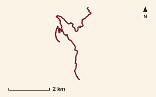
OSM route line, simplified. Branches and gaps as mapped. Trekking Trek, fort trek
Mangalgad Fort
Near Varandha Ghat, about 59.5 km from Pune centre (computed)
Mapped relation length 11.05 kmElevation Not recordedMapped in OpenStreetMap; access not checked Mapped only, not field-tested
Source: OpenStreetMap relation 12167829 (opens in a new tab) . © OpenStreetMap contributors, ODbL.
The route
- Original activity
- Trekking
- Type
- Fort trek. Trekking, Trail routes, Fort treks.
- Shape in OSM
- Non-linear in OSM (loop or multi-branch)
- Surface
- Trail (OSM hiking relation; may include road segments)
- Distance
- 11.05 km. Mapped relation length (OpenStreetMap via Waymarked Trails). Can include branches and alternatives.
- Elevation
- Not recorded. No gain, loss or profile data in the source.
- Difficulty
- Not recorded
- Start and finish
- Not recorded
Access and safety
- Access
- Not recorded. That does not mean open.
- Hazards
- Not recorded. That does not mean there are none.
- Permission
- Not recorded
- Field check
- Mapped only, not field-tested. Field check recommended (geometry from source)
Data and source
- Status
- Mapped in OSM: geometry exists; ground truth not verified
- Graphic
- Route line from the OpenStreetMap relation (12 ways, fetched 7 Oct 2026), simplified for the card. Not field-checked.
- Source notes
- Mangalgad/Kangorigad
- Source
- OpenStreetMap via Waymarked Trails (hiking). OpenStreetMap (opens in a new tab) Waymarked Trails (opens in a new tab)
- Credit
- OpenStreetMap contributors (see relation history)
- Source checked
- 7 Oct 2026 , OSM data via Waymarked Trails API; not field-verified
- GPX
- Download GPX , built from the OpenStreetMap line (ODbL). Mapped, not field-verified.
- Route ID
- OSM-12167829 Show on the map
Route record
- Category
- HIKES & TREKS
- Type
- Trek
- Area
- Near Varandha Ghat (computed)
- City status
- OUTSIDE PUNE
- Distance
- 11.05 km
- Elevation gain
- Not recorded
- Difficulty
- Not recorded
- Technicality
- Not recorded
- Endurance
- Not recorded
- Navigation
- Not recorded
- Exposure
- Not recorded
- Remoteness
- Not recorded
- Terrain
- Trail (OSM hiking relation; may include road segments)
- Surface
- Not recorded
- Monsoon risk
- Not recorded
- Heat risk
- Not recorded
- Wildlife
- Not recorded
- Water
- Not recorded
- Mobile network
- Not recorded
- Emergency access
- Not recorded
- Beginner suitability
- Not recorded
- Start
- Not recorded
- Finish
- Not recorded
- Nearest landmark
- Not recorded
- Creator
- OpenStreetMap contributors (see relation history)
- Source
- OpenStreetMap via Waymarked Trails (hiking)
- GPX
- Yes
- GPX link
- GPX file
- Licence
- ODbL 1.0
- Reuse
- Open licence: credit OpenStreetMap contributors, share-alike
- Route date
- Not recorded
- Last verified
- 7 Oct 2026
- Data confidence
- OSM route line, desk-checked; not field-verified
- Safety notes
- Not recorded
-
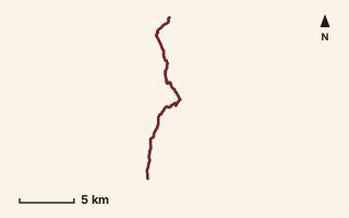
OSM route line, simplified. Branches and gaps as mapped. Trekking Trek, fort trek
Matheran - Peb - Nakhind
Near Matheran, about 81.5 km from Pune centre (computed)
Mapped relation length 19.69 kmElevation Not recordedMapped in OpenStreetMap; access not checked Mapped only, not field-tested
Source: OpenStreetMap relation 15552652 (opens in a new tab) . © OpenStreetMap contributors, ODbL.
The route
- Original activity
- Trekking
- Type
- Fort trek. Trekking, Trail routes, Fort treks.
- Shape in OSM
- Non-linear in OSM (loop or multi-branch)
- Surface
- Trail (OSM hiking relation; may include road segments)
- Distance
- 19.69 km. Mapped relation length (OpenStreetMap via Waymarked Trails). Can include branches and alternatives.
- Elevation
- Not recorded. No gain, loss or profile data in the source.
- Difficulty
- Not recorded
- Start and finish
- Not recorded
Access and safety
- Access
- Not recorded. That does not mean open.
- Hazards
- Not recorded. That does not mean there are none.
- Permission
- Not recorded
- Field check
- Mapped only, not field-tested. Field check recommended (geometry from source)
Data and source
- Status
- Mapped in OSM: geometry exists; ground truth not verified
- Graphic
- Route line from the OpenStreetMap relation (21 ways, fetched 7 Oct 2026), simplified for the card. Not field-checked.
- Overlap
- Overlap; Overlap (one route's extent lies inside the other's)
- Source
- OpenStreetMap via Waymarked Trails (hiking). OpenStreetMap (opens in a new tab) Waymarked Trails (opens in a new tab)
- Credit
- OpenStreetMap contributors (see relation history)
- Source checked
- 7 Oct 2026 , OSM data via Waymarked Trails API; not field-verified
- GPX
- Download GPX , built from the OpenStreetMap line (ODbL). Mapped, not field-verified.
- Route ID
- OSM-15552652 Show on the map
Route record
- Category
- HIKES & TREKS
- Type
- Trek
- Area
- Near Matheran (computed)
- City status
- OUTSIDE PUNE
- Distance
- 19.69 km
- Elevation gain
- Not recorded
- Difficulty
- Not recorded
- Technicality
- Not recorded
- Endurance
- Not recorded
- Navigation
- Not recorded
- Exposure
- Not recorded
- Remoteness
- Not recorded
- Terrain
- Trail (OSM hiking relation; may include road segments)
- Surface
- Not recorded
- Monsoon risk
- Not recorded
- Heat risk
- Not recorded
- Wildlife
- Not recorded
- Water
- Not recorded
- Mobile network
- Not recorded
- Emergency access
- Not recorded
- Beginner suitability
- Not recorded
- Start
- Not recorded
- Finish
- Not recorded
- Nearest landmark
- Not recorded
- Creator
- OpenStreetMap contributors (see relation history)
- Source
- OpenStreetMap via Waymarked Trails (hiking)
- GPX
- Yes
- GPX link
- GPX file
- Licence
- ODbL 1.0
- Reuse
- Open licence: credit OpenStreetMap contributors, share-alike
- Route date
- Not recorded
- Last verified
- 7 Oct 2026
- Data confidence
- OSM route line, desk-checked; not field-verified
- Safety notes
- Not recorded
-
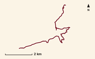
OSM route line, simplified. Branches and gaps as mapped. Trekking Trek, fort trek
Mohangad Fort
Near Varandha Ghat, about 55.2 km from Pune centre (computed)
Mapped relation length 10.06 kmElevation Not recordedMapped in OpenStreetMap; access not checked Mapped only, not field-tested
Source: OpenStreetMap relation 11863803 (opens in a new tab) . © OpenStreetMap contributors, ODbL.
The route
- Original activity
- Trekking
- Type
- Fort trek. Trekking, Trail routes, Fort treks.
- Shape in OSM
- Non-linear in OSM (loop or multi-branch)
- Surface
- Trail (OSM hiking relation; may include road segments)
- Distance
- 10.06 km. Mapped relation length (OpenStreetMap via Waymarked Trails). Can include branches and alternatives.
- Elevation
- Not recorded. No gain, loss or profile data in the source.
- Difficulty
- Not recorded
- Start and finish
- Not recorded
Access and safety
- Access
- Not recorded. That does not mean open.
- Hazards
- Not recorded. That does not mean there are none.
- Permission
- Not recorded
- Field check
- Mapped only, not field-tested. Field check recommended (geometry from source)
Data and source
- Status
- Mapped in OSM: geometry exists; ground truth not verified
- Graphic
- Route line from the OpenStreetMap relation (8 ways, fetched 7 Oct 2026), simplified for the card. Not field-checked.
- Overlap
- Overlap (one route's extent lies inside the other's); Variant
- Source notes
- Mohangad + Chorkana paths
- Source
- OpenStreetMap via Waymarked Trails (hiking). OpenStreetMap (opens in a new tab) Waymarked Trails (opens in a new tab)
- Credit
- OpenStreetMap contributors (see relation history)
- Source checked
- 7 Oct 2026 , OSM data via Waymarked Trails API; not field-verified
- GPX
- Download GPX , built from the OpenStreetMap line (ODbL). Mapped, not field-verified.
- Route ID
- OSM-11863803 Show on the map
Route record
- Category
- HIKES & TREKS
- Type
- Trek
- Area
- Near Varandha Ghat (computed)
- City status
- OUTSIDE PUNE
- Distance
- 10.06 km
- Elevation gain
- Not recorded
- Difficulty
- Not recorded
- Technicality
- Not recorded
- Endurance
- Not recorded
- Navigation
- Not recorded
- Exposure
- Not recorded
- Remoteness
- Not recorded
- Terrain
- Trail (OSM hiking relation; may include road segments)
- Surface
- Not recorded
- Monsoon risk
- Not recorded
- Heat risk
- Not recorded
- Wildlife
- Not recorded
- Water
- Not recorded
- Mobile network
- Not recorded
- Emergency access
- Not recorded
- Beginner suitability
- Not recorded
- Start
- Not recorded
- Finish
- Not recorded
- Nearest landmark
- Not recorded
- Creator
- OpenStreetMap contributors (see relation history)
- Source
- OpenStreetMap via Waymarked Trails (hiking)
- GPX
- Yes
- GPX link
- GPX file
- Licence
- ODbL 1.0
- Reuse
- Open licence: credit OpenStreetMap contributors, share-alike
- Route date
- Not recorded
- Last verified
- 7 Oct 2026
- Data confidence
- OSM route line, desk-checked; not field-verified
- Safety notes
- Not recorded
-
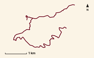
OSM route line, simplified. Branches and gaps as mapped. Trekking Trek, fort trek
Mohangad Fort 2
Near Varandha Ghat, about 55 km from Pune centre (computed)
Mapped relation length 9.81 kmElevation Not recordedMapped in OpenStreetMap; access not checked Mapped only, not field-tested
Source: OpenStreetMap relation 15570592 (opens in a new tab) . © OpenStreetMap contributors, ODbL.
The route
- Original activity
- Trekking
- Type
- Fort trek. Trekking, Trail routes, Fort treks.
- Shape in OSM
- Linear (A→B or one-way trail)
- Surface
- Trail (OSM hiking relation; may include road segments)
- Distance
- 9.81 km. Mapped relation length (OpenStreetMap via Waymarked Trails). Can include branches and alternatives.
- Elevation
- Not recorded. No gain, loss or profile data in the source.
- Difficulty
- Not recorded
- Start and finish
- Not recorded
Access and safety
- Access
- Not recorded. That does not mean open.
- Hazards
- Not recorded. That does not mean there are none.
- Permission
- Not recorded
- Field check
- Mapped only, not field-tested. Field check recommended (geometry from source)
Data and source
- Status
- Mapped in OSM: geometry exists; ground truth not verified
- Graphic
- Route line from the OpenStreetMap relation (10 ways, fetched 7 Oct 2026), simplified for the card. Not field-checked.
- Overlap
- Overlap (one route's extent lies inside the other's); Variant
- Source
- OpenStreetMap via Waymarked Trails (hiking). OpenStreetMap (opens in a new tab) Waymarked Trails (opens in a new tab)
- Credit
- OpenStreetMap contributors (see relation history)
- Source checked
- 7 Oct 2026 , OSM data via Waymarked Trails API; not field-verified
- GPX
- Download GPX , built from the OpenStreetMap line (ODbL). Mapped, not field-verified.
- Route ID
- OSM-15570592 Show on the map
Route record
- Category
- HIKES & TREKS
- Type
- Trek
- Area
- Near Varandha Ghat (computed)
- City status
- OUTSIDE PUNE
- Distance
- 9.81 km
- Elevation gain
- Not recorded
- Difficulty
- Not recorded
- Technicality
- Not recorded
- Endurance
- Not recorded
- Navigation
- Not recorded
- Exposure
- Not recorded
- Remoteness
- Not recorded
- Terrain
- Trail (OSM hiking relation; may include road segments)
- Surface
- Not recorded
- Monsoon risk
- Not recorded
- Heat risk
- Not recorded
- Wildlife
- Not recorded
- Water
- Not recorded
- Mobile network
- Not recorded
- Emergency access
- Not recorded
- Beginner suitability
- Not recorded
- Start
- Not recorded
- Finish
- Not recorded
- Nearest landmark
- Not recorded
- Creator
- OpenStreetMap contributors (see relation history)
- Source
- OpenStreetMap via Waymarked Trails (hiking)
- GPX
- Yes
- GPX link
- GPX file
- Licence
- ODbL 1.0
- Reuse
- Open licence: credit OpenStreetMap contributors, share-alike
- Route date
- Not recorded
- Last verified
- 7 Oct 2026
- Data confidence
- OSM route line, desk-checked; not field-verified
- Safety notes
- Not recorded
-
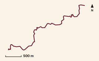
OSM route line, simplified. Branches and gaps as mapped. Hiking Hike, trail / ghat / naal route
Naandand
Near Sudhagad / Pali, about 55 km from Pune centre (computed)
Mapped relation length 4.25 kmElevation Not recordedMapped in OpenStreetMap; access not checked Mapped only, not field-tested
Source: OpenStreetMap relation 19829615 (opens in a new tab) . © OpenStreetMap contributors, ODbL.
The route
- Original activity
- Hiking
- Type
- Trail / ghat / naal route. Hiking, Trail routes.
- Shape in OSM
- Linear (A→B or one-way trail)
- Surface
- Trail (OSM hiking relation; may include road segments)
- Distance
- 4.25 km. Mapped relation length (OpenStreetMap via Waymarked Trails). Can include branches and alternatives.
- Elevation
- Not recorded. No gain, loss or profile data in the source.
- Difficulty
- Not recorded
- Start and finish
- Not recorded
Access and safety
- Access
- Not recorded. That does not mean open.
- Hazards
- Not recorded. That does not mean there are none.
- Permission
- Not recorded
- Field check
- Mapped only, not field-tested. Field check recommended (geometry from source)
Data and source
- Status
- Mapped in OSM: geometry exists; ground truth not verified
- Graphic
- Route line from the OpenStreetMap relation (1 ways, fetched 7 Oct 2026), simplified for the card. Not field-checked.
- Overlap
- Overlap (one route's extent lies inside the other's)
- Source notes
- website manav.in
- Source
- OpenStreetMap via Waymarked Trails (hiking). OpenStreetMap (opens in a new tab) Waymarked Trails (opens in a new tab)
- Credit
- OpenStreetMap contributors (see relation history): relation tags reference manav.in
- Source checked
- 7 Oct 2026 , OSM data via Waymarked Trails API; not field-verified
- GPX
- Download GPX , built from the OpenStreetMap line (ODbL). Mapped, not field-verified.
- Route ID
- OSM-19829615 Show on the map
Route record
- Category
- HIKES & TREKS
- Type
- Hike
- Area
- Near Sudhagad / Pali (computed)
- City status
- OUTSIDE PUNE
- Distance
- 4.25 km
- Elevation gain
- Not recorded
- Difficulty
- Not recorded
- Technicality
- Not recorded
- Endurance
- Not recorded
- Navigation
- Not recorded
- Exposure
- Not recorded
- Remoteness
- Not recorded
- Terrain
- Trail (OSM hiking relation; may include road segments)
- Surface
- Not recorded
- Monsoon risk
- Not recorded
- Heat risk
- Not recorded
- Wildlife
- Not recorded
- Water
- Not recorded
- Mobile network
- Not recorded
- Emergency access
- Not recorded
- Beginner suitability
- Not recorded
- Start
- Not recorded
- Finish
- Not recorded
- Nearest landmark
- Not recorded
- Creator
- OpenStreetMap contributors (see relation history): relation tags reference manav.in
- Source
- OpenStreetMap via Waymarked Trails (hiking)
- GPX
- Yes
- GPX link
- GPX file
- Licence
- ODbL 1.0
- Reuse
- Open licence: credit OpenStreetMap contributors, share-alike
- Route date
- Not recorded
- Last verified
- 7 Oct 2026
- Data confidence
- OSM route line, desk-checked; not field-verified
- Safety notes
- Not recorded
-
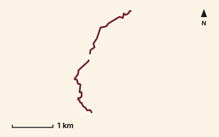
OSM route line, simplified. Branches and gaps as mapped. Hiking Hike, trail / ghat / naal route
Nakhind
Near Matheran, about 86.8 km from Pune centre (computed)
Mapped relation length 3.61 kmElevation Not recordedMapped in OpenStreetMap; access not checked Mapped only, not field-tested
Source: OpenStreetMap relation 15583914 (opens in a new tab) . © OpenStreetMap contributors, ODbL.
The route
- Original activity
- Hiking
- Type
- Trail / ghat / naal route. Hiking, Trail routes.
- Shape in OSM
- Non-linear in OSM (loop or multi-branch)
- Surface
- Trail (OSM hiking relation; may include road segments)
- Distance
- 3.61 km. Mapped relation length (OpenStreetMap via Waymarked Trails). Can include branches and alternatives.
- Elevation
- Not recorded. No gain, loss or profile data in the source.
- Difficulty
- Not recorded
- Start and finish
- Not recorded
Access and safety
- Access
- Not recorded. That does not mean open.
- Hazards
- Not recorded. That does not mean there are none.
- Permission
- Not recorded
- Field check
- Mapped only, not field-tested. Field check recommended (geometry from source)
Data and source
- Status
- Mapped in OSM: geometry exists; ground truth not verified
- Graphic
- Route line from the OpenStreetMap relation (6 ways, fetched 7 Oct 2026), simplified for the card. Not field-checked.
- Source
- OpenStreetMap via Waymarked Trails (hiking). OpenStreetMap (opens in a new tab) Waymarked Trails (opens in a new tab)
- Credit
- OpenStreetMap contributors (see relation history)
- Source checked
- 7 Oct 2026 , OSM data via Waymarked Trails API; not field-verified
- GPX
- Download GPX , built from the OpenStreetMap line (ODbL). Mapped, not field-verified.
- Route ID
- OSM-15583914 Show on the map
Route record
- Category
- HIKES & TREKS
- Type
- Hike
- Area
- Near Matheran (computed)
- City status
- OUTSIDE PUNE
- Distance
- 3.61 km
- Elevation gain
- Not recorded
- Difficulty
- Not recorded
- Technicality
- Not recorded
- Endurance
- Not recorded
- Navigation
- Not recorded
- Exposure
- Not recorded
- Remoteness
- Not recorded
- Terrain
- Trail (OSM hiking relation; may include road segments)
- Surface
- Not recorded
- Monsoon risk
- Not recorded
- Heat risk
- Not recorded
- Wildlife
- Not recorded
- Water
- Not recorded
- Mobile network
- Not recorded
- Emergency access
- Not recorded
- Beginner suitability
- Not recorded
- Start
- Not recorded
- Finish
- Not recorded
- Nearest landmark
- Not recorded
- Creator
- OpenStreetMap contributors (see relation history)
- Source
- OpenStreetMap via Waymarked Trails (hiking)
- GPX
- Yes
- GPX link
- GPX file
- Licence
- ODbL 1.0
- Reuse
- Open licence: credit OpenStreetMap contributors, share-alike
- Route date
- Not recorded
- Last verified
- 7 Oct 2026
- Data confidence
- OSM route line, desk-checked; not field-verified
- Safety notes
- Not recorded
-
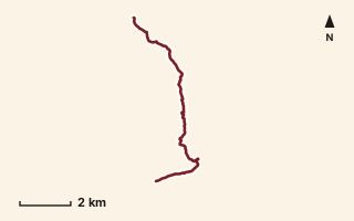
OSM route line, simplified. Branches and gaps as mapped. Hiking Hike, trail / ghat / naal route
Nanvali to Dhanakiwadi
Near Ahupe / Siddhagad, about 79.5 km from Pune centre (computed)
Mapped relation length 10.08 kmElevation Not recordedMapped in OpenStreetMap; access not checked Mapped only, not field-tested
Source: OpenStreetMap relation 18585220 (opens in a new tab) . © OpenStreetMap contributors, ODbL.
The route
- Original activity
- Hiking
- Type
- Trail / ghat / naal route. Hiking, Trail routes.
- Shape in OSM
- Linear (A→B or one-way trail)
- Surface
- Trail (OSM hiking relation; may include road segments)
- Distance
- 10.08 km. Mapped relation length (OpenStreetMap via Waymarked Trails). Can include branches and alternatives.
- Elevation
- Not recorded. No gain, loss or profile data in the source.
- Difficulty
- Not recorded
- Start and finish
- Not recorded
- Places named in OSM
- Zakhind Maata Mandir
Access and safety
- Access
- Not recorded. That does not mean open.
- Hazards
- Not recorded. That does not mean there are none.
- Permission
- Not recorded
- Field check
- Mapped only, not field-tested. Field check recommended (geometry from source)
Data and source
- Status
- Mapped in OSM: geometry exists; ground truth not verified
- Graphic
- Route line from the OpenStreetMap relation (10 ways, fetched 7 Oct 2026), simplified for the card. Not field-checked.
- Source notes
- via Zakhind Mata Mandir
- Source
- OpenStreetMap via Waymarked Trails (hiking). OpenStreetMap (opens in a new tab) Waymarked Trails (opens in a new tab)
- Credit
- OpenStreetMap contributors (see relation history)
- Source checked
- 7 Oct 2026 , OSM data via Waymarked Trails API; not field-verified
- GPX
- Download GPX , built from the OpenStreetMap line (ODbL). Mapped, not field-verified.
- Route ID
- OSM-18585220 Show on the map
Route record
- Category
- HIKES & TREKS
- Type
- Hike
- Area
- Near Ahupe / Siddhagad (computed)
- City status
- OUTSIDE PUNE
- Distance
- 10.08 km
- Elevation gain
- Not recorded
- Difficulty
- Not recorded
- Technicality
- Not recorded
- Endurance
- Not recorded
- Navigation
- Not recorded
- Exposure
- Not recorded
- Remoteness
- Not recorded
- Terrain
- Trail (OSM hiking relation; may include road segments)
- Surface
- Not recorded
- Monsoon risk
- Not recorded
- Heat risk
- Not recorded
- Wildlife
- Not recorded
- Water
- Not recorded
- Mobile network
- Not recorded
- Emergency access
- Not recorded
- Beginner suitability
- Not recorded
- Start
- Not recorded
- Finish
- Not recorded
- Nearest landmark
- Zakhind Maata Mandir
- Creator
- OpenStreetMap contributors (see relation history)
- Source
- OpenStreetMap via Waymarked Trails (hiking)
- GPX
- Yes
- GPX link
- GPX file
- Licence
- ODbL 1.0
- Reuse
- Open licence: credit OpenStreetMap contributors, share-alike
- Route date
- Not recorded
- Last verified
- 7 Oct 2026
- Data confidence
- OSM route line, desk-checked; not field-verified
- Safety notes
- Not recorded
-
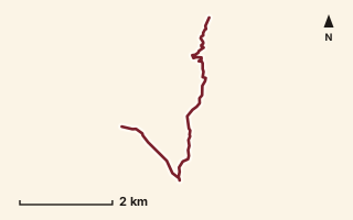
OSM route line, simplified. Branches and gaps as mapped. Trekking Trek, fort trek
Pandavgad
Near Raireshwar, about 58.7 km from Pune centre (computed)
Mapped relation length 6.33 kmElevation Not recordedMapped in OpenStreetMap; access not checked Mapped only, not field-tested
Source: OpenStreetMap relation 11875895 (opens in a new tab) . © OpenStreetMap contributors, ODbL.
The route
- Original activity
- Trekking
- Type
- Fort trek. Trekking, Trail routes, Fort treks.
- Shape in OSM
- Non-linear in OSM (loop or multi-branch)
- Surface
- Trail (OSM hiking relation; may include road segments)
- Distance
- 6.33 km. Mapped relation length (OpenStreetMap via Waymarked Trails). Can include branches and alternatives.
- Elevation
- Not recorded. No gain, loss or profile data in the source.
- Difficulty
- Not recorded
- Start and finish
- Not recorded
Access and safety
- Access
- Not recorded. That does not mean open.
- Hazards
- Not recorded. That does not mean there are none.
- Permission
- Not recorded
- Field check
- Mapped only, not field-tested. Field check recommended (geometry from source)
Data and source
- Status
- Mapped in OSM: geometry exists; ground truth not verified
- Graphic
- Route line from the OpenStreetMap relation (3 ways, fetched 7 Oct 2026), simplified for the card. Not field-checked.
- Source
- OpenStreetMap via Waymarked Trails (hiking). OpenStreetMap (opens in a new tab) Waymarked Trails (opens in a new tab)
- Credit
- OpenStreetMap contributors (see relation history)
- Source checked
- 7 Oct 2026 , OSM data via Waymarked Trails API; not field-verified
- GPX
- Download GPX , built from the OpenStreetMap line (ODbL). Mapped, not field-verified.
- Route ID
- OSM-11875895 Show on the map
Route record
- Category
- HIKES & TREKS
- Type
- Trek
- Area
- Near Raireshwar (computed)
- City status
- OUTSIDE PUNE
- Distance
- 6.33 km
- Elevation gain
- Not recorded
- Difficulty
- Not recorded
- Technicality
- Not recorded
- Endurance
- Not recorded
- Navigation
- Not recorded
- Exposure
- Not recorded
- Remoteness
- Not recorded
- Terrain
- Trail (OSM hiking relation; may include road segments)
- Surface
- Not recorded
- Monsoon risk
- Not recorded
- Heat risk
- Not recorded
- Wildlife
- Not recorded
- Water
- Not recorded
- Mobile network
- Not recorded
- Emergency access
- Not recorded
- Beginner suitability
- Not recorded
- Start
- Not recorded
- Finish
- Not recorded
- Nearest landmark
- Not recorded
- Creator
- OpenStreetMap contributors (see relation history)
- Source
- OpenStreetMap via Waymarked Trails (hiking)
- GPX
- Yes
- GPX link
- GPX file
- Licence
- ODbL 1.0
- Reuse
- Open licence: credit OpenStreetMap contributors, share-alike
- Route date
- Not recorded
- Last verified
- 7 Oct 2026
- Data confidence
- OSM route line, desk-checked; not field-verified
- Safety notes
- Not recorded
-
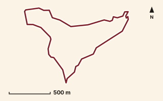
OSM route line, simplified. Branches and gaps as mapped. Hiking Hike, trail / ghat / naal route
Pandavleni Loop (Gaidhara)
Near Raireshwar, about 54.6 km from Pune centre (computed)
Mapped relation length 3.99 kmElevation Not recordedMapped in OpenStreetMap; access not checked Mapped only, not field-tested
Source: OpenStreetMap relation 16863732 (opens in a new tab) . © OpenStreetMap contributors, ODbL.
The route
- Original activity
- Hiking
- Type
- Trail / ghat / naal route. Hiking, Trail routes.
- Shape in OSM
- Loop (by name)
- Surface
- Trail (OSM hiking relation; may include road segments)
- Distance
- 3.99 km. Mapped relation length (OpenStreetMap via Waymarked Trails). Can include branches and alternatives.
- Elevation
- Not recorded. No gain, loss or profile data in the source.
- Difficulty
- Not recorded
- Start and finish
- Not recorded
Access and safety
- Access
- Not recorded. That does not mean open.
- Hazards
- Not recorded. That does not mean there are none.
- Permission
- Not recorded
- Field check
- Mapped only, not field-tested. Field check recommended (geometry from source)
Data and source
- Status
- Mapped in OSM: geometry exists; ground truth not verified
- Graphic
- Route line from the OpenStreetMap relation (4 ways, fetched 7 Oct 2026), simplified for the card. Not field-checked.
- Overlap
- Overlap (one route's extent lies inside the other's)
- Source notes
- website_old creedaz.in
- Source
- OpenStreetMap via Waymarked Trails (hiking). OpenStreetMap (opens in a new tab) Waymarked Trails (opens in a new tab)
- Credit
- OpenStreetMap contributors (see relation history): relation tags reference creedaz.in
- Source checked
- 7 Oct 2026 , OSM data via Waymarked Trails API; not field-verified
- GPX
- Download GPX , built from the OpenStreetMap line (ODbL). Mapped, not field-verified.
- Route ID
- OSM-16863732 Show on the map
Route record
- Category
- HIKES & TREKS
- Type
- Hike
- Area
- Near Raireshwar (computed)
- City status
- OUTSIDE PUNE
- Distance
- 3.99 km
- Elevation gain
- Not recorded
- Difficulty
- Not recorded
- Technicality
- Not recorded
- Endurance
- Not recorded
- Navigation
- Not recorded
- Exposure
- Not recorded
- Remoteness
- Not recorded
- Terrain
- Trail (OSM hiking relation; may include road segments)
- Surface
- Not recorded
- Monsoon risk
- Not recorded
- Heat risk
- Not recorded
- Wildlife
- Not recorded
- Water
- Not recorded
- Mobile network
- Not recorded
- Emergency access
- Not recorded
- Beginner suitability
- Not recorded
- Start
- Not recorded
- Finish
- Not recorded
- Nearest landmark
- Not recorded
- Creator
- OpenStreetMap contributors (see relation history): relation tags reference creedaz.in
- Source
- OpenStreetMap via Waymarked Trails (hiking)
- GPX
- Yes
- GPX link
- GPX file
- Licence
- ODbL 1.0
- Reuse
- Open licence: credit OpenStreetMap contributors, share-alike
- Route date
- Not recorded
- Last verified
- 7 Oct 2026
- Data confidence
- OSM route line, desk-checked; not field-verified
- Safety notes
- Not recorded
-
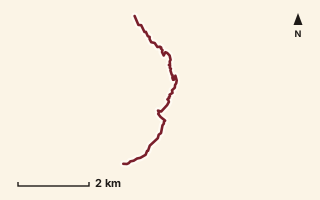
OSM route line, simplified. Branches and gaps as mapped. Hiking Hike, trail / ghat / naal route
Pane to Khanu
Near Raigad, about 47.9 km from Pune centre (computed)
Mapped relation length 6.55 kmElevation Not recordedMapped in OpenStreetMap; access not checked Mapped only, not field-tested
Source: OpenStreetMap relation 15567521 (opens in a new tab) . © OpenStreetMap contributors, ODbL.
The route
- Original activity
- Hiking
- Type
- Trail / ghat / naal route. Hiking, Trail routes.
- Shape in OSM
- Linear (A→B or one-way trail)
- Surface
- Trail (OSM hiking relation; may include road segments)
- Distance
- 6.55 km. Mapped relation length (OpenStreetMap via Waymarked Trails). Can include branches and alternatives.
- Elevation
- Not recorded. No gain, loss or profile data in the source.
- Difficulty
- Not recorded
- Start and finish
- Not recorded
Access and safety
- Access
- Not recorded. That does not mean open.
- Hazards
- Not recorded. That does not mean there are none.
- Permission
- Not recorded
- Field check
- Mapped only, not field-tested. Field check recommended (geometry from source)
Data and source
- Status
- Mapped in OSM: geometry exists; ground truth not verified
- Graphic
- Route line from the OpenStreetMap relation (9 ways, fetched 7 Oct 2026), simplified for the card. Not field-checked.
- Overlap
- Overlap (one route's extent lies inside the other's); Probable variant
- Source
- OpenStreetMap via Waymarked Trails (hiking). OpenStreetMap (opens in a new tab) Waymarked Trails (opens in a new tab)
- Credit
- OpenStreetMap contributors (see relation history)
- Source checked
- 7 Oct 2026 , OSM data via Waymarked Trails API; not field-verified
- GPX
- Download GPX , built from the OpenStreetMap line (ODbL). Mapped, not field-verified.
- Route ID
- OSM-15567521 Show on the map
Route record
- Category
- HIKES & TREKS
- Type
- Hike
- Area
- Near Raigad (computed)
- City status
- OUTSIDE PUNE
- Distance
- 6.55 km
- Elevation gain
- Not recorded
- Difficulty
- Not recorded
- Technicality
- Not recorded
- Endurance
- Not recorded
- Navigation
- Not recorded
- Exposure
- Not recorded
- Remoteness
- Not recorded
- Terrain
- Trail (OSM hiking relation; may include road segments)
- Surface
- Not recorded
- Monsoon risk
- Not recorded
- Heat risk
- Not recorded
- Wildlife
- Not recorded
- Water
- Not recorded
- Mobile network
- Not recorded
- Emergency access
- Not recorded
- Beginner suitability
- Not recorded
- Start
- Not recorded
- Finish
- Not recorded
- Nearest landmark
- Not recorded
- Creator
- OpenStreetMap contributors (see relation history)
- Source
- OpenStreetMap via Waymarked Trails (hiking)
- GPX
- Yes
- GPX link
- GPX file
- Licence
- ODbL 1.0
- Reuse
- Open licence: credit OpenStreetMap contributors, share-alike
- Route date
- Not recorded
- Last verified
- 7 Oct 2026
- Data confidence
- OSM route line, desk-checked; not field-verified
- Safety notes
- Not recorded
-
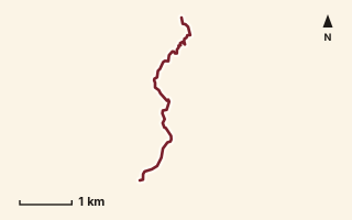
OSM route line, simplified. Branches and gaps as mapped. Hiking Hike, trail / ghat / naal route
Pasalwadi to Kalamb
Near Sudhagad / Pali, about 57.3 km from Pune centre (computed)
Mapped relation length 4.59 kmElevation Not recordedMapped in OpenStreetMap; access not checked Mapped only, not field-tested
Source: OpenStreetMap relation 16863868 (opens in a new tab) . © OpenStreetMap contributors, ODbL.
The route
- Original activity
- Hiking
- Type
- Trail / ghat / naal route. Hiking, Trail routes.
- Shape in OSM
- Linear (A→B or one-way trail)
- Surface
- Trail (OSM hiking relation; may include road segments)
- Distance
- 4.59 km. Mapped relation length (OpenStreetMap via Waymarked Trails). Can include branches and alternatives.
- Elevation
- Not recorded. No gain, loss or profile data in the source.
- Difficulty
- Not recorded
- Start and finish
- Not recorded
Access and safety
- Access
- Not recorded. That does not mean open.
- Hazards
- Not recorded. That does not mean there are none.
- Permission
- Not recorded
- Field check
- Mapped only, not field-tested. Field check recommended (geometry from source)
Data and source
- Status
- Mapped in OSM: geometry exists; ground truth not verified
- Graphic
- Route line from the OpenStreetMap relation (5 ways, fetched 7 Oct 2026), simplified for the card. Not field-checked.
- Source
- OpenStreetMap via Waymarked Trails (hiking). OpenStreetMap (opens in a new tab) Waymarked Trails (opens in a new tab)
- Credit
- OpenStreetMap contributors (see relation history)
- Source checked
- 7 Oct 2026 , OSM data via Waymarked Trails API; not field-verified
- GPX
- Download GPX , built from the OpenStreetMap line (ODbL). Mapped, not field-verified.
- Route ID
- OSM-16863868 Show on the map
Route record
- Category
- HIKES & TREKS
- Type
- Hike
- Area
- Near Sudhagad / Pali (computed)
- City status
- OUTSIDE PUNE
- Distance
- 4.59 km
- Elevation gain
- Not recorded
- Difficulty
- Not recorded
- Technicality
- Not recorded
- Endurance
- Not recorded
- Navigation
- Not recorded
- Exposure
- Not recorded
- Remoteness
- Not recorded
- Terrain
- Trail (OSM hiking relation; may include road segments)
- Surface
- Not recorded
- Monsoon risk
- Not recorded
- Heat risk
- Not recorded
- Wildlife
- Not recorded
- Water
- Not recorded
- Mobile network
- Not recorded
- Emergency access
- Not recorded
- Beginner suitability
- Not recorded
- Start
- Not recorded
- Finish
- Not recorded
- Nearest landmark
- Not recorded
- Creator
- OpenStreetMap contributors (see relation history)
- Source
- OpenStreetMap via Waymarked Trails (hiking)
- GPX
- Yes
- GPX link
- GPX file
- Licence
- ODbL 1.0
- Reuse
- Open licence: credit OpenStreetMap contributors, share-alike
- Route date
- Not recorded
- Last verified
- 7 Oct 2026
- Data confidence
- OSM route line, desk-checked; not field-verified
- Safety notes
- Not recorded
-
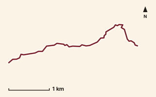
OSM route line, simplified. Branches and gaps as mapped. Hiking Hike, trail / ghat / naal route
Paymodi Trail
Near Lonavala, about 54.1 km from Pune centre (computed)
Mapped relation length 4.09 kmElevation Not recordedMapped in OpenStreetMap; access not checked Mapped only, not field-tested
Source: OpenStreetMap relation 19824459 (opens in a new tab) . © OpenStreetMap contributors, ODbL.
The route
- Original activity
- Hiking
- Type
- Trail / ghat / naal route. Hiking, Trail routes.
- Shape in OSM
- Linear (A→B or one-way trail)
- Surface
- Trail (OSM hiking relation; may include road segments)
- Distance
- 4.09 km. Mapped relation length (OpenStreetMap via Waymarked Trails). Can include branches and alternatives.
- Elevation
- Not recorded. No gain, loss or profile data in the source.
- Difficulty
- Not recorded
- Start and finish
- Not recorded
Access and safety
- Access
- Not recorded. That does not mean open.
- Hazards
- Not recorded. That does not mean there are none.
- Permission
- Not recorded
- Field check
- Mapped only, not field-tested. Field check recommended (geometry from source)
Data and source
- Status
- Mapped in OSM: geometry exists; ground truth not verified
- Graphic
- Route line from the OpenStreetMap relation (2 ways, fetched 7 Oct 2026), simplified for the card. Not field-checked.
- Overlap
- Overlap (one route's extent lies inside the other's)
- Source notes
- website manav.in
- Source
- OpenStreetMap via Waymarked Trails (hiking). OpenStreetMap (opens in a new tab) Waymarked Trails (opens in a new tab)
- Credit
- OpenStreetMap contributors (see relation history): relation tags reference manav.in
- Source checked
- 7 Oct 2026 , OSM data via Waymarked Trails API; not field-verified
- GPX
- Download GPX , built from the OpenStreetMap line (ODbL). Mapped, not field-verified.
- Route ID
- OSM-19824459 Show on the map
Route record
- Category
- HIKES & TREKS
- Type
- Hike
- Area
- Near Lonavala (computed)
- City status
- OUTSIDE PUNE
- Distance
- 4.09 km
- Elevation gain
- Not recorded
- Difficulty
- Not recorded
- Technicality
- Not recorded
- Endurance
- Not recorded
- Navigation
- Not recorded
- Exposure
- Not recorded
- Remoteness
- Not recorded
- Terrain
- Trail (OSM hiking relation; may include road segments)
- Surface
- Not recorded
- Monsoon risk
- Not recorded
- Heat risk
- Not recorded
- Wildlife
- Not recorded
- Water
- Not recorded
- Mobile network
- Not recorded
- Emergency access
- Not recorded
- Beginner suitability
- Not recorded
- Start
- Not recorded
- Finish
- Not recorded
- Nearest landmark
- Not recorded
- Creator
- OpenStreetMap contributors (see relation history): relation tags reference manav.in
- Source
- OpenStreetMap via Waymarked Trails (hiking)
- GPX
- Yes
- GPX link
- GPX file
- Licence
- ODbL 1.0
- Reuse
- Open licence: credit OpenStreetMap contributors, share-alike
- Route date
- Not recorded
- Last verified
- 7 Oct 2026
- Data confidence
- OSM route line, desk-checked; not field-verified
- Safety notes
- Not recorded
-
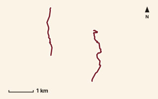
OSM route line, simplified. Branches and gaps as mapped. Hiking Hike, trail / ghat / naal route
Payri-Fenyadevi Ghat
Near Bhimashankar, about 62.1 km from Pune centre (computed)
Mapped relation length 4.99 kmElevation Not recordedMapped in OpenStreetMap; access not checked Mapped only, not field-tested
Source: OpenStreetMap relation 11846901 (opens in a new tab) . © OpenStreetMap contributors, ODbL.
The route
- Original activity
- Hiking
- Type
- Trail / ghat / naal route. Hiking, Trail routes.
- Shape in OSM
- Non-linear in OSM (loop or multi-branch)
- Surface
- Trail (OSM hiking relation; may include road segments)
- Distance
- 4.99 km. Mapped relation length (OpenStreetMap via Waymarked Trails). Can include branches and alternatives.
- Elevation
- Not recorded. No gain, loss or profile data in the source.
- Difficulty
- Not recorded
- Start and finish
- Not recorded
Access and safety
- Access
- Not recorded. That does not mean open.
- Hazards
- Not recorded. That does not mean there are none.
- Permission
- Not recorded
- Field check
- Mapped only, not field-tested. Field check recommended (geometry from source)
Data and source
- Status
- Mapped in OSM: geometry exists; ground truth not verified
- Graphic
- Route line from the OpenStreetMap relation (4 ways, fetched 7 Oct 2026), simplified for the card. Not field-checked.
- Overlap
- Overlap (one route's extent lies inside the other's)
- Source
- OpenStreetMap via Waymarked Trails (hiking). OpenStreetMap (opens in a new tab) Waymarked Trails (opens in a new tab)
- Credit
- OpenStreetMap contributors (see relation history)
- Source checked
- 7 Oct 2026 , OSM data via Waymarked Trails API; not field-verified
- GPX
- Download GPX , built from the OpenStreetMap line (ODbL). Mapped, not field-verified.
- Route ID
- OSM-11846901 Show on the map
Route record
- Category
- HIKES & TREKS
- Type
- Hike
- Area
- Near Bhimashankar (computed)
- City status
- OUTSIDE PUNE
- Distance
- 4.99 km
- Elevation gain
- Not recorded
- Difficulty
- Not recorded
- Technicality
- Not recorded
- Endurance
- Not recorded
- Navigation
- Not recorded
- Exposure
- Not recorded
- Remoteness
- Not recorded
- Terrain
- Trail (OSM hiking relation; may include road segments)
- Surface
- Not recorded
- Monsoon risk
- Not recorded
- Heat risk
- Not recorded
- Wildlife
- Not recorded
- Water
- Not recorded
- Mobile network
- Not recorded
- Emergency access
- Not recorded
- Beginner suitability
- Not recorded
- Start
- Not recorded
- Finish
- Not recorded
- Nearest landmark
- Not recorded
- Creator
- OpenStreetMap contributors (see relation history)
- Source
- OpenStreetMap via Waymarked Trails (hiking)
- GPX
- Yes
- GPX link
- GPX file
- Licence
- ODbL 1.0
- Reuse
- Open licence: credit OpenStreetMap contributors, share-alike
- Route date
- Not recorded
- Last verified
- 7 Oct 2026
- Data confidence
- OSM route line, desk-checked; not field-verified
- Safety notes
- Not recorded
-
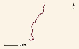
OSM route line, simplified. Branches and gaps as mapped. Trekking Trek, fort trek
Peb Fort 1
Near Matheran, about 84.4 km from Pune centre (computed)
Mapped relation length 7.77 kmElevation Not recordedMapped in OpenStreetMap; access not checked Mapped only, not field-tested
Source: OpenStreetMap relation 15581603 (opens in a new tab) . © OpenStreetMap contributors, ODbL.
The route
- Original activity
- Trekking
- Type
- Fort trek. Trekking, Trail routes, Fort treks.
- Shape in OSM
- Linear (A→B or one-way trail)
- Surface
- Trail (OSM hiking relation; may include road segments)
- Distance
- 7.77 km. Mapped relation length (OpenStreetMap via Waymarked Trails). Can include branches and alternatives.
- Elevation
- Not recorded. No gain, loss or profile data in the source.
- Difficulty
- Not recorded
- Start and finish
- Not recorded
Access and safety
- Access
- Not recorded. That does not mean open.
- Hazards
- Not recorded. That does not mean there are none.
- Permission
- Not recorded
- Field check
- Mapped only, not field-tested. Field check recommended (geometry from source)
Data and source
- Status
- Mapped in OSM: geometry exists; ground truth not verified
- Graphic
- Route line from the OpenStreetMap relation (4 ways, fetched 7 Oct 2026), simplified for the card. Not field-checked.
- Source
- OpenStreetMap via Waymarked Trails (hiking). OpenStreetMap (opens in a new tab) Waymarked Trails (opens in a new tab)
- Credit
- OpenStreetMap contributors (see relation history)
- Source checked
- 7 Oct 2026 , OSM data via Waymarked Trails API; not field-verified
- GPX
- Download GPX , built from the OpenStreetMap line (ODbL). Mapped, not field-verified.
- Route ID
- OSM-15581603 Show on the map
Route record
- Category
- HIKES & TREKS
- Type
- Trek
- Area
- Near Matheran (computed)
- City status
- OUTSIDE PUNE
- Distance
- 7.77 km
- Elevation gain
- Not recorded
- Difficulty
- Not recorded
- Technicality
- Not recorded
- Endurance
- Not recorded
- Navigation
- Not recorded
- Exposure
- Not recorded
- Remoteness
- Not recorded
- Terrain
- Trail (OSM hiking relation; may include road segments)
- Surface
- Not recorded
- Monsoon risk
- Not recorded
- Heat risk
- Not recorded
- Wildlife
- Not recorded
- Water
- Not recorded
- Mobile network
- Not recorded
- Emergency access
- Not recorded
- Beginner suitability
- Not recorded
- Start
- Not recorded
- Finish
- Not recorded
- Nearest landmark
- Not recorded
- Creator
- OpenStreetMap contributors (see relation history)
- Source
- OpenStreetMap via Waymarked Trails (hiking)
- GPX
- Yes
- GPX link
- GPX file
- Licence
- ODbL 1.0
- Reuse
- Open licence: credit OpenStreetMap contributors, share-alike
- Route date
- Not recorded
- Last verified
- 7 Oct 2026
- Data confidence
- OSM route line, desk-checked; not field-verified
- Safety notes
- Not recorded
-
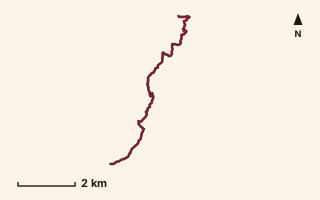
OSM route line, simplified. Branches and gaps as mapped. Hiking Hike, trail / ghat / naal route
Phane to Khanu
Near Raigad, about 47.1 km from Pune centre (computed)
Mapped relation length 8.78 kmElevation Not recordedMapped in OpenStreetMap; access not checked Mapped only, not field-tested
Source: OpenStreetMap relation 15554612 (opens in a new tab) . © OpenStreetMap contributors, ODbL.
The route
- Original activity
- Hiking
- Type
- Trail / ghat / naal route. Hiking, Trail routes.
- Shape in OSM
- Linear (A→B or one-way trail)
- Surface
- Trail (OSM hiking relation; may include road segments)
- Distance
- 8.78 km. Mapped relation length (OpenStreetMap via Waymarked Trails). Can include branches and alternatives.
- Elevation
- Not recorded. No gain, loss or profile data in the source.
- Difficulty
- Not recorded
- Start and finish
- Not recorded
Access and safety
- Access
- Not recorded. That does not mean open.
- Hazards
- Not recorded. That does not mean there are none.
- Permission
- Not recorded
- Field check
- Mapped only, not field-tested. Field check recommended (geometry from source)
Data and source
- Status
- Mapped in OSM: geometry exists; ground truth not verified
- Graphic
- Route line from the OpenStreetMap relation (11 ways, fetched 7 Oct 2026), simplified for the card. Not field-checked.
- Overlap
- Overlap (one route's extent lies inside the other's); Probable variant
- Source
- OpenStreetMap via Waymarked Trails (hiking). OpenStreetMap (opens in a new tab) Waymarked Trails (opens in a new tab)
- Credit
- OpenStreetMap contributors (see relation history)
- Source checked
- 7 Oct 2026 , OSM data via Waymarked Trails API; not field-verified
- GPX
- Download GPX , built from the OpenStreetMap line (ODbL). Mapped, not field-verified.
- Route ID
- OSM-15554612 Show on the map
Route record
- Category
- HIKES & TREKS
- Type
- Hike
- Area
- Near Raigad (computed)
- City status
- OUTSIDE PUNE
- Distance
- 8.78 km
- Elevation gain
- Not recorded
- Difficulty
- Not recorded
- Technicality
- Not recorded
- Endurance
- Not recorded
- Navigation
- Not recorded
- Exposure
- Not recorded
- Remoteness
- Not recorded
- Terrain
- Trail (OSM hiking relation; may include road segments)
- Surface
- Not recorded
- Monsoon risk
- Not recorded
- Heat risk
- Not recorded
- Wildlife
- Not recorded
- Water
- Not recorded
- Mobile network
- Not recorded
- Emergency access
- Not recorded
- Beginner suitability
- Not recorded
- Start
- Not recorded
- Finish
- Not recorded
- Nearest landmark
- Not recorded
- Creator
- OpenStreetMap contributors (see relation history)
- Source
- OpenStreetMap via Waymarked Trails (hiking)
- GPX
- Yes
- GPX link
- GPX file
- Licence
- ODbL 1.0
- Reuse
- Open licence: credit OpenStreetMap contributors, share-alike
- Route date
- Not recorded
- Last verified
- 7 Oct 2026
- Data confidence
- OSM route line, desk-checked; not field-verified
- Safety notes
- Not recorded
-
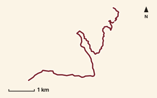
OSM route line, simplified. Branches and gaps as mapped. Hiking Hike, trail / ghat / naal route
Pol to Khanu
Near Lavasa, about 42.6 km from Pune centre (computed)
Mapped relation length 9.37 kmElevation Not recordedMapped in OpenStreetMap; access not checked Mapped only, not field-tested
Source: OpenStreetMap relation 15567605 (opens in a new tab) . © OpenStreetMap contributors, ODbL.
The route
- Original activity
- Hiking
- Type
- Trail / ghat / naal route. Hiking, Trail routes.
- Shape in OSM
- Non-linear in OSM (loop or multi-branch)
- Surface
- Trail (OSM hiking relation; may include road segments)
- Distance
- 9.37 km. Mapped relation length (OpenStreetMap via Waymarked Trails). Can include branches and alternatives.
- Elevation
- Not recorded. No gain, loss or profile data in the source.
- Difficulty
- Not recorded
- Start and finish
- Not recorded
Access and safety
- Access
- Not recorded. That does not mean open.
- Hazards
- Not recorded. That does not mean there are none.
- Permission
- Not recorded
- Field check
- Mapped only, not field-tested. Field check recommended (geometry from source)
Data and source
- Status
- Mapped in OSM: geometry exists; ground truth not verified
- Graphic
- Route line from the OpenStreetMap relation (8 ways, fetched 7 Oct 2026), simplified for the card. Not field-checked.
- Overlap
- Overlap (one route's extent lies inside the other's)
- Source
- OpenStreetMap via Waymarked Trails (hiking). OpenStreetMap (opens in a new tab) Waymarked Trails (opens in a new tab)
- Credit
- OpenStreetMap contributors (see relation history)
- Source checked
- 7 Oct 2026 , OSM data via Waymarked Trails API; not field-verified
- GPX
- Download GPX , built from the OpenStreetMap line (ODbL). Mapped, not field-verified.
- Route ID
- OSM-15567605 Show on the map
Route record
- Category
- HIKES & TREKS
- Type
- Hike
- Area
- Near Lavasa (computed)
- City status
- OUTSIDE PUNE
- Distance
- 9.37 km
- Elevation gain
- Not recorded
- Difficulty
- Not recorded
- Technicality
- Not recorded
- Endurance
- Not recorded
- Navigation
- Not recorded
- Exposure
- Not recorded
- Remoteness
- Not recorded
- Terrain
- Trail (OSM hiking relation; may include road segments)
- Surface
- Not recorded
- Monsoon risk
- Not recorded
- Heat risk
- Not recorded
- Wildlife
- Not recorded
- Water
- Not recorded
- Mobile network
- Not recorded
- Emergency access
- Not recorded
- Beginner suitability
- Not recorded
- Start
- Not recorded
- Finish
- Not recorded
- Nearest landmark
- Not recorded
- Creator
- OpenStreetMap contributors (see relation history)
- Source
- OpenStreetMap via Waymarked Trails (hiking)
- GPX
- Yes
- GPX link
- GPX file
- Licence
- ODbL 1.0
- Reuse
- Open licence: credit OpenStreetMap contributors, share-alike
- Route date
- Not recorded
- Last verified
- 7 Oct 2026
- Data confidence
- OSM route line, desk-checked; not field-verified
- Safety notes
- Not recorded
-
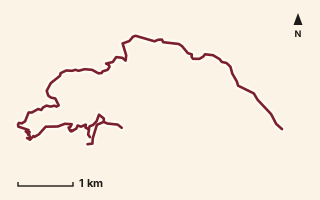
OSM route line, simplified. Branches and gaps as mapped. Trekking Trek, fort trek
Raigad Fort
Near Raigad, about 52.6 km from Pune centre (computed)
Mapped relation length 12.28 kmElevation Not recordedMapped in OpenStreetMap; access not checked Mapped only, not field-tested
Source: OpenStreetMap relation 15010971 (opens in a new tab) . © OpenStreetMap contributors, ODbL.
The route
- Original activity
- Trekking
- Type
- Fort trek. Trekking, Trail routes, Fort treks.
- Shape in OSM
- Non-linear in OSM (loop or multi-branch)
- Surface
- Trail (OSM hiking relation; may include road segments)
- Distance
- 12.28 km. Mapped relation length (OpenStreetMap via Waymarked Trails). Can include branches and alternatives.
- Elevation
- Not recorded. No gain, loss or profile data in the source.
- Difficulty
- Not recorded
- Start and finish
- Not recorded
Access and safety
- Access
- Not recorded. That does not mean open.
- Hazards
- Not recorded. That does not mean there are none.
- Permission
- Not recorded
- Field check
- Mapped only, not field-tested. Field check recommended (geometry from source)
Data and source
- Status
- Mapped in OSM: geometry exists; ground truth not verified
- Graphic
- Route line from the OpenStreetMap relation (12 ways, fetched 7 Oct 2026), simplified for the card. Not field-checked.
- Overlap
- Variant
- Source notes
- Lingana to Raigad + Raigad Fort Trail
- Source
- OpenStreetMap via Waymarked Trails (hiking). OpenStreetMap (opens in a new tab) Waymarked Trails (opens in a new tab)
- Credit
- OpenStreetMap contributors (see relation history)
- Source checked
- 7 Oct 2026 , OSM data via Waymarked Trails API; not field-verified
- GPX
- Download GPX , built from the OpenStreetMap line (ODbL). Mapped, not field-verified.
- Route ID
- OSM-15010971 Show on the map
Route record
- Category
- HIKES & TREKS
- Type
- Trek
- Area
- Near Raigad (computed)
- City status
- OUTSIDE PUNE
- Distance
- 12.28 km
- Elevation gain
- Not recorded
- Difficulty
- Not recorded
- Technicality
- Not recorded
- Endurance
- Not recorded
- Navigation
- Not recorded
- Exposure
- Not recorded
- Remoteness
- Not recorded
- Terrain
- Trail (OSM hiking relation; may include road segments)
- Surface
- Not recorded
- Monsoon risk
- Not recorded
- Heat risk
- Not recorded
- Wildlife
- Not recorded
- Water
- Not recorded
- Mobile network
- Not recorded
- Emergency access
- Not recorded
- Beginner suitability
- Not recorded
- Start
- Not recorded
- Finish
- Not recorded
- Nearest landmark
- Not recorded
- Creator
- OpenStreetMap contributors (see relation history)
- Source
- OpenStreetMap via Waymarked Trails (hiking)
- GPX
- Yes
- GPX link
- GPX file
- Licence
- ODbL 1.0
- Reuse
- Open licence: credit OpenStreetMap contributors, share-alike
- Route date
- Not recorded
- Last verified
- 7 Oct 2026
- Data confidence
- OSM route line, desk-checked; not field-verified
- Safety notes
- Not recorded
-
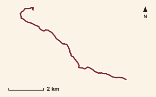
OSM route line, simplified. Branches and gaps as mapped. Trekking Trek, fort trek
Raigad Fort 2
Near Raigad, about 53.6 km from Pune centre (computed)
Mapped relation length 9.39 kmElevation Not recordedMapped in OpenStreetMap; access not checked Mapped only, not field-tested
Source: OpenStreetMap relation 15554676 (opens in a new tab) . © OpenStreetMap contributors, ODbL.
The route
- Original activity
- Trekking
- Type
- Fort trek. Trekking, Trail routes, Fort treks.
- Shape in OSM
- Linear (A→B or one-way trail)
- Surface
- Trail (OSM hiking relation; may include road segments)
- Distance
- 9.39 km. Mapped relation length (OpenStreetMap via Waymarked Trails). Can include branches and alternatives.
- Elevation
- Not recorded. No gain, loss or profile data in the source.
- Difficulty
- Not recorded
- Start and finish
- Not recorded
Access and safety
- Access
- Not recorded. That does not mean open.
- Hazards
- Not recorded. That does not mean there are none.
- Permission
- Not recorded
- Field check
- Mapped only, not field-tested. Field check recommended (geometry from source)
Data and source
- Status
- Mapped in OSM: geometry exists; ground truth not verified
- Graphic
- Route line from the OpenStreetMap relation (8 ways, fetched 7 Oct 2026), simplified for the card. Not field-checked.
- Overlap
- Variant
- Source
- OpenStreetMap via Waymarked Trails (hiking). OpenStreetMap (opens in a new tab) Waymarked Trails (opens in a new tab)
- Credit
- OpenStreetMap contributors (see relation history)
- Source checked
- 7 Oct 2026 , OSM data via Waymarked Trails API; not field-verified
- GPX
- Download GPX , built from the OpenStreetMap line (ODbL). Mapped, not field-verified.
- Route ID
- OSM-15554676 Show on the map
Route record
- Category
- HIKES & TREKS
- Type
- Trek
- Area
- Near Raigad (computed)
- City status
- OUTSIDE PUNE
- Distance
- 9.39 km
- Elevation gain
- Not recorded
- Difficulty
- Not recorded
- Technicality
- Not recorded
- Endurance
- Not recorded
- Navigation
- Not recorded
- Exposure
- Not recorded
- Remoteness
- Not recorded
- Terrain
- Trail (OSM hiking relation; may include road segments)
- Surface
- Not recorded
- Monsoon risk
- Not recorded
- Heat risk
- Not recorded
- Wildlife
- Not recorded
- Water
- Not recorded
- Mobile network
- Not recorded
- Emergency access
- Not recorded
- Beginner suitability
- Not recorded
- Start
- Not recorded
- Finish
- Not recorded
- Nearest landmark
- Not recorded
- Creator
- OpenStreetMap contributors (see relation history)
- Source
- OpenStreetMap via Waymarked Trails (hiking)
- GPX
- Yes
- GPX link
- GPX file
- Licence
- ODbL 1.0
- Reuse
- Open licence: credit OpenStreetMap contributors, share-alike
- Route date
- Not recorded
- Last verified
- 7 Oct 2026
- Data confidence
- OSM route line, desk-checked; not field-verified
- Safety notes
- Not recorded
-
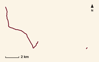
OSM route line, simplified. Branches and gaps as mapped. Trekking Trek, fort trek
Raigad to Kavlya
Near Varandha Ghat, about 50.6 km from Pune centre (computed)
Mapped relation length 9.96 kmElevation Not recordedMapped in OpenStreetMap; access not checked Mapped only, not field-tested
Source: OpenStreetMap relation 15555537 (opens in a new tab) . © OpenStreetMap contributors, ODbL.
The route
- Original activity
- Trekking
- Type
- Fort trek. Trekking, Trail routes, Fort treks.
- Shape in OSM
- Non-linear in OSM (loop or multi-branch)
- Surface
- Trail (OSM hiking relation; may include road segments)
- Distance
- 9.96 km. Mapped relation length (OpenStreetMap via Waymarked Trails). Can include branches and alternatives.
- Elevation
- Not recorded. No gain, loss or profile data in the source.
- Difficulty
- Not recorded
- Start and finish
- Not recorded
Access and safety
- Access
- Not recorded. That does not mean open.
- Hazards
- Not recorded. That does not mean there are none.
- Permission
- Not recorded
- Field check
- Mapped only, not field-tested. Field check recommended (geometry from source)
Data and source
- Status
- Mapped in OSM: geometry exists; ground truth not verified
- Graphic
- Route line from the OpenStreetMap relation (7 ways, fetched 7 Oct 2026), simplified for the card. Not field-checked.
- Source
- OpenStreetMap via Waymarked Trails (hiking). OpenStreetMap (opens in a new tab) Waymarked Trails (opens in a new tab)
- Credit
- OpenStreetMap contributors (see relation history)
- Source checked
- 7 Oct 2026 , OSM data via Waymarked Trails API; not field-verified
- GPX
- Download GPX , built from the OpenStreetMap line (ODbL). Mapped, not field-verified.
- Route ID
- OSM-15555537 Show on the map
Route record
- Category
- HIKES & TREKS
- Type
- Trek
- Area
- Near Varandha Ghat (computed)
- City status
- OUTSIDE PUNE
- Distance
- 9.96 km
- Elevation gain
- Not recorded
- Difficulty
- Not recorded
- Technicality
- Not recorded
- Endurance
- Not recorded
- Navigation
- Not recorded
- Exposure
- Not recorded
- Remoteness
- Not recorded
- Terrain
- Trail (OSM hiking relation; may include road segments)
- Surface
- Not recorded
- Monsoon risk
- Not recorded
- Heat risk
- Not recorded
- Wildlife
- Not recorded
- Water
- Not recorded
- Mobile network
- Not recorded
- Emergency access
- Not recorded
- Beginner suitability
- Not recorded
- Start
- Not recorded
- Finish
- Not recorded
- Nearest landmark
- Not recorded
- Creator
- OpenStreetMap contributors (see relation history)
- Source
- OpenStreetMap via Waymarked Trails (hiking)
- GPX
- Yes
- GPX link
- GPX file
- Licence
- ODbL 1.0
- Reuse
- Open licence: credit OpenStreetMap contributors, share-alike
- Route date
- Not recorded
- Last verified
- 7 Oct 2026
- Data confidence
- OSM route line, desk-checked; not field-verified
- Safety notes
- Not recorded
-
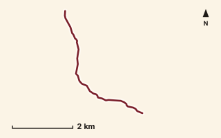
OSM route line, simplified. Branches and gaps as mapped. Trekking Trek, fort trek
Raireshwar Fort
Near Raireshwar, about 53.4 km from Pune centre (computed)
Mapped relation length 5.03 kmElevation Not recordedMapped in OpenStreetMap; access not checked Mapped only, not field-tested
Source: OpenStreetMap relation 11863855 (opens in a new tab) . © OpenStreetMap contributors, ODbL.
The route
- Original activity
- Trekking
- Type
- Fort trek. Trekking, Trail routes, Fort treks.
- Shape in OSM
- Linear (A→B or one-way trail)
- Surface
- Trail (OSM hiking relation; may include road segments)
- Distance
- 5.03 km. Mapped relation length (OpenStreetMap via Waymarked Trails). Can include branches and alternatives.
- Elevation
- Not recorded. No gain, loss or profile data in the source.
- Difficulty
- Not recorded
- Start and finish
- Not recorded
Access and safety
- Access
- Not recorded. That does not mean open.
- Hazards
- Not recorded. That does not mean there are none.
- Permission
- Not recorded
- Field check
- Mapped only, not field-tested. Field check recommended (geometry from source)
Data and source
- Status
- Mapped in OSM: geometry exists; ground truth not verified
- Graphic
- Route line from the OpenStreetMap relation (7 ways, fetched 7 Oct 2026), simplified for the card. Not field-checked.
- Overlap
- Overlap (one route's extent lies inside the other's)
- Source notes
- website creedaz.in
- Source
- OpenStreetMap via Waymarked Trails (hiking). OpenStreetMap (opens in a new tab) Waymarked Trails (opens in a new tab)
- Credit
- OpenStreetMap contributors (see relation history): relation tags reference creedaz.in
- Source checked
- 7 Oct 2026 , OSM data via Waymarked Trails API; not field-verified
- GPX
- Download GPX , built from the OpenStreetMap line (ODbL). Mapped, not field-verified.
- Route ID
- OSM-11863855 Show on the map
Route record
- Category
- HIKES & TREKS
- Type
- Trek
- Area
- Near Raireshwar (computed)
- City status
- OUTSIDE PUNE
- Distance
- 5.03 km
- Elevation gain
- Not recorded
- Difficulty
- Not recorded
- Technicality
- Not recorded
- Endurance
- Not recorded
- Navigation
- Not recorded
- Exposure
- Not recorded
- Remoteness
- Not recorded
- Terrain
- Trail (OSM hiking relation; may include road segments)
- Surface
- Not recorded
- Monsoon risk
- Not recorded
- Heat risk
- Not recorded
- Wildlife
- Not recorded
- Water
- Not recorded
- Mobile network
- Not recorded
- Emergency access
- Not recorded
- Beginner suitability
- Not recorded
- Start
- Not recorded
- Finish
- Not recorded
- Nearest landmark
- Not recorded
- Creator
- OpenStreetMap contributors (see relation history): relation tags reference creedaz.in
- Source
- OpenStreetMap via Waymarked Trails (hiking)
- GPX
- Yes
- GPX link
- GPX file
- Licence
- ODbL 1.0
- Reuse
- Open licence: credit OpenStreetMap contributors, share-alike
- Route date
- Not recorded
- Last verified
- 7 Oct 2026
- Data confidence
- OSM route line, desk-checked; not field-verified
- Safety notes
- Not recorded
-
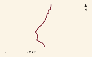
OSM route line, simplified. Branches and gaps as mapped. Hiking Hike, trail / ghat / naal route
Rairi to Raireshwar
Near Raireshwar, about 53.2 km from Pune centre (computed)
Mapped relation length 5.65 kmElevation Not recordedMapped in OpenStreetMap; access not checked Mapped only, not field-tested
Source: OpenStreetMap relation 19793784 (opens in a new tab) . © OpenStreetMap contributors, ODbL.
The route
- Original activity
- Hiking
- Type
- Trail / ghat / naal route. Hiking, Trail routes.
- Shape in OSM
- Linear (A→B or one-way trail)
- Surface
- Trail (OSM hiking relation; may include road segments)
- Distance
- 5.65 km. Mapped relation length (OpenStreetMap via Waymarked Trails). Can include branches and alternatives.
- Elevation
- Not recorded. No gain, loss or profile data in the source.
- Difficulty
- Not recorded
- Start and finish
- Not recorded
Access and safety
- Access
- Not recorded. That does not mean open.
- Hazards
- Not recorded. That does not mean there are none.
- Permission
- Not recorded
- Field check
- Mapped only, not field-tested. Field check recommended (geometry from source)
Data and source
- Status
- Mapped in OSM: geometry exists; ground truth not verified
- Graphic
- Route line from the OpenStreetMap relation (4 ways, fetched 7 Oct 2026), simplified for the card. Not field-checked.
- Overlap
- Overlap (one route's extent lies inside the other's)
- Source
- OpenStreetMap via Waymarked Trails (hiking). OpenStreetMap (opens in a new tab) Waymarked Trails (opens in a new tab)
- Credit
- OpenStreetMap contributors (see relation history)
- Source checked
- 7 Oct 2026 , OSM data via Waymarked Trails API; not field-verified
- GPX
- Download GPX , built from the OpenStreetMap line (ODbL). Mapped, not field-verified.
- Route ID
- OSM-19793784 Show on the map
Route record
- Category
- HIKES & TREKS
- Type
- Hike
- Area
- Near Raireshwar (computed)
- City status
- OUTSIDE PUNE
- Distance
- 5.65 km
- Elevation gain
- Not recorded
- Difficulty
- Not recorded
- Technicality
- Not recorded
- Endurance
- Not recorded
- Navigation
- Not recorded
- Exposure
- Not recorded
- Remoteness
- Not recorded
- Terrain
- Trail (OSM hiking relation; may include road segments)
- Surface
- Not recorded
- Monsoon risk
- Not recorded
- Heat risk
- Not recorded
- Wildlife
- Not recorded
- Water
- Not recorded
- Mobile network
- Not recorded
- Emergency access
- Not recorded
- Beginner suitability
- Not recorded
- Start
- Not recorded
- Finish
- Not recorded
- Nearest landmark
- Not recorded
- Creator
- OpenStreetMap contributors (see relation history)
- Source
- OpenStreetMap via Waymarked Trails (hiking)
- GPX
- Yes
- GPX link
- GPX file
- Licence
- ODbL 1.0
- Reuse
- Open licence: credit OpenStreetMap contributors, share-alike
- Route date
- Not recorded
- Last verified
- 7 Oct 2026
- Data confidence
- OSM route line, desk-checked; not field-verified
- Safety notes
- Not recorded
-
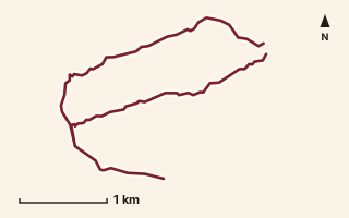
OSM route line, simplified. Branches and gaps as mapped. Trekking Trek, fort trek
Rajgad Fort
Near Rajgad, about 34.7 km from Pune centre (computed)
Mapped relation length 8.88 kmElevation Not recordedMapped in OpenStreetMap; access not checked Mapped only, not field-tested
Source: OpenStreetMap relation 15554626 (opens in a new tab) . © OpenStreetMap contributors, ODbL.
The route
- Original activity
- Trekking
- Type
- Fort trek. Trekking, Trail routes, Fort treks.
- Shape in OSM
- Linear (A→B or one-way trail)
- Surface
- Trail (OSM hiking relation; may include road segments)
- Distance
- 8.88 km. Mapped relation length (OpenStreetMap via Waymarked Trails). Can include branches and alternatives.
- Elevation
- Not recorded. No gain, loss or profile data in the source.
- Difficulty
- Not recorded
- Start and finish
- Not recorded
Access and safety
- Access
- Not recorded. That does not mean open.
- Hazards
- Not recorded. That does not mean there are none.
- Permission
- Not recorded
- Field check
- Mapped only, not field-tested. Field check recommended (geometry from source)
Data and source
- Status
- Mapped in OSM: geometry exists; ground truth not verified
- Graphic
- Route line from the OpenStreetMap relation (6 ways, fetched 7 Oct 2026), simplified for the card. Not field-checked.
- Overlap
- Overlap (one route's extent lies inside the other's)
- Source notes
- base trail + Suvela Machi/Gunjavane Darwaja alternatives
- Source
- OpenStreetMap via Waymarked Trails (hiking). OpenStreetMap (opens in a new tab) Waymarked Trails (opens in a new tab)
- Credit
- OpenStreetMap contributors (see relation history)
- Source checked
- 7 Oct 2026 , OSM data via Waymarked Trails API; not field-verified
- GPX
- Download GPX , built from the OpenStreetMap line (ODbL). Mapped, not field-verified.
- Route ID
- OSM-15554626 Show on the map
Route record
- Category
- HIKES & TREKS
- Type
- Trek
- Area
- Near Rajgad (computed)
- City status
- OUTSIDE PUNE
- Distance
- 8.88 km
- Elevation gain
- Not recorded
- Difficulty
- Not recorded
- Technicality
- Not recorded
- Endurance
- Not recorded
- Navigation
- Not recorded
- Exposure
- Not recorded
- Remoteness
- Not recorded
- Terrain
- Trail (OSM hiking relation; may include road segments)
- Surface
- Not recorded
- Monsoon risk
- Not recorded
- Heat risk
- Not recorded
- Wildlife
- Not recorded
- Water
- Not recorded
- Mobile network
- Not recorded
- Emergency access
- Not recorded
- Beginner suitability
- Not recorded
- Start
- Not recorded
- Finish
- Not recorded
- Nearest landmark
- Not recorded
- Creator
- OpenStreetMap contributors (see relation history)
- Source
- OpenStreetMap via Waymarked Trails (hiking)
- GPX
- Yes
- GPX link
- GPX file
- Licence
- ODbL 1.0
- Reuse
- Open licence: credit OpenStreetMap contributors, share-alike
- Route date
- Not recorded
- Last verified
- 7 Oct 2026
- Data confidence
- OSM route line, desk-checked; not field-verified
- Safety notes
- Not recorded
-
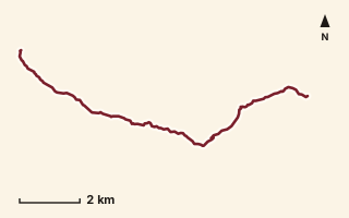
OSM route line, simplified. Branches and gaps as mapped. Trekking Trek, fort trek
Rajgad to Torna
Near Rajgad, about 36.1 km from Pune centre (computed)
Mapped relation length 12.63 kmElevation Not recordedMapped in OpenStreetMap; access not checked Mapped only, not field-tested
Source: OpenStreetMap relation 15554652 (opens in a new tab) . © OpenStreetMap contributors, ODbL.
The route
- Original activity
- Trekking
- Type
- Fort trek. Trekking, Trail routes, Fort treks.
- Shape in OSM
- Non-linear in OSM (loop or multi-branch)
- Surface
- Trail (OSM hiking relation; may include road segments)
- Distance
- 12.63 km. Mapped relation length (OpenStreetMap via Waymarked Trails). Can include branches and alternatives.
- Elevation
- Not recorded. No gain, loss or profile data in the source.
- Difficulty
- Not recorded
- Start and finish
- Not recorded
Access and safety
- Access
- Not recorded. That does not mean open.
- Hazards
- Not recorded. That does not mean there are none.
- Permission
- Not recorded
- Field check
- Mapped only, not field-tested. Field check recommended (geometry from source)
Data and source
- Status
- Mapped in OSM: geometry exists; ground truth not verified
- Graphic
- Route line from the OpenStreetMap relation (6 ways, fetched 7 Oct 2026), simplified for the card. Not field-checked.
- Overlap
- Overlap (one route's extent lies inside the other's); Race contains mapped route
- Source
- OpenStreetMap via Waymarked Trails (hiking). OpenStreetMap (opens in a new tab) Waymarked Trails (opens in a new tab)
- Credit
- OpenStreetMap contributors (see relation history)
- Source checked
- 7 Oct 2026 , OSM data via Waymarked Trails API; not field-verified
- GPX
- Download GPX , built from the OpenStreetMap line (ODbL). Mapped, not field-verified.
- Route ID
- OSM-15554652 Show on the map
Route record
- Category
- HIKES & TREKS
- Type
- Trek
- Area
- Near Rajgad (computed)
- City status
- OUTSIDE PUNE
- Distance
- 12.63 km
- Elevation gain
- Not recorded
- Difficulty
- Not recorded
- Technicality
- Not recorded
- Endurance
- Not recorded
- Navigation
- Not recorded
- Exposure
- Not recorded
- Remoteness
- Not recorded
- Terrain
- Trail (OSM hiking relation; may include road segments)
- Surface
- Not recorded
- Monsoon risk
- Not recorded
- Heat risk
- Not recorded
- Wildlife
- Not recorded
- Water
- Not recorded
- Mobile network
- Not recorded
- Emergency access
- Not recorded
- Beginner suitability
- Not recorded
- Start
- Not recorded
- Finish
- Not recorded
- Nearest landmark
- Not recorded
- Creator
- OpenStreetMap contributors (see relation history)
- Source
- OpenStreetMap via Waymarked Trails (hiking)
- GPX
- Yes
- GPX link
- GPX file
- Licence
- ODbL 1.0
- Reuse
- Open licence: credit OpenStreetMap contributors, share-alike
- Route date
- Not recorded
- Last verified
- 7 Oct 2026
- Data confidence
- OSM route line, desk-checked; not field-verified
- Safety notes
- Not recorded
-
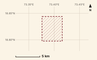
Mapped area only - not a route path. Trekking Trek, fort trek
Rajmachi Fort
Near Lonavala, about 58.8 km from Pune centre (computed)
Mapped relation length 6.96 kmElevation Not recordedMapped in OpenStreetMap; access not checked Mapped only, not field-tested Access note
Source: OpenStreetMap relation 15552720 (opens in a new tab) . © OpenStreetMap contributors, ODbL.
The route
- Original activity
- Trekking
- Type
- Fort trek. Trekking, Trail routes, Fort treks.
- Shape in OSM
- Non-linear in OSM (loop or multi-branch)
- Surface
- Trail (OSM hiking relation; may include road segments)
- Distance
- 6.96 km. Mapped relation length (OpenStreetMap via Waymarked Trails). Can include branches and alternatives.
- Elevation
- Not recorded. No gain, loss or profile data in the source.
- Difficulty
- Not recorded
- Start and finish
- Not recorded
Access and safety
- Access
- OSM tags indicate forest-department protected area
- Hazards
- Not recorded. That does not mean there are none.
- Permission
- Not recorded
- Field check
- Mapped only, not field-tested. Field check recommended (geometry from source)
Data and source
- Status
- Mapped in OSM: geometry exists; ground truth not verified
- Graphic
- Mapped area only. fetched way length 16.10 km is not within 10% of the mapped 6.96 km
- Overlap
- Overlap (one route's extent lies inside the other's)
- Source notes
- tagged protected area (forest dept); Bhairavnath & Godhaneshwar temple paths
- Source
- OpenStreetMap via Waymarked Trails (hiking). OpenStreetMap (opens in a new tab) Waymarked Trails (opens in a new tab)
- Credit
- OpenStreetMap contributors (see relation history)
- Source checked
- 7 Oct 2026 , OSM data via Waymarked Trails API; not field-verified
- GPX
- None: this record is an area, not a route line. Follow the source link to OpenStreetMap.
- Route ID
- OSM-15552720 Show on the map
Route record
- Category
- HIKES & TREKS
- Type
- Trek
- Area
- Near Lonavala (computed)
- City status
- OUTSIDE PUNE
- Distance
- 6.96 km
- Elevation gain
- Not recorded
- Difficulty
- Not recorded
- Technicality
- Not recorded
- Endurance
- Not recorded
- Navigation
- Not recorded
- Exposure
- Not recorded
- Remoteness
- Not recorded
- Terrain
- Trail (OSM hiking relation; may include road segments)
- Surface
- Not recorded
- Monsoon risk
- Not recorded
- Heat risk
- Not recorded
- Wildlife
- Not recorded
- Water
- Not recorded
- Mobile network
- Not recorded
- Emergency access
- Not recorded
- Beginner suitability
- Not recorded
- Start
- Not recorded
- Finish
- Not recorded
- Nearest landmark
- Not recorded
- Creator
- OpenStreetMap contributors (see relation history)
- Source
- OpenStreetMap via Waymarked Trails (hiking)
- GPX
- No: an area, not a route line
- GPX link
- Not recorded
- Licence
- ODbL 1.0
- Reuse
- Open licence: credit OpenStreetMap contributors, share-alike
- Route date
- Not recorded
- Last verified
- 7 Oct 2026
- Data confidence
- Mapped area only, desk-checked; not field-verified
- Safety notes
- OSM tags indicate forest-department protected area
-
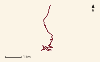
OSM route line, simplified. Branches and gaps as mapped. Hiking Hike, trail / ghat / naal route
Ranwadi to Kelad
Near Torna / Velhe, about 46.6 km from Pune centre (computed)
Mapped relation length 6.52 kmElevation Not recordedMapped in OpenStreetMap; access not checked Mapped only, not field-tested
Source: OpenStreetMap relation 15570543 (opens in a new tab) . © OpenStreetMap contributors, ODbL.
The route
- Original activity
- Hiking
- Type
- Trail / ghat / naal route. Hiking, Trail routes.
- Shape in OSM
- Linear (A→B or one-way trail)
- Surface
- Trail (OSM hiking relation; may include road segments)
- Distance
- 6.52 km. Mapped relation length (OpenStreetMap via Waymarked Trails). Can include branches and alternatives.
- Elevation
- Not recorded. No gain, loss or profile data in the source.
- Difficulty
- Not recorded
- Start and finish
- Not recorded
Access and safety
- Access
- Not recorded. That does not mean open.
- Hazards
- Not recorded. That does not mean there are none.
- Permission
- Not recorded
- Field check
- Mapped only, not field-tested. Field check recommended (geometry from source)
Data and source
- Status
- Mapped in OSM: geometry exists; ground truth not verified
- Graphic
- Route line from the OpenStreetMap relation (5 ways, fetched 7 Oct 2026), simplified for the card. Not field-checked.
- Overlap
- Overlap (one route's extent lies inside the other's)
- Source
- OpenStreetMap via Waymarked Trails (hiking). OpenStreetMap (opens in a new tab) Waymarked Trails (opens in a new tab)
- Credit
- OpenStreetMap contributors (see relation history)
- Source checked
- 7 Oct 2026 , OSM data via Waymarked Trails API; not field-verified
- GPX
- Download GPX , built from the OpenStreetMap line (ODbL). Mapped, not field-verified.
- Route ID
- OSM-15570543 Show on the map
Route record
- Category
- HIKES & TREKS
- Type
- Hike
- Area
- Near Torna / Velhe (computed)
- City status
- OUTSIDE PUNE
- Distance
- 6.52 km
- Elevation gain
- Not recorded
- Difficulty
- Not recorded
- Technicality
- Not recorded
- Endurance
- Not recorded
- Navigation
- Not recorded
- Exposure
- Not recorded
- Remoteness
- Not recorded
- Terrain
- Trail (OSM hiking relation; may include road segments)
- Surface
- Not recorded
- Monsoon risk
- Not recorded
- Heat risk
- Not recorded
- Wildlife
- Not recorded
- Water
- Not recorded
- Mobile network
- Not recorded
- Emergency access
- Not recorded
- Beginner suitability
- Not recorded
- Start
- Not recorded
- Finish
- Not recorded
- Nearest landmark
- Not recorded
- Creator
- OpenStreetMap contributors (see relation history)
- Source
- OpenStreetMap via Waymarked Trails (hiking)
- GPX
- Yes
- GPX link
- GPX file
- Licence
- ODbL 1.0
- Reuse
- Open licence: credit OpenStreetMap contributors, share-alike
- Route date
- Not recorded
- Last verified
- 7 Oct 2026
- Data confidence
- OSM route line, desk-checked; not field-verified
- Safety notes
- Not recorded
-
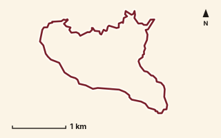
OSM route line, simplified. Branches and gaps as mapped. Hiking Hike, trail / ghat / naal route
Rayreshwar to Dhanivali Loop
Near Raireshwar, about 54 km from Pune centre (computed)
Mapped relation length 9.22 kmElevation Not recordedMapped in OpenStreetMap; access not checked Mapped only, not field-tested
Source: OpenStreetMap relation 16858301 (opens in a new tab) . © OpenStreetMap contributors, ODbL.
The route
- Original activity
- Hiking
- Type
- Trail / ghat / naal route. Hiking, Trail routes.
- Shape in OSM
- Loop (by name)
- Surface
- Trail (OSM hiking relation; may include road segments)
- Distance
- 9.22 km. Mapped relation length (OpenStreetMap via Waymarked Trails). Can include branches and alternatives.
- Elevation
- Not recorded. No gain, loss or profile data in the source.
- Difficulty
- Not recorded
- Start and finish
- Not recorded
- Places named in OSM
- Rayreshwar, Lower Dhanivali, Dhanivali
Access and safety
- Access
- Not recorded. That does not mean open.
- Hazards
- Not recorded. That does not mean there are none.
- Permission
- Not recorded
- Field check
- Mapped only, not field-tested. Field check recommended (geometry from source)
Data and source
- Status
- Mapped in OSM: geometry exists; ground truth not verified
- Graphic
- Route line from the OpenStreetMap relation (12 ways, fetched 7 Oct 2026), simplified for the card. Not field-checked.
- Overlap
- Overlap (one route's extent lies inside the other's)
- Source notes
- website_old creedaz.in
- Source
- OpenStreetMap via Waymarked Trails (hiking). OpenStreetMap (opens in a new tab) Waymarked Trails (opens in a new tab)
- Credit
- OpenStreetMap contributors (see relation history): relation tags reference creedaz.in
- Source checked
- 7 Oct 2026 , OSM data via Waymarked Trails API; not field-verified
- GPX
- Download GPX , built from the OpenStreetMap line (ODbL). Mapped, not field-verified.
- Route ID
- OSM-16858301 Show on the map
Route record
- Category
- HIKES & TREKS
- Type
- Hike
- Area
- Near Raireshwar (computed)
- City status
- OUTSIDE PUNE
- Distance
- 9.22 km
- Elevation gain
- Not recorded
- Difficulty
- Not recorded
- Technicality
- Not recorded
- Endurance
- Not recorded
- Navigation
- Not recorded
- Exposure
- Not recorded
- Remoteness
- Not recorded
- Terrain
- Trail (OSM hiking relation; may include road segments)
- Surface
- Not recorded
- Monsoon risk
- Not recorded
- Heat risk
- Not recorded
- Wildlife
- Not recorded
- Water
- Not recorded
- Mobile network
- Not recorded
- Emergency access
- Not recorded
- Beginner suitability
- Not recorded
- Start
- Not recorded
- Finish
- Not recorded
- Nearest landmark
- Rayreshwar
- Creator
- OpenStreetMap contributors (see relation history): relation tags reference creedaz.in
- Source
- OpenStreetMap via Waymarked Trails (hiking)
- GPX
- Yes
- GPX link
- GPX file
- Licence
- ODbL 1.0
- Reuse
- Open licence: credit OpenStreetMap contributors, share-alike
- Route date
- Not recorded
- Last verified
- 7 Oct 2026
- Data confidence
- OSM route line, desk-checked; not field-verified
- Safety notes
- Not recorded
-
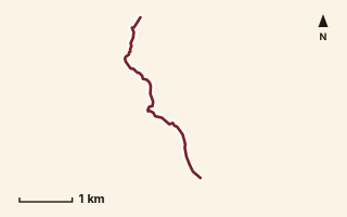
OSM route line, simplified. Branches and gaps as mapped. Hiking Hike, trail / ghat / naal route
Rayreshwar to Kankwadi
Near Raireshwar, about 54.3 km from Pune centre (computed)
Mapped relation length 4.17 kmElevation Not recordedMapped in OpenStreetMap; access not checked Mapped only, not field-tested
Source: OpenStreetMap relation 16858293 (opens in a new tab) . © OpenStreetMap contributors, ODbL.
The route
- Original activity
- Hiking
- Type
- Trail / ghat / naal route. Hiking, Trail routes.
- Shape in OSM
- Linear (A→B or one-way trail)
- Surface
- Trail (OSM hiking relation; may include road segments)
- Distance
- 4.17 km. Mapped relation length (OpenStreetMap via Waymarked Trails). Can include branches and alternatives.
- Elevation
- Not recorded. No gain, loss or profile data in the source.
- Difficulty
- Not recorded
- Start and finish
- Not recorded
- Places named in OSM
- Rayreshwar, Dharambe, Kankwadi
Access and safety
- Access
- Not recorded. That does not mean open.
- Hazards
- Not recorded. That does not mean there are none.
- Permission
- Not recorded
- Field check
- Mapped only, not field-tested. Field check recommended (geometry from source)
Data and source
- Status
- Mapped in OSM: geometry exists; ground truth not verified
- Graphic
- Route line from the OpenStreetMap relation (6 ways, fetched 7 Oct 2026), simplified for the card. Not field-checked.
- Overlap
- Overlap (one route's extent lies inside the other's)
- Source notes
- website_old creedaz.in
- Source
- OpenStreetMap via Waymarked Trails (hiking). OpenStreetMap (opens in a new tab) Waymarked Trails (opens in a new tab)
- Credit
- OpenStreetMap contributors (see relation history): relation tags reference creedaz.in
- Source checked
- 7 Oct 2026 , OSM data via Waymarked Trails API; not field-verified
- GPX
- Download GPX , built from the OpenStreetMap line (ODbL). Mapped, not field-verified.
- Route ID
- OSM-16858293 Show on the map
Route record
- Category
- HIKES & TREKS
- Type
- Hike
- Area
- Near Raireshwar (computed)
- City status
- OUTSIDE PUNE
- Distance
- 4.17 km
- Elevation gain
- Not recorded
- Difficulty
- Not recorded
- Technicality
- Not recorded
- Endurance
- Not recorded
- Navigation
- Not recorded
- Exposure
- Not recorded
- Remoteness
- Not recorded
- Terrain
- Trail (OSM hiking relation; may include road segments)
- Surface
- Not recorded
- Monsoon risk
- Not recorded
- Heat risk
- Not recorded
- Wildlife
- Not recorded
- Water
- Not recorded
- Mobile network
- Not recorded
- Emergency access
- Not recorded
- Beginner suitability
- Not recorded
- Start
- Not recorded
- Finish
- Not recorded
- Nearest landmark
- Rayreshwar
- Creator
- OpenStreetMap contributors (see relation history): relation tags reference creedaz.in
- Source
- OpenStreetMap via Waymarked Trails (hiking)
- GPX
- Yes
- GPX link
- GPX file
- Licence
- ODbL 1.0
- Reuse
- Open licence: credit OpenStreetMap contributors, share-alike
- Route date
- Not recorded
- Last verified
- 7 Oct 2026
- Data confidence
- OSM route line, desk-checked; not field-verified
- Safety notes
- Not recorded
-
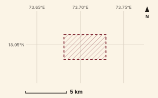
Mapped area only - not a route path. Hiking Hike, trail / ghat / naal route
Rayreshwar to Nivangan
Near Raireshwar, about 54.9 km from Pune centre (computed)
Mapped relation length 10.69 kmElevation Not recordedMapped in OpenStreetMap; access not checked Mapped only, not field-tested
Source: OpenStreetMap relation 16858305 (opens in a new tab) . © OpenStreetMap contributors, ODbL.
The route
- Original activity
- Hiking
- Type
- Trail / ghat / naal route. Hiking, Trail routes.
- Shape in OSM
- Linear (A→B or one-way trail)
- Surface
- Trail (OSM hiking relation; may include road segments)
- Distance
- 10.69 km. Mapped relation length (OpenStreetMap via Waymarked Trails). Can include branches and alternatives.
- Elevation
- Not recorded. No gain, loss or profile data in the source.
- Difficulty
- Not recorded
- Start and finish
- Not recorded
- Places named in OSM
- Rayreshwar, Dhanivali, Nivangan
Access and safety
- Access
- Not recorded. That does not mean open.
- Hazards
- Not recorded. That does not mean there are none.
- Permission
- Not recorded
- Field check
- Mapped only, not field-tested. Field check recommended (geometry from source)
Data and source
- Status
- Mapped in OSM: geometry exists; ground truth not verified
- Graphic
- Mapped area only. fetched way length 14.25 km is not within 10% of the mapped 10.69 km
- Overlap
- Overlap (one route's extent lies inside the other's)
- Source notes
- website creedaz.in
- Source
- OpenStreetMap via Waymarked Trails (hiking). OpenStreetMap (opens in a new tab) Waymarked Trails (opens in a new tab)
- Credit
- OpenStreetMap contributors (see relation history): relation tags reference creedaz.in
- Source checked
- 7 Oct 2026 , OSM data via Waymarked Trails API; not field-verified
- GPX
- None: this record is an area, not a route line. Follow the source link to OpenStreetMap.
- Route ID
- OSM-16858305 Show on the map
Route record
- Category
- HIKES & TREKS
- Type
- Hike
- Area
- Near Raireshwar (computed)
- City status
- OUTSIDE PUNE
- Distance
- 10.69 km
- Elevation gain
- Not recorded
- Difficulty
- Not recorded
- Technicality
- Not recorded
- Endurance
- Not recorded
- Navigation
- Not recorded
- Exposure
- Not recorded
- Remoteness
- Not recorded
- Terrain
- Trail (OSM hiking relation; may include road segments)
- Surface
- Not recorded
- Monsoon risk
- Not recorded
- Heat risk
- Not recorded
- Wildlife
- Not recorded
- Water
- Not recorded
- Mobile network
- Not recorded
- Emergency access
- Not recorded
- Beginner suitability
- Not recorded
- Start
- Not recorded
- Finish
- Not recorded
- Nearest landmark
- Rayreshwar
- Creator
- OpenStreetMap contributors (see relation history): relation tags reference creedaz.in
- Source
- OpenStreetMap via Waymarked Trails (hiking)
- GPX
- No: an area, not a route line
- GPX link
- Not recorded
- Licence
- ODbL 1.0
- Reuse
- Open licence: credit OpenStreetMap contributors, share-alike
- Route date
- Not recorded
- Last verified
- 7 Oct 2026
- Data confidence
- Mapped area only, desk-checked; not field-verified
- Safety notes
- Not recorded
-
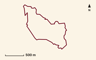
OSM route line, simplified. Branches and gaps as mapped. Hiking Hike, trail / ghat / naal route
Salthar Loop
Near Sudhagad / Pali, about 54.1 km from Pune centre (computed)
Mapped relation length 4.54 kmElevation Not recordedMapped in OpenStreetMap; access not checked Mapped only, not field-tested
Source: OpenStreetMap relation 19895145 (opens in a new tab) . © OpenStreetMap contributors, ODbL.
The route
- Original activity
- Hiking
- Type
- Trail / ghat / naal route. Hiking, Trail routes.
- Shape in OSM
- Loop (by name)
- Surface
- Trail (OSM hiking relation; may include road segments)
- Distance
- 4.54 km. Mapped relation length (OpenStreetMap via Waymarked Trails). Can include branches and alternatives.
- Elevation
- Not recorded. No gain, loss or profile data in the source.
- Difficulty
- Not recorded
- Start and finish
- Not recorded
Access and safety
- Access
- Not recorded. That does not mean open.
- Hazards
- Not recorded. That does not mean there are none.
- Permission
- Not recorded
- Field check
- Mapped only, not field-tested. Field check recommended (geometry from source)
Data and source
- Status
- Mapped in OSM: geometry exists; ground truth not verified
- Graphic
- Route line from the OpenStreetMap relation (1 ways, fetched 7 Oct 2026), simplified for the card. Not field-checked.
- Overlap
- Overlap (one route's extent lies inside the other's)
- Source notes
- website manav.in
- Source
- OpenStreetMap via Waymarked Trails (hiking). OpenStreetMap (opens in a new tab) Waymarked Trails (opens in a new tab)
- Credit
- OpenStreetMap contributors (see relation history): relation tags reference manav.in
- Source checked
- 7 Oct 2026 , OSM data via Waymarked Trails API; not field-verified
- GPX
- Download GPX , built from the OpenStreetMap line (ODbL). Mapped, not field-verified.
- Route ID
- OSM-19895145 Show on the map
Route record
- Category
- HIKES & TREKS
- Type
- Hike
- Area
- Near Sudhagad / Pali (computed)
- City status
- OUTSIDE PUNE
- Distance
- 4.54 km
- Elevation gain
- Not recorded
- Difficulty
- Not recorded
- Technicality
- Not recorded
- Endurance
- Not recorded
- Navigation
- Not recorded
- Exposure
- Not recorded
- Remoteness
- Not recorded
- Terrain
- Trail (OSM hiking relation; may include road segments)
- Surface
- Not recorded
- Monsoon risk
- Not recorded
- Heat risk
- Not recorded
- Wildlife
- Not recorded
- Water
- Not recorded
- Mobile network
- Not recorded
- Emergency access
- Not recorded
- Beginner suitability
- Not recorded
- Start
- Not recorded
- Finish
- Not recorded
- Nearest landmark
- Not recorded
- Creator
- OpenStreetMap contributors (see relation history): relation tags reference manav.in
- Source
- OpenStreetMap via Waymarked Trails (hiking)
- GPX
- Yes
- GPX link
- GPX file
- Licence
- ODbL 1.0
- Reuse
- Open licence: credit OpenStreetMap contributors, share-alike
- Route date
- Not recorded
- Last verified
- 7 Oct 2026
- Data confidence
- OSM route line, desk-checked; not field-verified
- Safety notes
- Not recorded
-
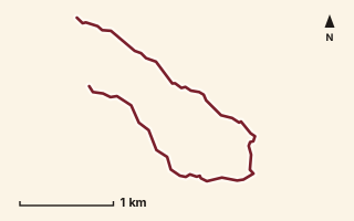
OSM route line, simplified. Branches and gaps as mapped. Hiking Hike, trail / ghat / naal route
Shiddoba Mandir
Near Junnar / Naneghat, about 82.2 km from Pune centre (computed)
Mapped relation length 5.35 kmElevation Not recordedMapped in OpenStreetMap; access not checked Mapped only, not field-tested
Source: OpenStreetMap relation 18550052 (opens in a new tab) . © OpenStreetMap contributors, ODbL.
The route
- Original activity
- Hiking
- Type
- Trail / ghat / naal route. Hiking, Trail routes.
- Shape in OSM
- Linear (A→B or one-way trail)
- Surface
- Trail (OSM hiking relation; may include road segments)
- Distance
- 5.35 km. Mapped relation length (OpenStreetMap via Waymarked Trails). Can include branches and alternatives.
- Elevation
- Not recorded. No gain, loss or profile data in the source.
- Difficulty
- Not recorded
- Start and finish
- Not recorded
Access and safety
- Access
- Not recorded. That does not mean open.
- Hazards
- Not recorded. That does not mean there are none.
- Permission
- Not recorded
- Field check
- Mapped only, not field-tested. Field check recommended (geometry from source)
Data and source
- Status
- Mapped in OSM: geometry exists; ground truth not verified
- Graphic
- Route line from the OpenStreetMap relation (1 ways, fetched 7 Oct 2026), simplified for the card. Not field-checked.
- Overlap
- Overlap (one route's extent lies inside the other's)
- Source notes
- website manav.in
- Source
- OpenStreetMap via Waymarked Trails (hiking). OpenStreetMap (opens in a new tab) Waymarked Trails (opens in a new tab)
- Credit
- OpenStreetMap contributors (see relation history): relation tags reference manav.in
- Source checked
- 7 Oct 2026 , OSM data via Waymarked Trails API; not field-verified
- GPX
- Download GPX , built from the OpenStreetMap line (ODbL). Mapped, not field-verified.
- Route ID
- OSM-18550052 Show on the map
Route record
- Category
- HIKES & TREKS
- Type
- Hike
- Area
- Near Junnar / Naneghat (computed)
- City status
- OUTSIDE PUNE
- Distance
- 5.35 km
- Elevation gain
- Not recorded
- Difficulty
- Not recorded
- Technicality
- Not recorded
- Endurance
- Not recorded
- Navigation
- Not recorded
- Exposure
- Not recorded
- Remoteness
- Not recorded
- Terrain
- Trail (OSM hiking relation; may include road segments)
- Surface
- Not recorded
- Monsoon risk
- Not recorded
- Heat risk
- Not recorded
- Wildlife
- Not recorded
- Water
- Not recorded
- Mobile network
- Not recorded
- Emergency access
- Not recorded
- Beginner suitability
- Not recorded
- Start
- Not recorded
- Finish
- Not recorded
- Nearest landmark
- Not recorded
- Creator
- OpenStreetMap contributors (see relation history): relation tags reference manav.in
- Source
- OpenStreetMap via Waymarked Trails (hiking)
- GPX
- Yes
- GPX link
- GPX file
- Licence
- ODbL 1.0
- Reuse
- Open licence: credit OpenStreetMap contributors, share-alike
- Route date
- Not recorded
- Last verified
- 7 Oct 2026
- Data confidence
- OSM route line, desk-checked; not field-verified
- Safety notes
- Not recorded
-
Mapped area only - not a route path. Hiking Hike, trail / ghat / naal route
Shidobacha Daar
Near Ahupe / Siddhagad, about 80.6 km from Pune centre (computed)
Mapped relation length 4.92 kmElevation Not recordedMapped in OpenStreetMap; access not checked Mapped only, not field-tested
Source: OpenStreetMap relation 18550131 (opens in a new tab) . © OpenStreetMap contributors, ODbL.
The route
- Original activity
- Hiking
- Type
- Trail / ghat / naal route. Hiking, Trail routes.
- Shape in OSM
- Linear (A→B or one-way trail)
- Surface
- Trail (OSM hiking relation; may include road segments)
- Distance
- 4.92 km. Mapped relation length (OpenStreetMap via Waymarked Trails). Can include branches and alternatives.
- Elevation
- Not recorded. No gain, loss or profile data in the source.
- Difficulty
- Not recorded
- Start and finish
- Not recorded
Access and safety
- Access
- Not recorded. That does not mean open.
- Hazards
- Not recorded. That does not mean there are none.
- Permission
- Not recorded
- Field check
- Mapped only, not field-tested. Field check recommended (geometry from source)
Data and source
- Status
- Mapped in OSM: geometry exists; ground truth not verified
- Graphic
- Mapped area only. relation download failed after retries; geometry not available
- Overlap
- Overlap (one route's extent lies inside the other's)
- Source notes
- website manav.in
- Source
- OpenStreetMap via Waymarked Trails (hiking). OpenStreetMap (opens in a new tab) Waymarked Trails (opens in a new tab)
- Credit
- OpenStreetMap contributors (see relation history): relation tags reference manav.in
- Source checked
- 7 Oct 2026 , OSM data via Waymarked Trails API; not field-verified
- GPX
- None: this record is an area, not a route line. Follow the source link to OpenStreetMap.
- Route ID
- OSM-18550131 Show on the map
Route record
- Category
- HIKES & TREKS
- Type
- Hike
- Area
- Near Ahupe / Siddhagad (computed)
- City status
- OUTSIDE PUNE
- Distance
- 4.92 km
- Elevation gain
- Not recorded
- Difficulty
- Not recorded
- Technicality
- Not recorded
- Endurance
- Not recorded
- Navigation
- Not recorded
- Exposure
- Not recorded
- Remoteness
- Not recorded
- Terrain
- Trail (OSM hiking relation; may include road segments)
- Surface
- Not recorded
- Monsoon risk
- Not recorded
- Heat risk
- Not recorded
- Wildlife
- Not recorded
- Water
- Not recorded
- Mobile network
- Not recorded
- Emergency access
- Not recorded
- Beginner suitability
- Not recorded
- Start
- Not recorded
- Finish
- Not recorded
- Nearest landmark
- Not recorded
- Creator
- OpenStreetMap contributors (see relation history): relation tags reference manav.in
- Source
- OpenStreetMap via Waymarked Trails (hiking)
- GPX
- No: an area, not a route line
- GPX link
- Not recorded
- Licence
- ODbL 1.0
- Reuse
- Open licence: credit OpenStreetMap contributors, share-alike
- Route date
- Not recorded
- Last verified
- 7 Oct 2026
- Data confidence
- Mapped area only, desk-checked; not field-verified
- Safety notes
- Not recorded
-
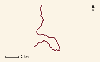
OSM route line, simplified. Branches and gaps as mapped. Hiking Hike, trail / ghat / naal route
Shilachi Vaat
Near Karjat, about 63.1 km from Pune centre (computed)
Mapped relation length 17.62 kmElevation Not recordedMapped in OpenStreetMap; access not checked Mapped only, not field-tested
Source: OpenStreetMap relation 18497193 (opens in a new tab) . © OpenStreetMap contributors, ODbL.
The route
- Original activity
- Hiking
- Type
- Trail / ghat / naal route. Hiking, Trail routes.
- Shape in OSM
- Linear (A→B or one-way trail)
- Surface
- Trail (OSM hiking relation; may include road segments)
- Distance
- 17.62 km. Mapped relation length (OpenStreetMap via Waymarked Trails). Can include branches and alternatives.
- Elevation
- Not recorded. No gain, loss or profile data in the source.
- Difficulty
- Not recorded
- Start and finish
- Not recorded
- Places named in OSM
- Potal, Dhak village, Dhak Bahiri Caves, Mangaon
Access and safety
- Access
- Not recorded. That does not mean open.
- Hazards
- Not recorded. That does not mean there are none.
- Permission
- Not recorded
- Field check
- Mapped only, not field-tested. Field check recommended (geometry from source)
Data and source
- Status
- Mapped in OSM: geometry exists; ground truth not verified
- Graphic
- Route line from the OpenStreetMap relation (11 ways, fetched 7 Oct 2026), simplified for the card. Not field-checked.
- Overlap
- Overlap (one route's extent lies inside the other's)
- Source notes
- Potal-Mangaon via Dhak village & Dhak Bahiri caves
- Source
- OpenStreetMap via Waymarked Trails (hiking). OpenStreetMap (opens in a new tab) Waymarked Trails (opens in a new tab)
- Credit
- OpenStreetMap contributors (see relation history)
- Source checked
- 7 Oct 2026 , OSM data via Waymarked Trails API; not field-verified
- GPX
- Download GPX , built from the OpenStreetMap line (ODbL). Mapped, not field-verified.
- Route ID
- OSM-18497193 Show on the map
Route record
- Category
- HIKES & TREKS
- Type
- Hike
- Area
- Near Karjat (computed)
- City status
- OUTSIDE PUNE
- Distance
- 17.62 km
- Elevation gain
- Not recorded
- Difficulty
- Not recorded
- Technicality
- Not recorded
- Endurance
- Not recorded
- Navigation
- Not recorded
- Exposure
- Not recorded
- Remoteness
- Not recorded
- Terrain
- Trail (OSM hiking relation; may include road segments)
- Surface
- Not recorded
- Monsoon risk
- Not recorded
- Heat risk
- Not recorded
- Wildlife
- Not recorded
- Water
- Not recorded
- Mobile network
- Not recorded
- Emergency access
- Not recorded
- Beginner suitability
- Not recorded
- Start
- Not recorded
- Finish
- Not recorded
- Nearest landmark
- Potal
- Creator
- OpenStreetMap contributors (see relation history)
- Source
- OpenStreetMap via Waymarked Trails (hiking)
- GPX
- Yes
- GPX link
- GPX file
- Licence
- ODbL 1.0
- Reuse
- Open licence: credit OpenStreetMap contributors, share-alike
- Route date
- Not recorded
- Last verified
- 7 Oct 2026
- Data confidence
- OSM route line, desk-checked; not field-verified
- Safety notes
- Not recorded
-
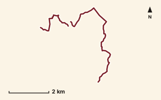
OSM route line, simplified. Branches and gaps as mapped. Hiking Hike, trail / ghat / naal route
Shivla to Chinchavli
Near Matheran, about 88.3 km from Pune centre (computed)
Mapped relation length 9.27 kmElevation Not recordedMapped in OpenStreetMap; access not checked Mapped only, not field-tested
Source: OpenStreetMap relation 15567409 (opens in a new tab) . © OpenStreetMap contributors, ODbL.
The route
- Original activity
- Hiking
- Type
- Trail / ghat / naal route. Hiking, Trail routes.
- Shape in OSM
- Non-linear in OSM (loop or multi-branch)
- Surface
- Trail (OSM hiking relation; may include road segments)
- Distance
- 9.27 km. Mapped relation length (OpenStreetMap via Waymarked Trails). Can include branches and alternatives.
- Elevation
- Not recorded. No gain, loss or profile data in the source.
- Difficulty
- Not recorded
- Start and finish
- Not recorded
Access and safety
- Access
- Not recorded. That does not mean open.
- Hazards
- Not recorded. That does not mean there are none.
- Permission
- Not recorded
- Field check
- Mapped only, not field-tested. Field check recommended (geometry from source)
Data and source
- Status
- Mapped in OSM: geometry exists; ground truth not verified
- Graphic
- Route line from the OpenStreetMap relation (17 ways, fetched 7 Oct 2026), simplified for the card. Not field-checked.
- Source
- OpenStreetMap via Waymarked Trails (hiking). OpenStreetMap (opens in a new tab) Waymarked Trails (opens in a new tab)
- Credit
- OpenStreetMap contributors (see relation history)
- Source checked
- 7 Oct 2026 , OSM data via Waymarked Trails API; not field-verified
- GPX
- Download GPX , built from the OpenStreetMap line (ODbL). Mapped, not field-verified.
- Route ID
- OSM-15567409 Show on the map
Route record
- Category
- HIKES & TREKS
- Type
- Hike
- Area
- Near Matheran (computed)
- City status
- OUTSIDE PUNE
- Distance
- 9.27 km
- Elevation gain
- Not recorded
- Difficulty
- Not recorded
- Technicality
- Not recorded
- Endurance
- Not recorded
- Navigation
- Not recorded
- Exposure
- Not recorded
- Remoteness
- Not recorded
- Terrain
- Trail (OSM hiking relation; may include road segments)
- Surface
- Not recorded
- Monsoon risk
- Not recorded
- Heat risk
- Not recorded
- Wildlife
- Not recorded
- Water
- Not recorded
- Mobile network
- Not recorded
- Emergency access
- Not recorded
- Beginner suitability
- Not recorded
- Start
- Not recorded
- Finish
- Not recorded
- Nearest landmark
- Not recorded
- Creator
- OpenStreetMap contributors (see relation history)
- Source
- OpenStreetMap via Waymarked Trails (hiking)
- GPX
- Yes
- GPX link
- GPX file
- Licence
- ODbL 1.0
- Reuse
- Open licence: credit OpenStreetMap contributors, share-alike
- Route date
- Not recorded
- Last verified
- 7 Oct 2026
- Data confidence
- OSM route line, desk-checked; not field-verified
- Safety notes
- Not recorded
-
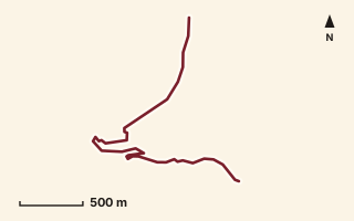
OSM route line, simplified. Branches and gaps as mapped. Trekking Trek, fort trek
Shivneri Fort
Near Malshej, about 75.1 km from Pune centre (computed)
Mapped relation length 3.18 kmElevation Not recordedMapped in OpenStreetMap; access not checked Mapped only, not field-tested
Source: OpenStreetMap relation 15552592 (opens in a new tab) . © OpenStreetMap contributors, ODbL.
The route
- Original activity
- Trekking
- Type
- Fort trek. Trekking, Trail routes, Fort treks.
- Shape in OSM
- Linear (A→B or one-way trail)
- Surface
- Trail (OSM hiking relation; may include road segments)
- Distance
- 3.18 km. Mapped relation length (OpenStreetMap via Waymarked Trails). Can include branches and alternatives.
- Elevation
- Not recorded. No gain, loss or profile data in the source.
- Difficulty
- Not recorded
- Start and finish
- Not recorded
Access and safety
- Access
- Not recorded. That does not mean open.
- Hazards
- Not recorded. That does not mean there are none.
- Permission
- Not recorded
- Field check
- Mapped only, not field-tested. Field check recommended (geometry from source)
Data and source
- Status
- Mapped in OSM: geometry exists; ground truth not verified
- Graphic
- Route line from the OpenStreetMap relation (4 ways, fetched 7 Oct 2026), simplified for the card. Not field-checked.
- Source
- OpenStreetMap via Waymarked Trails (hiking). OpenStreetMap (opens in a new tab) Waymarked Trails (opens in a new tab)
- Credit
- OpenStreetMap contributors (see relation history)
- Source checked
- 7 Oct 2026 , OSM data via Waymarked Trails API; not field-verified
- GPX
- Download GPX , built from the OpenStreetMap line (ODbL). Mapped, not field-verified.
- Route ID
- OSM-15552592 Show on the map
Route record
- Category
- HIKES & TREKS
- Type
- Trek
- Area
- Near Malshej (computed)
- City status
- OUTSIDE PUNE
- Distance
- 3.18 km
- Elevation gain
- Not recorded
- Difficulty
- Not recorded
- Technicality
- Not recorded
- Endurance
- Not recorded
- Navigation
- Not recorded
- Exposure
- Not recorded
- Remoteness
- Not recorded
- Terrain
- Trail (OSM hiking relation; may include road segments)
- Surface
- Not recorded
- Monsoon risk
- Not recorded
- Heat risk
- Not recorded
- Wildlife
- Not recorded
- Water
- Not recorded
- Mobile network
- Not recorded
- Emergency access
- Not recorded
- Beginner suitability
- Not recorded
- Start
- Not recorded
- Finish
- Not recorded
- Nearest landmark
- Not recorded
- Creator
- OpenStreetMap contributors (see relation history)
- Source
- OpenStreetMap via Waymarked Trails (hiking)
- GPX
- Yes
- GPX link
- GPX file
- Licence
- ODbL 1.0
- Reuse
- Open licence: credit OpenStreetMap contributors, share-alike
- Route date
- Not recorded
- Last verified
- 7 Oct 2026
- Data confidence
- OSM route line, desk-checked; not field-verified
- Safety notes
- Not recorded
-
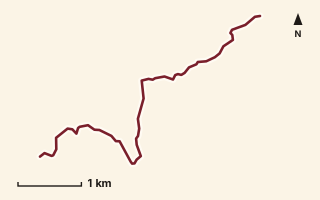
OSM route line, simplified. Branches and gaps as mapped. Trekking Trek, fort trek
Siddhagad to Ahupe
Near Ahupe / Siddhagad, about 78.9 km from Pune centre (computed)
Mapped relation length 6.1 kmElevation Not recordedMapped in OpenStreetMap; access not checked Mapped only, not field-tested
Source: OpenStreetMap relation 15567455 (opens in a new tab) . © OpenStreetMap contributors, ODbL.
The route
- Original activity
- Trekking
- Type
- Fort trek. Trekking, Trail routes, Fort treks.
- Shape in OSM
- Linear (A→B or one-way trail)
- Surface
- Trail (OSM hiking relation; may include road segments)
- Distance
- 6.1 km. Mapped relation length (OpenStreetMap via Waymarked Trails). Can include branches and alternatives.
- Elevation
- Not recorded. No gain, loss or profile data in the source.
- Difficulty
- Not recorded
- Start and finish
- Not recorded
Access and safety
- Access
- Not recorded. That does not mean open.
- Hazards
- Not recorded. That does not mean there are none.
- Permission
- Not recorded
- Field check
- Mapped only, not field-tested. Field check recommended (geometry from source)
Data and source
- Status
- Mapped in OSM: geometry exists; ground truth not verified
- Graphic
- Route line from the OpenStreetMap relation (6 ways, fetched 7 Oct 2026), simplified for the card. Not field-checked.
- Overlap
- Overlap (one route's extent lies inside the other's)
- Source
- OpenStreetMap via Waymarked Trails (hiking). OpenStreetMap (opens in a new tab) Waymarked Trails (opens in a new tab)
- Credit
- OpenStreetMap contributors (see relation history)
- Source checked
- 7 Oct 2026 , OSM data via Waymarked Trails API; not field-verified
- GPX
- Download GPX , built from the OpenStreetMap line (ODbL). Mapped, not field-verified.
- Route ID
- OSM-15567455 Show on the map
Route record
- Category
- HIKES & TREKS
- Type
- Trek
- Area
- Near Ahupe / Siddhagad (computed)
- City status
- OUTSIDE PUNE
- Distance
- 6.1 km
- Elevation gain
- Not recorded
- Difficulty
- Not recorded
- Technicality
- Not recorded
- Endurance
- Not recorded
- Navigation
- Not recorded
- Exposure
- Not recorded
- Remoteness
- Not recorded
- Terrain
- Trail (OSM hiking relation; may include road segments)
- Surface
- Not recorded
- Monsoon risk
- Not recorded
- Heat risk
- Not recorded
- Wildlife
- Not recorded
- Water
- Not recorded
- Mobile network
- Not recorded
- Emergency access
- Not recorded
- Beginner suitability
- Not recorded
- Start
- Not recorded
- Finish
- Not recorded
- Nearest landmark
- Not recorded
- Creator
- OpenStreetMap contributors (see relation history)
- Source
- OpenStreetMap via Waymarked Trails (hiking)
- GPX
- Yes
- GPX link
- GPX file
- Licence
- ODbL 1.0
- Reuse
- Open licence: credit OpenStreetMap contributors, share-alike
- Route date
- Not recorded
- Last verified
- 7 Oct 2026
- Data confidence
- OSM route line, desk-checked; not field-verified
- Safety notes
- Not recorded
-
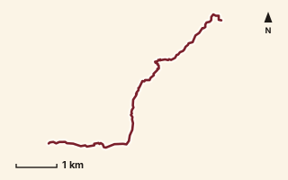
OSM route line, simplified. Branches and gaps as mapped. Hiking Hike, trail / ghat / naal route
Singapur Naal
Near Raigad, about 47.9 km from Pune centre (computed)
Mapped relation length 7.32 kmElevation Not recordedMapped in OpenStreetMap; access not checked Mapped only, not field-tested
Source: OpenStreetMap relation 19792985 (opens in a new tab) . © OpenStreetMap contributors, ODbL.
The route
- Original activity
- Hiking
- Type
- Trail / ghat / naal route. Hiking, Trail routes.
- Shape in OSM
- Linear (A→B or one-way trail)
- Surface
- Trail (OSM hiking relation; may include road segments)
- Distance
- 7.32 km. Mapped relation length (OpenStreetMap via Waymarked Trails). Can include branches and alternatives.
- Elevation
- Not recorded. No gain, loss or profile data in the source.
- Difficulty
- Not recorded
- Start and finish
- Not recorded
Access and safety
- Access
- Not recorded. That does not mean open.
- Hazards
- Not recorded. That does not mean there are none.
- Permission
- Not recorded
- Field check
- Mapped only, not field-tested. Field check recommended (geometry from source)
Data and source
- Status
- Mapped in OSM: geometry exists; ground truth not verified
- Graphic
- Route line from the OpenStreetMap relation (5 ways, fetched 7 Oct 2026), simplified for the card. Not field-checked.
- Overlap
- Overlap (one route's extent lies inside the other's)
- Source
- OpenStreetMap via Waymarked Trails (hiking). OpenStreetMap (opens in a new tab) Waymarked Trails (opens in a new tab)
- Credit
- OpenStreetMap contributors (see relation history)
- Source checked
- 7 Oct 2026 , OSM data via Waymarked Trails API; not field-verified
- GPX
- Download GPX , built from the OpenStreetMap line (ODbL). Mapped, not field-verified.
- Route ID
- OSM-19792985 Show on the map
Route record
- Category
- HIKES & TREKS
- Type
- Hike
- Area
- Near Raigad (computed)
- City status
- OUTSIDE PUNE
- Distance
- 7.32 km
- Elevation gain
- Not recorded
- Difficulty
- Not recorded
- Technicality
- Not recorded
- Endurance
- Not recorded
- Navigation
- Not recorded
- Exposure
- Not recorded
- Remoteness
- Not recorded
- Terrain
- Trail (OSM hiking relation; may include road segments)
- Surface
- Not recorded
- Monsoon risk
- Not recorded
- Heat risk
- Not recorded
- Wildlife
- Not recorded
- Water
- Not recorded
- Mobile network
- Not recorded
- Emergency access
- Not recorded
- Beginner suitability
- Not recorded
- Start
- Not recorded
- Finish
- Not recorded
- Nearest landmark
- Not recorded
- Creator
- OpenStreetMap contributors (see relation history)
- Source
- OpenStreetMap via Waymarked Trails (hiking)
- GPX
- Yes
- GPX link
- GPX file
- Licence
- ODbL 1.0
- Reuse
- Open licence: credit OpenStreetMap contributors, share-alike
- Route date
- Not recorded
- Last verified
- 7 Oct 2026
- Data confidence
- OSM route line, desk-checked; not field-verified
- Safety notes
- Not recorded
-
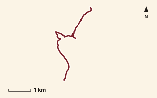
OSM route line, simplified. Branches and gaps as mapped. Trekking Trek, fort trek
Sinhagad
Near Sinhagad, about 20.3 km from Pune centre (computed)
Mapped relation length 5.85 kmElevation Not recordedMapped in OpenStreetMap; access not checked Mapped only, not field-tested
Source: OpenStreetMap relation 11855988 (opens in a new tab) . © OpenStreetMap contributors, ODbL.
The route
- Original activity
- Trekking
- Type
- Fort trek. Trekking, Trail routes, Fort treks.
- Shape in OSM
- Linear (A→B or one-way trail)
- Surface
- Trail (OSM hiking relation; may include road segments)
- Distance
- 5.85 km. Mapped relation length (OpenStreetMap via Waymarked Trails). Can include branches and alternatives.
- Elevation
- Not recorded. No gain, loss or profile data in the source.
- Difficulty
- Not recorded
- Start and finish
- Not recorded
Access and safety
- Access
- Not recorded. That does not mean open.
- Hazards
- Not recorded. That does not mean there are none.
- Permission
- Not recorded
- Field check
- Mapped only, not field-tested. Field check recommended (geometry from source)
Data and source
- Status
- Mapped in OSM: geometry exists; ground truth not verified
- Graphic
- Route line from the OpenStreetMap relation (9 ways, fetched 7 Oct 2026), simplified for the card. Not field-checked.
- Overlap
- Overlap (one route's extent lies inside the other's)
- Source notes
- Sinhagad Trail + ghat road segment
- Source
- OpenStreetMap via Waymarked Trails (hiking). OpenStreetMap (opens in a new tab) Waymarked Trails (opens in a new tab)
- Credit
- OpenStreetMap contributors (see relation history)
- Source checked
- 7 Oct 2026 , OSM data via Waymarked Trails API; not field-verified
- GPX
- Download GPX , built from the OpenStreetMap line (ODbL). Mapped, not field-verified.
- Route ID
- OSM-11855988 Show on the map
Route record
- Category
- HIKES & TREKS
- Type
- Trek
- Area
- Near Sinhagad (computed)
- City status
- OUTSIDE PUNE
- Distance
- 5.85 km
- Elevation gain
- Not recorded
- Difficulty
- Not recorded
- Technicality
- Not recorded
- Endurance
- Not recorded
- Navigation
- Not recorded
- Exposure
- Not recorded
- Remoteness
- Not recorded
- Terrain
- Trail (OSM hiking relation; may include road segments)
- Surface
- Not recorded
- Monsoon risk
- Not recorded
- Heat risk
- Not recorded
- Wildlife
- Not recorded
- Water
- Not recorded
- Mobile network
- Not recorded
- Emergency access
- Not recorded
- Beginner suitability
- Not recorded
- Start
- Not recorded
- Finish
- Not recorded
- Nearest landmark
- Not recorded
- Creator
- OpenStreetMap contributors (see relation history)
- Source
- OpenStreetMap via Waymarked Trails (hiking)
- GPX
- Yes
- GPX link
- GPX file
- Licence
- ODbL 1.0
- Reuse
- Open licence: credit OpenStreetMap contributors, share-alike
- Route date
- Not recorded
- Last verified
- 7 Oct 2026
- Data confidence
- OSM route line, desk-checked; not field-verified
- Safety notes
- Not recorded
-
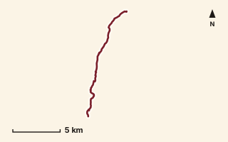
OSM route line, simplified. Branches and gaps as mapped. Trekking Trek, fort trek
Sinhagad to Rajgad
Near Sinhagad, about 26.6 km from Pune centre (computed)
Mapped relation length 14.12 kmElevation Not recordedMapped in OpenStreetMap; access not checked Mapped only, not field-tested
Source: OpenStreetMap relation 15554674 (opens in a new tab) . © OpenStreetMap contributors, ODbL.
The route
- Original activity
- Trekking
- Type
- Fort trek. Trekking, Trail routes, Fort treks.
- Shape in OSM
- Linear (A→B or one-way trail)
- Surface
- Trail (OSM hiking relation; may include road segments)
- Distance
- 14.12 km. Mapped relation length (OpenStreetMap via Waymarked Trails). Can include branches and alternatives.
- Elevation
- Not recorded. No gain, loss or profile data in the source.
- Difficulty
- Not recorded
- Start and finish
- Not recorded
Access and safety
- Access
- Not recorded. That does not mean open.
- Hazards
- Not recorded. That does not mean there are none.
- Permission
- Not recorded
- Field check
- Mapped only, not field-tested. Field check recommended (geometry from source)
Data and source
- Status
- Mapped in OSM: geometry exists; ground truth not verified
- Graphic
- Route line from the OpenStreetMap relation (9 ways, fetched 7 Oct 2026), simplified for the card. Not field-checked.
- Overlap
- Overlap (one route's extent lies inside the other's); Same corridor: conflicting distance
- Source
- OpenStreetMap via Waymarked Trails (hiking). OpenStreetMap (opens in a new tab) Waymarked Trails (opens in a new tab)
- Credit
- OpenStreetMap contributors (see relation history)
- Source checked
- 7 Oct 2026 , OSM data via Waymarked Trails API; not field-verified
- GPX
- Download GPX , built from the OpenStreetMap line (ODbL). Mapped, not field-verified.
- Route ID
- OSM-15554674 Show on the map
Route record
- Category
- HIKES & TREKS
- Type
- Trek
- Area
- Near Sinhagad (computed)
- City status
- OUTSIDE PUNE
- Distance
- 14.12 km
- Elevation gain
- Not recorded
- Difficulty
- Not recorded
- Technicality
- Not recorded
- Endurance
- Not recorded
- Navigation
- Not recorded
- Exposure
- Not recorded
- Remoteness
- Not recorded
- Terrain
- Trail (OSM hiking relation; may include road segments)
- Surface
- Not recorded
- Monsoon risk
- Not recorded
- Heat risk
- Not recorded
- Wildlife
- Not recorded
- Water
- Not recorded
- Mobile network
- Not recorded
- Emergency access
- Not recorded
- Beginner suitability
- Not recorded
- Start
- Not recorded
- Finish
- Not recorded
- Nearest landmark
- Not recorded
- Creator
- OpenStreetMap contributors (see relation history)
- Source
- OpenStreetMap via Waymarked Trails (hiking)
- GPX
- Yes
- GPX link
- GPX file
- Licence
- ODbL 1.0
- Reuse
- Open licence: credit OpenStreetMap contributors, share-alike
- Route date
- Not recorded
- Last verified
- 7 Oct 2026
- Data confidence
- OSM route line, desk-checked; not field-verified
- Safety notes
- Not recorded
-
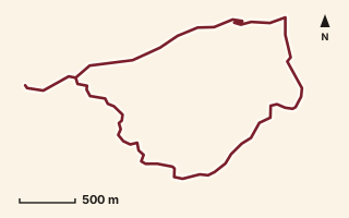
OSM route line, simplified. Branches and gaps as mapped. Hiking Hike, trail / ghat / naal route
Sondaand and Kurwande Ghat
Near Lonavala, about 58.1 km from Pune centre (computed)
Mapped relation length 7.21 kmElevation Not recordedMapped in OpenStreetMap; access not checked Mapped only, not field-tested
Source: OpenStreetMap relation 19800002 (opens in a new tab) . © OpenStreetMap contributors, ODbL.
The route
- Original activity
- Hiking
- Type
- Trail / ghat / naal route. Hiking, Trail routes.
- Shape in OSM
- Linear (A→B or one-way trail)
- Surface
- Trail (OSM hiking relation; may include road segments)
- Distance
- 7.21 km. Mapped relation length (OpenStreetMap via Waymarked Trails). Can include branches and alternatives.
- Elevation
- Not recorded. No gain, loss or profile data in the source.
- Difficulty
- Not recorded
- Start and finish
- Not recorded
Access and safety
- Access
- Not recorded. That does not mean open.
- Hazards
- Not recorded. That does not mean there are none.
- Permission
- Not recorded
- Field check
- Mapped only, not field-tested. Field check recommended (geometry from source)
Data and source
- Status
- Mapped in OSM: geometry exists; ground truth not verified
- Graphic
- Route line from the OpenStreetMap relation (8 ways, fetched 7 Oct 2026), simplified for the card. Not field-checked.
- Overlap
- Overlap (one route's extent lies inside the other's)
- Source
- OpenStreetMap via Waymarked Trails (hiking). OpenStreetMap (opens in a new tab) Waymarked Trails (opens in a new tab)
- Credit
- OpenStreetMap contributors (see relation history)
- Source checked
- 7 Oct 2026 , OSM data via Waymarked Trails API; not field-verified
- GPX
- Download GPX , built from the OpenStreetMap line (ODbL). Mapped, not field-verified.
- Route ID
- OSM-19800002 Show on the map
Route record
- Category
- HIKES & TREKS
- Type
- Hike
- Area
- Near Lonavala (computed)
- City status
- OUTSIDE PUNE
- Distance
- 7.21 km
- Elevation gain
- Not recorded
- Difficulty
- Not recorded
- Technicality
- Not recorded
- Endurance
- Not recorded
- Navigation
- Not recorded
- Exposure
- Not recorded
- Remoteness
- Not recorded
- Terrain
- Trail (OSM hiking relation; may include road segments)
- Surface
- Not recorded
- Monsoon risk
- Not recorded
- Heat risk
- Not recorded
- Wildlife
- Not recorded
- Water
- Not recorded
- Mobile network
- Not recorded
- Emergency access
- Not recorded
- Beginner suitability
- Not recorded
- Start
- Not recorded
- Finish
- Not recorded
- Nearest landmark
- Not recorded
- Creator
- OpenStreetMap contributors (see relation history)
- Source
- OpenStreetMap via Waymarked Trails (hiking)
- GPX
- Yes
- GPX link
- GPX file
- Licence
- ODbL 1.0
- Reuse
- Open licence: credit OpenStreetMap contributors, share-alike
- Route date
- Not recorded
- Last verified
- 7 Oct 2026
- Data confidence
- OSM route line, desk-checked; not field-verified
- Safety notes
- Not recorded
-
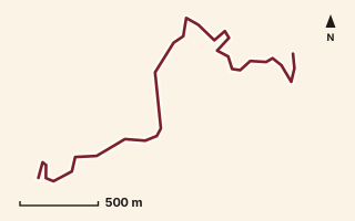
OSM route line, simplified. Branches and gaps as mapped. Trekking Trek, fort trek
Sondai Fort
Near Matheran, about 75.9 km from Pune centre (computed)
Mapped relation length 3.25 kmElevation Not recordedMapped in OpenStreetMap; access not checked Mapped only, not field-tested
Source: OpenStreetMap relation 15552721 (opens in a new tab) . © OpenStreetMap contributors, ODbL.
The route
- Original activity
- Trekking
- Type
- Fort trek. Trekking, Trail routes, Fort treks.
- Shape in OSM
- Linear (A→B or one-way trail)
- Surface
- Trail (OSM hiking relation; may include road segments)
- Distance
- 3.25 km. Mapped relation length (OpenStreetMap via Waymarked Trails). Can include branches and alternatives.
- Elevation
- Not recorded. No gain, loss or profile data in the source.
- Difficulty
- Not recorded
- Start and finish
- Not recorded
Access and safety
- Access
- Not recorded. That does not mean open.
- Hazards
- Not recorded. That does not mean there are none.
- Permission
- Not recorded
- Field check
- Mapped only, not field-tested. Field check recommended (geometry from source)
Data and source
- Status
- Mapped in OSM: geometry exists; ground truth not verified
- Graphic
- Route line from the OpenStreetMap relation (4 ways, fetched 7 Oct 2026), simplified for the card. Not field-checked.
- Overlap
- Overlap (one route's extent lies inside the other's)
- Source
- OpenStreetMap via Waymarked Trails (hiking). OpenStreetMap (opens in a new tab) Waymarked Trails (opens in a new tab)
- Credit
- OpenStreetMap contributors (see relation history)
- Source checked
- 7 Oct 2026 , OSM data via Waymarked Trails API; not field-verified
- GPX
- Download GPX , built from the OpenStreetMap line (ODbL). Mapped, not field-verified.
- Route ID
- OSM-15552721 Show on the map
Route record
- Category
- HIKES & TREKS
- Type
- Trek
- Area
- Near Matheran (computed)
- City status
- OUTSIDE PUNE
- Distance
- 3.25 km
- Elevation gain
- Not recorded
- Difficulty
- Not recorded
- Technicality
- Not recorded
- Endurance
- Not recorded
- Navigation
- Not recorded
- Exposure
- Not recorded
- Remoteness
- Not recorded
- Terrain
- Trail (OSM hiking relation; may include road segments)
- Surface
- Not recorded
- Monsoon risk
- Not recorded
- Heat risk
- Not recorded
- Wildlife
- Not recorded
- Water
- Not recorded
- Mobile network
- Not recorded
- Emergency access
- Not recorded
- Beginner suitability
- Not recorded
- Start
- Not recorded
- Finish
- Not recorded
- Nearest landmark
- Not recorded
- Creator
- OpenStreetMap contributors (see relation history)
- Source
- OpenStreetMap via Waymarked Trails (hiking)
- GPX
- Yes
- GPX link
- GPX file
- Licence
- ODbL 1.0
- Reuse
- Open licence: credit OpenStreetMap contributors, share-alike
- Route date
- Not recorded
- Last verified
- 7 Oct 2026
- Data confidence
- OSM route line, desk-checked; not field-verified
- Safety notes
- Not recorded
-
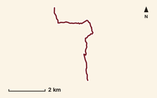
OSM route line, simplified. Branches and gaps as mapped. Trekking Trek, fort trek
Sudhagad Fort
Near Sudhagad / Pali, about 57 km from Pune centre (computed)
Mapped relation length 6.69 kmElevation Not recordedMapped in OpenStreetMap; access not checked Mapped only, not field-tested
Source: OpenStreetMap relation 11855365 (opens in a new tab) . © OpenStreetMap contributors, ODbL.
The route
- Original activity
- Trekking
- Type
- Fort trek. Trekking, Trail routes, Fort treks.
- Shape in OSM
- Linear (A→B or one-way trail)
- Surface
- Trail (OSM hiking relation; may include road segments)
- Distance
- 6.69 km. Mapped relation length (OpenStreetMap via Waymarked Trails). Can include branches and alternatives.
- Elevation
- Not recorded. No gain, loss or profile data in the source.
- Difficulty
- Not recorded
- Start and finish
- Not recorded
Access and safety
- Access
- Not recorded. That does not mean open.
- Hazards
- Not recorded. That does not mean there are none.
- Permission
- Not recorded
- Field check
- Mapped only, not field-tested. Field check recommended (geometry from source)
Data and source
- Status
- Mapped in OSM: geometry exists; ground truth not verified
- Graphic
- Route line from the OpenStreetMap relation (3 ways, fetched 7 Oct 2026), simplified for the card. Not field-checked.
- Source
- OpenStreetMap via Waymarked Trails (hiking). OpenStreetMap (opens in a new tab) Waymarked Trails (opens in a new tab)
- Credit
- OpenStreetMap contributors (see relation history)
- Source checked
- 7 Oct 2026 , OSM data via Waymarked Trails API; not field-verified
- GPX
- Download GPX , built from the OpenStreetMap line (ODbL). Mapped, not field-verified.
- Route ID
- OSM-11855365 Show on the map
Route record
- Category
- HIKES & TREKS
- Type
- Trek
- Area
- Near Sudhagad / Pali (computed)
- City status
- OUTSIDE PUNE
- Distance
- 6.69 km
- Elevation gain
- Not recorded
- Difficulty
- Not recorded
- Technicality
- Not recorded
- Endurance
- Not recorded
- Navigation
- Not recorded
- Exposure
- Not recorded
- Remoteness
- Not recorded
- Terrain
- Trail (OSM hiking relation; may include road segments)
- Surface
- Not recorded
- Monsoon risk
- Not recorded
- Heat risk
- Not recorded
- Wildlife
- Not recorded
- Water
- Not recorded
- Mobile network
- Not recorded
- Emergency access
- Not recorded
- Beginner suitability
- Not recorded
- Start
- Not recorded
- Finish
- Not recorded
- Nearest landmark
- Not recorded
- Creator
- OpenStreetMap contributors (see relation history)
- Source
- OpenStreetMap via Waymarked Trails (hiking)
- GPX
- Yes
- GPX link
- GPX file
- Licence
- ODbL 1.0
- Reuse
- Open licence: credit OpenStreetMap contributors, share-alike
- Route date
- Not recorded
- Last verified
- 7 Oct 2026
- Data confidence
- OSM route line, desk-checked; not field-verified
- Safety notes
- Not recorded
-
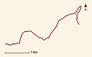
OSM route line, simplified. Branches and gaps as mapped. Hiking Hike, trail / ghat / naal route
Tail Baila 1
Near Sudhagad / Pali, about 56.6 km from Pune centre (computed)
Mapped relation length 5.57 kmElevation Not recordedMapped in OpenStreetMap; access not checked Mapped only, not field-tested
Source: OpenStreetMap relation 15552813 (opens in a new tab) . © OpenStreetMap contributors, ODbL.
The route
- Original activity
- Hiking
- Type
- Trail / ghat / naal route. Hiking, Trail routes.
- Shape in OSM
- Non-linear in OSM (loop or multi-branch)
- Surface
- Trail (OSM hiking relation; may include road segments)
- Distance
- 5.57 km. Mapped relation length (OpenStreetMap via Waymarked Trails). Can include branches and alternatives.
- Elevation
- Not recorded. No gain, loss or profile data in the source.
- Difficulty
- Not recorded
- Start and finish
- Not recorded
Access and safety
- Access
- Not recorded. That does not mean open.
- Hazards
- Not recorded. That does not mean there are none.
- Permission
- Not recorded
- Field check
- Mapped only, not field-tested. Field check recommended (geometry from source)
Data and source
- Status
- Mapped in OSM: geometry exists; ground truth not verified
- Graphic
- Route line from the OpenStreetMap relation (3 ways, fetched 7 Oct 2026), simplified for the card. Not field-checked.
- Overlap
- Overlap (one route's extent lies inside the other's)
- Source notes
- Sudhagad to Tailbaila
- Source
- OpenStreetMap via Waymarked Trails (hiking). OpenStreetMap (opens in a new tab) Waymarked Trails (opens in a new tab)
- Credit
- OpenStreetMap contributors (see relation history)
- Source checked
- 7 Oct 2026 , OSM data via Waymarked Trails API; not field-verified
- GPX
- Download GPX , built from the OpenStreetMap line (ODbL). Mapped, not field-verified.
- Route ID
- OSM-15552813 Show on the map
Route record
- Category
- HIKES & TREKS
- Type
- Hike
- Area
- Near Sudhagad / Pali (computed)
- City status
- OUTSIDE PUNE
- Distance
- 5.57 km
- Elevation gain
- Not recorded
- Difficulty
- Not recorded
- Technicality
- Not recorded
- Endurance
- Not recorded
- Navigation
- Not recorded
- Exposure
- Not recorded
- Remoteness
- Not recorded
- Terrain
- Trail (OSM hiking relation; may include road segments)
- Surface
- Not recorded
- Monsoon risk
- Not recorded
- Heat risk
- Not recorded
- Wildlife
- Not recorded
- Water
- Not recorded
- Mobile network
- Not recorded
- Emergency access
- Not recorded
- Beginner suitability
- Not recorded
- Start
- Not recorded
- Finish
- Not recorded
- Nearest landmark
- Not recorded
- Creator
- OpenStreetMap contributors (see relation history)
- Source
- OpenStreetMap via Waymarked Trails (hiking)
- GPX
- Yes
- GPX link
- GPX file
- Licence
- ODbL 1.0
- Reuse
- Open licence: credit OpenStreetMap contributors, share-alike
- Route date
- Not recorded
- Last verified
- 7 Oct 2026
- Data confidence
- OSM route line, desk-checked; not field-verified
- Safety notes
- Not recorded
-
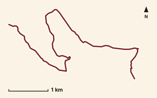
OSM route line, simplified. Branches and gaps as mapped. Hiking Hike, trail / ghat / naal route
Tail Baila 2
Near Sudhagad / Pali, about 56.7 km from Pune centre (computed)
Mapped relation length 7.87 kmElevation Not recordedMapped in OpenStreetMap; access not checked Mapped only, not field-tested
Source: OpenStreetMap relation 15556677 (opens in a new tab) . © OpenStreetMap contributors, ODbL.
The route
- Original activity
- Hiking
- Type
- Trail / ghat / naal route. Hiking, Trail routes.
- Shape in OSM
- Non-linear in OSM (loop or multi-branch)
- Surface
- Trail (OSM hiking relation; may include road segments)
- Distance
- 7.87 km. Mapped relation length (OpenStreetMap via Waymarked Trails). Can include branches and alternatives.
- Elevation
- Not recorded. No gain, loss or profile data in the source.
- Difficulty
- Not recorded
- Start and finish
- Not recorded
Access and safety
- Access
- Not recorded. That does not mean open.
- Hazards
- Not recorded. That does not mean there are none.
- Permission
- Not recorded
- Field check
- Mapped only, not field-tested. Field check recommended (geometry from source)
Data and source
- Status
- Mapped in OSM: geometry exists; ground truth not verified
- Graphic
- Route line from the OpenStreetMap relation (4 ways, fetched 7 Oct 2026), simplified for the card. Not field-checked.
- Overlap
- Overlap (one route's extent lies inside the other's)
- Source notes
- Sudhagad to Tailbaila (variant)
- Source
- OpenStreetMap via Waymarked Trails (hiking). OpenStreetMap (opens in a new tab) Waymarked Trails (opens in a new tab)
- Credit
- OpenStreetMap contributors (see relation history)
- Source checked
- 7 Oct 2026 , OSM data via Waymarked Trails API; not field-verified
- GPX
- Download GPX , built from the OpenStreetMap line (ODbL). Mapped, not field-verified.
- Route ID
- OSM-15556677 Show on the map
Route record
- Category
- HIKES & TREKS
- Type
- Hike
- Area
- Near Sudhagad / Pali (computed)
- City status
- OUTSIDE PUNE
- Distance
- 7.87 km
- Elevation gain
- Not recorded
- Difficulty
- Not recorded
- Technicality
- Not recorded
- Endurance
- Not recorded
- Navigation
- Not recorded
- Exposure
- Not recorded
- Remoteness
- Not recorded
- Terrain
- Trail (OSM hiking relation; may include road segments)
- Surface
- Not recorded
- Monsoon risk
- Not recorded
- Heat risk
- Not recorded
- Wildlife
- Not recorded
- Water
- Not recorded
- Mobile network
- Not recorded
- Emergency access
- Not recorded
- Beginner suitability
- Not recorded
- Start
- Not recorded
- Finish
- Not recorded
- Nearest landmark
- Not recorded
- Creator
- OpenStreetMap contributors (see relation history)
- Source
- OpenStreetMap via Waymarked Trails (hiking)
- GPX
- Yes
- GPX link
- GPX file
- Licence
- ODbL 1.0
- Reuse
- Open licence: credit OpenStreetMap contributors, share-alike
- Route date
- Not recorded
- Last verified
- 7 Oct 2026
- Data confidence
- OSM route line, desk-checked; not field-verified
- Safety notes
- Not recorded
-
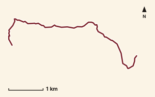
OSM route line, simplified. Branches and gaps as mapped. Hiking Hike, trail / ghat / naal route
Tail Baila 3
Near Sudhagad / Pali, about 53.3 km from Pune centre (computed)
Mapped relation length 5.77 kmElevation Not recordedMapped in OpenStreetMap; access not checked Mapped only, not field-tested
Source: OpenStreetMap relation 15556676 (opens in a new tab) . © OpenStreetMap contributors, ODbL.
The route
- Original activity
- Hiking
- Type
- Trail / ghat / naal route. Hiking, Trail routes.
- Shape in OSM
- Non-linear in OSM (loop or multi-branch)
- Surface
- Trail (OSM hiking relation; may include road segments)
- Distance
- 5.77 km. Mapped relation length (OpenStreetMap via Waymarked Trails). Can include branches and alternatives.
- Elevation
- Not recorded. No gain, loss or profile data in the source.
- Difficulty
- Not recorded
- Start and finish
- Not recorded
Access and safety
- Access
- Not recorded. That does not mean open.
- Hazards
- Not recorded. That does not mean there are none.
- Permission
- Not recorded
- Field check
- Mapped only, not field-tested. Field check recommended (geometry from source)
Data and source
- Status
- Mapped in OSM: geometry exists; ground truth not verified
- Graphic
- Route line from the OpenStreetMap relation (3 ways, fetched 7 Oct 2026), simplified for the card. Not field-checked.
- Overlap
- Overlap (one route's extent lies inside the other's)
- Source notes
- Tailbaila to Ghangad
- Source
- OpenStreetMap via Waymarked Trails (hiking). OpenStreetMap (opens in a new tab) Waymarked Trails (opens in a new tab)
- Credit
- OpenStreetMap contributors (see relation history)
- Source checked
- 7 Oct 2026 , OSM data via Waymarked Trails API; not field-verified
- GPX
- Download GPX , built from the OpenStreetMap line (ODbL). Mapped, not field-verified.
- Route ID
- OSM-15556676 Show on the map
Route record
- Category
- HIKES & TREKS
- Type
- Hike
- Area
- Near Sudhagad / Pali (computed)
- City status
- OUTSIDE PUNE
- Distance
- 5.77 km
- Elevation gain
- Not recorded
- Difficulty
- Not recorded
- Technicality
- Not recorded
- Endurance
- Not recorded
- Navigation
- Not recorded
- Exposure
- Not recorded
- Remoteness
- Not recorded
- Terrain
- Trail (OSM hiking relation; may include road segments)
- Surface
- Not recorded
- Monsoon risk
- Not recorded
- Heat risk
- Not recorded
- Wildlife
- Not recorded
- Water
- Not recorded
- Mobile network
- Not recorded
- Emergency access
- Not recorded
- Beginner suitability
- Not recorded
- Start
- Not recorded
- Finish
- Not recorded
- Nearest landmark
- Not recorded
- Creator
- OpenStreetMap contributors (see relation history)
- Source
- OpenStreetMap via Waymarked Trails (hiking)
- GPX
- Yes
- GPX link
- GPX file
- Licence
- ODbL 1.0
- Reuse
- Open licence: credit OpenStreetMap contributors, share-alike
- Route date
- Not recorded
- Last verified
- 7 Oct 2026
- Data confidence
- OSM route line, desk-checked; not field-verified
- Safety notes
- Not recorded
-
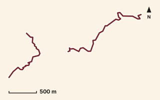
OSM route line, simplified. Branches and gaps as mapped. Hiking Hike, trail / ghat / naal route
Takori Khind
Near Harishchandragad, about 93.5 km from Pune centre (computed)
Mapped relation length 4.02 kmElevation Not recordedMapped in OpenStreetMap; access not checked Mapped only, not field-tested
Source: OpenStreetMap relation 19880941 (opens in a new tab) . © OpenStreetMap contributors, ODbL.
The route
- Original activity
- Hiking
- Type
- Trail / ghat / naal route. Hiking, Trail routes.
- Shape in OSM
- Non-linear in OSM (loop or multi-branch)
- Surface
- Trail (OSM hiking relation; may include road segments)
- Distance
- 4.02 km. Mapped relation length (OpenStreetMap via Waymarked Trails). Can include branches and alternatives.
- Elevation
- Not recorded. No gain, loss or profile data in the source.
- Difficulty
- Not recorded
- Start and finish
- Not recorded
Access and safety
- Access
- Not recorded. That does not mean open.
- Hazards
- Not recorded. That does not mean there are none.
- Permission
- Not recorded
- Field check
- Mapped only, not field-tested. Field check recommended (geometry from source)
Data and source
- Status
- Mapped in OSM: geometry exists; ground truth not verified
- Graphic
- Route line from the OpenStreetMap relation (3 ways, fetched 7 Oct 2026), simplified for the card. Not field-checked.
- Overlap
- Overlap (one route's extent lies inside the other's)
- Source
- OpenStreetMap via Waymarked Trails (hiking). OpenStreetMap (opens in a new tab) Waymarked Trails (opens in a new tab)
- Credit
- OpenStreetMap contributors (see relation history)
- Source checked
- 7 Oct 2026 , OSM data via Waymarked Trails API; not field-verified
- GPX
- Download GPX , built from the OpenStreetMap line (ODbL). Mapped, not field-verified.
- Route ID
- OSM-19880941 Show on the map
Route record
- Category
- HIKES & TREKS
- Type
- Hike
- Area
- Near Harishchandragad (computed)
- City status
- OUTSIDE PUNE
- Distance
- 4.02 km
- Elevation gain
- Not recorded
- Difficulty
- Not recorded
- Technicality
- Not recorded
- Endurance
- Not recorded
- Navigation
- Not recorded
- Exposure
- Not recorded
- Remoteness
- Not recorded
- Terrain
- Trail (OSM hiking relation; may include road segments)
- Surface
- Not recorded
- Monsoon risk
- Not recorded
- Heat risk
- Not recorded
- Wildlife
- Not recorded
- Water
- Not recorded
- Mobile network
- Not recorded
- Emergency access
- Not recorded
- Beginner suitability
- Not recorded
- Start
- Not recorded
- Finish
- Not recorded
- Nearest landmark
- Not recorded
- Creator
- OpenStreetMap contributors (see relation history)
- Source
- OpenStreetMap via Waymarked Trails (hiking)
- GPX
- Yes
- GPX link
- GPX file
- Licence
- ODbL 1.0
- Reuse
- Open licence: credit OpenStreetMap contributors, share-alike
- Route date
- Not recorded
- Last verified
- 7 Oct 2026
- Data confidence
- OSM route line, desk-checked; not field-verified
- Safety notes
- Not recorded
-
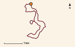
Route line on OpenStreetMap paths. Orange dot: start and finish. Hiking Hike, hill loop in the city
Taljai hill loop
Taljai, Pune city
Round the Taljai Forest Walking Path on Taljai hill.
One loop 7.37kmUnderfoot 89% pedestrian ways, 11% paths and tracks Elevation not recordedPlotted by PuneRunners on OpenStreetMap paths Mapped only, not field-tested
Check before you go: Forest hill park: confirm opening hours and entry rules.
Safety: Forest hill park. Opening hours and entry rules not checked; go in daylight and carry water.
Route record
- Category
- HIKES & TREKS
- Type
- Hike
- Area
- Taljai
- City status
- PUNE CITY
- Distance
- 7.37 km
- Elevation gain
- Not recorded
- Difficulty
- Not recorded
- Technicality
- Not recorded
- Endurance
- Not recorded
- Navigation
- Not recorded
- Exposure
- Not recorded
- Remoteness
- Not recorded
- Terrain
- 89% pedestrian ways, 11% paths and tracks (from OSM highway tags)
- Surface
- ground 89%, not tagged 11% (OSM surface tags)
- Monsoon risk
- Not recorded
- Heat risk
- Not recorded
- Wildlife
- Not recorded
- Water
- Not recorded
- Mobile network
- Not recorded
- Emergency access
- Not recorded
- Beginner suitability
- Not recorded
- Start
- Taljai Forest Walking Path (18.48719, 73.83611)
- Finish
- Taljai Forest Walking Path (18.48719, 73.83611), a loop
- Nearest landmark
- Not recorded
- Creator
- PuneRunners, plotted on OpenStreetMap data
- Source
- OpenStreetMap streets and paths
- GPX
- Yes
- GPX link
- GPX file
- Licence
- ODbL 1.0 (derived from OpenStreetMap)
- Reuse
- Ours to publish; credit OpenStreetMap contributors, share-alike
- Route date
- 7 Oct 2026
- Last verified
- Not recorded
- Data confidence
- Plotted on mapped streets and paths; not field-tested
- Safety notes
- Forest hill park. Opening hours and entry rules not checked; go in daylight and carry water.
Paths used: Taljai Forest Walking Path. Route line © OpenStreetMap contributors, ODbL 1.0.
-
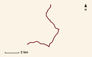
OSM route line, simplified. Branches and gaps as mapped. Hiking Hike, trail / ghat / naal route
Tamhini Valley 1
Near Sudhagad / Pali, about 51.1 km from Pune centre (computed)
Mapped relation length 11.87 kmElevation Not recordedMapped in OpenStreetMap; access not checked Mapped only, not field-tested
Source: OpenStreetMap relation 11855363 (opens in a new tab) . © OpenStreetMap contributors, ODbL.
The route
- Original activity
- Hiking
- Type
- Trail / ghat / naal route. Hiking, Trail routes.
- Shape in OSM
- Linear (A→B or one-way trail)
- Surface
- Trail (OSM hiking relation; may include road segments)
- Distance
- 11.87 km. Mapped relation length (OpenStreetMap via Waymarked Trails). Can include branches and alternatives.
- Elevation
- Not recorded. No gain, loss or profile data in the source.
- Difficulty
- Not recorded
- Start and finish
- Not recorded
Access and safety
- Access
- Not recorded. That does not mean open.
- Hazards
- Not recorded. That does not mean there are none.
- Permission
- Not recorded
- Field check
- Mapped only, not field-tested. Field check recommended (geometry from source)
Data and source
- Status
- Mapped in OSM: geometry exists; ground truth not verified
- Graphic
- Route line from the OpenStreetMap relation (7 ways, fetched 7 Oct 2026), simplified for the card. Not field-checked.
- Source notes
- Andharban trail, Ghutake-Hirdi, Dare ghat segments
- Source
- OpenStreetMap via Waymarked Trails (hiking). OpenStreetMap (opens in a new tab) Waymarked Trails (opens in a new tab)
- Credit
- OpenStreetMap contributors (see relation history)
- Source checked
- 7 Oct 2026 , OSM data via Waymarked Trails API; not field-verified
- GPX
- Download GPX , built from the OpenStreetMap line (ODbL). Mapped, not field-verified.
- Route ID
- OSM-11855363 Show on the map
Route record
- Category
- HIKES & TREKS
- Type
- Hike
- Area
- Near Sudhagad / Pali (computed)
- City status
- OUTSIDE PUNE
- Distance
- 11.87 km
- Elevation gain
- Not recorded
- Difficulty
- Not recorded
- Technicality
- Not recorded
- Endurance
- Not recorded
- Navigation
- Not recorded
- Exposure
- Not recorded
- Remoteness
- Not recorded
- Terrain
- Trail (OSM hiking relation; may include road segments)
- Surface
- Not recorded
- Monsoon risk
- Not recorded
- Heat risk
- Not recorded
- Wildlife
- Not recorded
- Water
- Not recorded
- Mobile network
- Not recorded
- Emergency access
- Not recorded
- Beginner suitability
- Not recorded
- Start
- Not recorded
- Finish
- Not recorded
- Nearest landmark
- Not recorded
- Creator
- OpenStreetMap contributors (see relation history)
- Source
- OpenStreetMap via Waymarked Trails (hiking)
- GPX
- Yes
- GPX link
- GPX file
- Licence
- ODbL 1.0
- Reuse
- Open licence: credit OpenStreetMap contributors, share-alike
- Route date
- Not recorded
- Last verified
- 7 Oct 2026
- Data confidence
- OSM route line, desk-checked; not field-verified
- Safety notes
- Not recorded
-
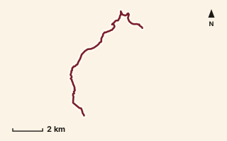
OSM route line, simplified. Branches and gaps as mapped. Hiking Hike, trail / ghat / naal route
Tamhini Valley 2
Near Tamhini / Mulshi, about 48 km from Pune centre (computed)
Mapped relation length 12.31 kmElevation Not recordedMapped in OpenStreetMap; access not checked Mapped only, not field-tested
Source: OpenStreetMap relation 15554602 (opens in a new tab) . © OpenStreetMap contributors, ODbL.
The route
- Original activity
- Hiking
- Type
- Trail / ghat / naal route. Hiking, Trail routes.
- Shape in OSM
- Linear (A→B or one-way trail)
- Surface
- Trail (OSM hiking relation; may include road segments)
- Distance
- 12.31 km. Mapped relation length (OpenStreetMap via Waymarked Trails). Can include branches and alternatives.
- Elevation
- Not recorded. No gain, loss or profile data in the source.
- Difficulty
- Not recorded
- Start and finish
- Not recorded
Access and safety
- Access
- Not recorded. That does not mean open.
- Hazards
- Not recorded. That does not mean there are none.
- Permission
- Not recorded
- Field check
- Mapped only, not field-tested. Field check recommended (geometry from source)
Data and source
- Status
- Mapped in OSM: geometry exists; ground truth not verified
- Graphic
- Route line from the OpenStreetMap relation (7 ways, fetched 7 Oct 2026), simplified for the card. Not field-checked.
- Overlap
- Overlap (one route's extent lies inside the other's)
- Source
- OpenStreetMap via Waymarked Trails (hiking). OpenStreetMap (opens in a new tab) Waymarked Trails (opens in a new tab)
- Credit
- OpenStreetMap contributors (see relation history)
- Source checked
- 7 Oct 2026 , OSM data via Waymarked Trails API; not field-verified
- GPX
- Download GPX , built from the OpenStreetMap line (ODbL). Mapped, not field-verified.
- Route ID
- OSM-15554602 Show on the map
Route record
- Category
- HIKES & TREKS
- Type
- Hike
- Area
- Near Tamhini / Mulshi (computed)
- City status
- OUTSIDE PUNE
- Distance
- 12.31 km
- Elevation gain
- Not recorded
- Difficulty
- Not recorded
- Technicality
- Not recorded
- Endurance
- Not recorded
- Navigation
- Not recorded
- Exposure
- Not recorded
- Remoteness
- Not recorded
- Terrain
- Trail (OSM hiking relation; may include road segments)
- Surface
- Not recorded
- Monsoon risk
- Not recorded
- Heat risk
- Not recorded
- Wildlife
- Not recorded
- Water
- Not recorded
- Mobile network
- Not recorded
- Emergency access
- Not recorded
- Beginner suitability
- Not recorded
- Start
- Not recorded
- Finish
- Not recorded
- Nearest landmark
- Not recorded
- Creator
- OpenStreetMap contributors (see relation history)
- Source
- OpenStreetMap via Waymarked Trails (hiking)
- GPX
- Yes
- GPX link
- GPX file
- Licence
- ODbL 1.0
- Reuse
- Open licence: credit OpenStreetMap contributors, share-alike
- Route date
- Not recorded
- Last verified
- 7 Oct 2026
- Data confidence
- OSM route line, desk-checked; not field-verified
- Safety notes
- Not recorded
-
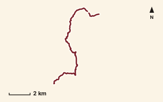
OSM route line, simplified. Branches and gaps as mapped. Hiking Hike, trail / ghat / naal route
Tamhini Valley 3
Near Tamhini / Mulshi, about 49 km from Pune centre (computed)
Mapped relation length 13.75 kmElevation Not recordedMapped in OpenStreetMap; access not checked Mapped only, not field-tested
Source: OpenStreetMap relation 15554601 (opens in a new tab) . © OpenStreetMap contributors, ODbL.
The route
- Original activity
- Hiking
- Type
- Trail / ghat / naal route. Hiking, Trail routes.
- Shape in OSM
- Non-linear in OSM (loop or multi-branch)
- Surface
- Trail (OSM hiking relation; may include road segments)
- Distance
- 13.75 km. Mapped relation length (OpenStreetMap via Waymarked Trails). Can include branches and alternatives.
- Elevation
- Not recorded. No gain, loss or profile data in the source.
- Difficulty
- Not recorded
- Start and finish
- Not recorded
Access and safety
- Access
- Not recorded. That does not mean open.
- Hazards
- Not recorded. That does not mean there are none.
- Permission
- Not recorded
- Field check
- Mapped only, not field-tested. Field check recommended (geometry from source)
Data and source
- Status
- Mapped in OSM: geometry exists; ground truth not verified
- Graphic
- Route line from the OpenStreetMap relation (7 ways, fetched 7 Oct 2026), simplified for the card. Not field-checked.
- Overlap
- Overlap (one route's extent lies inside the other's)
- Source notes
- Bedgaon-Bhira incl. Devkund trail & Plus Valley
- Source
- OpenStreetMap via Waymarked Trails (hiking). OpenStreetMap (opens in a new tab) Waymarked Trails (opens in a new tab)
- Credit
- OpenStreetMap contributors (see relation history)
- Source checked
- 7 Oct 2026 , OSM data via Waymarked Trails API; not field-verified
- GPX
- Download GPX , built from the OpenStreetMap line (ODbL). Mapped, not field-verified.
- Route ID
- OSM-15554601 Show on the map
Route record
- Category
- HIKES & TREKS
- Type
- Hike
- Area
- Near Tamhini / Mulshi (computed)
- City status
- OUTSIDE PUNE
- Distance
- 13.75 km
- Elevation gain
- Not recorded
- Difficulty
- Not recorded
- Technicality
- Not recorded
- Endurance
- Not recorded
- Navigation
- Not recorded
- Exposure
- Not recorded
- Remoteness
- Not recorded
- Terrain
- Trail (OSM hiking relation; may include road segments)
- Surface
- Not recorded
- Monsoon risk
- Not recorded
- Heat risk
- Not recorded
- Wildlife
- Not recorded
- Water
- Not recorded
- Mobile network
- Not recorded
- Emergency access
- Not recorded
- Beginner suitability
- Not recorded
- Start
- Not recorded
- Finish
- Not recorded
- Nearest landmark
- Not recorded
- Creator
- OpenStreetMap contributors (see relation history)
- Source
- OpenStreetMap via Waymarked Trails (hiking)
- GPX
- Yes
- GPX link
- GPX file
- Licence
- ODbL 1.0
- Reuse
- Open licence: credit OpenStreetMap contributors, share-alike
- Route date
- Not recorded
- Last verified
- 7 Oct 2026
- Data confidence
- OSM route line, desk-checked; not field-verified
- Safety notes
- Not recorded
-
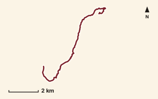
OSM route line, simplified. Branches and gaps as mapped. Trekking Trek, fort trek
Thakurwadi to Ghangad
Near Sudhagad / Pali, about 54.1 km from Pune centre (computed)
Mapped relation length 9.88 kmElevation Not recordedMapped in OpenStreetMap; access not checked Mapped only, not field-tested
Source: OpenStreetMap relation 16864740 (opens in a new tab) . © OpenStreetMap contributors, ODbL.
The route
- Original activity
- Trekking
- Type
- Fort trek. Trekking, Trail routes, Fort treks.
- Shape in OSM
- Linear (sorted)
- Surface
- Trail (OSM hiking relation; may include road segments)
- Distance
- 9.88 km. Mapped relation length (OpenStreetMap via Waymarked Trails). Can include branches and alternatives.
- Elevation
- Not recorded. No gain, loss or profile data in the source.
- Difficulty
- Not recorded
- Start and finish
- Not recorded
Access and safety
- Access
- Not recorded. That does not mean open.
- Hazards
- Not recorded. That does not mean there are none.
- Permission
- Not recorded
- Field check
- Mapped only, not field-tested. Field check recommended (geometry from source)
Data and source
- Status
- Mapped in OSM: geometry exists; ground truth not verified
- Graphic
- Route line from the OpenStreetMap relation (8 ways, fetched 7 Oct 2026), simplified for the card. Not field-checked.
- Overlap
- Overlap (one route's extent lies inside the other's); Probable duplicate / variant
- Source
- OpenStreetMap via Waymarked Trails (hiking). OpenStreetMap (opens in a new tab) Waymarked Trails (opens in a new tab)
- Credit
- OpenStreetMap contributors (see relation history)
- Source checked
- 7 Oct 2026 , OSM data via Waymarked Trails API; not field-verified
- GPX
- Download GPX , built from the OpenStreetMap line (ODbL). Mapped, not field-verified.
- Route ID
- OSM-16864740 Show on the map
Route record
- Category
- HIKES & TREKS
- Type
- Trek
- Area
- Near Sudhagad / Pali (computed)
- City status
- OUTSIDE PUNE
- Distance
- 9.88 km
- Elevation gain
- Not recorded
- Difficulty
- Not recorded
- Technicality
- Not recorded
- Endurance
- Not recorded
- Navigation
- Not recorded
- Exposure
- Not recorded
- Remoteness
- Not recorded
- Terrain
- Trail (OSM hiking relation; may include road segments)
- Surface
- Not recorded
- Monsoon risk
- Not recorded
- Heat risk
- Not recorded
- Wildlife
- Not recorded
- Water
- Not recorded
- Mobile network
- Not recorded
- Emergency access
- Not recorded
- Beginner suitability
- Not recorded
- Start
- Not recorded
- Finish
- Not recorded
- Nearest landmark
- Not recorded
- Creator
- OpenStreetMap contributors (see relation history)
- Source
- OpenStreetMap via Waymarked Trails (hiking)
- GPX
- Yes
- GPX link
- GPX file
- Licence
- ODbL 1.0
- Reuse
- Open licence: credit OpenStreetMap contributors, share-alike
- Route date
- Not recorded
- Last verified
- 7 Oct 2026
- Data confidence
- OSM route line, desk-checked; not field-verified
- Safety notes
- Not recorded
-
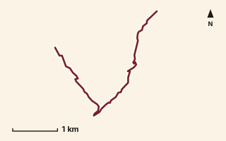
OSM route line, simplified. Branches and gaps as mapped. Trekking Trek, fort trek
Torna Fort
Near Torna / Velhe, about 36.8 km from Pune centre (computed)
Mapped relation length 5.33 kmElevation Not recordedMapped in OpenStreetMap; access not checked Mapped only, not field-tested
Source: OpenStreetMap relation 15554627 (opens in a new tab) . © OpenStreetMap contributors, ODbL.
The route
- Original activity
- Trekking
- Type
- Fort trek. Trekking, Trail routes, Fort treks.
- Shape in OSM
- Linear (A→B or one-way trail)
- Surface
- Trail (OSM hiking relation; may include road segments)
- Distance
- 5.33 km. Mapped relation length (OpenStreetMap via Waymarked Trails). Can include branches and alternatives.
- Elevation
- Not recorded. No gain, loss or profile data in the source.
- Difficulty
- Not recorded
- Start and finish
- Not recorded
Access and safety
- Access
- Not recorded. That does not mean open.
- Hazards
- Not recorded. That does not mean there are none.
- Permission
- Not recorded
- Field check
- Mapped only, not field-tested. Field check recommended (geometry from source)
Data and source
- Status
- Mapped in OSM: geometry exists; ground truth not verified
- Graphic
- Route line from the OpenStreetMap relation (4 ways, fetched 7 Oct 2026), simplified for the card. Not field-checked.
- Overlap
- Overlap (one route's extent lies inside the other's)
- Source notes
- Velhe-Torna-Bhatti
- Source
- OpenStreetMap via Waymarked Trails (hiking). OpenStreetMap (opens in a new tab) Waymarked Trails (opens in a new tab)
- Credit
- OpenStreetMap contributors (see relation history)
- Source checked
- 7 Oct 2026 , OSM data via Waymarked Trails API; not field-verified
- GPX
- Download GPX , built from the OpenStreetMap line (ODbL). Mapped, not field-verified.
- Route ID
- OSM-15554627 Show on the map
Route record
- Category
- HIKES & TREKS
- Type
- Trek
- Area
- Near Torna / Velhe (computed)
- City status
- OUTSIDE PUNE
- Distance
- 5.33 km
- Elevation gain
- Not recorded
- Difficulty
- Not recorded
- Technicality
- Not recorded
- Endurance
- Not recorded
- Navigation
- Not recorded
- Exposure
- Not recorded
- Remoteness
- Not recorded
- Terrain
- Trail (OSM hiking relation; may include road segments)
- Surface
- Not recorded
- Monsoon risk
- Not recorded
- Heat risk
- Not recorded
- Wildlife
- Not recorded
- Water
- Not recorded
- Mobile network
- Not recorded
- Emergency access
- Not recorded
- Beginner suitability
- Not recorded
- Start
- Not recorded
- Finish
- Not recorded
- Nearest landmark
- Not recorded
- Creator
- OpenStreetMap contributors (see relation history)
- Source
- OpenStreetMap via Waymarked Trails (hiking)
- GPX
- Yes
- GPX link
- GPX file
- Licence
- ODbL 1.0
- Reuse
- Open licence: credit OpenStreetMap contributors, share-alike
- Route date
- Not recorded
- Last verified
- 7 Oct 2026
- Data confidence
- OSM route line, desk-checked; not field-verified
- Safety notes
- Not recorded
-
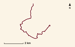
OSM route line, simplified. Branches and gaps as mapped. Hiking Hike, trail / ghat / naal route
Umbarde - Taliye - Mazeri
Near Varandha Ghat, about 52.7 km from Pune centre (computed)
Mapped relation length 9.11 kmElevation Not recordedMapped in OpenStreetMap; access not checked Mapped only, not field-tested
Source: OpenStreetMap relation 15570580 (opens in a new tab) . © OpenStreetMap contributors, ODbL.
The route
- Original activity
- Hiking
- Type
- Trail / ghat / naal route. Hiking, Trail routes.
- Shape in OSM
- Linear (A→B or one-way trail)
- Surface
- Trail (OSM hiking relation; may include road segments)
- Distance
- 9.11 km. Mapped relation length (OpenStreetMap via Waymarked Trails). Can include branches and alternatives.
- Elevation
- Not recorded. No gain, loss or profile data in the source.
- Difficulty
- Not recorded
- Start and finish
- Not recorded
Access and safety
- Access
- Not recorded. That does not mean open.
- Hazards
- Not recorded. That does not mean there are none.
- Permission
- Not recorded
- Field check
- Mapped only, not field-tested. Field check recommended (geometry from source)
Data and source
- Status
- Mapped in OSM: geometry exists; ground truth not verified
- Graphic
- Route line from the OpenStreetMap relation (7 ways, fetched 7 Oct 2026), simplified for the card. Not field-checked.
- Overlap
- Overlap (one route's extent lies inside the other's)
- Source
- OpenStreetMap via Waymarked Trails (hiking). OpenStreetMap (opens in a new tab) Waymarked Trails (opens in a new tab)
- Credit
- OpenStreetMap contributors (see relation history)
- Source checked
- 7 Oct 2026 , OSM data via Waymarked Trails API; not field-verified
- GPX
- Download GPX , built from the OpenStreetMap line (ODbL). Mapped, not field-verified.
- Route ID
- OSM-15570580 Show on the map
Route record
- Category
- HIKES & TREKS
- Type
- Hike
- Area
- Near Varandha Ghat (computed)
- City status
- OUTSIDE PUNE
- Distance
- 9.11 km
- Elevation gain
- Not recorded
- Difficulty
- Not recorded
- Technicality
- Not recorded
- Endurance
- Not recorded
- Navigation
- Not recorded
- Exposure
- Not recorded
- Remoteness
- Not recorded
- Terrain
- Trail (OSM hiking relation; may include road segments)
- Surface
- Not recorded
- Monsoon risk
- Not recorded
- Heat risk
- Not recorded
- Wildlife
- Not recorded
- Water
- Not recorded
- Mobile network
- Not recorded
- Emergency access
- Not recorded
- Beginner suitability
- Not recorded
- Start
- Not recorded
- Finish
- Not recorded
- Nearest landmark
- Not recorded
- Creator
- OpenStreetMap contributors (see relation history)
- Source
- OpenStreetMap via Waymarked Trails (hiking)
- GPX
- Yes
- GPX link
- GPX file
- Licence
- ODbL 1.0
- Reuse
- Open licence: credit OpenStreetMap contributors, share-alike
- Route date
- Not recorded
- Last verified
- 7 Oct 2026
- Data confidence
- OSM route line, desk-checked; not field-verified
- Safety notes
- Not recorded
-
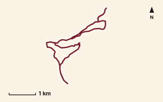
OSM route line, simplified. Branches and gaps as mapped. Hiking Hike, trail / ghat / naal route
Viewpoint Trail
Near Raireshwar, about 54.2 km from Pune centre (computed)
Mapped relation length 11.71 kmElevation Not recordedMapped in OpenStreetMap; access not checked Mapped only, not field-tested
Source: OpenStreetMap relation 16863758 (opens in a new tab) . © OpenStreetMap contributors, ODbL.
The route
- Original activity
- Hiking
- Type
- Trail / ghat / naal route. Hiking, Trail routes.
- Shape in OSM
- Linear (A→B or one-way trail)
- Surface
- Trail (OSM hiking relation; may include road segments)
- Distance
- 11.71 km. Mapped relation length (OpenStreetMap via Waymarked Trails). Can include branches and alternatives.
- Elevation
- Not recorded. No gain, loss or profile data in the source.
- Difficulty
- Not recorded
- Start and finish
- Not recorded
Access and safety
- Access
- Not recorded. That does not mean open.
- Hazards
- Not recorded. That does not mean there are none.
- Permission
- Not recorded
- Field check
- Mapped only, not field-tested. Field check recommended (geometry from source)
Data and source
- Status
- Mapped in OSM: geometry exists; ground truth not verified
- Graphic
- Route line from the OpenStreetMap relation (16 ways, fetched 7 Oct 2026), simplified for the card. Not field-checked.
- Overlap
- Overlap (one route's extent lies inside the other's)
- Source notes
- Raireshwar plateau; website_old creedaz.in
- Source
- OpenStreetMap via Waymarked Trails (hiking). OpenStreetMap (opens in a new tab) Waymarked Trails (opens in a new tab)
- Credit
- OpenStreetMap contributors (see relation history): relation tags reference creedaz.in
- Source checked
- 7 Oct 2026 , OSM data via Waymarked Trails API; not field-verified
- GPX
- Download GPX , built from the OpenStreetMap line (ODbL). Mapped, not field-verified.
- Route ID
- OSM-16863758 Show on the map
Route record
- Category
- HIKES & TREKS
- Type
- Hike
- Area
- Near Raireshwar (computed)
- City status
- OUTSIDE PUNE
- Distance
- 11.71 km
- Elevation gain
- Not recorded
- Difficulty
- Not recorded
- Technicality
- Not recorded
- Endurance
- Not recorded
- Navigation
- Not recorded
- Exposure
- Not recorded
- Remoteness
- Not recorded
- Terrain
- Trail (OSM hiking relation; may include road segments)
- Surface
- Not recorded
- Monsoon risk
- Not recorded
- Heat risk
- Not recorded
- Wildlife
- Not recorded
- Water
- Not recorded
- Mobile network
- Not recorded
- Emergency access
- Not recorded
- Beginner suitability
- Not recorded
- Start
- Not recorded
- Finish
- Not recorded
- Nearest landmark
- Not recorded
- Creator
- OpenStreetMap contributors (see relation history): relation tags reference creedaz.in
- Source
- OpenStreetMap via Waymarked Trails (hiking)
- GPX
- Yes
- GPX link
- GPX file
- Licence
- ODbL 1.0
- Reuse
- Open licence: credit OpenStreetMap contributors, share-alike
- Route date
- Not recorded
- Last verified
- 7 Oct 2026
- Data confidence
- OSM route line, desk-checked; not field-verified
- Safety notes
- Not recorded
-
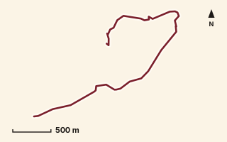
OSM route line, simplified. Branches and gaps as mapped. Trekking Trek, fort trek
Visapur Fort
Near Kamshet / Pawna, about 44.5 km from Pune centre (computed)
Mapped relation length 4.1 kmElevation Not recordedMapped in OpenStreetMap; access not checked Mapped only, not field-tested
Source: OpenStreetMap relation 15552768 (opens in a new tab) . © OpenStreetMap contributors, ODbL.
The route
- Original activity
- Trekking
- Type
- Fort trek. Trekking, Trail routes, Fort treks.
- Shape in OSM
- Non-linear in OSM (loop or multi-branch)
- Surface
- Trail (OSM hiking relation; may include road segments)
- Distance
- 4.1 km. Mapped relation length (OpenStreetMap via Waymarked Trails). Can include branches and alternatives.
- Elevation
- Not recorded. No gain, loss or profile data in the source.
- Difficulty
- Not recorded
- Start and finish
- Not recorded
Access and safety
- Access
- Not recorded. That does not mean open.
- Hazards
- Not recorded. That does not mean there are none.
- Permission
- Not recorded
- Field check
- Mapped only, not field-tested. Field check recommended (geometry from source)
Data and source
- Status
- Mapped in OSM: geometry exists; ground truth not verified
- Graphic
- Route line from the OpenStreetMap relation (5 ways, fetched 7 Oct 2026), simplified for the card. Not field-checked.
- Source
- OpenStreetMap via Waymarked Trails (hiking). OpenStreetMap (opens in a new tab) Waymarked Trails (opens in a new tab)
- Credit
- OpenStreetMap contributors (see relation history)
- Source checked
- 7 Oct 2026 , OSM data via Waymarked Trails API; not field-verified
- GPX
- Download GPX , built from the OpenStreetMap line (ODbL). Mapped, not field-verified.
- Route ID
- OSM-15552768 Show on the map
Route record
- Category
- HIKES & TREKS
- Type
- Trek
- Area
- Near Kamshet / Pawna (computed)
- City status
- OUTSIDE PUNE
- Distance
- 4.1 km
- Elevation gain
- Not recorded
- Difficulty
- Not recorded
- Technicality
- Not recorded
- Endurance
- Not recorded
- Navigation
- Not recorded
- Exposure
- Not recorded
- Remoteness
- Not recorded
- Terrain
- Trail (OSM hiking relation; may include road segments)
- Surface
- Not recorded
- Monsoon risk
- Not recorded
- Heat risk
- Not recorded
- Wildlife
- Not recorded
- Water
- Not recorded
- Mobile network
- Not recorded
- Emergency access
- Not recorded
- Beginner suitability
- Not recorded
- Start
- Not recorded
- Finish
- Not recorded
- Nearest landmark
- Not recorded
- Creator
- OpenStreetMap contributors (see relation history)
- Source
- OpenStreetMap via Waymarked Trails (hiking)
- GPX
- Yes
- GPX link
- GPX file
- Licence
- ODbL 1.0
- Reuse
- Open licence: credit OpenStreetMap contributors, share-alike
- Route date
- Not recorded
- Last verified
- 7 Oct 2026
- Data confidence
- OSM route line, desk-checked; not field-verified
- Safety notes
- Not recorded
-
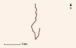
OSM route line, simplified. Branches and gaps as mapped. Hiking Hike, trail / ghat / naal route
Yesnicha Dongar
Near Junnar / Naneghat, about 85.1 km from Pune centre (computed)
Mapped relation length 3.32 kmElevation Not recordedMapped in OpenStreetMap; access not checked Mapped only, not field-tested
Source: OpenStreetMap relation 19884850 (opens in a new tab) . © OpenStreetMap contributors, ODbL.
The route
- Original activity
- Hiking
- Type
- Trail / ghat / naal route. Hiking, Trail routes.
- Shape in OSM
- Linear (A→B or one-way trail)
- Surface
- Trail (OSM hiking relation; may include road segments)
- Distance
- 3.32 km. Mapped relation length (OpenStreetMap via Waymarked Trails). Can include branches and alternatives.
- Elevation
- Not recorded. No gain, loss or profile data in the source.
- Difficulty
- Not recorded
- Start and finish
- Not recorded
Access and safety
- Access
- Not recorded. That does not mean open.
- Hazards
- Not recorded. That does not mean there are none.
- Permission
- Not recorded
- Field check
- Mapped only, not field-tested. Field check recommended (geometry from source)
Data and source
- Status
- Mapped in OSM: geometry exists; ground truth not verified
- Graphic
- Route line from the OpenStreetMap relation (1 ways, fetched 7 Oct 2026), simplified for the card. Not field-checked.
- Source notes
- website manav.in
- Source
- OpenStreetMap via Waymarked Trails (hiking). OpenStreetMap (opens in a new tab) Waymarked Trails (opens in a new tab)
- Credit
- OpenStreetMap contributors (see relation history): relation tags reference manav.in
- Source checked
- 7 Oct 2026 , OSM data via Waymarked Trails API; not field-verified
- GPX
- Download GPX , built from the OpenStreetMap line (ODbL). Mapped, not field-verified.
- Route ID
- OSM-19884850 Show on the map
Route record
- Category
- HIKES & TREKS
- Type
- Hike
- Area
- Near Junnar / Naneghat (computed)
- City status
- OUTSIDE PUNE
- Distance
- 3.32 km
- Elevation gain
- Not recorded
- Difficulty
- Not recorded
- Technicality
- Not recorded
- Endurance
- Not recorded
- Navigation
- Not recorded
- Exposure
- Not recorded
- Remoteness
- Not recorded
- Terrain
- Trail (OSM hiking relation; may include road segments)
- Surface
- Not recorded
- Monsoon risk
- Not recorded
- Heat risk
- Not recorded
- Wildlife
- Not recorded
- Water
- Not recorded
- Mobile network
- Not recorded
- Emergency access
- Not recorded
- Beginner suitability
- Not recorded
- Start
- Not recorded
- Finish
- Not recorded
- Nearest landmark
- Not recorded
- Creator
- OpenStreetMap contributors (see relation history): relation tags reference manav.in
- Source
- OpenStreetMap via Waymarked Trails (hiking)
- GPX
- Yes
- GPX link
- GPX file
- Licence
- ODbL 1.0
- Reuse
- Open licence: credit OpenStreetMap contributors, share-alike
- Route date
- Not recorded
- Last verified
- 7 Oct 2026
- Data confidence
- OSM route line, desk-checked; not field-verified
- Safety notes
- Not recorded
The data
Dataset compiled 7 October 2026 by desk research. Not field-verified. Records come from the OpenStreetMap rows of a desk-research database. Rows from other sources (running, trail-running and cycling reference pages) have no reuse permission and are not published here.
Route data © OpenStreetMap contributors (opens in a new tab). The OpenStreetMap-derived database is available under the Open Database License 1.0. If you reuse or adapt it, credit OpenStreetMap contributors and keep the adapted database under the ODbL.
Before you go
- Check access, permissions and forest rules locally before you set out. Nothing here confirms them.
- Monsoon changes ghats, naals and fort paths. Check conditions on the day and turn back early.
- Carry water and tell someone your route. No water point is recorded for any entry.
- A hiking route is not a running route. Do not assume a trail is runnable because it is mapped.