Magarpatta: pick your line
Circle laps, township circuits and longer distance builds in one area. Every route here starts and finishes at the same point on the circle road, so you can pick the distance and keep the same meeting spot.
What this is
Magarpatta City around Aditi Garden and the Magarpatta Inner Circle, on the Hadapsar side of Pune. Not the traffic junction outside. The short option is the circle road, about 1.31 km a lap. The wider candidates use more of the township, about 12.61 km a lap, and longer distances repeat that lap and add a short out and back.
Start and finish for all nine: the circle road, at 18.51676, 73.92647. That is a plotted point, not a checked meeting spot, entrance or parking bay. Parking on the circle road is the founder's note; the exact bay and permission are not verified.
The 6.2 km Magarpatta City loop on the running routes page is a separate line with a different start on West Gate Road. Two laps of it (about 12.4 km) are not the same as the 12.61 km wider lap here.
Local notes from the club founder
- Clean, green roads around the township.
- Lighter traffic and slower cars on the stretches the founder runs. Still live roads, not a safety guarantee.
- Washrooms nearby. Check which ones runners can use, and their hours.
- Water and snacks around Destination Centre (DC). Shop hours matter on an early run.
Local observations, not an amenities or access audit.
Nine lines, one start
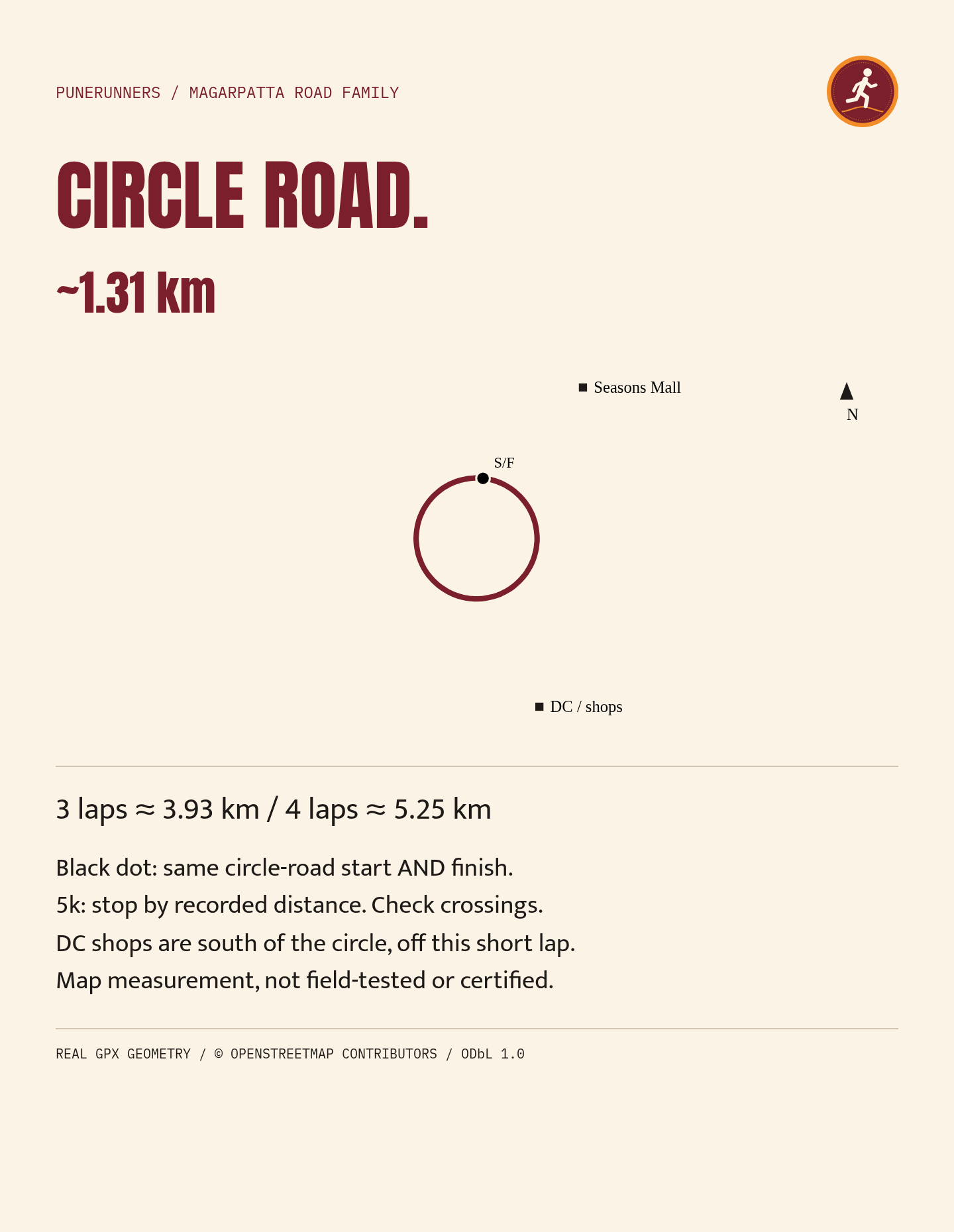
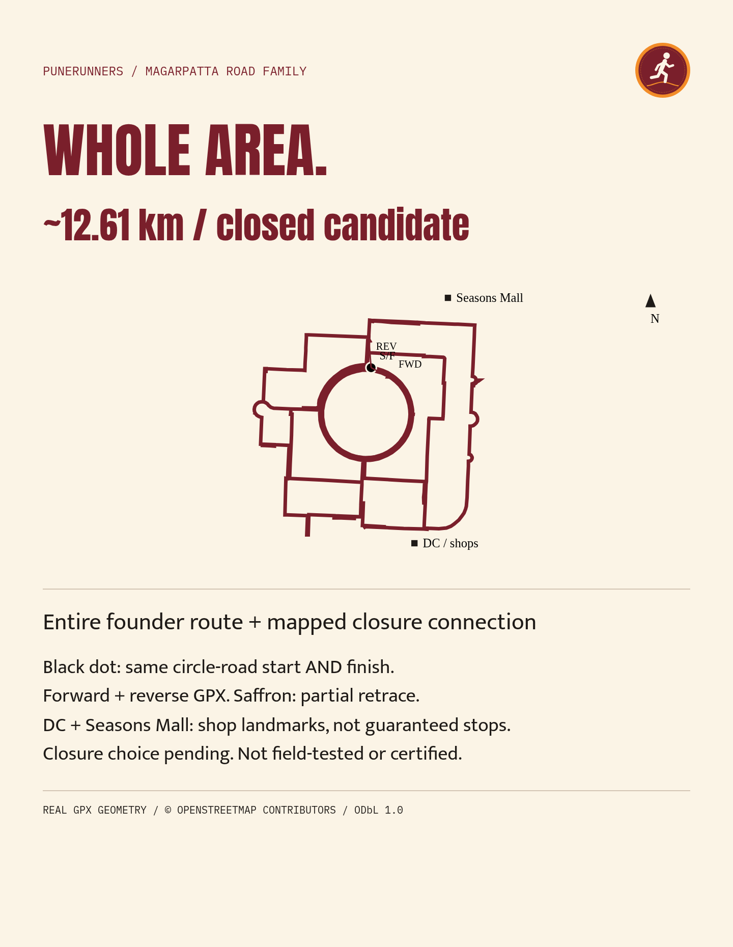
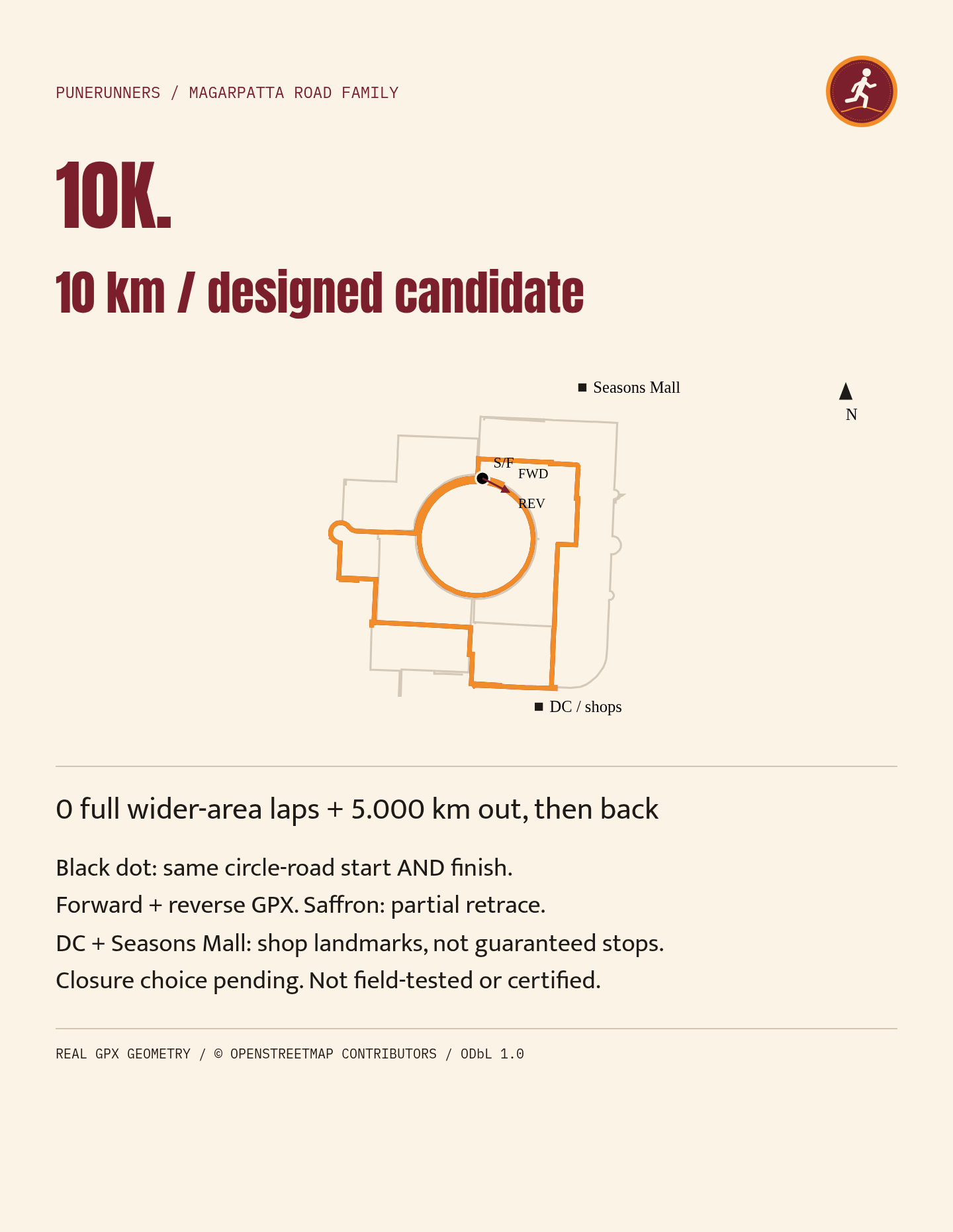
Maroon on the cards is the base route, saffron is a partial retrace, the black dot is the shared start and finish. Seasons Mall and DC shops are landmarks for finding your way, not guaranteed water stops. FWD and REV on the cards mean the order the route was drawn in, not a traffic direction or a clockwise claim.
-
Tap to open full size. © OpenStreetMap contributors, ODbL 1.0. 01
Circle road
about 1.31 km
One lap of the circle road. Three laps are about 3.93 km, four about 5.25 km. For a 5 km outing, stop by your recorded distance.
Mapped road-centreline lap, not field-tested or certified. Actual distance depends on your footpath and line.
- Start and finish
- Circle road, 18.51676, 73.92647. Same point.
- Surface
- Mapped township roads and paths. Route-specific surface audit not recorded.
- Elevation and difficulty
- Not recorded
- Water and emergency access
- Not recorded
- GPX
- Not offered for download. The card is the reference.
-
Tap to open full size. © OpenStreetMap contributors, ODbL 1.0. 02
Whole-area candidate
about 12.61 km
One lap of the wider area: the layout example plus a mapped closure candidate, starting and finishing on the circle road.
Designed candidate, not field-tested, device-tested or certified. Check township entry, permitted pedestrian access, footpaths and crossings before use. A GPX does not certify access or safety.
- Start and finish
- Circle road, 18.51676, 73.92647. Same point.
- Surface
- Mapped township roads and paths. Route-specific surface audit not recorded.
- Elevation and difficulty
- Not recorded
- Water and emergency access
- Not recorded
- GPX
- Not offered for download. The card is the reference.
-
Tap to open full size. © OpenStreetMap contributors, ODbL 1.0. 03
10K candidate
10 km
5 km out along the wider route, then retrace to the start.
Designed candidate, not field-tested, device-tested or certified. Check township entry, permitted pedestrian access, footpaths and crossings before use. A GPX does not certify access or safety.
- Start and finish
- Circle road, 18.51676, 73.92647. Same point.
- Surface
- Mapped township roads and paths. Route-specific surface audit not recorded.
- Elevation and difficulty
- Not recorded
- Water and emergency access
- Not recorded
- GPX
- Not offered for download. The card is the reference.
-
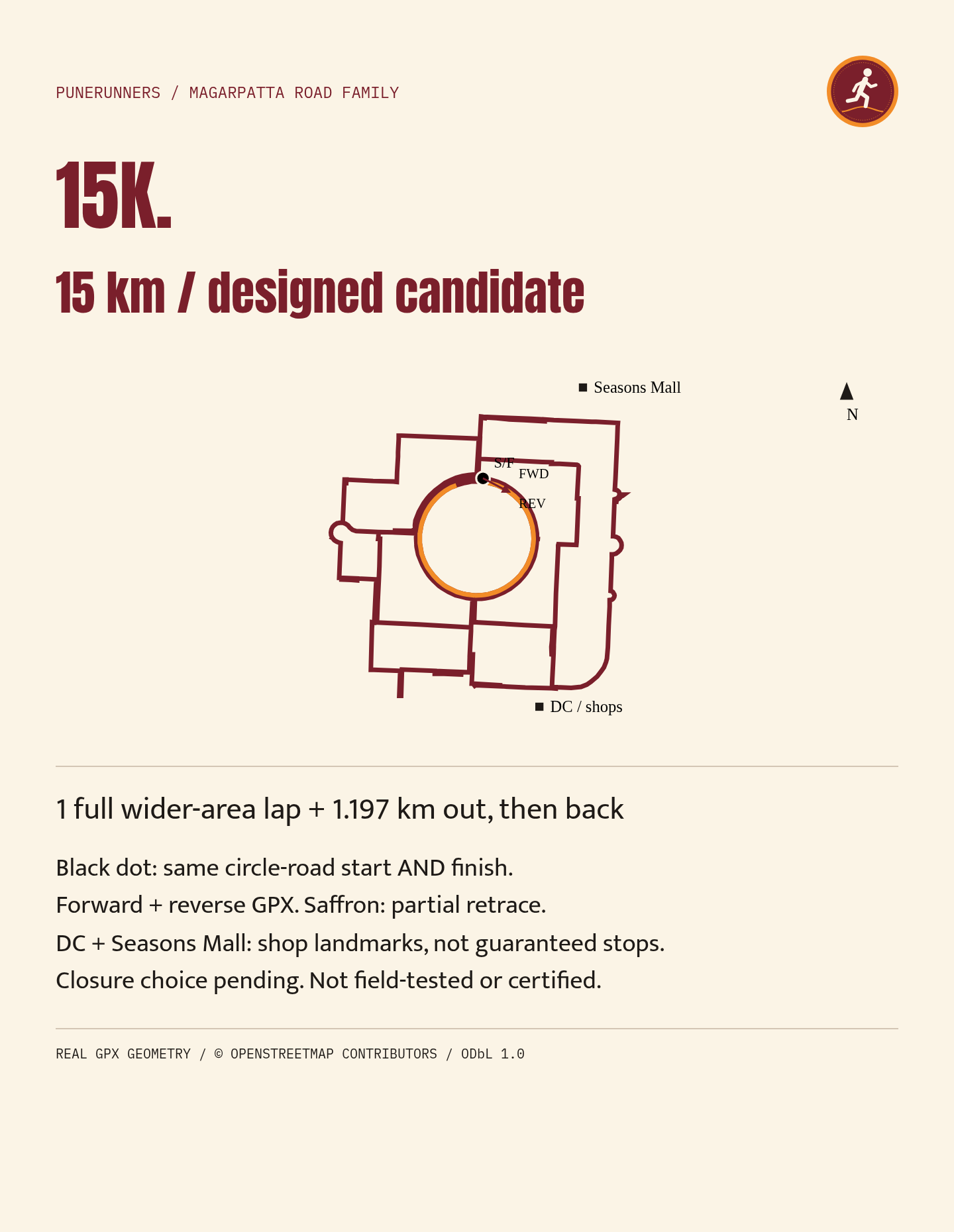
Tap to open full size. © OpenStreetMap contributors, ODbL 1.0. 04
15K candidate
15 km
One full wider lap, then 1.2 km out along the route and back the same way.
Designed candidate, not field-tested, device-tested or certified. Check township entry, permitted pedestrian access, footpaths and crossings before use. A GPX does not certify access or safety.
- Start and finish
- Circle road, 18.51676, 73.92647. Same point.
- Surface
- Mapped township roads and paths. Route-specific surface audit not recorded.
- Elevation and difficulty
- Not recorded
- Water and emergency access
- Not recorded
- GPX
- Not offered for download. The card is the reference.
-
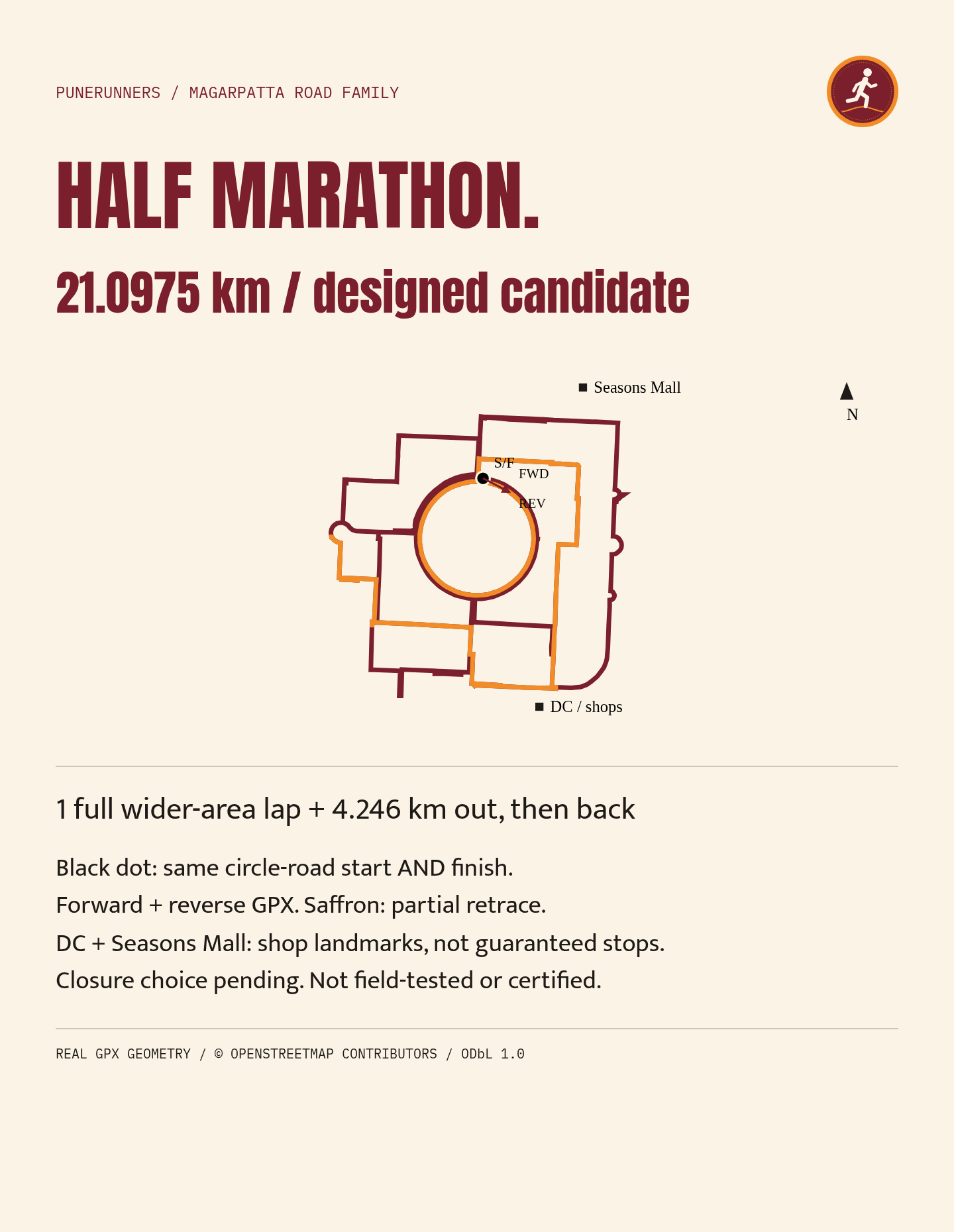
Tap to open full size. © OpenStreetMap contributors, ODbL 1.0. 05
Half-marathon candidate
21.1 km
One full wider lap, then 4.25 km out along the route and back the same way.
Designed candidate, not field-tested, device-tested or certified. Check township entry, permitted pedestrian access, footpaths and crossings before use. A GPX does not certify access or safety.
- Start and finish
- Circle road, 18.51676, 73.92647. Same point.
- Surface
- Mapped township roads and paths. Route-specific surface audit not recorded.
- Elevation and difficulty
- Not recorded
- Water and emergency access
- Not recorded
- GPX
- Not offered for download. The card is the reference.
-
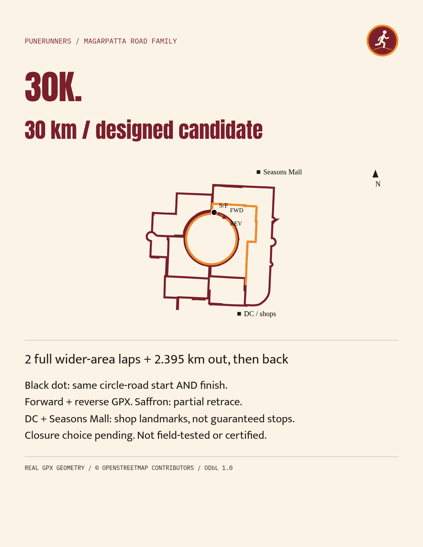
Tap to open full size. © OpenStreetMap contributors, ODbL 1.0. 06
30K candidate
30 km
Two full wider laps, then 2.39 km out along the route and back the same way.
Designed candidate, not field-tested, device-tested or certified. Check township entry, permitted pedestrian access, footpaths and crossings before use. A GPX does not certify access or safety.
- Start and finish
- Circle road, 18.51676, 73.92647. Same point.
- Surface
- Mapped township roads and paths. Route-specific surface audit not recorded.
- Elevation and difficulty
- Not recorded
- Water and emergency access
- Not recorded
- GPX
- Not offered for download. The card is the reference.
-
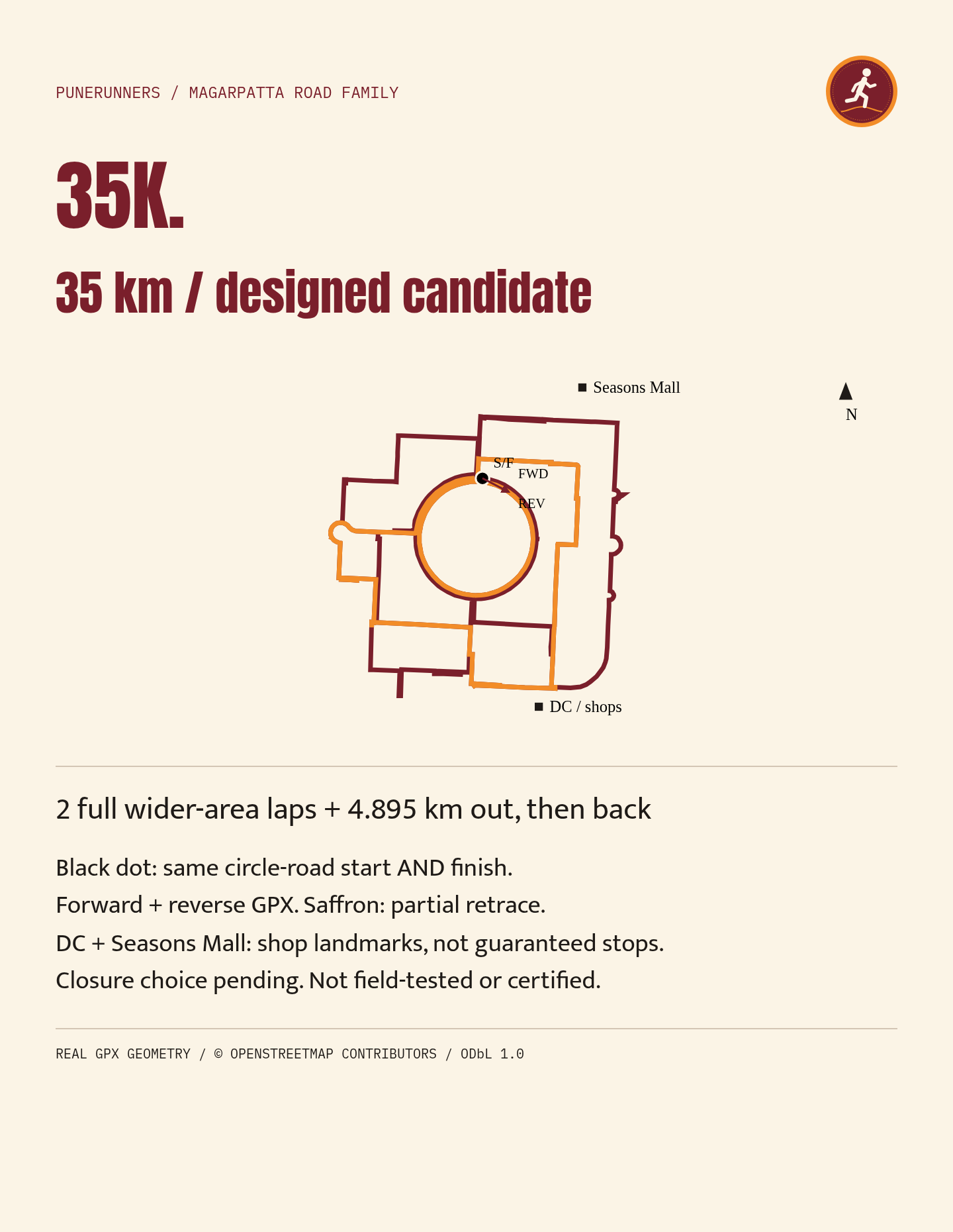
Tap to open full size. © OpenStreetMap contributors, ODbL 1.0. 07
35K candidate
35 km
Two full wider laps, then 4.89 km out along the route and back the same way.
Designed candidate, not field-tested, device-tested or certified. Check township entry, permitted pedestrian access, footpaths and crossings before use. A GPX does not certify access or safety.
- Start and finish
- Circle road, 18.51676, 73.92647. Same point.
- Surface
- Mapped township roads and paths. Route-specific surface audit not recorded.
- Elevation and difficulty
- Not recorded
- Water and emergency access
- Not recorded
- GPX
- Not offered for download. The card is the reference.
-
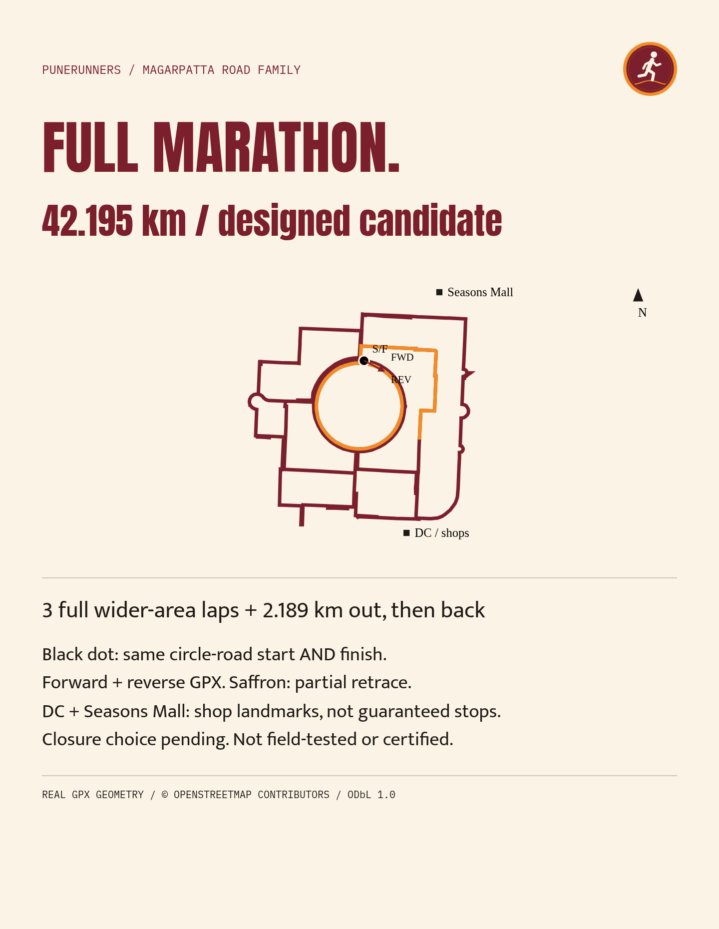
Tap to open full size. © OpenStreetMap contributors, ODbL 1.0. 08
Full-marathon candidate
42.2 km
Three full wider laps, then 2.19 km out along the route and back the same way.
Designed candidate, not field-tested, device-tested or certified. Check township entry, permitted pedestrian access, footpaths and crossings before use. A GPX does not certify access or safety.
- Start and finish
- Circle road, 18.51676, 73.92647. Same point.
- Surface
- Mapped township roads and paths. Route-specific surface audit not recorded.
- Elevation and difficulty
- Not recorded
- Water and emergency access
- Not recorded
- GPX
- Not offered for download. The card is the reference.
A distance build, not advice to run this far in training. Township laps do not reproduce the climbing or terrain of a trail ultra.
-
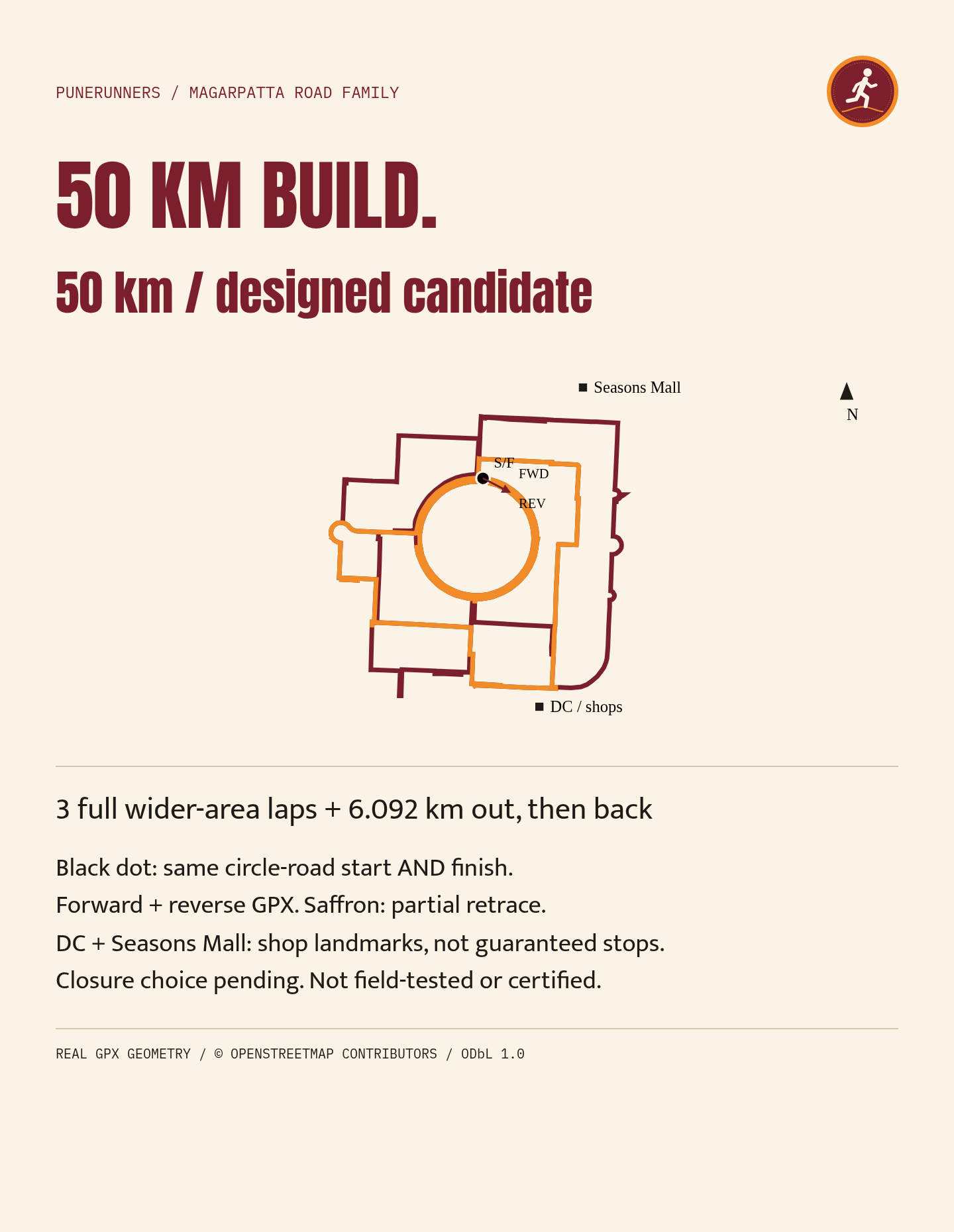
Tap to open full size. © OpenStreetMap contributors, ODbL 1.0. 09
50 km candidate
50 km
Three full wider laps, then 6.09 km out along the route and back the same way.
Designed candidate, not field-tested, device-tested or certified. Check township entry, permitted pedestrian access, footpaths and crossings before use. A GPX does not certify access or safety.
- Start and finish
- Circle road, 18.51676, 73.92647. Same point.
- Surface
- Mapped township roads and paths. Route-specific surface audit not recorded.
- Elevation and difficulty
- Not recorded
- Water and emergency access
- Not recorded
- GPX
- Not offered for download. The card is the reference.
A distance build, not advice to run this far in training. Township laps do not reproduce the climbing or terrain of a trail ultra.
Before the first lap
- Magarpatta City is a privately managed township. Confirm entry for runners, and any timing rules, before you go.
- Check footpaths and crossings in person. Use permitted pedestrian space; a one-way rule for cars does not make a carriageway a running track.
- Never follow a watch line through a closed gate or a gap in traffic. Stop at crossings.
- Run a loop once before turning it into repeated laps.
Ran one of these? Tell us in the WhatsApp group what you found at the gates and crossings. Field reports matter more than another lap claim.
Route lines © OpenStreetMap contributors (opens in a new tab), available under the ODbL 1.0. Distances are measured along the supplied route points and are not certified courses.